|
Mahates
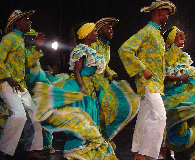
Mahates is a river town and municipality located in the Bolívar Department, northern Colombia. The town of Mahates was founded on April 17, 1533 by Spanish conquistador Pedro de Heredia. The municipality of Mahates also covers the village of Palenque de San Basilio, inhabited mainly by Afro-Colombians which are direct descendants of African slaves brought by the Spanish during the Colonization of the Americas and have preserved their ancestral traditions. In 2005 the Palenque de San Basilio village was proclaimed Masterpiece of the Oral and Intangible Heritage of Humanity by UNESCO. History The town of Mahates was founded in 1533 by Pedro de Heredia after founding Cartagena de Indias. In 1538 was given in encomienda to his son, Antonio de Heredia who transfer the property to Luis Pelo de Águila who finally erected the parish. Due to its rapid increase on population Mahates quickly became a village and political chiefdom of the municipality and First Instance Court until ... [...More Info...] [...Related Items...] OR: [Wikipedia] [Google] [Baidu] |
San Basilio De Palenque
San Basilio de Palenque or Palenque de San Basilio, often referred to by the locals simply as Palenke, is a Palenque village and corregimiento in the Municipality of Mahates, Bolivar in northern Colombia. Palenque was the first free African town in the Americas, and in 2005 was declared a Masterpiece of the Oral and Intangible Heritage of Humanity by UNESCO. History Spaniards introduced kidnapped enslaved Africans in South America through the Magdalena River Valley. Its mouth is close to the important port of Cartagena de Indias where ships full of Africans arrived. Some Africans escaped and set up Palenque de San Basilio, a town close to Cartagena. This community began in 1619, when Domingo Biohó led a group of about 30 runaways into the forests, and defeated attempts to subdue them. Biohó declared himself King Benkos, and his palenque of San Basilio attracted large numbers of runaways to join his community. His Maroons defeated the first expedition sent against them, killi ... [...More Info...] [...Related Items...] OR: [Wikipedia] [Google] [Baidu] |
Palenque De San Basilio
San Basilio de Palenque or Palenque de San Basilio, often referred to by the locals simply as Palenke, is a Palenque village and corregimiento in the Municipality of Mahates, Bolivar in northern Colombia. Palenque was the first free African town in the Americas, and in 2005 was declared a Masterpiece of the Oral and Intangible Heritage of Humanity by UNESCO. History Spaniards introduced kidnapped enslaved Africans in South America through the Magdalena River Valley. Its mouth is close to the important port of Cartagena de Indias where ships full of Africans arrived. Some Africans escaped and set up Palenque de San Basilio, a town close to Cartagena. This community began in 1619, when Domingo Biohó led a group of about 30 runaways into the forests, and defeated attempts to subdue them. Biohó declared himself King Benkos, and his palenque of San Basilio attracted large numbers of runaways to join his community. His Maroons defeated the first expedition sent against them, killi ... [...More Info...] [...Related Items...] OR: [Wikipedia] [Google] [Baidu] |
María La Baja
María La Baja is a town and municipality located in the Bolívar Department, northern Colombia. History María La Baja was founded by Alonso de Heredia (brother of Pedro de Heredia) on December 8, 1535. Geography and climate The municipality of María La Baja has a total area of 547 km², bordering to the north with the municipality of Arjona, Colombia, Arjona, to the east with the municipalities of Mahates and San Juan Nepomuceno, Bolívar, San Juan Nepomuceno, south with the municipalities of El Carmen de Bolívar and San Jacinto, Bolívar, San Jacinto and to the west with the municipality of San Onofre, Sucre, San Onofre, Sucre Department, Sucre. The town of María La Baja has an area of approximately 150 km² and it is some 72 km away from the Department's capital Cartagena, Colombia, Cartagena. A warm climate prevails throughout the year at an average temperature of 28 °C. Involvement in armed conflict María La Baja has grown substantially in recent ... [...More Info...] [...Related Items...] OR: [Wikipedia] [Google] [Baidu] |
Canal Del Dique
The Canal del Dique ( Levee Channel) is a 118 km artificial canal connecting Cartagena Bay (at the corregimiento of Pasacaballos) to the Magdalena River in the Bolívar Department in northern Colombia. The canal is a bifurcation or artificial arm of the Magdalena River, and its eastern portion forms most of the border between the departments of Bolívar and Atlántico. The port on the Magdalena River is Calamar. History The canal was needed since the mouth of the Magdalena River (which provided access into the interior of Colombia) was virtually impenetrable, and Colombia's two main colonial ports ( Cartagena and Santa Marta) had no access to the river. It was built by the Spanish in 1582 but quickly fell into disrepair; it was rebuilt in 1650. However, by the end of the 18th century, it had become impassable except during times of high runoff, and by 1821 it was completely blocked. Thus, trade moved increasingly away from Cartagena to Santa Marta and Sabanilla (a port ... [...More Info...] [...Related Items...] OR: [Wikipedia] [Google] [Baidu] |
Municipalities Of Colombia
The Municipalities of Colombia are decentralized subdivisions of the Republic of Colombia. Municipalities make up most of the departments of Colombia with 1,122 municipalities (''municipios''). Each one of them is led by a mayor (''alcalde'') elected by popular vote and represents the maximum executive government official at a municipality level under the mandate of the governor of their department which is a representative of all municipalities in the department; municipalities are grouped to form departments. The municipalities of Colombia are also grouped in an association called the ''Federación Colombiana de Municipios'' (Colombian Federation of Municipalities), which functions as a union under the private law and under the constitutional right to free association to defend their common interests. Categories Conforming to the law 1551/12 that modified the sixth article of the law 136/94 Article 7 http://www.alcaldiabogota.gov.co/sisjur/normas/Norma1.jsp?i=48267 the mu ... [...More Info...] [...Related Items...] OR: [Wikipedia] [Google] [Baidu] |
Köppen Climate Classification
The Köppen climate classification is one of the most widely used climate classification systems. It was first published by German-Russian climatologist Wladimir Köppen (1846–1940) in 1884, with several later modifications by Köppen, notably in 1918 and 1936. Later, the climatologist Rudolf Geiger (1894–1981) introduced some changes to the classification system, which is thus sometimes called the Köppen–Geiger climate classification system. The Köppen climate classification divides climates into five main climate groups, with each group being divided based on seasonal precipitation and temperature patterns. The five main groups are ''A'' (tropical), ''B'' (arid), ''C'' (temperate), ''D'' (continental), and ''E'' (polar). Each group and subgroup is represented by a letter. All climates are assigned a main group (the first letter). All climates except for those in the ''E'' group are assigned a seasonal precipitation subgroup (the second letter). For example, ''Af'' indi ... [...More Info...] [...Related Items...] OR: [Wikipedia] [Google] [Baidu] |
Mulattos
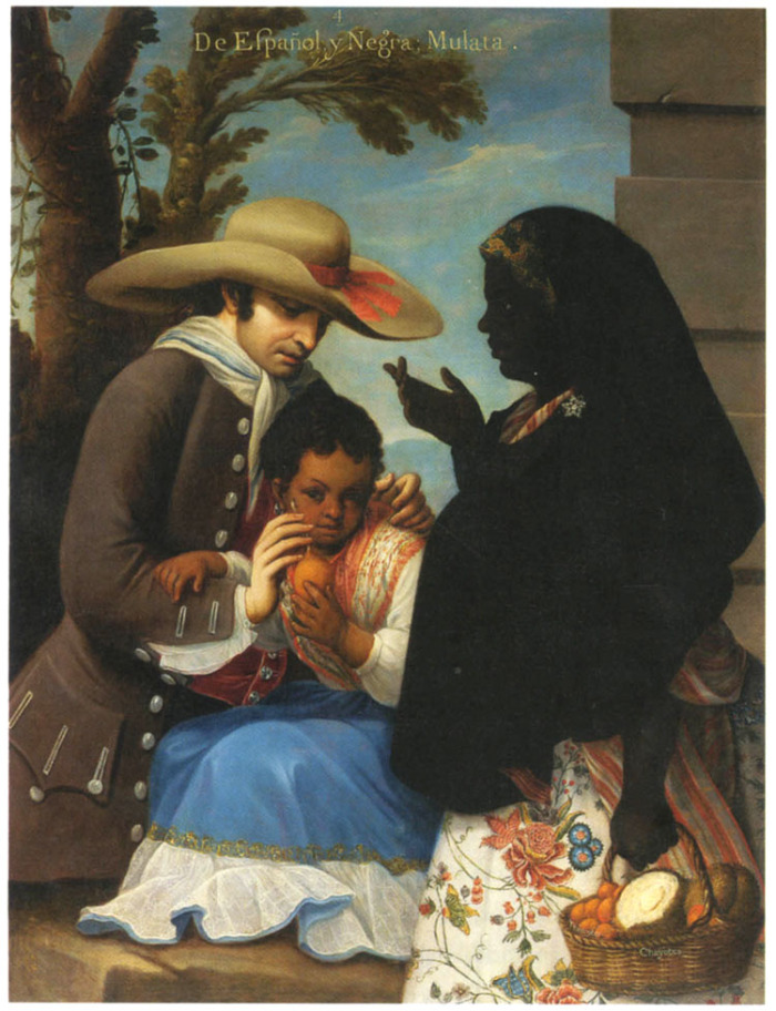
(, ) is a racial classification to refer to people of mixed African and European ancestry. Its use is considered outdated and offensive in several languages, including English and Dutch, whereas in languages such as Spanish and Portuguese is not, and can even be a source of pride. A () is a female ''mulatto''. Etymology The English term and spelling ''mulatto'' is derived from the Spanish and Portuguese . It was a common term in the Southeastern United States during the era of slavery. Some sources suggest that it may derive from the Portuguese word (from the Latin ), meaning ' mule', the hybrid offspring of a horse and a donkey. The Real Academia Española traces its origin to in the sense of hybridity; originally used to refer to any mixed race person. The term is now generally considered outdated and offensive in non-Spanish and non-Portuguese speaking countries, and was considered offensive even in the 19th century. Jack D. Forbes suggests it originated in the Arabic ... [...More Info...] [...Related Items...] OR: [Wikipedia] [Google] [Baidu] |
San Juan Nepomuceno, Bolívar
San Juan Nepomuceno is a town and municipality located in the Bolívar Department, northern Colombia. It is named after Saint John of Nepomuk John of Nepomuk (or John Nepomucene) ( cs, Jan Nepomucký; german: Johannes Nepomuk; la, Ioannes Nepomucenus) ( 1345 – 20 March 1393) was the saint of Bohemia (Czech Republic) who was drowned in the Vltava river at the behest of Wenceslaus .... Notable residents Mayerlis Angarita was born here in about 1980. She has won awards for her leadership on women's rights and she has been a mayoral candidate. References Municipalities of Bolívar Department {{Bolivar-Colombia-geo-stub ... [...More Info...] [...Related Items...] OR: [Wikipedia] [Google] [Baidu] |
San Estanislao, Bolívar
San Estanislao de Kostka is a town and municipality located in the Bolívar Department, northern Colombia. San Estanislao is also informally known as Arenal by the locals, Arenal is Spanish for "sand Sand is a granular material composed of finely divided mineral particles. Sand has various compositions but is defined by its grain size. Sand grains are smaller than gravel and coarser than silt. Sand can also refer to a textural class of s ...", which earned its nickname in result that the town accumulates high amounts of sand during rain and wind. A mission was established on the present site in 1650. Access to the town can be challenging as the roads that access the town are unpaved and often water-logged after long periods of rain. Inhabitants of San Estanislao generally support themselves through family farms yielding a variety of produce and meat products from the cattle as well as poultry and pork and some of the best dairy products and a local cheese called "ques ... [...More Info...] [...Related Items...] OR: [Wikipedia] [Google] [Baidu] |
Soplaviento
Soplaviento is a town and municipality located in the Bolívar Department, northern Colombia. The town is located on the south bank of the Dique Canal across from the town of San Estanislao {{Infobox settlement , settlement_type = City & District , official_name = San Estanislao de Kostka , native_name = , nickname = Santaní , motto = , image_skyline = , imagesize .... Municipalities of Bolívar Department {{Bolivar-Colombia-geo-stub ... [...More Info...] [...Related Items...] OR: [Wikipedia] [Google] [Baidu] |


