|
Konstanz (district)
Konstanz (or ''Constance'') is a ''Landkreis'' (district) in the south of Baden-Württemberg on the German-Swiss border, situated along the shores of Lake Constance. Neighboring districts are (from west clockwise) Schwarzwald-Baar, Tuttlingen, Sigmaringen and Bodenseekreis. To the south it borders the Swiss cantons of Zurich, Thurgau and Schaffhausen. The municipality of Büsingen am Hochrhein is an exclave of Germany surrounded by Swiss territory. History The district dates back to the ''Bezirksamt Konstanz'', which was created in 1806 when the area became part of Württemberg (since 1810 Baden). After some changes in its outline it was changed into the district in 1936, including part of the dissolved ''Bezirksamt Engen''. 1939 the city Constance became district-free, but was reintegrated into the district in 1953. 1973 it was merged with the neighboring district Stockach and some municipalities from the districts Sigmaringen and Donaueschingen. Geography The district is loc ... [...More Info...] [...Related Items...] OR: [Wikipedia] [Google] [Baidu] |
Konstanz
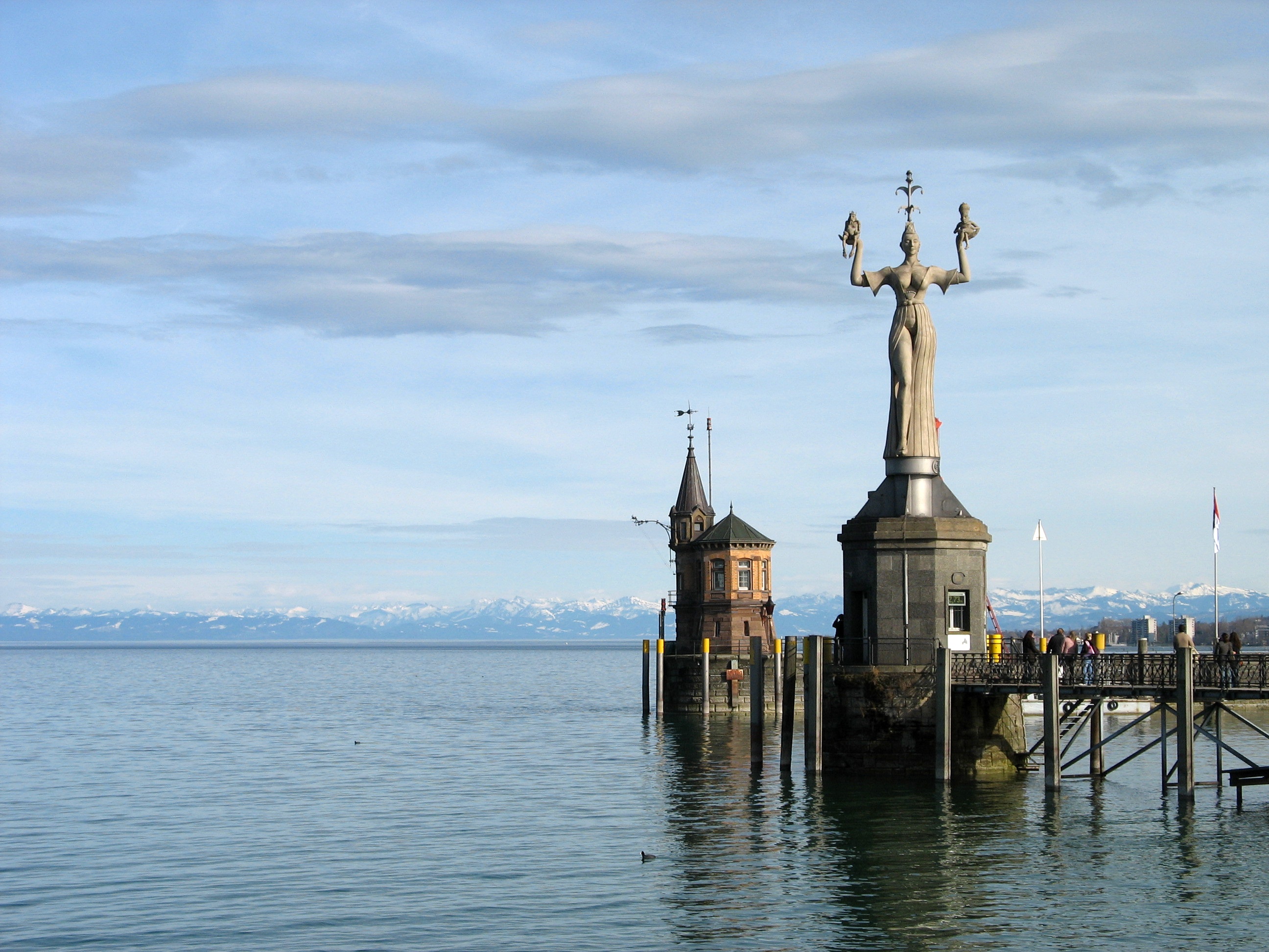
Konstanz (, , locally: ; also written as Constance in English) is a university city with approximately 83,000 inhabitants located at the western end of Lake Constance in the south of Germany. The city houses the University of Konstanz and was the residence of the Roman Catholic Diocese of Konstanz for more than 1,200 years. Location The city is located in the state of Baden-Württemberg and situated at the banks of Lake Constance (''Bodensee'' in German). The river Rhine, which starts in the Swiss Alps, passes through Lake Constance and leaves it, considerably larger, by flowing under a bridge connecting the two parts of the city. North of the river lies the larger part of the city with residential areas, industrial estates, and the University of Konstanz; while south of the river is the old town, which houses the administrative centre and shopping facilities in addition to the ''Hochschule'' or the ''University of Applied Sciences''. Car ferries provide access across Lake Con ... [...More Info...] [...Related Items...] OR: [Wikipedia] [Google] [Baidu] |
Württemberg
Württemberg ( ; ) is a historical German territory roughly corresponding to the cultural and linguistic region of Swabia. The main town of the region is Stuttgart. Together with Baden and Hohenzollern, two other historical territories, Württemberg now forms the Federal State of Baden-Württemberg. Württemberg was formerly also spelled Würtemberg and Wirtemberg. History Originally part of the old Duchy of Swabia, its history can be summarized in the following periods: *County of Württemberg (1083–1495) * Duchy of Württemberg (1495–1803) *Electorate of Württemberg (1803–1806) *Kingdom of Württemberg (1806–1918) *Free People's State of Württemberg (1918–1945) After World War II, it was split into Württemberg-Baden and Württemberg-Hohenzollern due to the different occupation zones of the United States and France. Finally, in 1952, it was integrated into Baden-Württemberg. Stuttgart, the historical capital city of Württemberg, became the capital of the p ... [...More Info...] [...Related Items...] OR: [Wikipedia] [Google] [Baidu] |
Singen
Singen (Low Alemannic German, Low Alemannic: ''Singe'') is an industrial city in the very south of Baden-Württemberg in southern Germany and just north of the German-Swiss border. Location Singen is an industrial city situated in the very south of Baden-Württemberg in Germany close to Lake Constance just north of the German-Swiss border and is the most important city in the Hegau area. Landmarks The most famous landmark of Singen is Hohentwiel, a volcanic stub on which there are the ruins of a fortress destroyed by French troops during the Napoleonic Wars. World War II 'Singen route' Singen is notable in military history for the Singen route in World War II. This route into Switzerland was discovered by Dutch naval lieutenant Hans Larive in 1940 on his first escape attempt from an Oflag (prisoner's camp for officers) in Soest. After being captured at the Swiss border near Singen, the interrogating Gestapo officer was so confident the war would soon be won by Germany that he t ... [...More Info...] [...Related Items...] OR: [Wikipedia] [Google] [Baidu] |
Radolfzell
Radolfzell am Bodensee is a town in Germany at the western end of Lake Constance approximately 18 km northwest of Konstanz. It is the third largest town, after Constance and Singen, in the district of Konstanz, in Baden-Württemberg. Radolfzell is a well-known health care town (Mettnau) and an important railway junction of the High Rhine Railway and the Hegau-Ablach Valley Railway (leading to the Stahringen–Friedrichshafen railway). In 1990 Radolfzell was named the Federal Environment Capital City of Germany. History This town developed out of a monastery founded in 826 AD as a "cell" under Bishop Radolf of Verona. The town belonged to the Abbey of Reichenau, then to the house of Habsburg for a long time, and for 40 years was a Free Imperial City. In the centre is the gothic Cathedral of our Dear Lady, dating from the 15th century and decorated in the baroque style in the 18th. One particularly beautiful feature is the Rosary altar by the Zürn brothers and the Master ... [...More Info...] [...Related Items...] OR: [Wikipedia] [Google] [Baidu] |
Engen, Germany
Engen is a town in the district of Konstanz, in Baden-Württemberg, Germany. It is situated 12 km northwest of Singen, and 15 km south of Tuttlingen. City structure History Engen has been proved by documentary evidence in the 11th century for the first time, where it belonged to the Baron of Höwen (also Hewen). In the city area of Engen, there has been a medieval castle, the Burg Neuhausen, remaining unlocated however. In the 13th century, Engen received the city charter. From 1639, the city belonged to the Count of Fürstenberg, and thus to the Principality of Fürstenberg. In 1640, the area was devastated by Swedes and French in the context of the Thirty Years' War. During the War of the Second Coalition, on May 3, 1800, a battle between the Austrians, led by Paul Kray, and the French, commanded by Jean Victor Marie Moreau, took place, resulting in a retreat of the Austrian troops. In 1806, Engen went to Grand Duchy of Baden. The city became a distr ... [...More Info...] [...Related Items...] OR: [Wikipedia] [Google] [Baidu] |
Aach, Baden-Württemberg
Aach () is a small town in the German state of Baden-Württemberg (the region of Hegau). Being situated close to Lake Constance and the Swiss border, it is mostly known for the Aachtopf — Germany's biggest natural spring in terms of production. The town was originally twinned with the region of Colmnitz, but following the integration of Colmnitz into Klingenberg, Saxony the town is now twinned with Klingenberg itself. History Aach was first mentioned in the year 1100, as part of the Duchy of Swabia. By the year 1150 the settlement was known in Latin as '. In 1200, the lords transferred ownershp of the town to the Prince-Bishopric of Constance. Aach was granted town rights in 1283 by King Rudolph I of Germany. For the next centuries it was a part of Further Austria until the House of Habsburg purchased the County of Nellenburg, the county in which Aach was situated. In 1499 battles of the Swabian War took place right before gates of Aach. Only 26 years later, in 1525, the Germ ... [...More Info...] [...Related Items...] OR: [Wikipedia] [Google] [Baidu] |
Banner Landkreis Konstanz
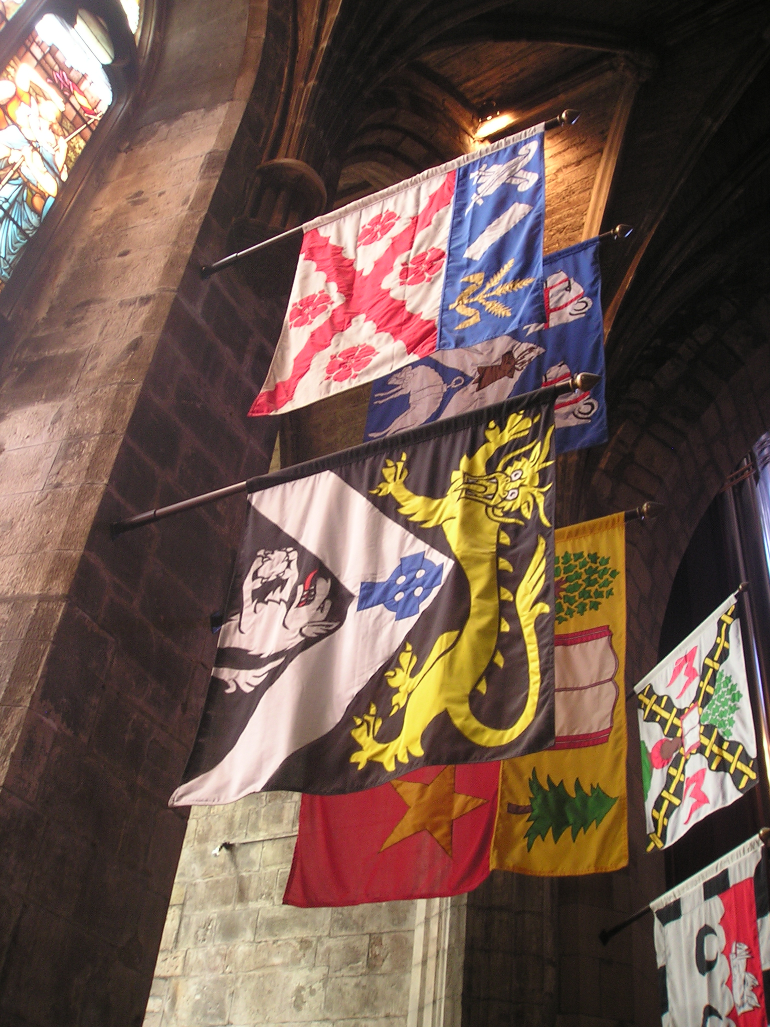
A banner can be a flag or another piece of cloth bearing a symbol, logo, slogan or another message. A flag whose design is the same as the shield in a coat of arms (but usually in a square or rectangular shape) is called a banner of arms. Also, a bar-shaped piece of non-cloth advertising material sporting a name, slogan, or other marketing message is also a banner. Banner-making is an ancient craft. Church banners commonly portray the saint to whom the church is dedicated. The word derives from Old French ''baniere'' (modern french: bannière), from Late Latin ''bandum'', which was borrowed from a Germanic source (compare got, 𐌱𐌰𐌽𐌳𐍅𐌰, translit=bandwa). Cognates include Italian ''bandiera'', Portuguese ''bandeira'', and Spanish ''bandera''. Vexillum The vexillum was a flag-like object used as a military standard by units in the Ancient Roman army. The word ''vexillum'' itself is a diminutive of the Latin ''velum'', meaning a sail, which confirms the histo ... [...More Info...] [...Related Items...] OR: [Wikipedia] [Google] [Baidu] |
Water Divide
A drainage divide, water divide, ridgeline, watershed, water parting or height of land is elevated terrain that separates neighboring drainage basins. On rugged land, the divide lies along topographical ridges, and may be in the form of a single range of hills or mountains, known as a dividing range. On flat terrain, especially where the ground is marshy, the divide may be difficult to discern. A triple divide is a point, often a summit, where three drainage basins meet. A ''valley floor divide'' is a low drainage divide that runs across a valley, sometimes created by deposition or stream capture. Major divides separating rivers that drain to different seas or oceans are continental divides. The term ''height of land'' is used in Canada and the United States to refer to a drainage divide. It is frequently used in border descriptions, which are set according to the "doctrine of natural boundaries". In glaciated areas it often refers to a low point on a divide where it is p ... [...More Info...] [...Related Items...] OR: [Wikipedia] [Google] [Baidu] |
Karst
Karst is a topography formed from the dissolution of soluble rocks such as limestone, dolomite, and gypsum. It is characterized by underground drainage systems with sinkholes and caves. It has also been documented for more weathering-resistant rocks, such as quartzite, given the right conditions. Subterranean drainage may limit surface water, with few to no rivers or lakes. However, in regions where the dissolved bedrock is covered (perhaps by debris) or confined by one or more superimposed non-soluble rock strata, distinctive karst features may occur only at subsurface levels and can be totally missing above ground. The study of ''paleokarst'' (buried karst in the stratigraphic column) is important in petroleum geology because as much as 50% of the world's hydrocarbon reserves are hosted in carbonate rock, and much of this is found in porous karst systems. Etymology The English word ''karst'' was borrowed from German in the late 19th century, which entered German much earlier ... [...More Info...] [...Related Items...] OR: [Wikipedia] [Google] [Baidu] |
Danube
The Danube ( ; ) is a river that was once a long-standing frontier of the Roman Empire and today connects 10 European countries, running through their territories or being a border. Originating in Germany, the Danube flows southeast for , passing through or bordering Austria, Slovakia, Hungary, Croatia, Serbia, Romania, Bulgaria, Moldova, and Ukraine before draining into the Black Sea. Its drainage basin extends into nine more countries. The largest cities on the river are Vienna, Budapest, Belgrade and Bratislava, all of which are the capitals of their respective countries; the Danube passes through four capital cities, more than any other river in the world. Five more capital cities lie in the Danube's basin: Bucharest, Sofia, Zagreb, Ljubljana and Sarajevo. The fourth-largest city in its basin is Munich, the capital of Bavaria, standing on the Isar River. The Danube is the second-longest river in Europe, after the Volga in Russia. It flows through much of Central and Sou ... [...More Info...] [...Related Items...] OR: [Wikipedia] [Google] [Baidu] |
Aachtopf
The Aachtopf () is Germany's biggest karst spring, south of the western end of the Swabian Jura near the town of Aach. It produces an average of 8,500 litres per second. Most of the water stems from the River Danube where it disappears underground at the Danube Sinkhole, north near Immendingen and about north near Fridingen. The cave system has been explored since the 1960s, but as of 2020 only a small part has been discovered due to a large blockage after a few hundred metres. Etymology The name Aachtopf is compounded from ''Aach'' (meaning "water" in Old High German); ''Topf'' can be translated as "bowl" and is commonly used for round, bowl-shaped springs. Geography The Aachtopf is a karst spring, south of the western end of the Swabian Jura near the town of Aach. The spring is the source of the river Radolfzeller Aach, which flows southward into Lake Constance, and empties into the Rhine. Origin The spring marks the southern end of a cave system that transports water ... [...More Info...] [...Related Items...] OR: [Wikipedia] [Google] [Baidu] |
Mainau Island
Mainau also referred to as Mav(e)no(w), Maienowe (in 1242), Maienow (in 1357), Maienau, Mainowe (in 1394) and Mainaw (in 1580) is an island in Lake Constance (on the Southern shore of the Überlinger See near the city of Konstanz, Baden-Württemberg, Germany). It is maintained as a garden island and a model of excellent environmental practices. Administratively, the island has been a part of Konstanz since December 1, 1971, when the municipality of Litzelstetten, of which Mainau was part, was incorporated into Konstanz. Mainau is still part of Litzelstetten, now one of 15 wards (administrative subdivisions) of Konstanz. The island belongs to the Lennart Bernadotte-Stiftung (eng. The Lennart Bernadotte Foundation), an entity created by Prince Lennart Bernadotte, Count of Wisborg, originally a Prince of Sweden and Duke of Småland. It is one of the main tourist attractions of Lake Constance. Beside flowers there is a park landscape with views on the lake. There is a greenhous ... [...More Info...] [...Related Items...] OR: [Wikipedia] [Google] [Baidu] |


.jpg)


