|
Kirkcudbrightshire
Kirkcudbrightshire ( ), or the County of Kirkcudbright or the Stewartry of Kirkcudbright is one of the historic counties of Scotland, covering an area in the south-west of the country. Until 1975, Kirkcudbrightshire was an administrative county used for local government. Since 1975, the area has formed part of Dumfries and Galloway for local government purposes. Kirkcudbrightshire continues to be used as a registration county for land registration. A lower-tier district called Stewartry covered the majority of the historic county from 1975 to 1996. The area of Stewartry district is still used as a lieutenancy area. Dumfries and Galloway Council also has a Stewartry area committee. Kirkcudbrightshire forms the eastern part of the medieval lordship of Galloway, which retained a degree of autonomy until it was fully absorbed by Scotland in the 13th century. In 1369, the part of Galloway east of the River Cree was placed under the control of a steward based in Kirkcudbright and so t ... [...More Info...] [...Related Items...] OR: [Wikipedia] [Google] [Baidu] |
Dumfries And Galloway
Dumfries and Galloway ( sco, Dumfries an Gallowa; gd, Dùn Phrìs is Gall-Ghaidhealaibh) is one of 32 unitary council areas of Scotland and is located in the western Southern Uplands. It covers the counties of Scotland, historic counties of Dumfriesshire, Kirkcudbrightshire, and Wigtownshire, the latter two of which are collectively known as Galloway. The administrative centre and largest settlement is the town of Dumfries. The second largest town is Stranraer, on the North Channel (Great Britain and Ireland), North Channel coast, some to the west of Dumfries. Following the 1975 reorganisation of local government in Scotland, the three counties were joined to form a single regions and districts of Scotland, region of Dumfries and Galloway, with four districts within it. The districts were abolished in 1996, since when Dumfries and Galloway has been a unitary local authority. For lieutenancy areas of Scotland, lieutenancy purposes, the area is divided into three lieutenancy a ... [...More Info...] [...Related Items...] OR: [Wikipedia] [Google] [Baidu] |
Kirkcudbright
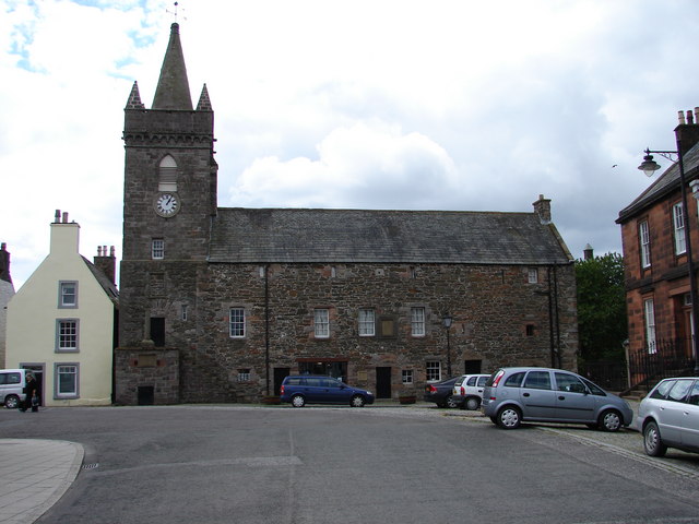
Kirkcudbright ( ; sco, Kirkcoubrie; gd, Cille Chùithbeirt) is a town, parish and a Royal Burgh from 1455 in Kirkcudbrightshire, of which it is traditionally the county town, within Dumfries and Galloway, Scotland. The town lies southwest of Castle Douglas and Dalbeattie at the mouth of the River Dee, around from the Irish Sea. History An early rendition of the name of the town was Kilcudbrit; this derives from the Gaelic ''Cille Chuithbeirt'' meaning "chapel of Cuthbert", the saint whose mortal remains were kept at the town between their exhumation at Lindisfarne and reinterment at Chester-le-Street. John Spottiswoode, in his account of religious houses in Scotland, mentions that the Franciscans, or Grey Friars, had been established at Kirkcudbright from the 12th century. John Balliol was in possession of the ancient castle at Castledykes in the late 13th century and Edward I of England is said to have stayed here in 1300 during his war against Scotland. In 1455 Kirkcudb ... [...More Info...] [...Related Items...] OR: [Wikipedia] [Google] [Baidu] |
Stewartry
Stewartry was a local government district from 1975 until 1996 within the Dumfries and Galloway region in south-west Scotland. Under the name Stewartry of Kirkcudbright the area of the former district is still used as a lieutenancy area. Dumfries and Galloway Council has a Stewartry area committee which approximately covers the same area, subject to some adjustments where ward boundaries no longer follow the pre-1996 district boundary. Stewartry covers the majority of the historic county of Kirkcudbrightshire, and derives its name from the county's alternative name of the "Stewartry of Kirkcudbright". History Stewartry district was created on 16 May 1975 under the Local Government (Scotland) Act 1973, which established a two-tier structure of local government across Scotland comprising upper-tier regions and lower-tier districts. Stewartry district was one of four districts created within the region of Dumfries and Galloway. The district covered the majority of the former admin ... [...More Info...] [...Related Items...] OR: [Wikipedia] [Google] [Baidu] |
Wigtownshire
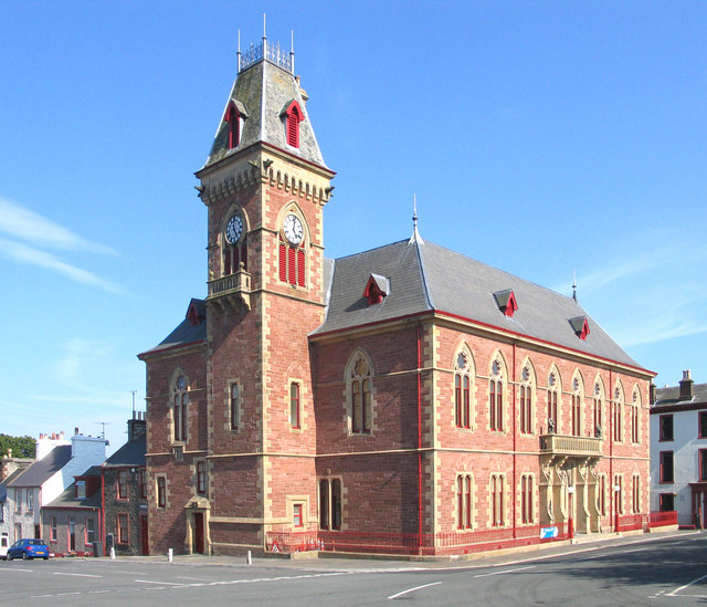
Wigtownshire or the County of Wigtown (, ) is one of the historic counties of Scotland, covering an area in the south-west of the country. Until 1975, Wigtownshire was an administrative county used for local government. Since 1975 the area has formed part of Dumfries and Galloway for local government purposes. Wigtownshire continues to be used as a territory for land registration, being a registration county. The historic county is all within the slightly larger Wigtown Area, which is one of the lieutenancy areas of Scotland and was used in local government as the Wigtown District from 1975 to 1996. Wigtownshire forms the western part of the medieval lordship of Galloway, which retained a degree of autonomy until it was fully absorbed by Scotland in the 13th century. In 1369, the part of Galloway east of the River Cree was placed under the control of a steward and so became known as the Stewartry of Kirkcudbright. The rest of Galloway remained under the authority of a sheriff, an ... [...More Info...] [...Related Items...] OR: [Wikipedia] [Google] [Baidu] |
Shires Of Scotland
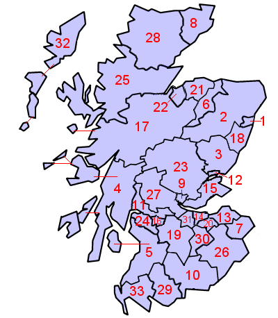
The shires of Scotland ( gd, Siorrachdan na h-Alba), or counties of Scotland, are historic subdivisions of Scotland established in the Middle Ages and used as administrative divisions until 1975. Originally established for judicial purposes (being the territory over which a sheriff had jurisdiction), from the 17th century they started to be used for local administration purposes as well. The areas used for judicial functions (sheriffdoms) came to diverge from the shires, which ceased to be used for local government purposes after 1975 under the Local Government (Scotland) Act 1973. Today, local government in Scotland is based upon council areas, which sometimes incorporate county names, but frequently have vastly different boundaries. Counties continue to be used for land registration, and form the basis of the lieutenancy areas (although the latter are not entirely identical). History Sheriffdoms or shires Malcolm III (reigned 1058 to 1093) appears to have introduced sheri ... [...More Info...] [...Related Items...] OR: [Wikipedia] [Google] [Baidu] |
Counties Of Scotland
The shires of Scotland ( gd, Siorrachdan na h-Alba), or counties of Scotland, are historic subdivisions of Scotland established in the Middle Ages and used as administrative divisions until 1975. Originally established for judicial purposes (being the territory over which a sheriff had jurisdiction), from the 17th century they started to be used for local administration purposes as well. The areas used for judicial functions (sheriffdoms) came to diverge from the shires, which ceased to be used for local government purposes after 1975 under the Local Government (Scotland) Act 1973. Today, local government in Scotland is based upon council areas, which sometimes incorporate county names, but frequently have vastly different boundaries. Counties continue to be used for land registration, and form the basis of the lieutenancy areas (although the latter are not entirely identical). History Sheriffdoms or shires Malcolm III (reigned 1058 to 1093) appears to have introduced sheri ... [...More Info...] [...Related Items...] OR: [Wikipedia] [Google] [Baidu] |
Galloway
Galloway ( ; sco, Gallowa; la, Gallovidia) is a region in southwestern Scotland comprising the historic counties of Wigtownshire and Kirkcudbrightshire. It is administered as part of the council area of Dumfries and Galloway. A native or inhabitant of Galloway is called a Gallovidian. The place name Galloway is derived from the Gaelic ' ("amongst the '"). The , literally meaning "Stranger-'"; the specific identity of whom the term was applied to is unknown, but the predominant view is that it referred to an ethnic and/or cultural identity such as the Strathclyde Britons or another related but distinct population. A popular theory is that it refers to a population of mixed Scandinavian and Gaelic ethnicity that may have inhabited Galloway in the Middle Ages. Galloway is bounded by sea to the west and south, the Galloway Hills to the north, and the River Nith to the east; the border between Kirkcudbrightshire and Wigtownshire is marked by the River Cree. The definition has ... [...More Info...] [...Related Items...] OR: [Wikipedia] [Google] [Baidu] |
Dumfriesshire
Dumfriesshire or the County of Dumfries or Shire of Dumfries (''Siorrachd Dhùn Phris'' in Gaelic) is a historic county and registration county in southern Scotland. The Dumfries lieutenancy area covers a similar area to the historic county. In terms of historic counties it borders Kirkcudbrightshire to the west, Ayrshire to the north-west, Lanarkshire, Peeblesshire and Selkirkshire to the north, and Roxburghshire to the east. To the south is the coast of the Solway Firth, and the English county of Cumberland. Dumfriesshire has three traditional subdivisions, based on the three main valleys in the county: Annandale, Eskdale and Nithsdale. These had been independent provinces in medieval times but were gradually superseded as administrative areas by the area controlled by the sheriff of Dumfries, or Dumfriesshire. A Dumfriesshire County Council existed from 1890 until 1975. Since 1975, the area of the historic county has formed part of the Dumfries and Galloway council ... [...More Info...] [...Related Items...] OR: [Wikipedia] [Google] [Baidu] |
Novantae
The Novantae were a people of the late 2nd century who lived in what is now Galloway and Carrick, in southwesternmost Scotland. They are mentioned briefly in Ptolemy's ''Geography'' (written c. 150), and there is no other historical record of them. Excavations at Rispain Camp, near Whithorn, show that it was a large fortified farmstead occupied between 100 BC and 200 AD, indicating that the people living in the area at that time were engaged in agriculture. Their ethnic and cultural affinity is uncertain, with various authorities positing different links, beginning with Bede, who referred to the Novantae as the Niduarian Picts, and including the Encyclopædia Britannica (11th ed.), which described them as ''"a tribe of Celtic Gaels called Novantae or Atecott Picts."'' Scottish author Edward Grant Ries has identified the Novantae (along with other early tribes of southern Scotland) as a Brythonic-speaking culture. However, the region has a history that includes the culture of t ... [...More Info...] [...Related Items...] OR: [Wikipedia] [Google] [Baidu] |
Lieutenancy Areas Of Scotland
The lieutenancy areas of Scotland are the areas used for the ceremonial lord-lieutenants, the monarch's representatives, in Scotland. The lord-lieutenants' titles chosen by the monarch and his legal advisers are mainly based on placenames of the traditional counties of Scotland. In 1794 permanent lieutenancies were established by Royal Warrant. By the Militia Act 1797 (37 Geo.3, C.103), the lieutenants appointed "for the Counties, Stewartries, Cities, and Places" were given powers to raise and command County Militia Units. While in their lieutenancies, lord lieutenants are among the few individuals in Scotland officially permitted to fly a banner of the Royal Arms of Scotland, the "Lion Rampant" as it is more commonly known. Lieutenancy areas are different from the current local government council areas and their committee areas. They also differ from other subdivisions of Scotland including sheriffdoms and former regions and districts. The Lord Provosts of Aberdeen, Dunde ... [...More Info...] [...Related Items...] OR: [Wikipedia] [Google] [Baidu] |
Registration County
A registration county was, in Great Britain and Ireland, a statistical unit used for the registration of births, deaths and marriages and for the output of census information. In Scotland registration counties are used for land registration purposes. England and Wales The Births and Deaths Registration Act 1836 divided England and Wales into registration districts. The districts were not innovations, however, but were identical to the poor law unions already in existence. Unions had been formed by the grouping parishes surrounding towns in which a workhouse was situated without reference to geographical county boundaries. Many PLUs included areas in two or more civil counties. Registration counties (also known as poor law counties) were formed by the aggregation of registration districts by reference to which county the workhouse was situated in. Accordingly, the boundaries of registration counties rarely coincided with those of the civil county. Attempts to establish a single ... [...More Info...] [...Related Items...] OR: [Wikipedia] [Google] [Baidu] |
.jpg)


.png)


