|
Galicia (eastern Europe)
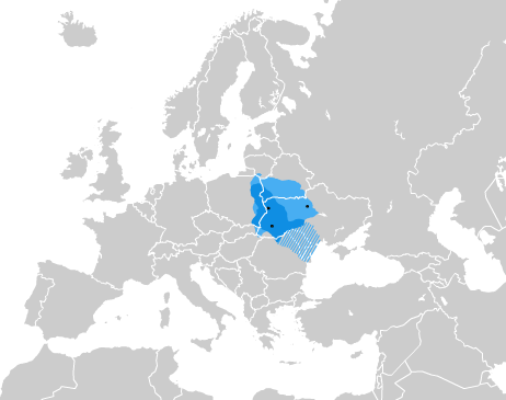
Galicia ()"Galicia" ''Collins English Dictionary'' ( uk, Галичина, translit=Halychyna ; pl, Galicja; yi, גאַליציע) is a historical and geographic region spanning what is now southeastern Poland and western Ukraine, long part of the Polish–Lithuanian Commonwealth.See also: It covers much of such historic regions as Red Ruthenia (centered on Lviv) and Lesser Poland (centered on Kraków). The name of the region derives from the medieval city of Halych, and was first mentioned in Hungarian historical chronicles in the year 1206 as ''Galiciæ''. The eastern part of the region was controlled by the medieval Kingdom of Galicia a ... [...More Info...] [...Related Items...] OR: [Wikipedia] [Google] [Baidu] |
Chorągiew Królewska Króla Zygmunta III Wazy
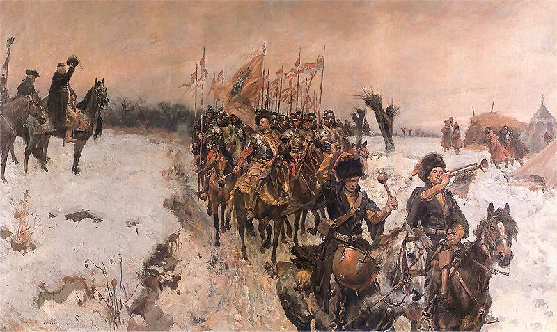
Chorągiew (; literally: "banner") was the basic administrative unit of the Polish cavalry, Polish and Lithuanian cavalry from the 14th century. An alternative name until the 17th century was ''Rota (formation), Rota''. 14th to 17th centuries Between the 14th and 17th century the ''Chorągiew'' was composed of smaller sub-units – the ''Poczet''. Types of ''Chorągiew'' were: * Chorągiew ziemska (District banner), formed by knights of a district. * Chorągiew rodowa (Clan banner), formed by Polish heraldry, clans. * Chorągiew nadworna (Court banner), formed by troops of the King. 15th century (2nd half) to 18th century (1st half) In the cavalry, since the second half of the 15th century until the first half of the 18th century, a ''Chorągiew'' was formed according to the "companion system" (system zaciągu towarzyskiego). See: ''Towarzysz'' (companion). Types of ''Chorągiew'' were: * Chorągiew husarska (Hussar banner), formed by Polish hussars, Hussars. * Chorągiew l ... [...More Info...] [...Related Items...] OR: [Wikipedia] [Google] [Baidu] |
King Of Ruthenia
King of Ruthenia, King of Rus', King of Galicia and Lodomeria, Land of Ruthenia Lord and Heir (Ukrainian: ''Король Русі'', ''король Галичини і Володимирії'', ''князь і володар Всієї Землі Руської''; Latin: ''Rex Rusiae'', ''Rex Galiciae et Lodomeriae'', ''Terrae Russiae Dominus et Heres'') was a title of princes of Galicia and Volhynia, granted by the Pope. The title was initially issued to the ruling Izyaslavichi branch of Rurik dynasty of Volhynia. Later the title was passed on to as rulers of the united Kingdom of Galicia–Volhynia. By the 15th century the title was used as a claim by other royal houses. List of kings of Ruthenia Kings of Kyivan Rus * Iziaslav I of Kyiv (as König der Russen) * Yaropolk Izyaslavich Kings of Ruthenia (Kingdom of Ruthenia) * Danylo I of Halych, king of Rus' (1253–1264). * Lev I of Halych, king of Rus' (1293–1301), moved the capital from Kholm to Lviv in 1272. * ... [...More Info...] [...Related Items...] OR: [Wikipedia] [Google] [Baidu] |
Lesser Poland Voivodeship
Lesser Poland Voivodeship or Lesser Poland Province (in pl, województwo małopolskie ), also known as Małopolska, is a voivodeship (province), in southern Poland. It has an area of , and a population of 3,404,863 (2019). It was created on 1 January 1999 out of the former Kraków, Tarnów, Nowy Sącz and parts of Bielsko-Biała, Katowice, Kielce and Krosno Voivodeships, pursuant to the Polish local government reforms adopted in 1998. The province's name recalls the traditional name of a historic Polish region, Lesser Poland, or in Polish: Małopolska. Current Lesser Poland Voivodeship, however, covers only a small part of the broader ancient Małopolska region which, together with Greater Poland (''Wielkopolska'') and Silesia (''Śląsk''), formed the early medieval Polish state. Historic Lesser Poland is much larger than the current province. It stretches far north, to Radom, and Siedlce, also including such cities, as Stalowa Wola, Lublin, Kielce, Częstochowa, and Sosnowie ... [...More Info...] [...Related Items...] OR: [Wikipedia] [Google] [Baidu] |
Oblasts
An oblast (; ; Cyrillic (in most languages, including Russian and Ukrainian): , Bulgarian: ) is a type of administrative division of Belarus, Bulgaria, Kazakhstan, Kyrgyzstan, Russia, and Ukraine, as well as the Soviet Union and the Kingdom of Yugoslavia. Official terms in successor states of the Soviet Union differ, but some still use a cognate of the Russian term, e.g., ''vobłasć'' (''voblasts'', ''voblasts'', official orthography: , Taraškievica: , ) is used for regions of Belarus, ' (plural: ') for regions of Kazakhstan, and ''oblusu'' (') for regions of Kyrgyzstan. The term is often translated as "area", "zone", "province" or "region". The last translation may lead to confusion, because "raion" may be used for other kinds of administrative division, which may be translated as "region", "district" or "county" depending on the context. Unlike "province", translations as "area", "zone", and "region" may lead to confusion because they have very common meanings other than ... [...More Info...] [...Related Items...] OR: [Wikipedia] [Google] [Baidu] |
Ivano-Frankivsk Oblast
Ivano-Frankivsk Oblast ( uk, Іва́но-Франкі́вська о́бласть, translit=Ivano-Frankivska oblast), also referred to as Ivano-Frankivshchyna ( uk, Іва́но-Франкі́вщина), is an administrative divisions of Ukraine, oblast (region) in western Ukraine. Its administrative center is the city of Ivano-Frankivsk. As is the case with most other oblasts of Ukraine this region has the same name as its administrative center – which was renamed by the Ukrainian Soviet Socialist Republic, Soviet Ukrainian authorities after the Ukrainian writer Ivan Franko on 9 November 1962. It has a population of Ivano-Frankivsk Oblast is also known to Ukrainians by a deep-rooted alternative name: ''Prykarpattia'' (although some sources may also consider the southern Lviv Oblast including such cities as Stryi, Truskavets, and Drohobych, as also part of Prykarpattia). Prykarpattia, together with Lviv Oblast, Lviv and Ternopil Oblast, Ternopil regions, was the main body of ... [...More Info...] [...Related Items...] OR: [Wikipedia] [Google] [Baidu] |
Ternopilska Oblast
Ternopil Oblast ( uk, Тернопі́льська о́бласть, translit=Ternopilska oblast; also referred to as Ternopilshchyna, uk, Терно́пільщина, label=none, or Ternopillia, uk, Тернопілля, label=none) is an oblast (province) of Ukraine. Its administrative center is Ternopil, through which flows the Seret, a tributary of the Dniester. Population: One of the natural wonders of the region are its cave complexes.Tell about Ukraine. Ternopil Oblast 24 Kanal (youtube). Although Ternopil Oblast is among the smallest regions in Ukraine, over 100 caves have been discovered there. Scientists believe these are only 20% of all possible caves in the region. The biggest cave is [...More Info...] [...Related Items...] OR: [Wikipedia] [Google] [Baidu] |
Lviv Oblast
Lviv Oblast ( uk, Льві́вська о́бласть, translit=Lvivska oblast, ), also referred to as Lvivshchyna ( uk, Льві́вщина, ), ). The name of each oblast is a wikt:Appendix:Glossary#relational, relational adjective—in English translating to a noun adjunct which otherwise serves the same function—formed by adding a feminine suffix to the name of the respective center city: ''Lʹvív'' is the center of the ''Lʹvívsʹka óblastʹ'' (Lviv Oblast). Most oblasts are also sometimes referred to in a feminine noun form, following the convention of traditional regional place names, ending with the suffix "-shchyna", as is the case with the Lviv Oblast, ''Lvivshchyna''. is an administrative divisions of Ukraine, oblast (province) in western Ukraine. The capital city, administrative center of the oblast is the city of Lviv. The current population is History The oblast was created as part of the Ukrainian Soviet Socialist Republic on December 4, 1939 following the So ... [...More Info...] [...Related Items...] OR: [Wikipedia] [Google] [Baidu] |
Western Ukraine
Western Ukraine or West Ukraine ( uk, Західна Україна, Zakhidna Ukraina or , ) is the territory of Ukraine linked to the former Kingdom of Galicia–Volhynia, which was part of the Polish–Lithuanian Commonwealth, the Austrian Empire, Austria-Hungary and the Second Polish Republic, and came fully under the control of the Soviet Union (via the Ukrainian Soviet Socialist Republic) only in 1939, following the Molotov–Ribbentrop Pact. There is no universally accepted definition of the territory's boundaries (see the map, right), but the contemporary Ukrainian administrative regions or Oblasts of Chernivtsi, Ivano-Frankovsk, Lviv, Ternopil and Transcarpathia (which were part of the former Austro-Hungarian Empire) are nearly always included and the Lutsk and Rivne Oblasts (parts of the annexed from Poland during its Third Partition) are usually included. It is less common to include the Khmelnytski and, especially, the Vinnytsia and Zhytomyr Oblasts in this c ... [...More Info...] [...Related Items...] OR: [Wikipedia] [Google] [Baidu] |
Kingdom Of Galicia And Lodomeria
The Kingdom of Galicia and Lodomeria,, ; pl, Królestwo Galicji i Lodomerii, ; uk, Королівство Галичини та Володимирії, Korolivstvo Halychyny ta Volodymyrii; la, Rēgnum Galiciae et Lodomeriae also known as Austrian Galicia or colloquially Austrian Poland, was a constituent possession of the Habsburg monarchy in the historical region of Galicia in Eastern Europe. The crownland was established in 1772. The lands were annexed from the Polish-Lithuanian Commonwealth as part of the First Partition of Poland. In 1804 it became a crownland of the newly proclaimed Austrian Empire. From 1867 it was a crownland within the Cisleithanian or Austrian half of the dual monarchy of Austria-Hungary. It maintained a degree of provincial autonomy. Its status remained unchanged until the dissolution of the monarchy in 1918. The domain was initially carved in 1772 from the south-western part of the Polish–Lithuanian Commonwealth. During the following pe ... [...More Info...] [...Related Items...] OR: [Wikipedia] [Google] [Baidu] |
Austrian Empire
The Austrian Empire (german: link=no, Kaiserthum Oesterreich, modern spelling , ) was a Central-Eastern European multinational great power from 1804 to 1867, created by proclamation out of the realms of the Habsburgs. During its existence, it was the third most populous monarchy in Europe after the Russian Empire and the United Kingdom. Along with Prussia, it was one of the two major powers of the German Confederation. Geographically, it was the third-largest empire in Europe after the Russian Empire and the First French Empire (). The empire was proclaimed by Francis II, Holy Roman Emperor, Francis II in 1804 in response to Napoleon's declaration of the First French Empire, unifying all Habsburg monarchy, Habsburg possessions under one central government. It remained part of the Holy Roman Empire until the latter's dissolution in 1806. It continued fighting against Napoleon throughout the Napoleonic Wars, except for a period between 1809 and 1813, when Austria was first all ... [...More Info...] [...Related Items...] OR: [Wikipedia] [Google] [Baidu] |
Cisleithania
Cisleithania, also ''Zisleithanien'' sl, Cislajtanija hu, Ciszlajtánia cs, Předlitavsko sk, Predlitavsko pl, Przedlitawia sh-Cyrl-Latn, Цислајтанија, Cislajtanija ro, Cisleithania uk, Цислейтанія, Tsysleitaniia it, Cisleitania , officially The Kingdoms and Lands Represented in the Imperial Council, () was the northern and western part of Austria-Hungary, the Dual Monarchy created in the Compromise of 1867—as distinguished from ''Transleithania'' (i.e., the Hungarian Lands of the Crown of Saint Stephen east of beyond"the Leitha River). This name for the region was a common, but unofficial one. The Cisleithanian capital was Vienna, the residence of the Austrian emperor. The territory had a population of 28,571,900 in 1910. It reached from Vorarlberg in the west to the Kingdom of Galicia and Lodomeria and the Duchy of Bukovina (today part of Ukraine and Romania) in the east, as well as from the Kingdom of Bohemia in the north to the Kingdom of Dalmatia (t ... [...More Info...] [...Related Items...] OR: [Wikipedia] [Google] [Baidu] |
Partitions Of Poland
The Partitions of Poland were three partitions of the Polish–Lithuanian Commonwealth that took place toward the end of the 18th century and ended the existence of the state, resulting in the elimination of sovereign Poland and Lithuania for 123 years. The partitions were conducted by the Habsburg monarchy, the Kingdom of Prussia, and the Russian Empire, which divided up the Commonwealth lands among themselves progressively in the process of territorial seizures and annexations. The First Partition was decided on August 5, 1772 after the Bar Confederation lost the war with Russia. The Second Partition occurred in the aftermath of the Polish–Russian War of 1792 and the Targowica Confederation of 1792 when Russian and Prussian troops entered the Commonwealth and the partition treaty was signed during the Grodno Sejm on January 23, 1793 (without Austria). The Third Partition took place on October 24, 1795, in reaction to the unsuccessful Polish Kościuszko Uprising the previ ... [...More Info...] [...Related Items...] OR: [Wikipedia] [Google] [Baidu] |


