Elbe
   HOME
*


picture info

Elbe
The Elbe (; cs, Labe ; nds, Ilv or ''Elv''; Upper and dsb, Łobjo) is one of the major rivers of Central Europe. It rises in the Giant Mountains of the northern Czech Republic before traversing much of Bohemia (western half of the Czech Republic), then Germany and flowing into the North Sea at Cuxhaven, northwest of Hamburg. Its total length is . The Elbe's major tributaries include the rivers Vltava, Saale, Havel, Mulde, Schwarze Elster, and Ohře. The Elbe river basin, comprising the Elbe and its tributaries, has a catchment area of , the twelfth largest in Europe. The basin spans four countries, however it lies almost entirely just in two of them, Germany (65.5%) and the Czech Republic (33.7%, covering about two thirds of the state's territory). Marginally, the basin stretches also to Austria (0.6%) and Poland (0.2%). The Elbe catchment area is inhabited by 24.4 million people, the biggest cities within are Berlin, Hamburg, Prague, Dresden and Leipzig. Etymology Firs ...
[...More Info...]      
[...Related Items...]     OR:     [Wikipedia]   [Google]   [Baidu]  


picture info

Dresden
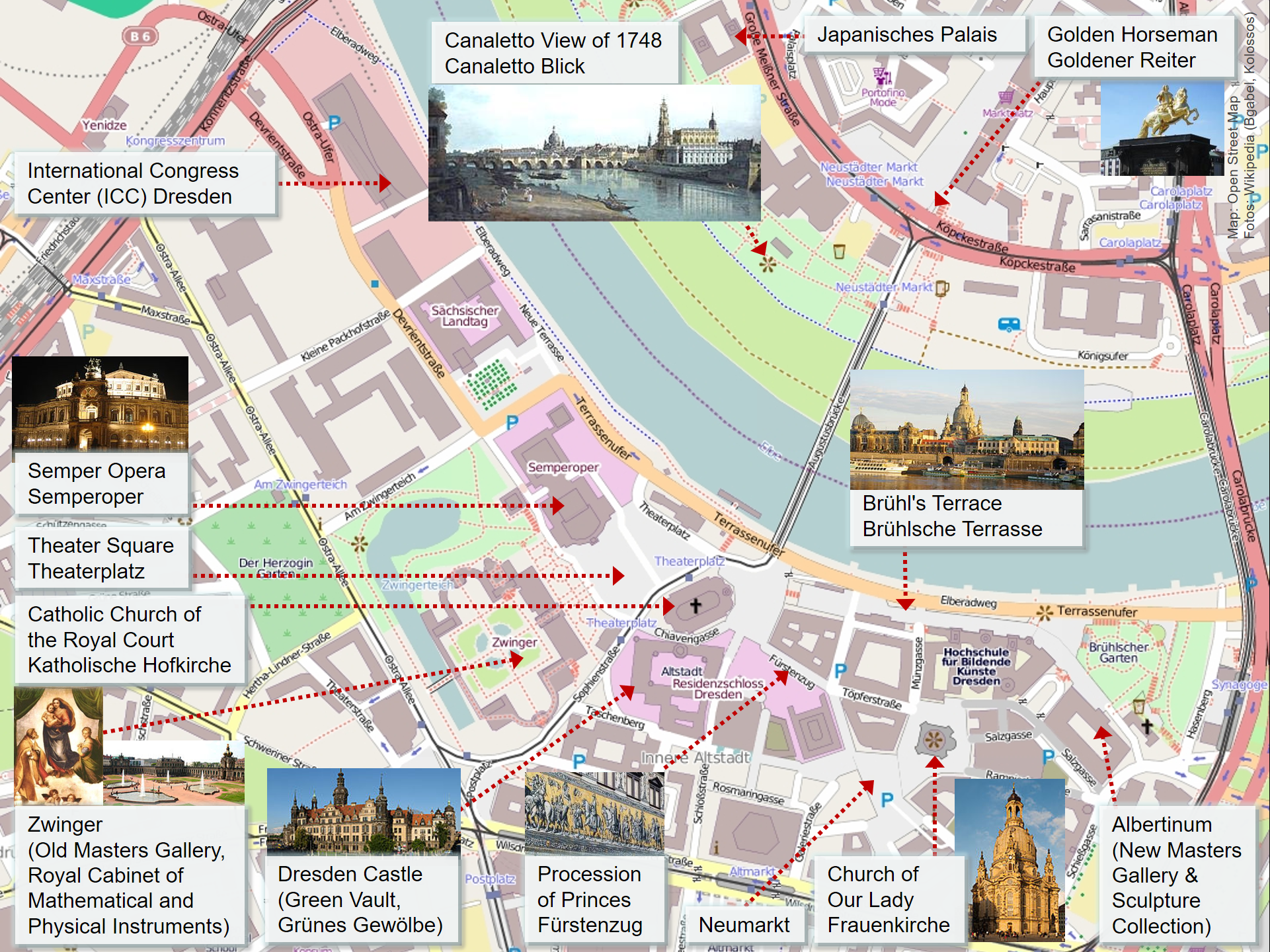
Dresden (, ; Upper Saxon: ''Dräsdn''; wen, label=Upper Sorbian, Drježdźany) is the capital city of the German state of Saxony and its second most populous city, after Leipzig. It is the 12th most populous city of Germany, the fourth largest by area (after Berlin, Hamburg and Cologne), and the third most populous city in the area of former East Germany, after Berlin and Leipzig. Dresden's urban area comprises the towns of Freital, Pirna, Radebeul, Meissen, Coswig, Radeberg and Heidenau and has around 790,000 inhabitants. The Dresden metropolitan area has approximately 1.34 million inhabitants. Dresden is the second largest city on the River Elbe after Hamburg. Most of the city's population lives in the Elbe Valley, but a large, albeit very sparsely populated area of the city east of the Elbe lies in the West Lusatian Hill Country and Uplands (the westernmost part of the Sudetes) and thus in Lusatia. Many boroughs west of the Elbe lie in the foreland of the Ore Mounta ...
[...More Info...]      
[...Related Items...]     OR:     [Wikipedia]   [Google]   [Baidu]  


picture info

Hamburg
(male), (female) en, Hamburger(s), Hamburgian(s) , timezone1 = Central (CET) , utc_offset1 = +1 , timezone1_DST = Central (CEST) , utc_offset1_DST = +2 , postal_code_type = Postal code(s) , postal_code = 20001–21149, 22001–22769 , area_code_type = Area code(s) , area_code = 040 , registration_plate = , blank_name_sec1 = GRP (nominal) , blank_info_sec1 = €123 billion (2019) , blank1_name_sec1 = GRP per capita , blank1_info_sec1 = €67,000 (2019) , blank1_name_sec2 = HDI (2018) , blank1_info_sec2 = 0.976 · 1st of 16 , iso_code = DE-HH , blank_name_sec2 = NUTS Region , blank_info_sec2 = DE6 , website = , footnotes ...
[...More Info...]      
[...Related Items...]     OR:     [Wikipedia]   [Google]   [Baidu]  


picture info

Děčín
Děčín (; german: Tetschen, 1942–1945: ''Tetschen–Bodenbach'') is a city in the Ústí nad Labem Region of the Czech Republic. It has about 47,000 inhabitants. It is the 7th largest municipality in the country by area. Administrative parts Děčín is made up of 35 city parts and villages: *Děčín I-Děčín *Děčín II-Nové Město *Děčín III-Staré Město *Děčín IV-Podmokly *Děčín V-Rozbělesy *Děčín VI-Letná *Děčín VII-Chrochvice *Děčín VIII-Dolní Oldřichov *Děčín IX-Bynov *Děčín X-Bělá *Děčín XI-Horní Žleb *Děčín XII-Vilsnice *Děčín XIII-Loubí *Děčín XIV-Dolní Žleb *Děčín XV-Prostřední Žleb *Děčín XVI-Přípeř *Děčín XVII-Jalůvčí *Děčín XVIII-Maxičky *Děčín XIX-Čechy *Děčín XX-Nová Ves *Děčín XXI-Horní Oldřichov *Děčín XXII-Václavov *Děčín XXIII-Popovice *Děčín XXIV-Krásný Studenec *Děčín XXV-Chmelnice *Děčín XXVI-Bechlejovice *Děčín XXVII-Březiny *Děčín XXVIII-Folkn ...
[...More Info...]      
[...Related Items...]     OR:     [Wikipedia]   [Google]   [Baidu]  


picture info

Stade
Stade (), officially the Hanseatic City of Stade (german: Hansestadt Stade, nds, Hansestadt Stood) is a city in Lower Saxony in northern Germany. First mentioned in records in 934, it is the seat of the district () which bears its name. It is located roughly to the west of Hamburg and belongs to that city's wider metropolitan region. Within the area of the city are the urban districts of Bützfleth, Hagen, Haddorf and Wiepenkathen, each of which have a council () of their own with some autonomous decision-making rights. Stade is located in the lower regions of the river Elbe. It is also on the German Timber-Frame Road. History The first human settlers came to the Stade area in 30,000 BC. Since 1180 Stade belonged to the Prince-Archbishopric of Bremen. In early 1208 King Valdemar II of Denmark and his troops conquered Stade. In August Valdemar II's cousin being in enmity with the king, the then Prince-Archbishop Valdemar reconquered the city only to lose it soon after ...
[...More Info...]      
[...Related Items...]     OR:     [Wikipedia]   [Google]   [Baidu]  


picture info

Magdeburg
Magdeburg (; nds, label=Low Saxon, Meideborg ) is the capital and second-largest city of the German state Saxony-Anhalt. The city is situated at the Elbe river. Otto I, the first Holy Roman Emperor and founder of the Archdiocese of Magdeburg, was buried in the city's cathedral after his death. Magdeburg's version of German town law, known as Magdeburg rights, spread throughout Central and Eastern Europe. In the Late Middle Ages, Magdeburg was one of the largest and most prosperous German cities and a notable member of the Hanseatic League. One of the most notable people from the city is Otto von Guericke, famous for his experiments with the Magdeburg hemispheres. Magdeburg has been destroyed twice in its history. The Catholic League sacked Magdeburg in 1631, resulting in the death of 25,000 non-combatants, the largest loss of the Thirty Years' War. During the World War II the Allies bombed the city in 1945 and destroying much of it. After World War II the city belonged t ...
[...More Info...]      
[...Related Items...]     OR:     [Wikipedia]   [Google]   [Baidu]  


picture info

Cuxhaven
Cuxhaven (; ) is an independent town and seat of the Cuxhaven district, in Lower Saxony, Germany. The town includes the northernmost point of Lower Saxony. It is situated on the shore of the North Sea at the mouth of the Elbe River. Cuxhaven has a footprint of (east–west) by (north–south). Its town quarters Duhnen, Döse and Sahlenburg are especially popular vacation spots on the North Sea and home to about 52,000 residents. Cuxhaven is home to an important fisherman's wharf and ship registration point for Hamburg as well as the Kiel Canal until 2008. Tourism is also of great importance. The city and its precursor Ritzebüttel belonged to Hamburg from the 13th century until 1937. The island of Neuwerk, a Hamburg dependency, is located just northwest of Cuxhaven in the North Sea. The city's symbol, known as the Kugelbake, is a beacon once used as a lighthouse; the wooden landmark on the mouth of the Elbe marks the boundary between the river and the North Sea and also adorns t ...
[...More Info...]      
[...Related Items...]     OR:     [Wikipedia]   [Google]   [Baidu]  


picture info

Wittenberg
Wittenberg ( , ; Low Saxon language, Low Saxon: ''Wittenbarg''; meaning ''White Mountain''; officially Lutherstadt Wittenberg (''Luther City Wittenberg'')), is the fourth largest town in Saxony-Anhalt, Germany. Wittenberg is situated on the River Elbe, north of Leipzig and south-west of Berlin, and has a population of 46,008 (2018). Wittenberg is famous for its close connection with Martin Luther and the Protestant Reformation, for which it received the honourific ''Lutherstadt''. Several of Wittenberg's buildings are associated with the events, including a preserved part of the Augustinians, Augustinian monastery in which Luther lived, first as a monk and later as owner with his wife Katharina von Bora and family, considered to be the world's premier museum dedicated to Luther. Wittenberg was also the seat of the Elector of Saxony, a dignity held by the dukes of Duchy of Saxe-Wittenberg, Saxe-Wittenberg, making it one of the most powerful cities in the Holy Roman Empire. To ...
[...More Info...]      
[...Related Items...]     OR:     [Wikipedia]   [Google]   [Baidu]  


picture info

Lower Saxony
Lower Saxony (german: Niedersachsen ; nds, Neddersassen; stq, Läichsaksen) is a German state (') in northwestern Germany. It is the second-largest state by land area, with , and fourth-largest in population (8 million in 2021) among the 16 ' federated as the Federal Republic of Germany. In rural areas, Northern Low Saxon and Saterland Frisian are still spoken, albeit in declining numbers. Lower Saxony borders on (from north and clockwise) the North Sea, the states of Schleswig-Holstein, Hamburg, , Brandenburg, Saxony-Anhalt, Thuringia, Hesse and North Rhine-Westphalia, and the Netherlands. Furthermore, the state of Bremen forms two enclaves within Lower Saxony, one being the city of Bremen, the other its seaport, Bremerhaven (which is a semi-enclave, as it has a coastline). Lower Saxony thus borders more neighbours than any other single '. The state's largest cities are state capital Hanover, Braunschweig (Brunswick), Lüneburg, Osnabrück, Oldenburg, Hildesheim, Salzgitt ...
[...More Info...]      
[...Related Items...]     OR:     [Wikipedia]   [Google]   [Baidu]  


picture info

Ústí Nad Labem Region
Ústí nad Labem Region or Ústecký Region ( cs, Ústecký kraj, , ), is an administrative unit ( cs, kraj) of the Czech Republic, located in the north-western part of the historical land of Bohemia, and named after the capital, Ústí nad Labem. It covers the majority of the former North Bohemia province ( cs, Severočeský kraj) and is part of the broader area of North Bohemia. The region borders the regions of Liberec (east), Central Bohemia (south), Plzeň (southwest), Karlovy Vary (west) and the German region of Saxony to the north. The Ústí region comprises a range of very different types of landscape. Between the high escarpment of the Ore Mountains ( cs, Krušné hory) range and the Bohemian Central Uplands with many volcanic hills, there are vast areas devastated by surface coal mining (the North Bohemian Basin), partly being recultivated into an artificial landscape with ponds, plains and groves. The Elbe river runs through the Central Uplands in a winding gorge o ...
[...More Info...]      
[...Related Items...]     OR:     [Wikipedia]   [Google]   [Baidu]  


picture info

Ústí Nad Labem
Ústí nad Labem (, , ) is a city in the Czech Republic. It has about 92,000 inhabitants. It is the capital of its eponymous region and district. It is a major industrial centre and, besides being an active river port, is an important railway junction. Administrative division Ústí nad Labem is divided into four boroughs, which are further divided into 22 administrative parts: *Ústí nad Labem-město (parts Ústí nad Labem-centrum, Božtěšice, Bukov, Habrovice, Hostovice, Klíše, Předlice, Skorotice, Strážky, Vaňov and Všebořice); *Ústí nad Labem-Neštěmice (parts Krásné Březno, Mojžíř and Neštěmice); *Ústí nad Labem-Severní terasa (part Severní Terasa); *Ústí nad Labem-Střekov (parts Brná, Církvice, Kojetice, Olešnice, Sebuzín, Střekov and Svádov). Etymology The name of Ústí nad Labem is formed from the Old Czech ' ("river mouth") and ' (the Elbe River). It thus literally means "Mouth-upon-the-Elbe", in reference to its location at the B ...
[...More Info...]      
[...Related Items...]     OR:     [Wikipedia]   [Google]   [Baidu]  


picture info

Dessau
Dessau is a town and former municipality in Germany at the confluence of the rivers Mulde and Elbe, in the '' Bundesland'' (Federal State) of Saxony-Anhalt. Since 1 July 2007, it has been part of the newly created municipality of Dessau-Roßlau. Population of Dessau proper: 67,747 (Dec. 2020). Geography Dessau is situated on a floodplain where the Mulde flows into the Elbe. This causes yearly floods. The worst flood took place in the year 2002, when the Waldersee district was nearly completely flooded. The south of Dessau touches a well-wooded area called Mosigkauer Heide. The highest elevation is a 110 m high former rubbish dump called Scherbelberg in the southwest of Dessau. Dessau is surrounded by numerous parks and palaces that make it one of the greenest towns in Germany. History Dessau was first mentioned in 1213. It became an important centre in 1570, when the Principality of Anhalt was founded. Dessau became the capital of this state within the Holy Roman Empire. In ...
[...More Info...]      
[...Related Items...]     OR:     [Wikipedia]   [Google]   [Baidu]  


picture info

Vltava
Vltava ( , ; german: Moldau ) is the longest river in the Czech Republic, running southeast along the Bohemian Forest and then north across Bohemia, through Český Krumlov, České Budějovice and Prague, and finally merging with the Labe at Mělník. It is commonly referred to as the "Czech national river". Both the Czech name ' and the German name ' are believed to originate from the old Germanic words ' 'wild water' (compare Latin '). In the ' (872 AD) it is called '; from 1113 AD it is attested as '. In the ' (1125 AD) it is attested for the first time in its Bohemian form, '. Course The Vltava River is long and drains an area of in size, over half of Bohemia and about a third of the Czech Republic's entire territory. As it runs through Prague, the river is crossed by 18 bridges (including the Charles Bridge) and covers within the city. The water from the river was used for drinking until 1912 when the Vinohrady Water Tower ceased pumping operations.
[...More Info...]       [...Related Items...]     OR:     [Wikipedia]   [Google]   [Baidu]