|
Curragha Crossroads - Geograph
Curraha, also written Curragha (), is a small village located 4.5 km from Ashbourne and 4 km from Ratoath, County Meath, Ireland on the R155 road between Ratoath and the junction with the N2. The built-up area is mainly within Crickstown townland. The area of Curraha stretches from the road towards Ratoath with the border not far from Ratoath Rugby pitch down to past Kilmoon Cross. It also stretches from Greenpark Bridge over to the N2 (along the 'Bog of Curraha'). The theme park Emerald Park is also located in Curraha. Bus service Bus Éireann route 103 comes through the village four times daily (including Sundays) in each direction on its way to/from Tayto Park. In the other direction route 103 continues to Dublin via Ratoath and Ashbourne. Facilities The local national (primary) school, St Andrew's National School Curraha, first opened in 1952. Curraha also has one church (St Andrew's Church, built in 1904), four cemeteries (Curraha, Crickstown, Kilbrew an ... [...More Info...] [...Related Items...] OR: [Wikipedia] [Google] [Baidu] |
Ashbourne, County Meath
Ashbourne, historically called ''Killeglan'' or ''Kildeglan'' (), is a town in County Meath, Ireland. Located about 20 km north of Dublin and close to the M2 motorway, Ashbourne is a commuter town within Greater Dublin. In the 20 years between the 1996 and 2016 census, the town almost tripled in population from approximately 4,900 to 12,700 inhabitants. The town is passed by the Broad Meadow Water, which comes from Ratoath and Dunshaughlin. History Ancient settlement Archaeological excavations in the area around Ashbourne have revealed evidence of settlement back to neolithic times. In the townland of Rath, to the north of the town centre, a Bronze Age settlement was found during the construction of the M2 motorway. Excavations in the vicinity of the cemetery of Killegland revealed the extent of the early Christian settlement, with souterrains, house sites and a large enclosure centred around the remains of the church that is visible in the cemetery. This would link the ... [...More Info...] [...Related Items...] OR: [Wikipedia] [Google] [Baidu] |
Ratoath
Ratoath () is a commuter town in County Meath, Ireland. A branch of the Broad Meadow Water (Broadmeadow River) () flows through the town. The R125 and R155 roads meet in the village. At the 2016 census, there were 9,533 people living in Ratoath. The town is around northwest of Dublin city centre. Name Ratoath gives its name to a village, a townland, a parish, an electoral division and to a barony. The derivation or meaning of the word is uncertain. Two alternative Irish forms are cited: ''Ráth-Tógh'' and ''Ráth-Tábhachta''. These place names occur in Irish manuscripts and scholars say that the writers were referring to Ratoath; it seems that they were trying to give a phonetic rendering of a name that was unfamiliar to them. ''Mruigtuaithe'' occurs in the Book of Armagh as the name of one of these places in Meath where Saint Patrick founded a church and Eoin MacNeill identifies it as Ratoath. If this is correct it would seem that the second portion of the word comes from ... [...More Info...] [...Related Items...] OR: [Wikipedia] [Google] [Baidu] |
County Meath
County Meath (; gle, Contae na Mí or simply ) is a county in the Eastern and Midland Region of Ireland, within the province of Leinster. It is bordered by Dublin to the southeast, Louth to the northeast, Kildare to the south, Offaly to the southwest, Westmeath to the west, Cavan to the northwest, and Monaghan to the north. To the east, Meath also borders the Irish Sea along a narrow strip between the rivers Boyne and Delvin, giving it the second shortest coastline of any county. Meath County Council is the local authority for the county. Meath is the 14th-largest of Ireland's 32 traditional counties by land area, and the 8th-most populous, with a total population of 220,296 according to the 2022 census. The county town and largest settlement in Meath is Navan, located in the centre of the county along the River Boyne. Other towns in the county include Trim, Kells, Laytown, Ashbourne, Dunboyne, Slane and Bettystown. Colloquially known as "The Royal County", the historic ... [...More Info...] [...Related Items...] OR: [Wikipedia] [Google] [Baidu] |
Republic Of Ireland
Ireland ( ga, Éire ), also known as the Republic of Ireland (), is a country in north-western Europe consisting of 26 of the 32 counties of the island of Ireland. The capital and largest city is Dublin, on the eastern side of the island. Around 2.1 million of the country's population of 5.13 million people resides in the Greater Dublin Area. The sovereign state shares its only land border with Northern Ireland, which is part of the United Kingdom. It is otherwise surrounded by the Atlantic Ocean, with the Celtic Sea to the south, St George's Channel to the south-east, and the Irish Sea to the east. It is a unitary, parliamentary republic. The legislature, the , consists of a lower house, ; an upper house, ; and an elected President () who serves as the largely ceremonial head of state, but with some important powers and duties. The head of government is the (Prime Minister, literally 'Chief', a title not used in English), who is elected by the Dáil and appointed by ... [...More Info...] [...Related Items...] OR: [Wikipedia] [Google] [Baidu] |
Townland
A townland ( ga, baile fearainn; Ulster-Scots: ''toonlann'') is a small geographical division of land, historically and currently used in Ireland and in the Western Isles in Scotland, typically covering . The townland system is of Gaelic origin, pre-dating the Norman invasion, and most have names of Irish origin. However, some townland names and boundaries come from Norman manors, plantation divisions, or later creations of the Ordnance Survey.Connolly, S. J., ''The Oxford Companion to Irish History, page 577. Oxford University Press, 2002. ''Maxwell, Ian, ''How to Trace Your Irish Ancestors'', page 16. howtobooks, 2009. The total number of inhabited townlands in Ireland was 60,679 in 1911. The total number recognised by the Irish Place Names database as of 2014 was 61,098, including uninhabited townlands, mainly small islands. Background In Ireland a townland is generally the smallest administrative division of land, though a few large townlands are further divided into h ... [...More Info...] [...Related Items...] OR: [Wikipedia] [Google] [Baidu] |
Emerald Park
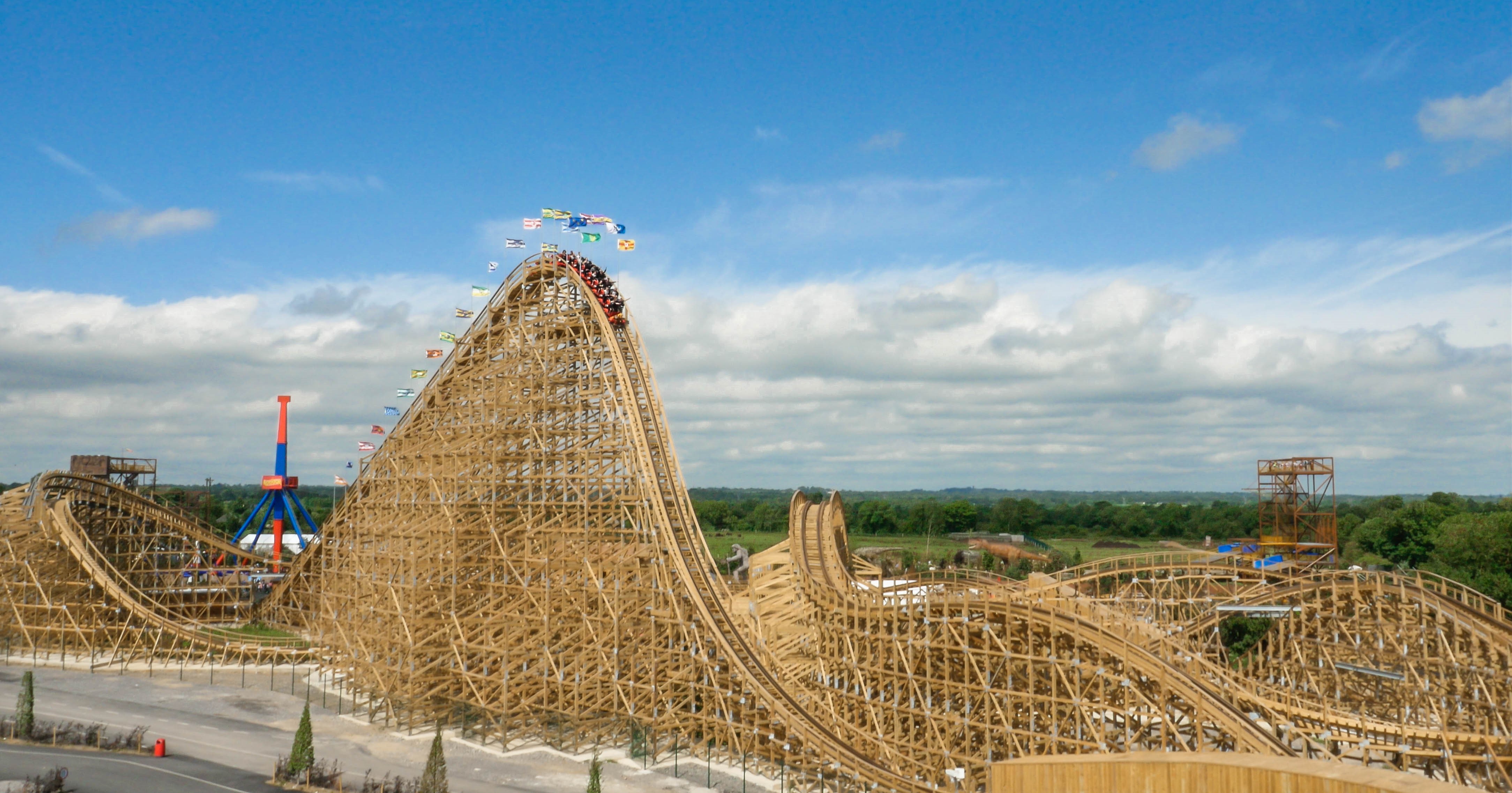
Emerald Park (), known from 2010 to 2022 as Tayto Park, is an amusement park in Ireland, originally themed based on the Irish potato crisp brand Tayto. It is located in the townland of Kilbrew, in County Meath and was founded by farmer-turned-entrepreneur Raymond Coyle (d. 2022). History The park opened on 24 November 2010. It was designed by Stewart and Sinnott Architects, landscaper Anthony Ryan and designer Milo Fitzgerald, with an €8.5 million investment from Ray Coyle, the potato farmer who established Largo Foods, and bought out the Tayto brand. The park developed 22 hectares of County Meath farmland into and includes Ireland's only wooden roller coaster, a Maxi Dance Party 360, adventure playgrounds and an exotic zoo. It is the sixth most popular paid-for attraction in Ireland, with 750,000 visitors in 2015. In February 2022, it was announced that the park would be rebranded in 2023 after Tayto Snacks confirmed they would not be renewing their sponsorship agreeme ... [...More Info...] [...Related Items...] OR: [Wikipedia] [Google] [Baidu] |
Bus Éireann
Bus Éireann (; "Irish Bus") is a state-owned bus and coach operator providing services throughout Ireland, with the exception of Dublin and the Greater Dublin Area, where bus services are provided by sister company Dublin Bus. It is a subsidiary of Córas Iompair Éireann (CIÉ). The company's primary hub is ''Busáras, Central Bus Station'', located in Store Street, Central Dublin. History Bus Éireann was established in February 1987 when it was split out from Córas Iompair Éireann (CIÉ). The logo of Bus Éireann incorporates a red Irish Setter, a breed of dog which originated in Ireland. During 2016, it was reported that Bus Éireann amassed losses of around and that these losses were set to rise throughout 2017. As a result, Shane Ross, TD, Ireland's Minister for Transport, Tourism and Sport, mentioned the company "faces insolvency within 18 months". Bus Éireann concluded an all out strike on Thursday 13 April that lasted since Friday 24 March 2017. The company ... [...More Info...] [...Related Items...] OR: [Wikipedia] [Google] [Baidu] |
Tayto Park
Emerald Park (), known from 2010 to 2022 as Tayto Park, is an amusement park in Ireland, originally themed based on the Irish potato crisp brand Tayto. It is located in the townland of Kilbrew, in County Meath and was founded by farmer-turned-entrepreneur Raymond Coyle (d. 2022). History The park opened on 24 November 2010. It was designed by Stewart and Sinnott Architects, landscaper Anthony Ryan and designer Milo Fitzgerald, with an €8.5 million investment from Ray Coyle, the potato farmer who established Largo Foods, and bought out the Tayto brand. The park developed 22 hectares of County Meath farmland into and includes Ireland's only wooden roller coaster, a Maxi Dance Party 360, adventure playgrounds and an exotic zoo. It is the sixth most popular paid-for attraction in Ireland, with 750,000 visitors in 2015. In February 2022, it was announced that the park would be rebranded in 2023 after Tayto Snacks confirmed they would not be renewing their sponsorship agreeme ... [...More Info...] [...Related Items...] OR: [Wikipedia] [Google] [Baidu] |
Dublin
Dublin (; , or ) is the capital and largest city of Republic of Ireland, Ireland. On a bay at the mouth of the River Liffey, it is in the Provinces of Ireland, province of Leinster, bordered on the south by the Dublin Mountains, a part of the Wicklow Mountains range. At the 2016 census of Ireland, 2016 census it had a population of 1,173,179, while the preliminary results of the 2022 census of Ireland, 2022 census recorded that County Dublin as a whole had a population of 1,450,701, and that the population of the Greater Dublin Area was over 2 million, or roughly 40% of the Republic of Ireland's total population. A settlement was established in the area by the Gaels during or before the 7th century, followed by the Vikings. As the Kings of Dublin, Kingdom of Dublin grew, it became Ireland's principal settlement by the 12th century Anglo-Norman invasion of Ireland. The city expanded rapidly from the 17th century and was briefly the second largest in the British Empire and sixt ... [...More Info...] [...Related Items...] OR: [Wikipedia] [Google] [Baidu] |
1798 Memorial, Curragha, Co Meath
Events January–June * January – Eli Whitney contracts with the U.S. federal government for 10,000 muskets, which he produces with interchangeable parts Interchangeable parts are parts ( components) that are identical for practical purposes. They are made to specifications that ensure that they are so nearly identical that they will fit into any assembly of the same type. One such part can freely r .... * January 4 – Constantine Hangerli enters Bucharest, as List of rulers of Wallachia, Prince of Wallachia. * January 22 – A coup d'état is staged in the Netherlands (Batavian Republic). Unitarian Democrat Pieter Vreede ends the power of the parliament (with a conservative-moderate majority). * February 10 – The Pope is taken captive, and the Papacy is removed from power, by French General Louis-Alexandre Berthier. * February 15 – U.S. Representative Roger Griswold (Fed-CT) beats Congressman Matthew Lyon (Dem-Rep-VT) with a cane after the H ... [...More Info...] [...Related Items...] OR: [Wikipedia] [Google] [Baidu] |
National School (Ireland)
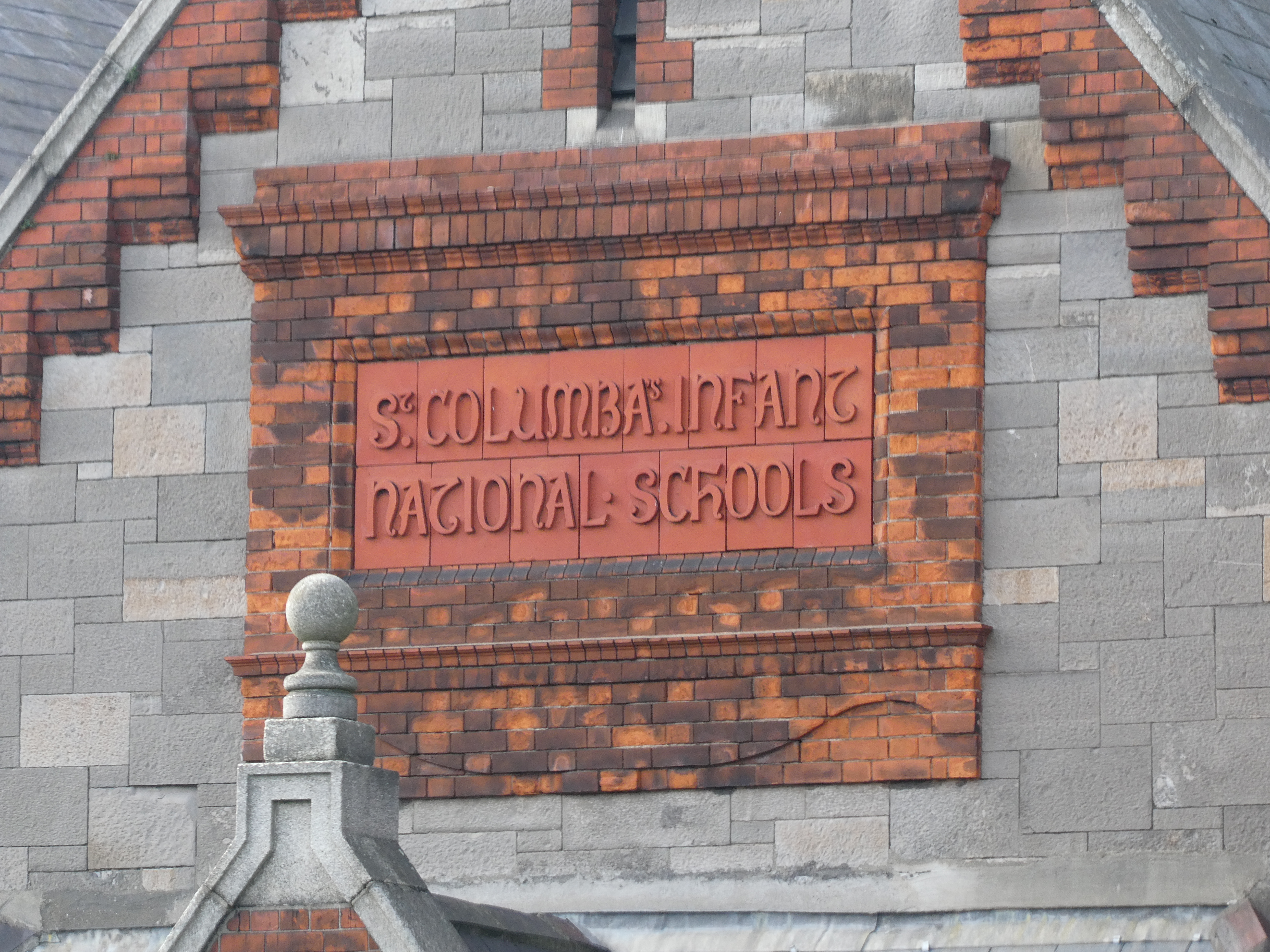
In Ireland, a national school () is a type of primary school that is financed directly by the state, but typically administered jointly by the state, a patron body, and local representatives. In national schools, most major policies, such as the curriculum and teacher salaries and conditions, are managed by the state through the Department of Education and Skills. Minor policies of the school are managed by local people, sometimes directed by a member of the clergy, as representative of the patron, through a local 'board of management'. Most primary schools in Ireland fall into this category, which is a pre-independence concept. While there are other forms of primary school in Ireland, including a relatively small number of private denominational schools which do not receive state aid, there were just 34 such private primary schools in 2012, with a combined enrollment of 7,600 pupils. By comparison there were, as of 2019, over 3,200 national schools in Ireland with a combined en ... [...More Info...] [...Related Items...] OR: [Wikipedia] [Google] [Baidu] |

.jpg)


