|
Cugir (river)
The Cugir ( hu, Kudzsir-patak) is a left tributary of the river Mure»ô (river), Mure»ô in Romania. It discharges into the Mure»ô near »ėibot. e-calauza.ro Its length is (including its headwater R√Ęul Mare (Cugir), R√Ęul Mare) and its basin size is .Valea Cugirului din preistorie p√ĘnńÉ √ģn zorii epocii moderne. Monumenta Archaeo ... [...More Info...] [...Related Items...] OR: [Wikipedia] [Google] [Baidu] |
Romania
Romania ( ; ro, Rom√Ęnia ) is a country located at the crossroads of Central Europe, Central, Eastern Europe, Eastern, and Southeast Europe, Southeastern Europe. It borders Bulgaria to the south, Ukraine to the north, Hungary to the west, Serbia to the southwest, Moldova to the east, and the Black Sea to the southeast. It has a predominantly Temperate climate, temperate-continental climate, and an area of , with a population of around 19 million. Romania is the List of European countries by area, twelfth-largest country in Europe and the List of European Union member states by population, sixth-most populous member state of the European Union. Its capital and largest city is Bucharest, followed by Ia»ôi, Cluj-Napoca, Timi»ôoara, Constan»õa, Craiova, Bra»ôov, and Gala»õi. The Danube, Europe's second-longest river, rises in Germany's Black Forest and flows in a southeasterly direction for , before emptying into Romania's Danube Delta. The Carpathian Mountains, which cross Roma ... [...More Info...] [...Related Items...] OR: [Wikipedia] [Google] [Baidu] |
Cugir
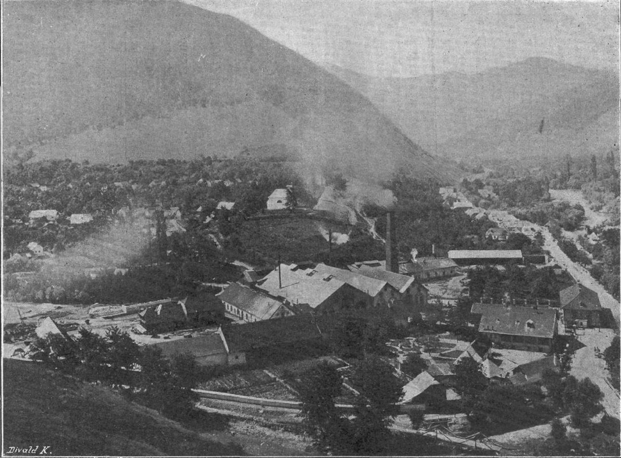
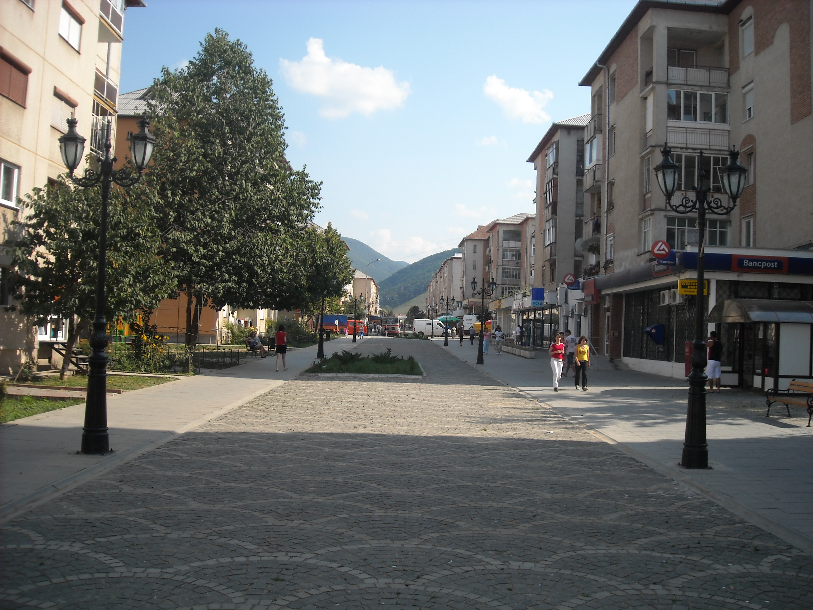
Cugir (; German: ''Kudsir, Kudschir'', Hungarian: ''Kudzsir'') is a town in Alba County, Romania. Declared a town in 1968, it administers seven villages: Boc»ôitura (Hungarian ''Boksiturahavas'', German ''Potschitur''), Bucuru (''Bukuruhavas''/''Bukur''), CńÉlene (''Kalenihavas''/''Kalleney''), Fe»õeni (''Fecehavas''/''Fetzeberg''), Goa»ôele (''Goaselehavas''/''Eisenhammer''), Muge»ôti (''Mugestihavas''/''Kudschirstallen''), and Vinerea (''Felkeny√©r''/''Oberbrodsdorf''). Geography The central settlement of the Breadfield region, the town lies on the banks of the Cugir River, at the confluence of headwaters R√Ęul Mare and R√Ęul Mic. It is situated above sea level, at the base of the »ėureanu Mountains. Cugir is located in the southwestern part of Alba County, about from Sebe»ô and from Alba Iulia, the capital of the county. It lies on the border with Hunedoara County, from OrńÉ»ôtie and from Deva. Demographics According to the 2011 census, there was a total population ... [...More Info...] [...Related Items...] OR: [Wikipedia] [Google] [Baidu] |
Vinerea, Alba
Cugir (; German: ''Kudsir, Kudschir'', Hungarian: ''Kudzsir'') is a town in Alba County, Romania. Declared a town in 1968, it administers seven villages: Boc»ôitura (Hungarian ''Boksiturahavas'', German ''Potschitur''), Bucuru (''Bukuruhavas''/''Bukur''), CńÉlene (''Kalenihavas''/''Kalleney''), Fe»õeni (''Fecehavas''/''Fetzeberg''), Goa»ôele (''Goaselehavas''/''Eisenhammer''), Muge»ôti (''Mugestihavas''/''Kudschirstallen''), and Vinerea (''Felkeny√©r''/''Oberbrodsdorf''). Geography The central settlement of the Breadfield region, the town lies on the banks of the Cugir River, at the confluence of headwaters R√Ęul Mare and R√Ęul Mic. It is situated above sea level, at the base of the »ėureanu Mountains. Cugir is located in the southwestern part of Alba County, about from Sebe»ô and from Alba Iulia, the capital of the county. It lies on the border with Hunedoara County, from OrńÉ»ôtie and from Deva. Demographics According to the 2011 census, there was a total population ... [...More Info...] [...Related Items...] OR: [Wikipedia] [Google] [Baidu] |
»ėibot
»ėibot (german: Unterbrodsdorf, Unter-Brotfeld; hu, Alkeny√©r or ''Zsibotalkeny√©r'') is a commune located in Alba County, Transylvania, Romania Romania ( ; ro, Rom√Ęnia ) is a country located at the crossroads of Central, Eastern, and Southeastern Europe. It borders Bulgaria to the south, Ukraine to the north, Hungary to the west, Serbia to the southwest, Moldova to the east, and .... It is composed of four villages: BńÉcńÉin»õi (''Bocksdorf'', ''Bokajalfalu''), Balomiru de C√Ęmp (''Ballendorf'', ''Balomir''), SńÉrńÉcsńÉu (''Szaraksz√≥'') and »ėibot. Natives * Iosif S√ģrbu References Communes in Alba County Localities in Transylvania {{Alba-geo-stub ... [...More Info...] [...Related Items...] OR: [Wikipedia] [Google] [Baidu] |
R√Ęul Mare (Cugir)
The R√Ęul Mare (in its upper course also: ''Canciu'') is the right headwater of the river Cugir in Romania. At its confluence with the R√Ęul Mic in the town Cugir, the river Cugir is formed. e-calauza.ro Its length is and its basin size is . Tributaries The following rivers are tributaries to the R√Ęul Mare (from source to mouth): *Left: ZńÉnoaga,Bo»ôorog
The Bo»ôorog (in its upper course also: ''Grop»ôoara'') is a left tributary of the R√Ęul Mare in Romania. Its source is located in the »ėureanu Mountains
The »ėureanu Mountains, (German: ''M√ľhlbacher Gebirge'', Hungarian: ''Kudzsiri-havasok' ... , ...
[...More Info...] [...Related Items...] OR: [Wikipedia] [Google] [Baidu] |
R√Ęul Mic (Cugir)
The R√Ęul Mic is the left headwater of the river Cugir in Romania. At its confluence with the R√Ęul Mare in the town Cugir Cugir (; German: ''Kudsir, Kudschir'', Hungarian: ''Kudzsir'') is a town in Alba County, Romania. Declared a town in 1968, it administers seven villages: Boc»ôitura (Hungarian ''Boksiturahavas'', German ''Potschitur''), Bucuru (''Bukuruhavas''/' ..., the river Cugir is formed. e-calauza.ro Its length is and its basin size is . Tributaries The following rivers are tributaries to the R√Ęul Mic (from source to mouth): *Left: Sc√Ęrna, Tisa, Arie»ô, Valea Prihodi»ôtei, BrńÉdet *Right: RńÉchitaReferences [...More Info...] [...Related Items...] OR: [Wikipedia] [Google] [Baidu] |
Mure»ô (river)
The Mure»ô (; hu, Maros, ; sr, script=Cyrl, –ú–ĺ—Ä–ł—ą, MoriŇ°) is a river in Eastern Europe. Its drainage basin covers an area of .Analysis of the Tisza River Basin 2007 IPCDR It originates in the HńÉ»ôma»ôu Mare Range in the Eastern , |
Tributary
A tributary, or affluent, is a stream or river that flows into a larger stream or main stem (or parent) river or a lake. A tributary does not flow directly into a sea or ocean. Tributaries and the main stem river drain the surrounding drainage basin of its surface water and groundwater, leading the water out into an ocean. The Irtysh is a chief tributary of the Ob river and is also the longest tributary river in the world with a length of . The Madeira River is the largest tributary river by volume in the world with an average discharge of . A confluence, where two or more bodies of water meet, usually refers to the joining of tributaries. The opposite to a tributary is a distributary, a river or stream that branches off from and flows away from the main stream. PhysicalGeography.net, Michael Pidwirny & S ... [...More Info...] [...Related Items...] OR: [Wikipedia] [Google] [Baidu] |
Headwater
The headwaters of a river or stream is the farthest place in that river or stream from its estuary or downstream confluence with another river, as measured along the course of the river. It is also known as a river's source. Definition The United States Geological Survey (USGS) states that a river's "length may be considered to be the distance from the mouth to the most distant headwater source (irrespective of stream name), or from the mouth to the headwaters of the stream commonly known as the source stream". As an example of the second definition above, the USGS at times considers the Missouri River as a tributary of the Mississippi River. But it also follows the first definition above (along with virtually all other geographic authorities and publications) in using the combined Missouri‚ÄĒlower Mississippi length figure in lists of lengths of rivers around the world. Most rivers have numerous tributaries and change names often; it is customary to regard the longest t ... [...More Info...] [...Related Items...] OR: [Wikipedia] [Google] [Baidu] |
»ėureanu Mountains
The »ėureanu Mountains, (German: ''M√ľhlbacher Gebirge'', Hungarian: ''Kudzsiri-havasok''), belong to Romania's Par√Ęng range in the Southern Carpathians, with peaks frequently exceeding . The mountains are located north of Romania's Jiu Valley, in the Hunedoara and Alba counties. They border the Cindrel Mountains to the east and the Lotru Mountains to the southeast. The Par√Ęng Mountains are to the south, separated by the Jiul de Est River. To the west, across the Ha»õeg Depression and the OrńÉ»ôtie Corridor, lie the Retezat Mountains and the Poiana RuscńÉ Mountains, while to the north, across the Mure»ô River valley, lie the Apuseni Mountains. The »ėureanu Mountains are divided into the Sebe»ô Mountains to the east and the OrńÉ»ôtiei Mountains to the west. In all, they cover an area of . The highest peak is Peter's Peak (''V√Ęrfu lui PńÉtru''), at ; other peaks are »ėureanu Peak, at and V√Ęrfu Negru, at , as well as Au»ôelu, ComńÉrnicelul, Grop»ôoara, and P√Ęrva peaks. T ... [...More Info...] [...Related Items...] OR: [Wikipedia] [Google] [Baidu] |


