|
Crisman, Colorado
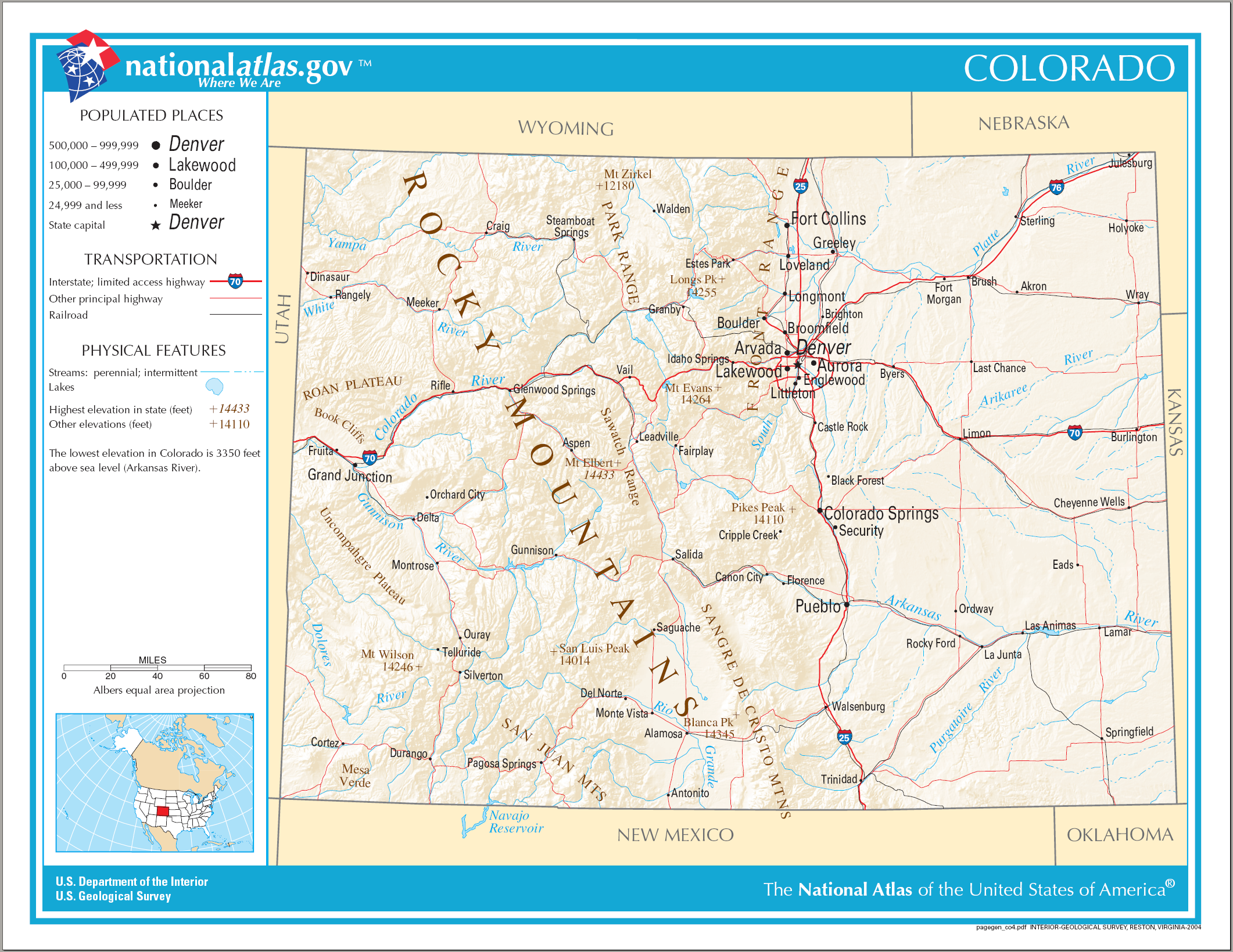
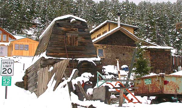
Crisman is an unincorporated community and a census-designated place (CDP) located in and governed by Boulder County, Colorado, United States. The CDP is a part of the Boulder, CO Metropolitan Statistical Area. The population of the Crisman CDP was 186 at the United States Census 2010. The Boulder post office ( Zip Code 80302) serves the area. History Crisman was founded in 1874 as a mining camp and named after the adjacent Crisman Mill, an ore-processing mill owned by prospector and early settler Obed Crisman. Crisman became a boomtown in 1881, when the Yellow Pine Mine produced a massive silver strike. Crisman became a stop on the Greeley, Salt Lake and Pacific Railway. The Panic of 1893 and the subsequent crash of the silver market severely damaged Crisman's economy, although the nearby mines remained open for the duration. In 1894, Boulder Creek flooded, and much of the town was destroyed, including a section of railroad track. The obliterated structures were never rebuilt, ... [...More Info...] [...Related Items...] OR: [Wikipedia] [Google] [Baidu] |
Census-designated Place
A census-designated place (CDP) is a concentration of population defined by the United States Census Bureau for statistical purposes only. CDPs have been used in each decennial census since 1980 as the counterparts of incorporated places, such as self-governing cities, towns, and villages, for the purposes of gathering and correlating statistical data. CDPs are populated areas that generally include one officially designated but currently unincorporated community, for which the CDP is named, plus surrounding inhabited countryside of varying dimensions and, occasionally, other, smaller unincorporated communities as well. CDPs include small rural communities, edge cities, colonias located along the Mexico–United States border, and unincorporated resort and retirement communities and their environs. The boundaries of any CDP may change from decade to decade, and the Census Bureau may de-establish a CDP after a period of study, then re-establish it some decades later. Most unin ... [...More Info...] [...Related Items...] OR: [Wikipedia] [Google] [Baidu] |
Colorado Cities And Towns
The U.S. State of Colorado has 272 active incorporated municipalities, comprising 197 towns, 73 cities, and two consolidated city and county governments. At the 2020 United States Census, 4,299,942 of the 5,773,714 Colorado residents (74.47%) lived in one of these 272 municipalities. Another 714,417 residents (12.37%) lived in one of the 210 census-designated places, while the remaining 759,355 residents (13.15%) lived in the many rural and mountainous areas of the state. Colorado municipalities range in population from the City and County of Denver, the state capital, with a 2020 population of 715,522, to the Town of Carbonate, which has had no year-round population since the 1890 Census due to its severe winter weather and difficult access. The City of Black Hawk with a 2020 population of 127 is the least populous Colorado city, while the Town of Castle Rock with a 2020 population of 73,158 is the most populous Colorado town. Only of Colorado's of land area (1.90%) a ... [...More Info...] [...Related Items...] OR: [Wikipedia] [Google] [Baidu] |
State Of Colorado
Colorado (, other variants) is a state in the Mountain West subregion of the Western United States. It encompasses most of the Southern Rocky Mountains, as well as the northeastern portion of the Colorado Plateau and the western edge of the Great Plains. Colorado is the eighth most extensive and 21st most populous U.S. state. The 2020 United States census enumerated the population of Colorado at 5,773,714, an increase of 14.80% since the 2010 United States census. The region has been inhabited by Native Americans and their ancestors for at least 13,500 years and possibly much longer. The eastern edge of the Rocky Mountains was a major migration route for early peoples who spread throughout the Americas. "''Colorado''" is the Spanish adjective meaning "ruddy", the color of the Fountain Formation outcroppings found up and down the Front Range of the Rocky Mountains. The Territory of Colorado was organized on February 28, 1861, and on August 1, 1876, U.S. President Ulysses S. ... [...More Info...] [...Related Items...] OR: [Wikipedia] [Google] [Baidu] |
Index Of Colorado-related Articles
This is an alphabetical list of articles related to the U.S. State of Colorado. 0–9 * .co.us – Internet second-level domain for the State of Colorado * 4 Corners ** 4 Corners Monument * 6th Principal Meridian * 10-mile Range * 10th Mountain Division (United States) * 16th Street Mall * 25th meridian west from Washington * 32nd meridian west from Washington * 37th parallel north * 38th parallel north * 39th parallel north * 40th parallel north * 41st parallel north * 64 counties of the State of Colorado * 100 km isolated peaks of Colorado * 103rd meridian west * 104th meridian west * 105th meridian west * 106th meridian west * 107th meridian west * 108th meridian west * 109th meridian west * 1500 meter prominent peaks of Colorado * 4000 meter peaks of Colorado * 5280 magazinebr>website* 14,000-foot peaks of Colorado A * Adams County, Colorado * Adams-Onís Treaty of 1819 * Adjacent States: (seven, the third most of the 50 states) ** ** ** ** ** ** ... [...More Info...] [...Related Items...] OR: [Wikipedia] [Google] [Baidu] |
Outline Of Colorado
The following outline is provided as an overview of and topical guide to the U.S. state of Colorado: Colorado – 22nd most populous, the eighth most extensive, and the highest in average elevation of the 50 United States. Colorado is one of the western Mountain States. The 30 highest major summits of the Rocky Mountains all rise within Colorado. The Territory of Colorado joined the Union as the 38th state on August 1, 1876. General reference * Names ** Common name: Colorado *** Pronunciation: ** Official name: State of Colorado ** Abbreviations and name codes *** Postal symbol: CO *** ISO 3166-2 code: US-CO *** Internet second-level domain: .co.us ** Nicknames ***Buffalo Plains State (in disuse) ***Centennial State (previously used on license plates) ***Colorful Colorado (previously used on license plates) ***Columbine State ***Highest State ***Lead State (in disuse) ***Mother of Rivers ***Rocky Mountain Empire ***Rocky Mountain State ***Silver State ... [...More Info...] [...Related Items...] OR: [Wikipedia] [Google] [Baidu] |
Gold Hill, Colorado
Gold Hill is an unincorporated community and a census-designated place (CDP) located in and governed by Boulder County, Colorado, United States. The CDP is a part of the Boulder, CO Metropolitan Statistical Area. The population of the Gold Hill CDP was 230 at the United States Census 2010. The Boulder post office ( Zip Code 80302) serves the area. Gold Hill is located to the northwest of Boulder, perched on a mountainside above Left Hand Canyon at an elevation of 8,300 feet. Originally a mining camp, it was the site of the first major discovery of gold during the 1859 Colorado Gold Rush and remained an important mining camp throughout the late 19th century, with a population approaching 1500 at its height, before falling into decline. It has been revived somewhat in recent years as a quiet isolated haven, with no paved streets, but easily accessed by dirt roads. The town contains numerous historic wooden structures, some restored in recent years, as well as decaying ruins from ... [...More Info...] [...Related Items...] OR: [Wikipedia] [Google] [Baidu] |
Rocky Mountains
The Rocky Mountains, also known as the Rockies, are a major mountain range and the largest mountain system in North America. The Rocky Mountains stretch in straight-line distance from the northernmost part of western Canada, to New Mexico in the southwestern United States. Depending on differing definitions between Canada and the U.S., its northern terminus is located either in northern British Columbia's Terminal Range south of the Liard River and east of the Trench, or in the northeastern foothills of the Brooks Range/ British Mountains that face the Beaufort Sea coasts between the Canning River and the Firth River across the Alaska-Yukon border. Its southernmost point is near the Albuquerque area adjacent to the Rio Grande rift and north of the Sandia–Manzano Mountain Range. Being the easternmost portion of the North American Cordillera, the Rockies are distinct from the tectonically younger Cascade Range and Sierra Nevada, which both lie farther to its west. The ... [...More Info...] [...Related Items...] OR: [Wikipedia] [Google] [Baidu] |
Front Range
The Front Range is a mountain range of the Southern Rocky Mountains of North America located in the central portion of the U.S. State of Colorado, and southeastern portion of the U.S. State of Wyoming. It is the first mountain range encountered as one goes westbound along the 40th parallel north across the Great Plains of North America. The Front Range runs north-south between Casper, Wyoming, and Pueblo, Colorado, and rises nearly 10,000 feet above the Great Plains. Longs Peak, Mount Evans, and Pikes Peak are its most prominent peaks, visible from the Interstate 25 corridor. The area is a popular destination for mountain biking, hiking, climbing, and camping during the warmer months and for skiing and snowboarding during winter. Millions of years ago, the present-day Front Range was home to ancient mountain ranges, deserts, beaches, and even oceans. The name "Front Range" is also applied to the Front Range Urban Corridor, the populated region of Colorado and Wyoming just ... [...More Info...] [...Related Items...] OR: [Wikipedia] [Google] [Baidu] |
Boulder Creek (Colorado)
Boulder Creek is a U.S. Geological Survey. National Hydrography Dataset high-resolution flowline dataThe National Map, accessed March 25, 2011 creek draining the Rocky Mountains to the west of Boulder, Colorado, as well as the city itself and surrounding plains. Route The creek is formed by two main tributaries rising along the Continental Divide: North and Middle Boulder Creek; and later joined by South Boulder Creek. North Boulder Creek forms in a valley between Navajo Peak and Arikaree Peak on the Continental Divide, in the Green Lakes chain of lakes. The creek flows past the community of Switzerland Park to join Middle Boulder Creek. Middle Boulder Creek rises as two forks from the Continental Divide: the North Fork rises in a cirque below Mount Neva and flows to the South Fork. The South Fork rises at Rollins Pass on the Continental Divide and flows to the North Fork. From the junction of the two forks, Middle Boulder Creek, long, flows east through the towns of ... [...More Info...] [...Related Items...] OR: [Wikipedia] [Google] [Baidu] |
Panic Of 1893
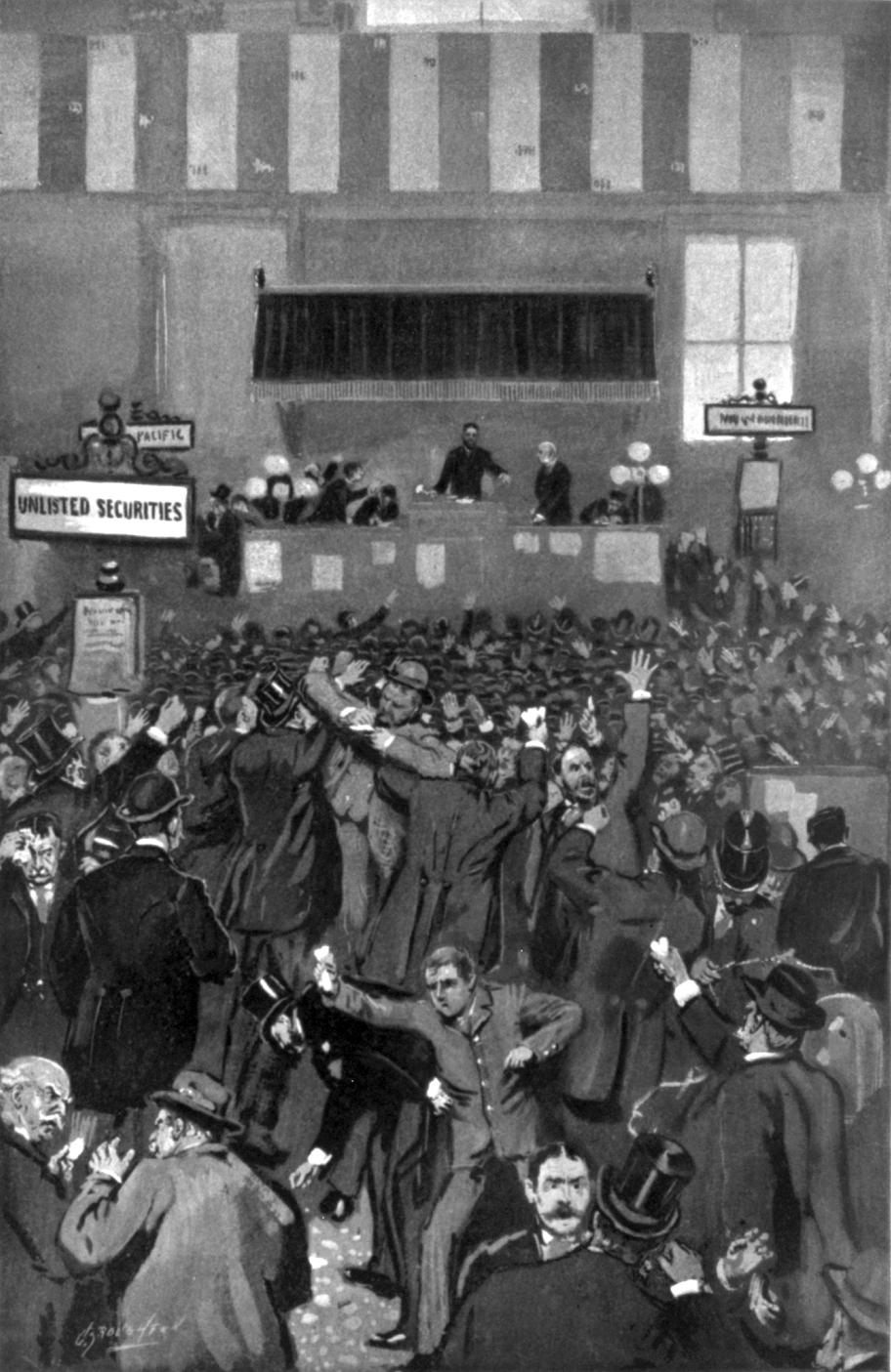
The Panic of 1893 was an economic depression in the United States that began in 1893 and ended in 1897. It deeply affected every sector of the economy, and produced political upheaval that led to the political realignment of 1896 and the presidency of William McKinley. Causes The Panic of 1893 has been traced to many causes, one of those points to Argentina; investment was encouraged by the Argentine agent bank, Baring Brothers. However, the 1890 wheat crop failure and a failed coup in Buenos Aires ended further investments. In addition, speculations in South African and Australian properties also collapsed. Because European investors were concerned that these problems might spread, they started a run on gold in the U.S. Treasury. Specie was considered more valuable than paper money; when people were uncertain about the future, they hoarded specie and rejected paper notes.Nelson, Scott Reynolds. 2012. A Nation of Deadbeats. New York: Alfred Knopf, p. 189. During the Gi ... [...More Info...] [...Related Items...] OR: [Wikipedia] [Google] [Baidu] |
Greeley, Salt Lake And Pacific Railway
The Greeley, Salt Lake and Pacific Railway was a railroad that operated in northern Colorado in the United States during the 1880s. Founded with heavy backing with the Union Pacific Railroad, it was controlled by the Union Pacific from its inception, but was incorporated into the new Colorado and Southern Railway in 1898, becoming part of the Chicago, Burlington and Quincy Railroad in 1908. History The railroad company was organized by investors in northern Colorado on January 17, 1881, with the intention of starting a southern branch of the transcontinental railroad that would pass through northern Colorado, connecting westward from the former Denver Pacific Railroad line at Greeley, as well as a narrow gauge line west of Boulder to the gold mining area above that city. The railroad received financial backing from the Union Pacific, which was concerned about plans by its rival, the Chicago, Burlington and Quincy Railroad, to extend its line westward from the South Platte River ... [...More Info...] [...Related Items...] OR: [Wikipedia] [Google] [Baidu] |


