|
Courtland Park
Courtland Park is a sub-neighbourhood of Carleton Heights in River Ward in the west end of Ottawa, Ontario, Canada. It is bounded on the north by Baseline Road, on the east by the Rideau River, on the south by Dynes Road and on the west by Fisher Avenue. Prince of Wales Drive runs thorough the neighbourhood. According to the Canada 2011 Census, the population of the neighbourhood was 2,807 (including apartments east of Prince of Wales and north of Hog's Back)Population calculated by combining Dissemination Areas 35060533, 35061252 and 35061067 and removing Census Block 3506106740. The development took place after World War II to the 1960s. Most of the homes were considered as 'vet houses". Some townhouses were built in the 1970s and early 1980s. Many of the vet homes have been demolished and turn into newer, more expensive, infill homes. Today, there are only a few vet homes left. The streets east of the Prince of Wales are Lampman, Villa, Forest Hill and Maryland. Features The ... [...More Info...] [...Related Items...] OR: [Wikipedia] [Google] [Baidu] |
Provinces Of Canada
A province is almost always an administrative division within a country or sovereign state, state. The term derives from the ancient Roman ''Roman province, provincia'', which was the major territorial and administrative unit of the Roman Empire, Roman Empire's territorial possessions outside Roman Italy, Italy. The term ''province'' has since been adopted by many countries. In some countries with no actual provinces, "the provinces" is a metaphorical term meaning "outside the capital city". While some provinces were produced artificially by Colonialism, colonial powers, others were formed around local groups with their own ethnic identities. Many have their own powers independent of central or Federation, federal authority, especially Provinces of Canada, in Canada and Pakistan. In other countries, like Provinces of China, China or Administrative divisions of France, France, provinces are the creation of central government, with very little autonomy. Etymology The English langu ... [...More Info...] [...Related Items...] OR: [Wikipedia] [Google] [Baidu] |
Prince Of Wales Drive
Prince of Wales Drive ( Ottawa Road #73) is a road serving Ottawa, Ontario, named after the eponymous road in Battersea, London, U.K. The northern section is a low-speed street running along the west bank of the Rideau River, while southern portions of the road were formerly Highway 16 (downgraded after the construction of Highway 416). Prince of Wales Drive is the continuation of Queen Elizabeth Driveway beyond Preston Street. It runs around Dow's Lake and through the Central Experimental Farm before reaching a roundabout. The speed limit is down to Fisher Avenue, at which point it increases to . There is a major intersection with Hunt Club Road, where several commuters from south Nepean use the bridge to cross the Rideau River. Prince of Wales Drive follows the Rideau River past Barrhaven and Manotick. South of the intersection with Jockvale Road, the road diverts from the river and heads in a southwesterly direction toward North Gower, where it terminates at Fourth Line ... [...More Info...] [...Related Items...] OR: [Wikipedia] [Google] [Baidu] |
Rideauview
Rideau View (also spelled Rideauview) is a sub-neighbourhood of Carleton Heights in River Ward, in the west-end of Ottawa, Ontario, Canada, located near the Rideau River. It is bordered by Meadowlands Drive to the south, Claymor Avenue to the west and Dynes Road to the north. Debra Avenue is the main road that runs through the neighbourhood and there is some residential housing on Eiffel Avenue. Some of parts of the neighbourhoods are east of Prince of Wales Drive and runs parallel along the Rideau River. The area is also located close to the former city of Nepean. A major feature of the neighbourhood is a low-income housing project designed and built by the Ottawa Housing corporation. There are four high-rise condominiums on Prince of Wales at the corner of Dynes and Meadowlands. The population of this neighbourhood according to the Canada 2011 Census was 1880 Population calculated by combining dissemination areas 35060538 and 35060539 with Census Block 3506053401 The area is h ... [...More Info...] [...Related Items...] OR: [Wikipedia] [Google] [Baidu] |
Carleton Square
Carleton Square is a sub-neighbourhood of Carleton Heights in the River Ward of Ottawa, Ontario, Canada. It is bounded on the west by Fisher Avenue Fisher is an archaic term for a fisherman, revived as gender-neutral. Fisher, Fishers or The Fisher may also refer to: Places Australia *Division of Fisher, an electoral district in the Australian House of Representatives, in Queensland *Elect ..., to the south Meadowlands Drive, Dynes Road to the north and Claymor Avenue to the east. According to the Canada 2011 Census the population for this area was 719.http://www12.statcan.gc.ca/census-recensement/2011/dp-pd/prof/details/page.cfm?Lang=E&TABID=3&Geo1=DA&Code1=35061834&Geo2=CSD&Code2=3506008&Data=Count&SearchText=35061834&SearchType=Begins&SearchPR=01&B1=All&Custom= plus Census Block 3506053402 Most of the homes are townhouses occupied by a mostly younger population. The neighbourhood is home to St. Pius X High School. Features Dynes Park. References {{authority contro ... [...More Info...] [...Related Items...] OR: [Wikipedia] [Google] [Baidu] |
Confederation Heights
Confederation Heights is an area in south Ottawa, Canada, made up of mostly government buildings. It is bounded on the east by Data Centre Road, on the north and west by the Rideau River and on the south by Brookfield Road. Confederation Heights includes the Clarke Memorial Centre (RA Centre), the Taxation Data Centre (Canada Revenue Agency), the Edward Drake Building (formerly Canadian Broadcasting Corporation and Communications Security Establishment), the Sir Leonard Tilley Building (formerly Communications Security Establishment), Canada Post Place (Canada Post headquarters), the Sir Charles Tupper Building (Public Works Canada), Hog's Back Park, Vincent Massey Park and Mooney's Bay station. History Prior to the expropriation of the Merkley Brick Yard in 1954, the area had been a combination of woods, farmland, quarry and brickyard. The arrival of Federal government departments in the late 1950s - early 1960s had a significant impact on the area. In 1959, the Fire Chi ... [...More Info...] [...Related Items...] OR: [Wikipedia] [Google] [Baidu] |
Carleton University
Carleton University is an English-language public research university in Ottawa, Ontario, Canada. Founded in 1942 as Carleton College, the institution originally operated as a private, non-denominational evening college to serve returning World War II veterans. Carleton was chartered as a university by the provincial government in 1952 through ''The Carleton University Act,'' which was then amended in 1957, giving the institution its current name. The university is named for the now-dissolved Carleton County, which included the city of Ottawa at the time the university was founded. Carleton County, in turn, was named in honour of Guy Carleton, 1st Baron Dorchester, who was Governor General of The Canadas from 1786 to 1796. The university moved to its current campus in 1959, growing rapidly in size during the 1960s as the Ontario government increased support for post-secondary institutions and expanded access to higher education. Carleton offers a diverse range of academic program ... [...More Info...] [...Related Items...] OR: [Wikipedia] [Google] [Baidu] |
Central Experimental Farm
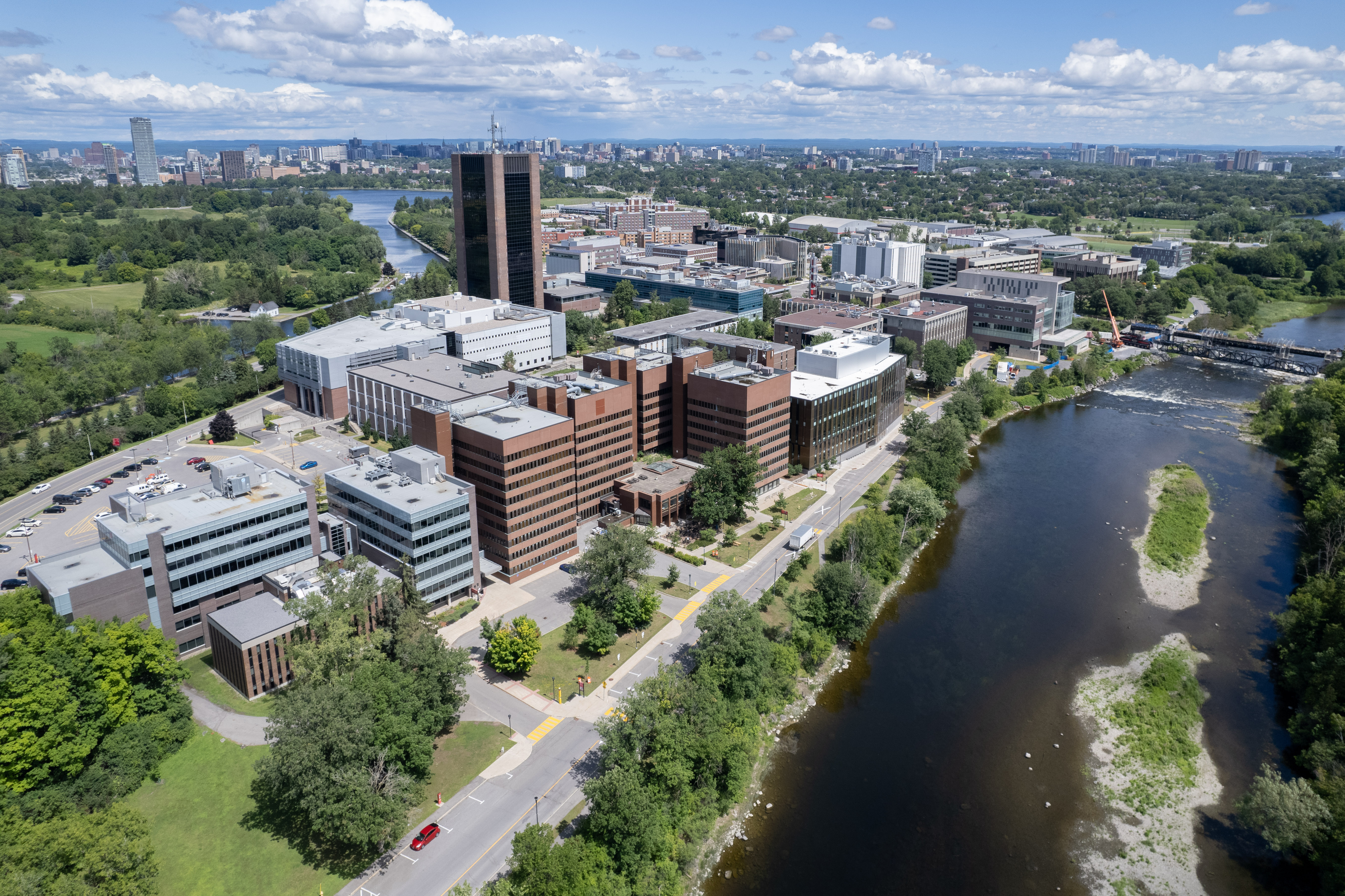
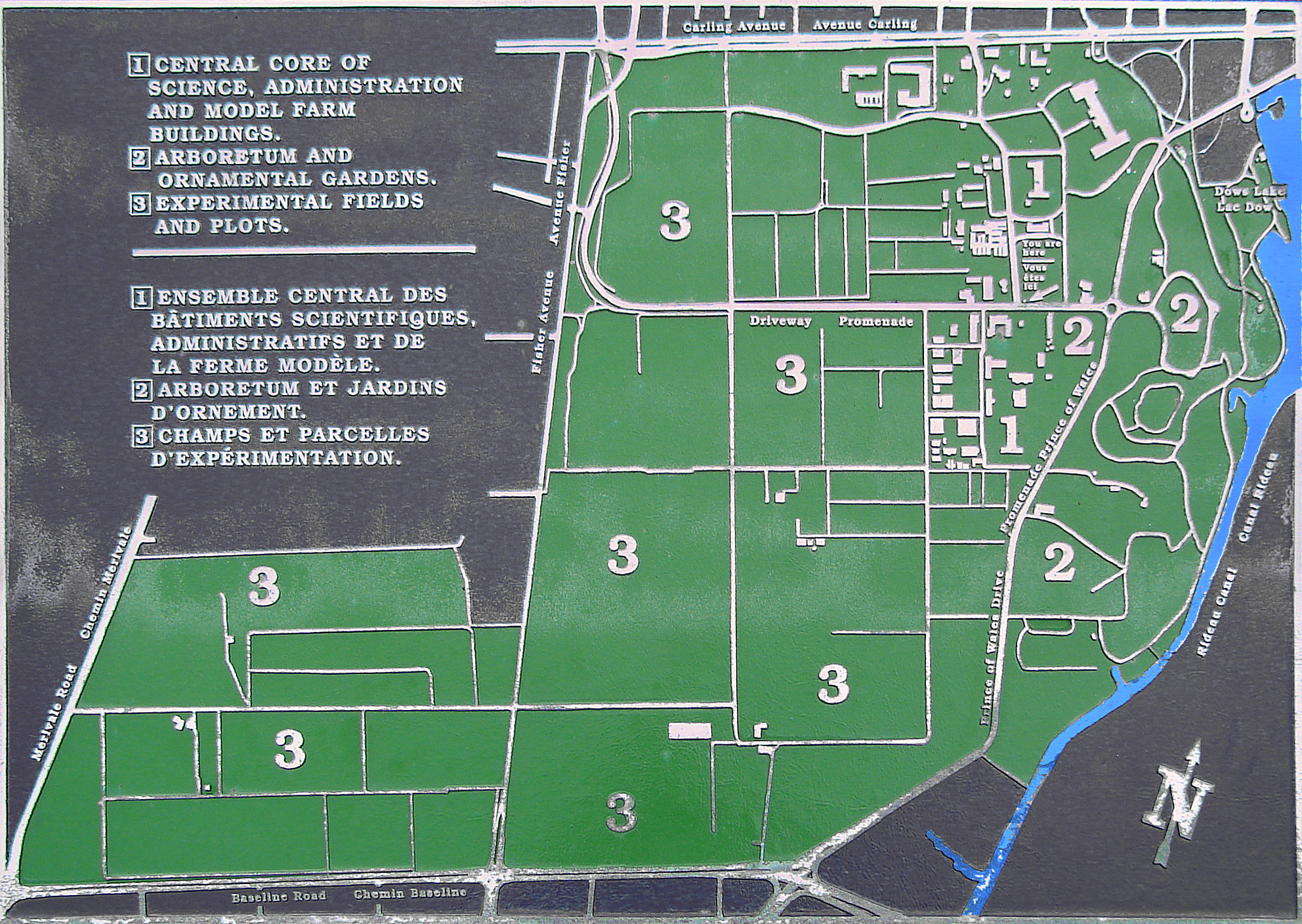
The Central Experimental Farm (CEF), commonly known as the Experimental Farm, is an agricultural facility, working farm, and research centre of the Science and Technology Branch, formerly the Research Branch, of Agriculture and Agri-Food Canada. As the name indicates, this farm is centrally located in and now surrounded by the City of Ottawa, Ontario, Canada. The farm is a National Historic Site of Canada and most buildings are protected and preserved as heritage buildings. The CEF original intent was to perform scientific research for improvement in agricultural methods and crops. While such research is still being conducted, the park-like atmosphere of the CEF has become an important place of recreation and education for the residents of Ottawa. Furthermore, over the years several other departments and agencies have encroached onto the CEF property, such as Natural Resources Canada, National Defence ( HMCS Carleton on Dow's Lake), and the Ottawa Civic Hospital (helicopter pad). ... [...More Info...] [...Related Items...] OR: [Wikipedia] [Google] [Baidu] |
Geography Of Ottawa
This is the outline of the geography of the city of Ottawa, the capital of Canada. Ottawa's current borders were formed in 2001, when the former city of Ottawa amalgamated with the ten other municipalities within the former Regional Municipality of Ottawa–Carleton. Ottawa is now a single-tiered census division, home to 1,017,449 people. The city centre is located at the confluence of the Ottawa and Rideau Rivers. The Ottawa River forms the entire northern boundary of the city which it shares with the province of Quebec's municipalities of Pontiac and Gatineau. The northern boundary begins in the west at Arnprior and continues east to Rockland. The boundary then turns south in a straight line, separating the former Township of Cumberland (now in Ottawa) and the City of Clarence-Rockland. It then turns west in another straight line separating the former Township of Cumberland with the municipalities of The Nation and Russell. It then turns south separating Russell from the f ... [...More Info...] [...Related Items...] OR: [Wikipedia] [Google] [Baidu] |
List Of Ottawa Neighbourhoods
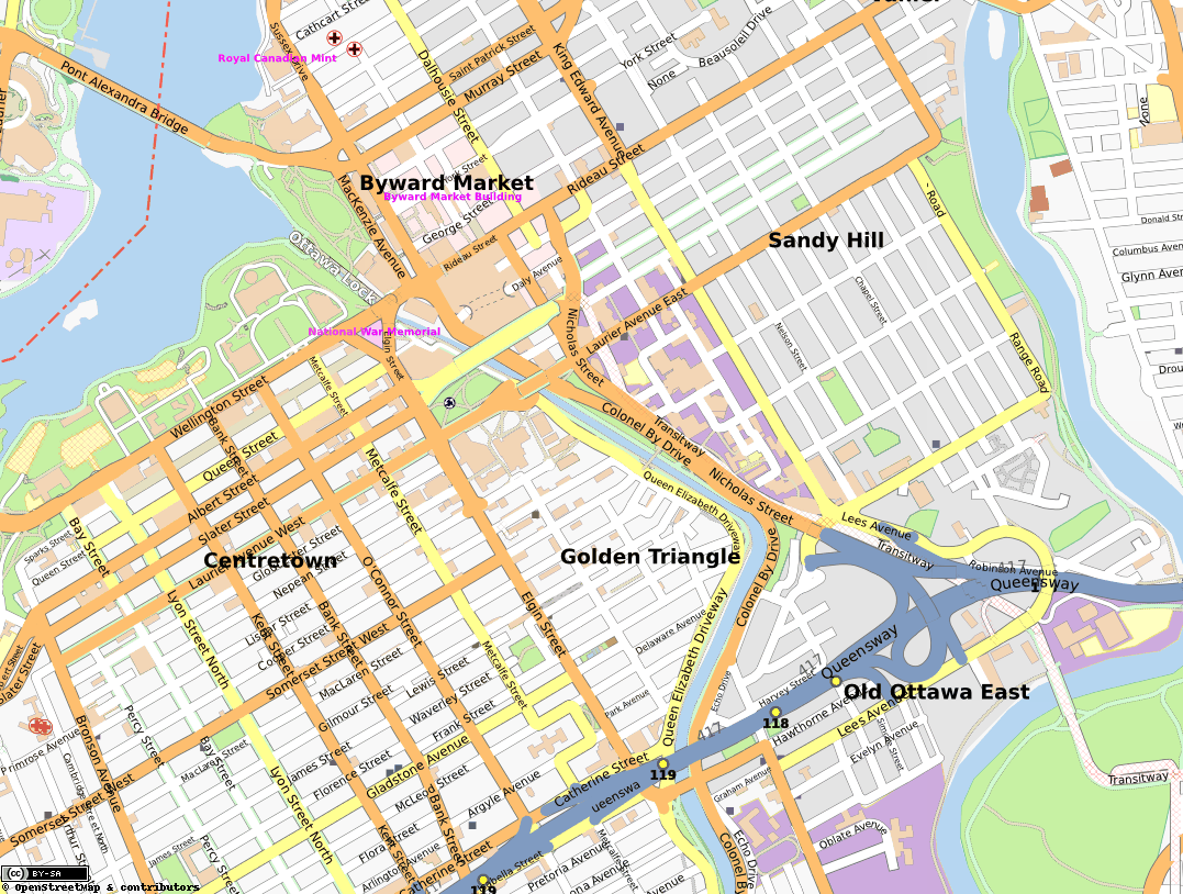
This is a list of neighbourhoods and outlying communities within the City of Ottawa, Ontario, Canada. In 2001, the old city of Ottawa was amalgamated with the suburbs of Nepean, Kanata, Gloucester, Rockcliffe Park, Vanier and Cumberland, and the rural townships of West Carleton, Osgoode, Rideau and Goulbourn, along with the systems and infrastructure of the Regional Municipality of Ottawa-Carleton, to become one municipality. The city is now organized into 23 wards. Old City of Ottawa Central Ottawa * ByWard Market *Centretown * Centretown West * Downtown *The Glebe *Golden Triangle * LeBreton Flats *Lower Town *Old Ottawa East *Old Ottawa South * Sandy Hill East end *Carson Meadows * Castle Heights *Forbes *Lees Avenue * Lindenlea * Manor Park *New Edinburgh * Overbrook *Rockcliffe Park * Vanier * Viscount Alexander Park South end * Airport-Uplands *Alta Vista *Billings Bridge *Confederation Heights * Ellwood *Elmvale Acres * Greenboro * Hawthorne Meadows *Heron Gate * ... [...More Info...] [...Related Items...] OR: [Wikipedia] [Google] [Baidu] |
Lexington Park (Ottawa)
Lexington Park was the name of a former minor league baseball park in St. Paul, Minnesota. It was the home of the St. Paul Saints from 1897 through 1956, when it was replaced by the first version of Midway Stadium. Lexington Park was commissioned by baseball owner Charlie Comiskey to serve as home for his St. Paul Saints Western League baseball franchise. In late 1899 the league changed its name to the American League in an ultimately successful bid to gain major league status. While the Saints were initially a member of that league, Comiskey moved his team to Chicago prior to Opening Day 1900 (where they still exist today as the Chicago White Sox). As such, the ballpark holds at least the technical distinction of being the original home to a current American League franchise—even if, admittedly, the league wasn't major at the time, and not a single major league game was ever played there. Comiskey continued to own the ballpark for another decade or so (leasing it out to a r ... [...More Info...] [...Related Items...] OR: [Wikipedia] [Google] [Baidu] |
McGregor Easson Public School
McGregor may refer to: People * McGregor (surname) * Clan MacGregor, a Scottish highland clan * McGregor W. Scott (born 1962), U.S. attorney Characters * Mr. McGregor, a fictional character from Peter Rabbit Places in Canada: * McGregor Lake, Alberta; a lake * McGregor, British Columbia * McGregor Plateau, Nechaka Plateau, Interior Plateau, British Columbia; a mountainous plateau * McGregor Range, Central Interior, British Columbia; a mountain range * McGregor Pass, Continental Divide, British Columbia; a mountain pass * McGregor River, British Columbia; a river * McGregor, Ontario in South Africa: * McGregor, Western Cape in the United States: * McGregor, Florida * McGregor, Georgia * McGregor, Iowa * McGregor Heights, Iowa * McGregor, Minnesota * McGregor Township, Aitkin County, Minnesota * Mount McGregor (mountain), New York * McGregor, North Dakota * McGregor, Armstrong County, Pennsylvania * McGregor, Texas ** McGregor Independent School District * McGregor Mountain (W ... [...More Info...] [...Related Items...] OR: [Wikipedia] [Google] [Baidu] |
Torah Academy Of Ottawa
The Torah (; hbo, ''Tōrā'', "Instruction", "Teaching" or "Law") is the compilation of the first five books of the Hebrew Bible, namely the books of Genesis, Exodus, Leviticus, Numbers and Deuteronomy. In that sense, Torah means the same as Pentateuch or the Five Books of Moses. It is also known in the Jewish tradition as the Written Torah (, ). If meant for liturgic purposes, it takes the form of a Torah scroll (''Sefer Torah''). If in bound book form, it is called ''Chumash'', and is usually printed with the rabbinic commentaries (). At times, however, the word ''Torah'' can also be used as a synonym for the whole of the Hebrew Bible or Tanakh, in which sense it includes not only the first five, but all 24 books of the Hebrew Bible. Finally, Torah can even mean the totality of Jewish teaching, culture, and practice, whether derived from biblical texts or later rabbinic writings. The latter is often known as the Oral Torah. Representing the core of the Jewish spiritu ... [...More Info...] [...Related Items...] OR: [Wikipedia] [Google] [Baidu] |


