|
Cote Blanche Bridge
The Cote Blanche Bridge crosses Bayou Lafourche at West 79th Street in the town of Cut Off, Louisiana Cut Off (historically named La Coupe) is a census-designated place (CDP) on the Bayou Lafourche in Lafourche Parish, Louisiana, United States. The population was 5,533 in 2020. It is part of the Houma– Bayou Cane– Thibodaux metro .... Built in 1956, this steel pontoon bridge has a total length of with its largest span at . The bridge deck is wide. References Pontoon bridges in the United States Road bridges in Louisiana 1956 establishments in Louisiana Bridges completed in 1956 {{Louisiana-bridge-struct-stub ... [...More Info...] [...Related Items...] OR: [Wikipedia] [Google] [Baidu] |
Bayou Lafourche
Bayou Lafourche ( ), originally called Chetimachas River or La Fourche des Chetimaches, (the fork of the Chitimacha), is a U.S. Geological Survey. National Hydrography Dataset high-resolution flowline dataThe National Map, accessed June 20, 2011 bayou in southeastern Louisiana, United States, that flows into the Gulf of Mexico. The bayou is flanked by Louisiana Highway 1 on the west and Louisiana Highway 308 on the east, and is known as "the longest Main Street in the world." It flows through parts of Ascension, Assumption, and Lafourche parishes. Today, approximately 300,000 Louisiana residents drink water drawn from the bayou. History The name Lafourche is from the French for "the fork", and alludes to the bayou's large outflow of Mississippi River water. The first settlements of Acadians in southern Louisiana were near Bayou Lafourche and Bayou des Écores, which led to a close association of the bayou with Cajun culture. It was formerly a Mississippi River outlet (distribut ... [...More Info...] [...Related Items...] OR: [Wikipedia] [Google] [Baidu] |
Cut Off, Louisiana
Cut Off (historically named La Coupe) is a census-designated place (CDP) on the Bayou Lafourche in Lafourche Parish, Louisiana, United States. The population was 5,533 in 2020. It is part of the Houma– Bayou Cane– Thibodaux metropolitan statistical area. Cut Off's ZIP code is 70345, the area code is 985 and local telephone prefixes are 325, 632 and 693. History Cut Off had its start by the building of a canal cutoff at that point from Bayou Lafourche northeast to Lake Salvador, to shorten the route to New Orleans. The name (''La Coupe'', or "The Cut") was French in origin. Geography Cut Off is located in south-central Lafourche Parish at (29.515201, -90.333839), on both sides of Bayou Lafourche. It is bordered to the northwest by Larose and to the south by Galliano. Louisiana Highway 1 runs through the center of Cut Off, along the west bank of Bayou Lafourche, while Highway 308 runs along the east bank. Highway 3235, a four-lane highway, runs through the ... [...More Info...] [...Related Items...] OR: [Wikipedia] [Google] [Baidu] |
United States
The United States of America (U.S.A. or USA), commonly known as the United States (U.S. or US) or America, is a country primarily located in North America. It consists of 50 states, a federal district, five major unincorporated territories, nine Minor Outlying Islands, and 326 Indian reservations. The United States is also in free association with three Pacific Island sovereign states: the Federated States of Micronesia, the Marshall Islands, and the Republic of Palau. It is the world's third-largest country by both land and total area. It shares land borders with Canada to its north and with Mexico to its south and has maritime borders with the Bahamas, Cuba, Russia, and other nations. With a population of over 333 million, it is the most populous country in the Americas and the third most populous in the world. The national capital of the United States is Washington, D.C. and its most populous city and principal financial center is New York City. Paleo-Americ ... [...More Info...] [...Related Items...] OR: [Wikipedia] [Google] [Baidu] |
Pontoon Bridge
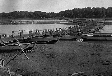
A pontoon bridge (or ponton bridge), also known as a floating bridge, uses float (nautical), floats or shallow-draft (hull), draft boats to support a continuous deck for pedestrian and vehicle travel. The buoyancy of the supports limits the maximum load that they can carry. Most pontoon bridges are temporary and used in wartime and civil emergencies. There are permanent pontoon bridges in civilian use that can carry highway traffic. Permanent floating bridges are useful for sheltered water crossings if it is not considered economically feasible to suspend a bridge from anchored piers. Such bridges can require a section that is elevated or can be raised or removed to allow waterborne traffic to pass. Pontoon bridges have been in use since ancient times and have been used to great advantage in many battles throughout history, such as the Battle of Garigliano (1503), Battle of Garigliano, the Battle of Oudenarde, the Operation Plunder, crossing of the Rhine during World War II, the ... [...More Info...] [...Related Items...] OR: [Wikipedia] [Google] [Baidu] |
Pontoon Bridges In The United States
Pontoon may refer to: Buoyant devices * Float (nautical), an air-filled structure providing buoyancy * Any of various objects that float on pontoons, including: ** Pontoon (boat), a flat-bottomed boat supported by two or more pontoons ** Floatplane, also known as a pontoon plane ** Floating dock (jetty), a platform supported by pontoons ** Pontoon bridge, a bridge supported by shallow draft open boats or encased floats Entertainment and media * Pontoon (card game), the Australian/Malaysian casino game * "Pontoon" (song), a song by Little Big Town * '' Pontoon: A Novel of Lake Wobegon'', a 2007 book by Garrison Keillor * Pontoon, a chiefly British version of the card game blackjack (also known as vingt-et-un or 21) Other uses * Ponton (automobile), or Pontoon style, the automobile fender style * Pontoon, County Mayo Pontoon () is a lakeside village on the R310 regional road in County Mayo in Ireland, situated between Lough Conn and Lough Cullin, and near the town of Foxford ... [...More Info...] [...Related Items...] OR: [Wikipedia] [Google] [Baidu] |
Road Bridges In Louisiana
A road is a linear way for the conveyance of traffic that mostly has an improved surface for use by vehicles (motorized and non-motorized) and pedestrians. Unlike streets, the main function of roads is transportation. There are many types of roads, including parkways, avenues, controlled-access highways (freeways, motorways, and expressways), tollways, interstates, highways, thoroughfares, and local roads. The primary features of roads include lanes, sidewalks (pavement), roadways (carriageways), medians, shoulders, verges, bike paths (cycle paths), and shared-use paths. Definitions Historically many roads were simply recognizable routes without any formal construction or some maintenance. The Organization for Economic Co-operation and Development (OECD) defines a road as "a line of communication (travelled way) using a stabilized base other than rails or air strips open to public traffic, primarily for the use of road motor vehicles running on their own wheels", which ... [...More Info...] [...Related Items...] OR: [Wikipedia] [Google] [Baidu] |
1956 Establishments In Louisiana
Events January * January 1 – The Anglo-Egyptian Condominium ends in Sudan. * January 8 – Operation Auca: Five U.S. evangelical Christian missionaries, Nate Saint, Roger Youderian, Ed McCully, Jim Elliot and Pete Fleming, are killed for trespassing by the Huaorani people of Ecuador, shortly after making contact with them. * January 16 – Egyptian leader Gamal Abdel Nasser vows to reconquer Palestine. * January 25– 26 – Finnish troops reoccupy Porkkala, after Soviet troops vacate its military base. Civilians can return February 4. * January 26 – The 1956 Winter Olympics open in Cortina d'Ampezzo, Italy. February * February 11 – British spies Guy Burgess and Donald Maclean resurface in the Soviet Union, after being missing for 5 years. * February 14– 25 – The 20th Congress of the Communist Party of the Soviet Union is held in Moscow. * February 16 – The 1956 World Figure Skating Championships open in Garmisch, West Germany. * Febr ... [...More Info...] [...Related Items...] OR: [Wikipedia] [Google] [Baidu] |


