|
Contarini–Rosselli Map
The Contarini–Rosselli map of 1506 was the first printed world map showing the New World. The Contarini–Rosselli map was designed by Giovanni Matteo Contarini and engraved by Francesco Rosselli. It is a copper-engraved map and was published in Venice or Florence in 1506. The only surviving copy is in the British Library. Age of discovery There had been many voyages of discovery in the immediately preceding years: * Bartolomeu Dias, Dias’ rounding of Africa (1487) * the discovery of Newfoundland by John Cabot (1497) * Vasco da Gama's travel to India (1499) * the explorations of the Caribbean and South America by Christopher Columbus, Columbus (1492–93, 1493–94, 1498, 1502–04) * visits to the Caribbean and South America by Amerigo Vespucci, Vespucci (1499, 1501–02) Although there had been maps created after these voyages, such as Juan de la Cosa's map of the world in 1500 (based on Columbus' second voyage) and the Cantino planisphere, Cantino world map (circa 1502), th ... [...More Info...] [...Related Items...] OR: [Wikipedia] [Google] [Baidu] |
Giovanni Matteo Contarini
Giovanni Matteo Contarini (1452-1507) was a cartographer and likely a member of a prominent Republic of Venice, Venetian family. In 1506, Contarini created a world map that Francesco Rosselli later engraved. The Contarini-Rosselli map is the first world map to have Voyages of Christopher Columbus, Columbus' discoveries incorporated. It was first discovered in 1922 and currently resides in the British Library. On the map, Contarini refers to himself as "famed in the Ptolemaean art" but no other maps by him have surfaced. In a titular inscription describing his map, Contarini called the land later called ''America'' by Martin Waldseemüller the ''Antipodes''. The inscription, placed to the west of this land said: The world and all its seas on a plane map, Europe, Lybia [i.e., Africa], Asia, and the Antipodes, the poles and zones and sites of places, the parallels for the climes of the mighty globe, lo! Giovanni Matteo Contarini, famed in the Ptolemæan art, has compiled and marked it ... [...More Info...] [...Related Items...] OR: [Wikipedia] [Google] [Baidu] |
Juan De La Cosa
Juan de la Cosa (c. 1450 – 28 February 1510) was a Castilian navigator and cartographer, known for designing the earliest European world map which incorporated the territories of the Americas discovered in the 15th century. De la Cosa was the owner and master of the '' Santa María'', and thus played an important role in the first and second voyage of Christopher Columbus to the West Indies. In 1499, he served as the chief pilot in the expedition of Alonso de Ojeda to the coasts of South America. Upon his return to Andalusia, he drew his famous mappa mundi ("world map") and soon returned to the Indies, this time with Rodrigo de Bastidas. In the following years, De la Cosa alternated trips to America under its own command with special duties from the Crown, including an assignment as a spy in Lisbon and participation in the board of pilots held in Burgos in 1508. In 1509, he began what would be his last expedition, again with Ojeda, to take possession of the coasts of modern ... [...More Info...] [...Related Items...] OR: [Wikipedia] [Google] [Baidu] |
History Of Geography
The history of geography includes many histories of geography which have differed over time and between different cultural and political groups. In more recent developments, geography has become a distinct academic discipline. 'Geography' derives from the Greek – ''geographia'', literally "Earth-writing", that is, description or writing about the Earth. The first person to use the word ''geography'' was Eratosthenes (276–194 BC). However, there is evidence for recognizable practices of geography, such as cartography (map-making), prior to the use of the term. Egypt The known world of Ancient Egypt saw the Nile as the center, and the world as based upon "the" river. Various oases were known to the east and west, and were considered locations of various gods (e.g. Siwa, for Amon). To the South lay the Kushitic region, known as far as the 4th cataract. Punt was a region south along the shores of the Red Sea. Various Asiatic peoples were known as Retenu, Kanaan, Que, Har ... [...More Info...] [...Related Items...] OR: [Wikipedia] [Google] [Baidu] |
Age Of Discovery
The Age of Discovery (or the Age of Exploration), also known as the early modern period, was a period largely overlapping with the Age of Sail, approximately from the 15th century to the 17th century in European history, during which seafaring Europeans explored and colonized regions across the globe. The extensive overseas exploration, with the Portuguese and Spanish at the forefront, later joined by the Dutch, English, and French, emerged as a powerful factor in European culture, most notably the European encounter and colonization of the Americas. It also marks an increased adoption of colonialism as a government policy in several European states. As such, it is sometimes synonymous with the first wave of European colonization. European exploration outside the Mediterranean started with the maritime expeditions of Portugal to the Canary Islands in 1336, and later with the Portuguese discoveries of the Atlantic archipelagos of Madeira and Azores, the coast of West Afr ... [...More Info...] [...Related Items...] OR: [Wikipedia] [Google] [Baidu] |
Johannes Ruysch
Johannes Ruysch (c. 1460? in Utrecht – 1533 in Cologne), a.k.a. ''Johann Ruijsch'' or ''Giovanni Ruisch'' was an explorer, cartographer, astronomer, manuscript illustrator and painter from the Low Countries who produced a famous map of the world: the second oldest known printed representation of the New World. This Ruysch map was published and widely distributed in 1507. Biography In old documents, Ruysch was sometimes called a Fleming or German, but he was likely born in Utrecht in the current Netherlands. It is thought (see the Beneventanus commentary below) that he accompanied John Cabot on his expedition to North America in 1497 and 1498, or, considering the prevalence of Portuguese names on his 1507 map, a Portuguese ship leaving from Bristol. Around 1505, Ruysch probably entered the Benedictine monastery of St. Martin in Cologne as a secular priest. Soon he left for Rome, where pope Julius II gave him a dispensation concerning his priestly occupation. He presumably made h ... [...More Info...] [...Related Items...] OR: [Wikipedia] [Google] [Baidu] |
Martin Waldseemüller
Martin Waldseemüller (c. 1470 – 16 March 1520) was a German cartographer and humanist scholar. Sometimes known by the Latinisation of names, Latinized form of his name, Hylacomylus, his work was influential among contemporary cartographers. He and his collaborator Matthias Ringmann are credited with the first recorded usage of the word ''Americas, America'' to name a portion of the New World in honour of the Italian explorer Amerigo Vespucci. Waldseemüller was also the first to map South America as a continent separate from Asia, the first to produce a printed globe and the first to create a printed wall map of Europe. A set of his maps printed as an appendix to the 1513 edition of Ptolemy's Geography (Ptolemy), ''Geography'' is considered to be the first example of a modern atlas. Life and works Details of Waldseemüller's life are scarce. He was born around 1470 in the German town of Wolfenweiler. His father was a butcher and moved to Freiburg (now Freiburg im Breisgau) in a ... [...More Info...] [...Related Items...] OR: [Wikipedia] [Google] [Baidu] |
Cantino Planisphere
The Cantino planisphere or Cantino world map is a manuscript Portuguese world map preserved at the Biblioteca Estense in Modena, Italy. It is named after Alberto Cantino, an agent for the Duke of Ferrara, who successfully smuggled it from Portugal to Italy in 1502. It measures 220 x 105 cm. This planisphere is the earliest surviving map showing Portuguese geographic discoveries in the east and west and is particularly notable for portraying a fragmentary record of the Brazilian coast, which the Portuguese explorer Pedro Álvares Cabral explored in 1500, the Southern coast of Greenland, explored in the late 1490s, and for depicting the African coast of the Atlantic and Indian Oceans with remarkable accuracy and detail. History In the beginning of the 16th century, Lisbon was a buzzing metropolis where people from diverse backgrounds came in search of work, glory or fortune. There were also many undercover agents looking for the secrets brought by the Portuguese voyages to remote ... [...More Info...] [...Related Items...] OR: [Wikipedia] [Google] [Baidu] |
Francesco Rosselli
Francesco Rosselli (1445 – before 1513) was an Italian miniature painter, and engraver of maps and old master prints. He was described as a cartographer, although his contribution did not include any primary research and was probably limited to engraving, decorating and selling manuscript maps created by others. He created many maps, including one of the first printed maps of the world to depict the Americas after Christopher Columbus' voyages. The attribution of prints to him is the subject of debate, as different engraving styles are used. This may be the result of different artists in his workshop, or of his and his shop's ability to use different styles. Life Rosselli was born in Florence. He painted miniatures in manuscripts produced in 15th-century Florence, including copies of Ptolemy's ''Geographia'' and liturgical works for the city's cathedral. The so-called '' Tavola Strozzi'', a view of the Bay of Naples depicting the return of the Aragonese fleet after the B ... [...More Info...] [...Related Items...] OR: [Wikipedia] [Google] [Baidu] |
Christopher Columbus
Christopher Columbus * lij, Cristoffa C(or)ombo * es, link=no, Cristóbal Colón * pt, Cristóvão Colombo * ca, Cristòfor (or ) * la, Christophorus Columbus. (; born between 25 August and 31 October 1451, died 20 May 1506) was an Italian explorer and navigator who completed Voyages of Christopher Columbus, four voyages across the Atlantic Ocean sponsored by the Catholic Monarchs of Spain, opening the way for the widespread European Age of Discovery, exploration and colonization of the Americas. His expeditions were the first known European contact with the Caribbean, Central America, and South America. The name ''Christopher Columbus'' is the anglicisation of the Latin . Scholars generally agree that Columbus was born in the Republic of Genoa and spoke a dialect of Ligurian (Romance language), Ligurian as his first language. He went to sea at a young age and travelled widely, as far north as the British Isles and as far south as what is now Ghana. He married Port ... [...More Info...] [...Related Items...] OR: [Wikipedia] [Google] [Baidu] |
Vasco Da Gama
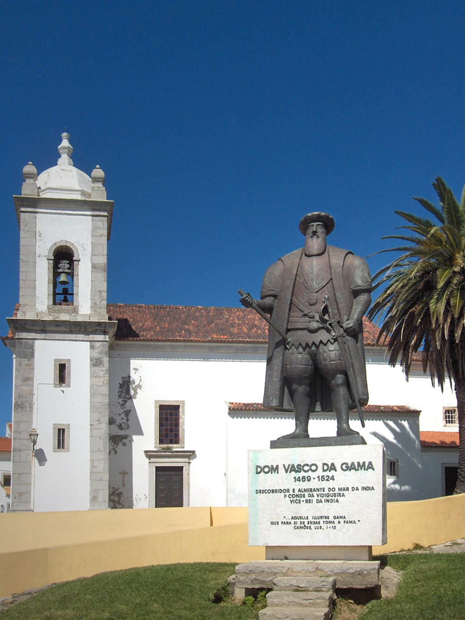
Vasco da Gama, 1st Count of Vidigueira (; ; c. 1460s – 24 December 1524), was a Portuguese explorer and the first European to reach India by sea. His initial voyage to India by way of Cape of Good Hope (1497–1499) was the first to link Europe and Asia by an ocean route, connecting the Atlantic and the Indian oceans. This is widely considered a milestone in world history, as it marked the beginning of a sea-based phase of global multiculturalism. Da Gama's discovery of the sea route to India opened the way for an age of global imperialism and enabled the Portuguese to establish a long-lasting colonial empire along the way from Africa to Asia. The violence and hostage-taking employed by da Gama and those who followed also assigned a brutal reputation to the Portuguese among India's indigenous kingdoms that would set the pattern for western colonialism in the Age of Exploration. Traveling the ocean route allowed the Portuguese to avoid sailing across the highly disputed Medit ... [...More Info...] [...Related Items...] OR: [Wikipedia] [Google] [Baidu] |


.jpg)


