|
Colo Shire
Colo Shire was a local government area in the Sydney Basin region of New South Wales, Australia. Colo Shire was proclaimed on 7 March 1906, one of 134 shires created after the passing of the ''Local Government (Shires) Act 1905''. The shire offices were in Wilberforce. Other towns in the shire included North Richmond, Sackville, Glossodia, Kurrajong, St Albans and Ebenezer. Colo Shire was amalgamated with the Municipality of Windsor to form Hawkesbury Shire on 1 January 1981 per the ''Local Government Areas Amalgamation Act 1980 The Local Government Areas Amalgamation Act 1980 (NSW) was an Act of the Parliament of New South Wales, which amended the ''Local Government Act 1919'', with the purpose of amalgamating a series of local government areas in New South Wales. The ...''. Schedule 1. References Former local government areas of New South Wales 1906 establishments in Australia 1981 disestablishments in Australia {{NSW-geo-stub ... [...More Info...] [...Related Items...] OR: [Wikipedia] [Google] [Baidu] |
Sydney Basin
The Sydney Basin is an interim Australian bioregion and is both a structural entity and a depositional area, now preserved on the east coast of New South Wales, Australia and with some of its eastern side now subsided beneath the Tasman Sea. The basin is named for the city of Sydney, on which it is centred. Around thick, the Sydney Basin consists of Permian and Triassic sedimentary rocks, which stretches from Newcastle in the north to Batemans Bay in the south, and west to the Great Dividing Range. The basin is also home to the major centres of Newcastle and Wollongong, New South Wales, Wollongong, and contains economically significant reserves of coal. Sydney's famous Port Jackson, harbour and the sculptured cliffs of the Blue Mountains (New South Wales), Blue Mountains are signature formations of relatively hard upper strata of sandstone. The basin contains the UNESCO World Heritage Site, UNESCO World Heritage-listed Greater Blue Mountains Area. Geography According to De ... [...More Info...] [...Related Items...] OR: [Wikipedia] [Google] [Baidu] |
Wilberforce, New South Wales
Wilberforce is a small town in New South Wales, Australia, in the local government area of the City of Hawkesbury. It is just beyond the outer suburbs of north-west Sydney and lies on the western bank of the Hawkesbury River. History Wilberforce is one of the original settlements established as a township by Lachlan Macquarie, colonial governor of New South Wales 1810–21. It is known locally as " Macquarie Town", a title given to townships established by Governor Macquarie on 6 December 1810 in and around the Sydney metropolitan area. It was named after William Wilberforce (1759–1833), who was a British politician, philanthropist, and a leader of the movement to abolish the slave trade. Heritage listings Wilberforce has a number of heritage-listed sites, including: * Clergy Road: Wilberforce Cemetery * 47 George Road: Wilberforce Park * 43-43a Macquarie Road: St John's Anglican Church and Macquarie Schoolhouse * Rose Street: Australiana Pioneer Village * Rose Street: Ros ... [...More Info...] [...Related Items...] OR: [Wikipedia] [Google] [Baidu] |
Local Government In Australia
Local government is the third level of government in Australia, administered with limited autonomy under the states and territories, and in turn beneath the federal government. Local government is not mentioned in the Constitution of Australia, and two referendums in 1974 and 1988 to alter the Constitution relating to local government were unsuccessful. Every state/territory government recognises local government in its own respective constitution. Unlike the two-tier local government system in Canada or the United States, there is only one tier of local government in each Australian state/territory, with no distinction between counties and cities. The Australian local government is generally run by a council, and its territory of public administration is referred to generically by the Australian Bureau of Statistics as the local government area or LGA, each of which encompasses multiple suburbs or localities often of different postcodes; however, stylised terms such a ... [...More Info...] [...Related Items...] OR: [Wikipedia] [Google] [Baidu] |
New South Wales
) , nickname = , image_map = New South Wales in Australia.svg , map_caption = Location of New South Wales in AustraliaCoordinates: , subdivision_type = Country , subdivision_name = Australia , established_title = Before federation , established_date = Colony of New South Wales , established_title2 = Establishment , established_date2 = 26 January 1788 , established_title3 = Responsible government , established_date3 = 6 June 1856 , established_title4 = Federation , established_date4 = 1 January 1901 , named_for = Wales , demonym = , capital = Sydney , largest_city = capital , coordinates = , admin_center = 128 local government areas , admin_center_type = Administration , leader_title1 = Monarch , leader_name1 = Charles III , leader_title2 = Governor , leader_name2 = Margaret Beazley , leader_title3 = Premier , leader_name3 = Dominic Perrottet (Liberal) , national_representation = Parliament of Australia , national_representation_type1 = Senat ... [...More Info...] [...Related Items...] OR: [Wikipedia] [Google] [Baidu] |
Local Government (Shires) Act 1905
Local Government (Shires) Act 1905 was a landmark New South Wales statute notable for the compulsory incorporation of local government areas for around 40% of the area of New South Wales. The Act created 134 rural shires, many surrounding a small urban area separately and voluntarily incorporated under the ''Municipalities Act 1858'' and the following '' Municipalities Act 1867'' and '' Municipalities Act 1897'' As well as the compulsory incorporation of rural areas, the ''Local Government (Shires) Act'' repealed the ''Municipalities Act'' - bringing local government under one legislative framework. The Act provided the newly constituted Shires with a limited set of powers; to act as a roads board and to provide other necessary local functions such as nightsoil Night soil is a historically used euphemism for human excreta collected from cesspools, privies, pail closets, pit latrines, privy middens, septic tanks, etc. This material was removed from the immediate area, usually ... [...More Info...] [...Related Items...] OR: [Wikipedia] [Google] [Baidu] |
North Richmond, New South Wales
North Richmond is a semi-rural suburb of Richmond, in the state of New South Wales, Australia. North Richmond is located 67 kilometres north-west of the Sydney central business district in the local government area of the City of Hawkesbury. It is separated from Richmond to the south-east by the Hawkesbury River. History The traditional land owners of the town and surrounding district are the Darug people. In the early years of European Settlement, the area was known as Enfield. The name was changed at a later date during the 19th century to avoid confusion with Enfield in Sydney's west. While located to the west of the town of Richmond, it is thought to have been named North Richmond because it was north of Richmond Hill. This hill was named by Governor Philip when travelling up the Hawkesbury River in 1789. In 1833 the "Woolpack Inn" was opened on higher ground near the river crossing, by John Town, a prominent local landowner. In 1874 the name changed to the "Travellers' R ... [...More Info...] [...Related Items...] OR: [Wikipedia] [Google] [Baidu] |
Sackville, New South Wales
Sackville (''Doorumboloo''a) is a suburb of Sydney, in the state of New South Wales, Australia. It is located in the City of Hawkesbury and at the had a population of 298, thirteen of whom identified as Aboriginal and Torres Strait Islander. Sackville is situated on the Hawkesbury River, and is the site of the Sackville Ferry, a car ferry that crosses the river to North Sackville. The suburb is home to five National Heritage Listed sites: Three residences, St Thomas' Anglican Church and the Sackville Cemetery, which dates back to 1828. Sackville is bound by Ebenezer and Wilberforce to the South, East Kurrajong to the East and Lower Portland to the North. History Located on the rich alluvial soil of the flood plains of the Hawkesbury, Sackville was close to a readily available fresh water supply, and had transportation links to Sydney via the Hawkesbury River. Sackville was first settled as a farming community by colonists in 1803, and the settlement was named after Viscoun ... [...More Info...] [...Related Items...] OR: [Wikipedia] [Google] [Baidu] |
Glossodia, New South Wales
Glossodia is a small town in the state of New South Wales, Australia. Glossodia is located 68 kilometres north-west of the Sydney central business district in the local government area of the City of Hawkesbury. History Glossodia was formerly known as "Currency Creek" and its name was changed in 1922. The name Glossodia originates from a small genus of mostly purple orchids Orchids are plants that belong to the family Orchidaceae (), a diverse and widespread group of flowering plants with blooms that are often colourful and fragrant. Along with the Asteraceae, they are one of the two largest families of flowering ... from Australia, which grow in the area. Population According to the 2016 census, there were 2,828 residents in Glossodia. 86.9% of people were born in Australia and 91.7% of people spoke only English at home. The most common ancestries were Australian 33.5%, English 30.1%, Scottish 6.4%, Irish 6.3% and Maltese 5.9%. The most common responses for religion ... [...More Info...] [...Related Items...] OR: [Wikipedia] [Google] [Baidu] |
Kurrajong, New South Wales
Kurrajong is a small town in New South Wales, Australia. Kurrajong is located north-west of Sydney, in the Local government in Australia, local government area of the City of Hawkesbury. Kurrajong is located to the west of the Hawkesbury River on the lower slopes of the Blue Mountains (Australia), Blue Mountains. It is north-west of Richmond, New South Wales, Richmond on the Bells Line of Road, with Kurrajong Hills, New South Wales, Kurrajong Hills and Kurrajong Heights, New South Wales, Kurrajong Heights further west on this road. History Kurrajong is a popular destination for tourists who enjoy the village's peaceful atmosphere and attractive natural surrounds. Kurrajong is an Indigenous Australian, Aboriginal name for several species of Australian trees in the genus ''Brachychiton'', which once grew in abundance in the area. The bark fibres were used to make fishing nets, ropes and baskets. The area is on traditional Dharug land and was first settled by Europeans aroun ... [...More Info...] [...Related Items...] OR: [Wikipedia] [Google] [Baidu] |
St Albans, New South Wales
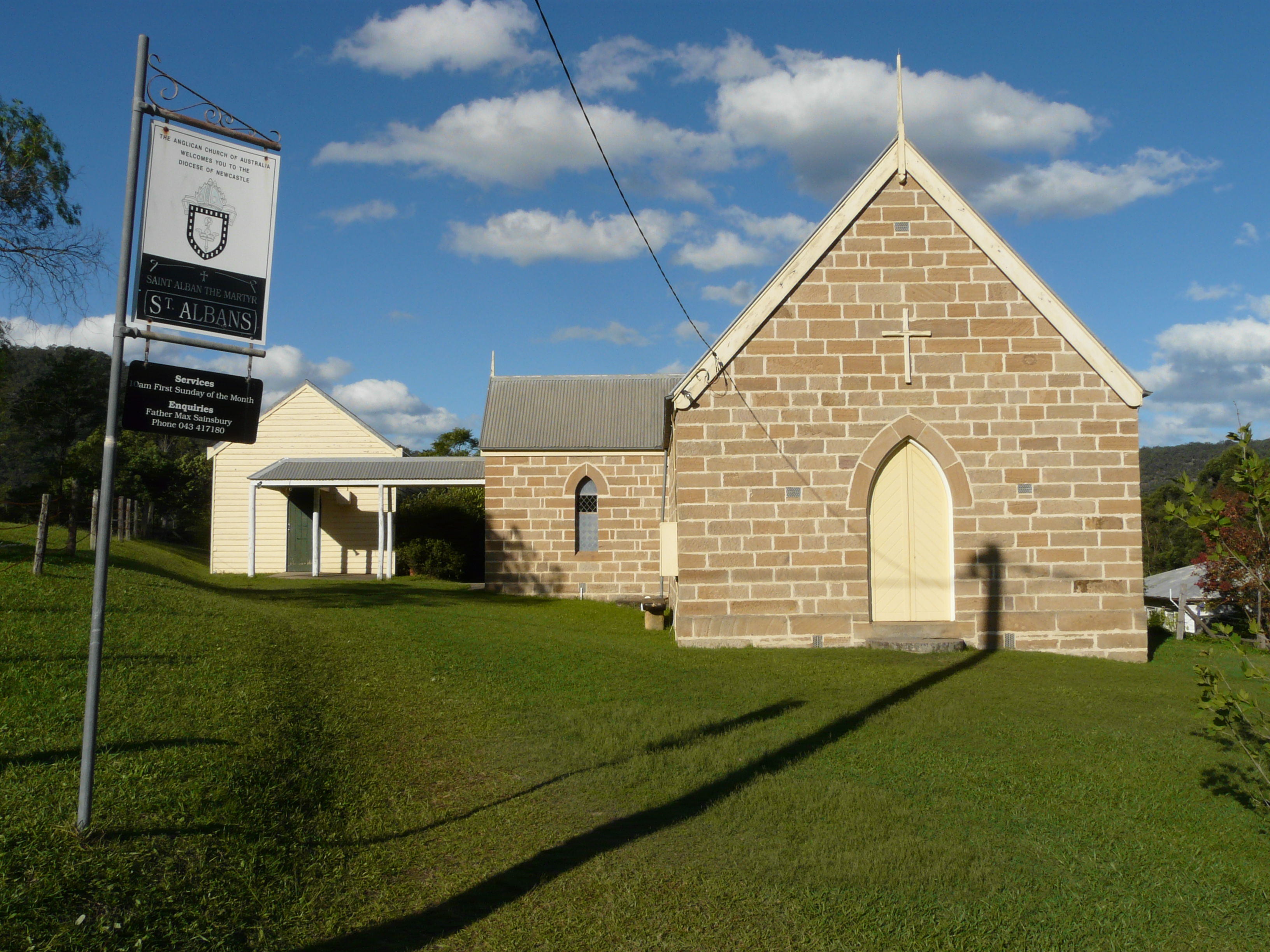
St Albans is a small and historic village on the Macdonald River, New South Wales, Australia, about 94 kilometres (65 mi) north west of Sydney. At the , St Albans and the surrounding area had a population of 305 people. History The original inhabitants of the Hawkesbury district were the Darug tribe of Aboriginals, also spelt as Dharug or Daruk. The river, which they called Derrubbin, was a focal point as a source of food and transport. The Darug people used the river to farm for fish, eels, water birds, and mussels. They also used the river as a mode of transport in bark canoes. It was first settled by Europeans in 1794 in a bid to acquire arable land to feed the increasing population of the penal colony at Sydney. In April 1794, Lieutenant Governor Francis Grose submitted plans for the first 22 farms on the Hawkesbury River in the present Pitt Town Bottoms area. In June 1795 a camp of Aboriginal peoples opposing the landtakings was harassed by a British regiment comman ... [...More Info...] [...Related Items...] OR: [Wikipedia] [Google] [Baidu] |
Ebenezer, New South Wales
Ebenezer is a historic town in New South Wales, Australia, in the local government area of the City of Hawkesbury. Ebenezer is located 69 kilometres north-west of Sydney and about 5 kilometres from the larger centre of Wilberforce. It sits on the banks of the Hawkesbury River and like typical early 19th century villages in NSW, it straggles along the roads rather than compactly around a village centre. History The town was named after Eben-Ezer in the Bible, 1 Samuel 7:12, wherein Samuel set up a stone between Mizpah and Shen and gave the name to Ebenezer. The Ebenezer Church is listed on the New South Wales Heritage Register. Church Ebenezer Uniting Church, on the banks of the Hawkesbury River, was originally a Presbyterian chapel which is the oldest standing church building in Australia. The area was settled in 1803 by a number of free settler families who sailed to Australia on the Coromandel in 1802. These settlers worshipped under a local gum tree, which still exists o ... [...More Info...] [...Related Items...] OR: [Wikipedia] [Google] [Baidu] |
Municipality Of Windsor
The Municipality of Windsor was a local government area of Greater Western Sydney, New South Wales, Australia. The municipality was proclaimed as the Borough of Windsor on 4 March 1871 and was centred on the Town of Windsor. In 1949, with the passing of the ''Local Government (Areas) Act 1948'', the council doubled in size with the amalgamation of the Municipality of Richmond to the west. On 1 January 1981, Windsor merged with the Colo Shire Council to the north, forming the Hawkesbury Shire (City of Hawkesbury from 1989). Council history Windsor District Council First settled by Europeans in 1794 in a bid to acquire arable land to feed the increasing population of the penal colony at Sydney, Windsor was proclaimed a Town in December 1810 by Governor of New South Wales Lachlan Macquarie, when he established the five ''Macquarie Towns'' in the Hawkesbury River area: Castlereagh, Pitt Town, Richmond, Wilberforce and Windsor. Windsor's place on the river, meant that it was an imp ... [...More Info...] [...Related Items...] OR: [Wikipedia] [Google] [Baidu] |

.jpg)


