|
Colla Swart
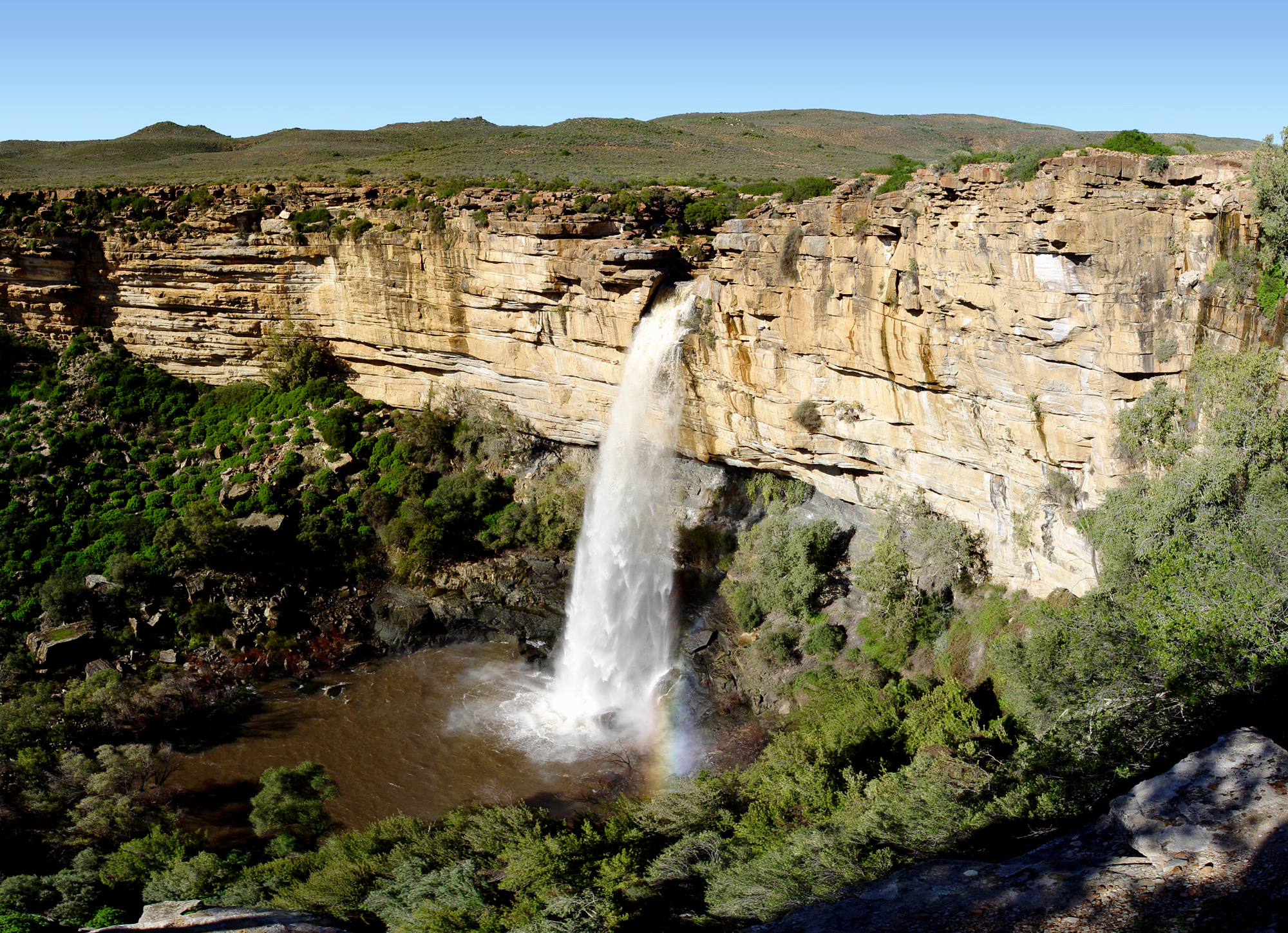
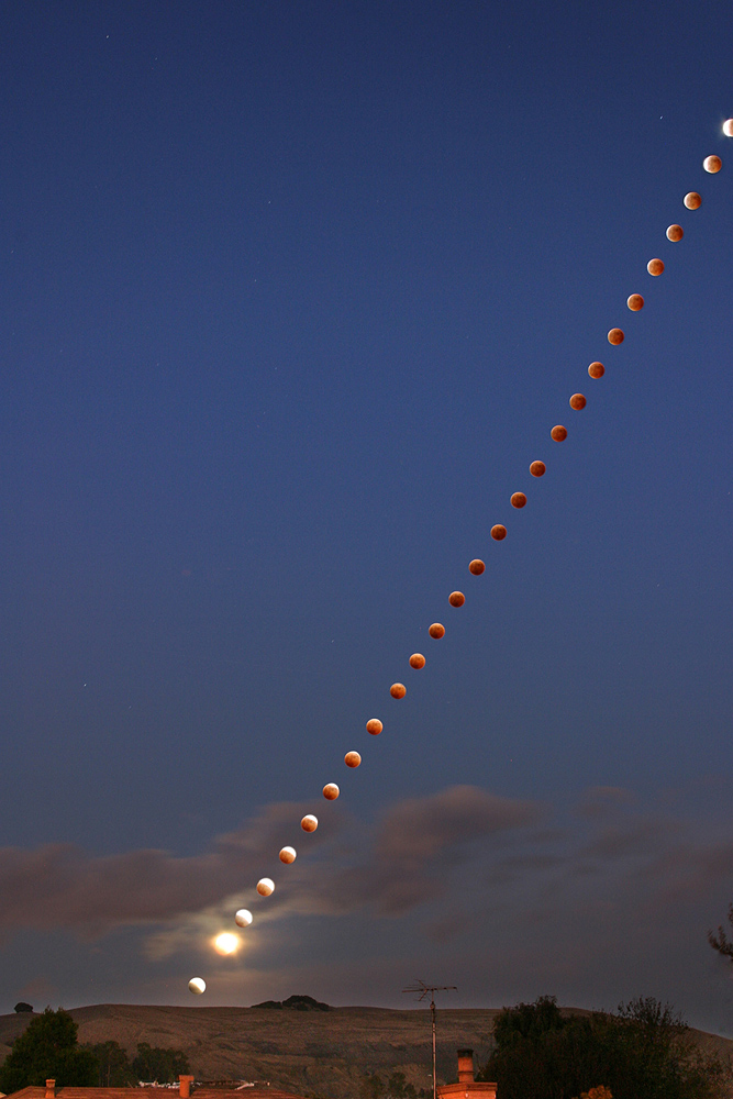
Colla Swart (born 1930) is a South African photographer. She started professional photography in 1982, and has photographed nature and people in and around her birth town of Kamieskroon. Colla and her Canadian photographer friend Freeman Patterson hosted, until recently, annual photographic workshops in Namaqualand, known for its beautiful floral scenery around August to September. Swart has photographed Namaqualand wild flowers and made multiple exposure photographs. She currently lives in Piketberg, Western Cape, South Africa South Africa, officially the Republic of South Africa (RSA), is the southernmost country in Africa. It is bounded to the south by of coastline that stretch along the South Atlantic and Indian Oceans; to the north by the neighbouring countri ..., the hometown of her late son, and daughter-in-law. External links *https://web.archive.org/web/20070607151654/http://www.agape.co.za/colla/ South African photographers South African women photographe ... [...More Info...] [...Related Items...] OR: [Wikipedia] [Google] [Baidu] |
Photography
Photography is the art, application, and practice of creating durable images by recording light, either electronically by means of an image sensor, or chemically by means of a light-sensitive material such as photographic film. It is employed in many fields of science, manufacturing (e.g., photolithography), and business, as well as its more direct uses for art, film and video production, recreational purposes, hobby, and mass communication. Typically, a lens is used to focus the light reflected or emitted from objects into a real image on the light-sensitive surface inside a camera during a timed exposure. With an electronic image sensor, this produces an electrical charge at each pixel, which is electronically processed and stored in a digital image file for subsequent display or processing. The result with photographic emulsion is an invisible latent image, which is later chemically "developed" into a visible image, either negative or positive, depending on the purp ... [...More Info...] [...Related Items...] OR: [Wikipedia] [Google] [Baidu] |
Kamieskroon
Kamieskroon is a small town in the Kamiesberg Local Municipality, lying in the foothills of the Kamiesberge at an elevation of approximately 800 m (2 600 ft). The town is more or less in the centre of Namaqualand, about 70 km (43 mi) to the south of Springbok, Northern Cape, South Africa. It is known mainly for its abundance of wild flowers during spring. Kamieskroon was founded in 1924, when the Dutch Reformed Church bought the land to relocate from Bowesdorp, 8 km to the north of the current location of the town. The move was forced by a shortage of water and restricted space for the growth of the town. Kamieskroon is located at the foot of the "Kroon" (Afrikaans, meaning Crown), a small koppie that resembles the crown of a king and is near Sneeukop, the second highest peak in Namaqualand. Also located close to Kamieskroon is Boesmankop, a mountain that resembles a Boesman ( Bushman or San) lying on his back. Between 1969 and 2003 it was a military base hous ... [...More Info...] [...Related Items...] OR: [Wikipedia] [Google] [Baidu] |
Freeman Patterson
Freeman Wilford Patterson, (born September 25, 1937) is a Canadian nature photographer and writer.Freeman Wilford Patterson , ''The Canadian Encyclopedia.'' He lives at Shamper's Bluff, New Brunswick. Patterson has authored several books on photographic techniques and theory, as well as on his nature photography. Life and work Patterson was born at Long Reach, New Brunswick. He earned a B.A. from |
Namaqualand
Namaqualand (khoekhoe: "Nama-kwa" meaning Nama Khoe people's land) is an arid region of Namibia and South Africa, extending along the west coast over and covering a total area of . It is divided by the lower course of the Orange River into two portions – Little Namaqualand to the south and Great Namaqualand to the north. Little Namaqualand is within the Namakwa District Municipality, forming part of Northern Cape Province, South Africa. It is geographically the largest district in the country, spanning over 26,836 km2. A typical municipality is Kamiesberg Local Municipality. The semidesert Succulent Karoo region experiences hot summers, sparse rainfall, and cold winters.Discover South Africa: Your Online Travel Directory. Discover Namakwa. Great Namaqualand in the Karas Region of Namibia, is sparsely populated by the Namaqua, a Khoikhoi people who have traditionally inhabited the Namaqualand region. Tourism The area’s landscape ranges from an unexploited coast ... [...More Info...] [...Related Items...] OR: [Wikipedia] [Google] [Baidu] |
Multiple Exposure
In photography and cinematography, a multiple exposure is the superimposition of two or more exposures to create a single image, and double exposure has a corresponding meaning in respect of two images. The exposure values may or may not be identical to each other. Overview Ordinarily, cameras have a sensitivity to light that is a function of time. For example, a one-second exposure is an exposure in which the camera image is equally responsive to light over the exposure time of one second. The criterion for determining that something is a double exposure is that the sensitivity goes up and then back down. The simplest example of a multiple exposure is a double exposure without flash, i.e. two partial exposures are made and then combined into one complete exposure. Some single exposures, such as "flash and blur" use a combination of electronic flash and ambient exposure. This effect can be approximated by a Dirac delta measure (flash) and a constant finite rectangular window, i ... [...More Info...] [...Related Items...] OR: [Wikipedia] [Google] [Baidu] |
Piketberg
Piketberg (also sometimes spelt Piquetberg in the past) is a town in the Western Cape, South Africa, located about 80 km east of Saldanha Bay. The original spelling of the name was "Piquetberg". The town is in the foothills of the Piketberg mountains, a range of low mountains formed from Table Mountain Sandstone. The area around the mountains is conducive to the farming of wheat, while the area on top of the mountains, being cooler and generally frost-free, is suited to the farming of fruit and Rooibos Tea. Piketberg possesses a large Dutch Reformed Church designed by the architect Carl Otto Hager in his trademark neo-Gothic style. History The area was inhabited by the Khoikhoi and the Bushmen, San before the arrival of 21 Dutch, Huguenot and German families in 1705-06, and there is still well-preserved San rock art in the mountains. There was once a small military post in the town to protect the livestock of farmers from raids by the Khoikhoi. By the 1730s the population had ... [...More Info...] [...Related Items...] OR: [Wikipedia] [Google] [Baidu] |
Western Cape
The Western Cape is a province of South Africa, situated on the south-western coast of the country. It is the fourth largest of the nine provinces with an area of , and the third most populous, with an estimated 7 million inhabitants in 2020. About two-thirds of these inhabitants live in the metropolitan area of Cape Town, which is also the provincial capital. The Western Cape was created in 1994 from part of the former Cape Province. The two largest cities are Cape Town and George. Geography The Western Cape Province is roughly L-shaped, extending north and east from the Cape of Good Hope, in the southwestern corner of South Africa. It stretches about northwards along the Atlantic coast and about eastwards along the South African south coast (Southern Indian Ocean). It is bordered on the north by the Northern Cape and on the east by the Eastern Cape. The total land area of the province is , about 10.6% of the country's total. It is roughly the size of England or the S ... [...More Info...] [...Related Items...] OR: [Wikipedia] [Google] [Baidu] |
South Africa
South Africa, officially the Republic of South Africa (RSA), is the southernmost country in Africa. It is bounded to the south by of coastline that stretch along the South Atlantic and Indian Oceans; to the north by the neighbouring countries of Namibia, Botswana, and Zimbabwe; and to the east and northeast by Mozambique and Eswatini. It also completely enclaves the country Lesotho. It is the southernmost country on the mainland of the Old World, and the second-most populous country located entirely south of the equator, after Tanzania. South Africa is a biodiversity hotspot, with unique biomes, plant and animal life. With over 60 million people, the country is the world's 24th-most populous nation and covers an area of . South Africa has three capital cities, with the executive, judicial and legislative branches of government based in Pretoria, Bloemfontein, and Cape Town respectively. The largest city is Johannesburg. About 80% of the population are Black South Afri ... [...More Info...] [...Related Items...] OR: [Wikipedia] [Google] [Baidu] |
South African Photographers
South is one of the cardinal directions or compass points. The direction is the opposite of north and is perpendicular to both east and west. Etymology The word ''south'' comes from Old English ''sūþ'', from earlier Proto-Germanic ''*sunþaz'' ("south"), possibly related to the same Proto-Indo-European root that the word ''sun'' derived from. Some languages describe south in the same way, from the fact that it is the direction of the sun at noon (in the Northern Hemisphere), like Latin meridies 'noon, south' (from medius 'middle' + dies 'day', cf English meridional), while others describe south as the right-hand side of the rising sun, like Biblical Hebrew תֵּימָן teiman 'south' from יָמִין yamin 'right', Aramaic תַּימנַא taymna from יָמִין yamin 'right' and Syriac ܬܰܝܡܢܳܐ taymna from ܝܰܡܝܺܢܳܐ yamina (hence the name of Yemen, the land to the south/right of the Levant). Navigation By convention, the ''bottom or down-facing side'' of ... [...More Info...] [...Related Items...] OR: [Wikipedia] [Google] [Baidu] |
South African Women Photographers
South is one of the cardinal directions or compass points. The direction is the opposite of north and is perpendicular to both east and west. Etymology The word ''south'' comes from Old English ''sūþ'', from earlier Proto-Germanic ''*sunþaz'' ("south"), possibly related to the same Proto-Indo-European root that the word ''sun'' derived from. Some languages describe south in the same way, from the fact that it is the direction of the sun at noon (in the Northern Hemisphere), like Latin meridies 'noon, south' (from medius 'middle' + dies 'day', cf English meridional), while others describe south as the right-hand side of the rising sun, like Biblical Hebrew תֵּימָן teiman 'south' from יָמִין yamin 'right', Aramaic תַּימנַא taymna from יָמִין yamin 'right' and Syriac ܬܰܝܡܢܳܐ taymna from ܝܰܡܝܺܢܳܐ yamina (hence the name of Yemen, the land to the south/right of the Levant). Navigation By convention, the ''bottom or down-facing side'' of ... [...More Info...] [...Related Items...] OR: [Wikipedia] [Google] [Baidu] |
Living People
Related categories * :Year of birth missing (living people) / :Year of birth unknown * :Date of birth missing (living people) / :Date of birth unknown * :Place of birth missing (living people) / :Place of birth unknown * :Year of death missing / :Year of death unknown * :Date of death missing / :Date of death unknown * :Place of death missing / :Place of death unknown * :Missing middle or first names See also * :Dead people * :Template:L, which generates this category or death years, and birth year and sort keys. : {{DEFAULTSORT:Living people 21st-century people People by status ... [...More Info...] [...Related Items...] OR: [Wikipedia] [Google] [Baidu] |


