|
Coldstream Mill
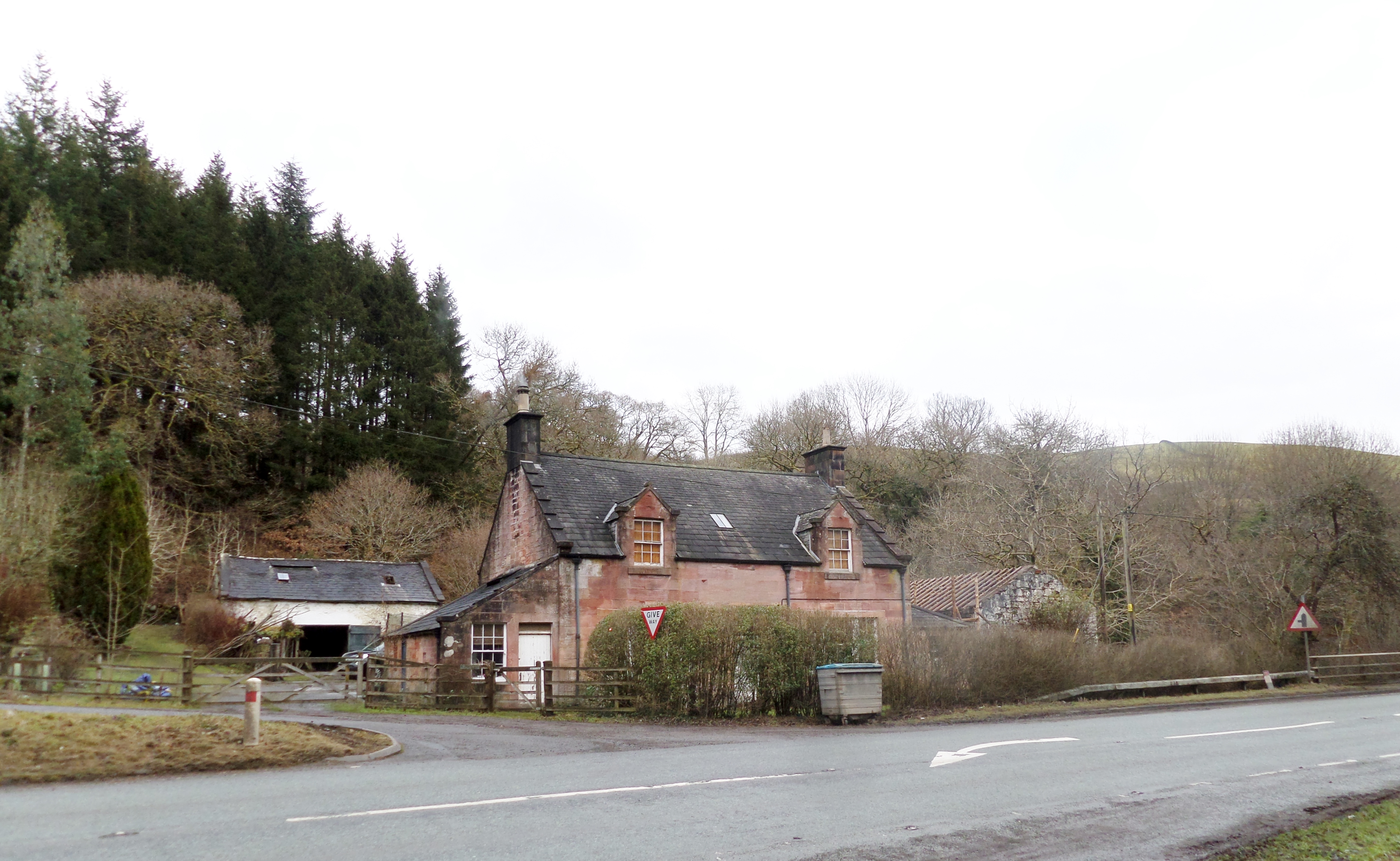
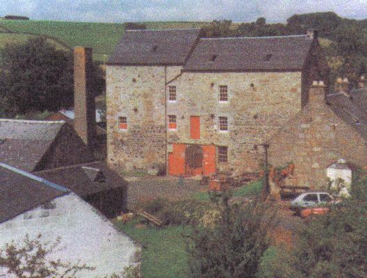
Coldstream Mill,Hume, John R. (1976). ''The Industrial Archaeology of Scotland. The Lowlands and Borders.'' London : B.T. Batsford. . p. 49. near Beith in North Ayrshire, Scotland was an early 19th century meal mill powered by the Dusk Water and Whitestone Burn that was enlarged from an existing much earlier watermill. The mill worked until 1991 and was the last traditional working water mill in Ayrshire and one of the last continuously worked watermills in Scotland. The mill buildings have been converted into a private dwelling and the mill pond has been retained. History Coldstream Mill was built to serve the Barony and castle of Hessilhead. It was officially known on the deeds as Whitestone Mill in the Lands of Coldstream. The circa 1602 Timothy Pont map issued by Blaeu in 1654 shows a Whitstammil (sic). The mill Coldstream was not mentioned in legal papers until 1728, but it may have been enlarged and improved circa 1673, as part of the general improvements in the barony ... [...More Info...] [...Related Items...] OR: [Wikipedia] [Google] [Baidu] |
Beith
Beith is a small town in the Garnock Valley, North Ayrshire, Scotland approximately south-west of Glasgow. The town is situated on the crest of a hill and was known originally as the "''Hill o' Beith''" (hill of the birches) after its ''Court Hill''. History Name Beith's name is thought to emanate from Ogham, which is sometimes referred to as the "''Celtic Tree Alphabet''", ascribing names of trees to individual letters. ''Beithe'' in Old Irish means ''Birch-tree'' (cognate to Latin ''betula''). There is reason to believe that the whole of the district was covered with woods. The town of Beith itself was once known as 'Hill of Beith' as this was the name of the feudal barony and was itself derived from the Court Hill near Hill of Beith Castle. Alternatively, Beith may be derived from Cumbric ''*baɣeδ'', 'boar' (Welsh ''baedd''). The local pronunciation of the name would favour this theory. The Wood of Beit, now the 'Moor of Beith', has been identified as an Arthurian sit ... [...More Info...] [...Related Items...] OR: [Wikipedia] [Google] [Baidu] |
Dalgarven Mill
The tiny village of Dalgarven in North Ayrshire, Scotland is located just north of Kilwinning on the road to Dalry. History In 1881 some two hundred people lived in the village, the mill being at its heart, with a Sunday school, smithy, joiner's shop and Dalgarven House. Most of the women were weavers, dressmakers, farm or domestic servants. The men were stonemasons, joiners, farm labourers, platelayers, railway surfacemen, etc. Monkcastle House is at one end of the village and Smithstone House at the other. The coming of the new road resulted in the demolition of most of the village apart from the smithy and a cottage row. A pre-reformation chapel is said to have existed in the vicinity and the old yew tree may be indicative of this. Located here on the River Garnock is Dalgarven Mill, home to the Museum of Ayrshire Country Life and Costume. The Dalgarven Arch was an ogee An ogee ( ) is the name given to objects, elements, and curves—often seen in architecture and bui ... [...More Info...] [...Related Items...] OR: [Wikipedia] [Google] [Baidu] |
Grinding Mills In The United Kingdom
Grind is the cross-sectional shape of a blade. Grind, grinds, or grinding may also refer to: Grinding action * Grinding (abrasive cutting), a method of crafting * Grinding (dance), suggestive club dancing * Grinding (video gaming), repetitive and uninteresting gameplay * Bruxism, grinding of the teeth * Grind (sport), a sliding stance usually performed in extreme sports such as aggressive skating and boardsports; Grinds (skateboarding) * Grind (whaling), pilot whale hunting in the Faroe Islands * Grinds, private tutoring, in Ireland * Mill (grinding) * Grinding, the operation of the winches on a yacht; the work done by a grinder (sailing position) Geography * Grind, a village in Lăpugiu de Jos Commune, Hunedoara County, Romania * Grind (Unirea), a tributary of the Unirea in Cluj and Alba Counties, Romania Film and TV * ''Grind'' (2003 film), about amateur skaters * ''The Grind'' (1915 film), a silent movie * ''Grind'' (1997 film), starring Billy Crudup and Adrienne Shel ... [...More Info...] [...Related Items...] OR: [Wikipedia] [Google] [Baidu] |
History Of North Ayrshire
History (derived ) is the systematic study and the documentation of the human activity. The time period of event before the invention of writing systems is considered prehistory. "History" is an umbrella term comprising past events as well as the memory, discovery, collection, organization, presentation, and interpretation of these events. Historians seek knowledge of the past using historical sources such as written documents, oral accounts, art and material artifacts, and ecological markers. History is not complete and still has debatable mysteries. History is also an academic discipline which uses narrative to describe, examine, question, and analyze past events, and investigate their patterns of cause and effect. Historians often debate which narrative best explains an event, as well as the significance of different causes and effects. Historians also debate the nature of history as an end in itself, as well as its usefulness to give perspective on the problems of the p ... [...More Info...] [...Related Items...] OR: [Wikipedia] [Google] [Baidu] |
Nether Mill
Nether Mill or the Nethermiln of Kilbirnie was originally the Barony of Kilbirnie corn mill and later became a meal mill as well, located in the Parish of Kilbirnie, near Kilbirnie Loch, North Ayrshire, south-west Scotland. The present ruins date from at least the start of the 20th century with structural evidence for at least three phases of development that finally ceased when the mill closed and abandoned circa 1938. The mill was probably a single storey building, developed to become a complex when at a later stage buildings such as a grain kiln, cottage and a wheel house enclosure may have been added. The mound near the site is locally known as the 'Miller's Knowe'. Kilbirnie Ladeside F.C. is named for the lade of the mill that has its confluence with the Garnock opposite the club's grounds. History A 'Neth Mill' is first recorded on the 1750s William Roy military map as well as a 'Load Side' or 'Lade Side' dwelling where the mill lade runs up towards its confluence with th ... [...More Info...] [...Related Items...] OR: [Wikipedia] [Google] [Baidu] |
Meikle Millbank Mill
Millbank Mill or Meikle Millbank Mill was an old corn mill in Burnbank Glen overlooking the Castle Semple Loch, Barr Loch near Lochwinnoch in Renfrewshire, south-west Scotland. The present ruins date from at least the end of the 18th century with structural evidence for six phases of development that finally ceased when the mill closed circa 1950. The mill was a two-storey building, developed to become T-shaped complex when at a later stage a grain kiln was added. History Milbanck (sic) is recorded on Blaeu's maps of 1654 and 1662-5 although a mill is only suggested by the name itself. In 1796 the mill is depicted on a map by John Ainslie with the mill dam and mill pond located far up the glen at a 'T' junction of the lane that once ran to Auchenhane (sic) rather than the later location near the mill itself. The mill at that time is shown with two buildings above. The miller's dwelling may have doubled as a small farm as most millers had a second occupation in between the busy pos ... [...More Info...] [...Related Items...] OR: [Wikipedia] [Google] [Baidu] |
Coylton
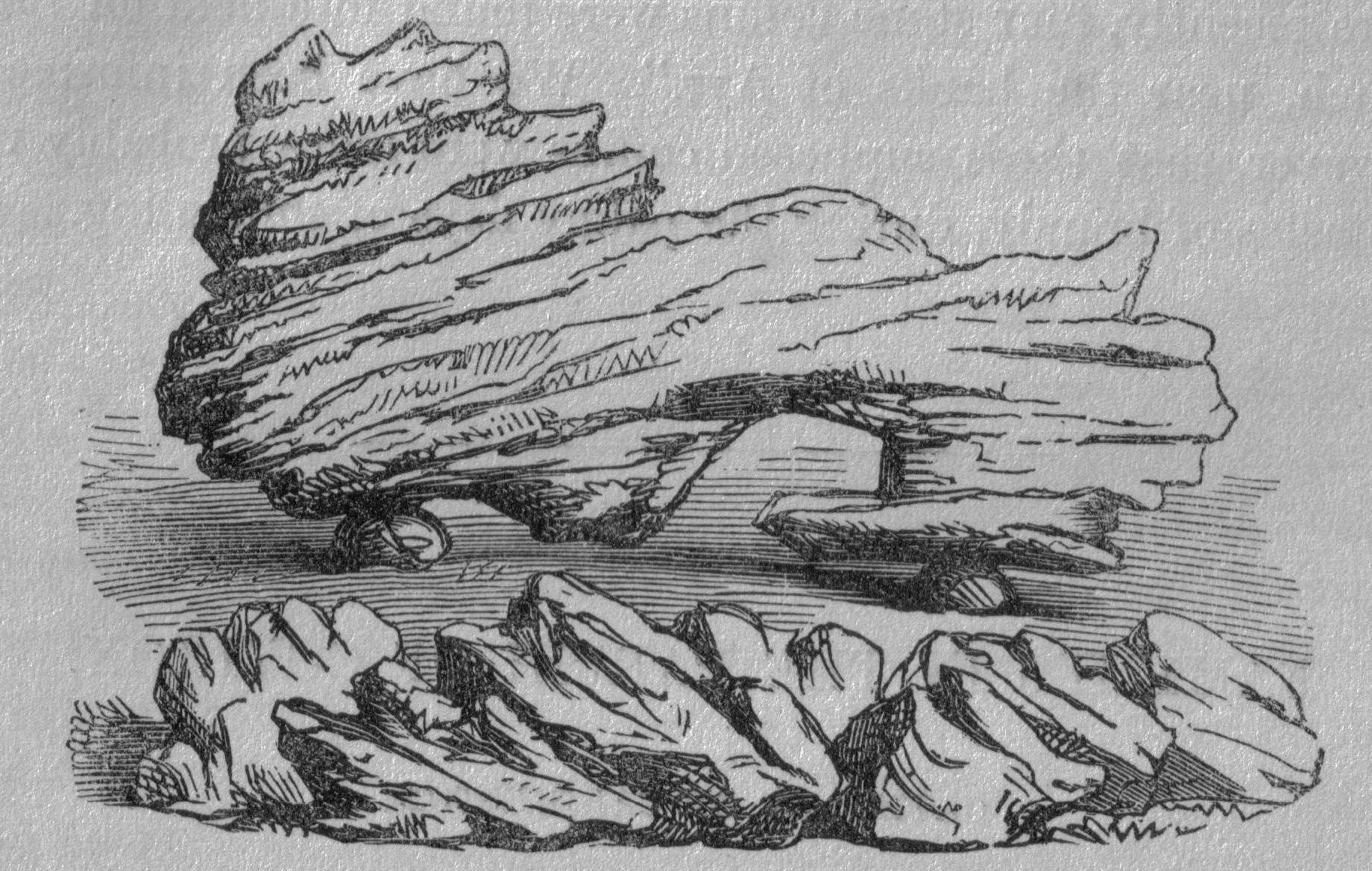
Coylton ( sco, Culton) is a village and civil parish in South Ayrshire, Scotland. It is east of Ayr and west of Drongan, on the A70 road, A70. Sundrum Castle Holiday Park is to the west of the village, in the grounds of Sundrum Castle, which partly dates to the 13th century. A rocking stone stands atop the Craigs of Kyle near Coylton. It weighs about 30 tons and rests upon two stones. A large standing stone known as Wallace's Stone stands nearby.James Paterson (journalist), Paterson, James (1863). ''History of the Counties of Ayr and Wigton.'' Vol. I. - Kyle. James Stillie, Edinburgh. pp.217–218. The village is also home to a parish church of the Gothic style, built in 1832. Notable people Professional footballers George Getgood (1892–1970) and David Affleck (1912–1984) were born in Coylton. Coylton was also home to one of Ayrshire's celebrated artists. Robert Bryden (1865–1939) was born in the village. After a period working in Ayr, he became a modeller of bro ... [...More Info...] [...Related Items...] OR: [Wikipedia] [Google] [Baidu] |
Millmannoch
Millmannoch, also once known locally as the 'Mill of Mannoch'Paterson, Page 211 or Kilmannoch, is a ruined mill and hamlet in the old Barony of Sundrum, South Ayrshire, Parish of Coylton, Scotland about a mile from Coylton and Drongan. The 'Trysting Tree' of Robert Burns's poem s:The Soldier's Return, ''The Soldier's Return'' stood nearby. A smithy was once located here in addition to the miller's cottage and later, a farm. Situation Nineteenth-century historian Paterson described it as being "on the south bank, not far from the 'Craigs o'Kyle', and a more lovely spot never inspired a poet's fancy. The Coyl winds round the mill in serpentine form, in a dark, deep, and rather narrow stream, over which the ash and elm throw their gigantic arms, and in summer, with their waving foliage, almost prevent the sun's beams from playing upon its waters. At the bend, where stands the mill, which is driven by water conveyed from a considerable distance above, the stream is spanned by a rusti ... [...More Info...] [...Related Items...] OR: [Wikipedia] [Google] [Baidu] |
Enterkinfoot
Enterkinfoot is a small village or hamlet which lies north of Thornhill on the A76 on the route to Sanquhar, in Dumfriesshire, Durisdeer Parish, in Dumfries and Galloway, south-west Scotland. Its original nucleus was the old mill with associated buildings, the school and the famous Enterkin Pass and path that followed the course of the Enterkin Glen to Wanlockhead and from there to Edinburgh. The site features the A76 that runs through the centre of Enterkinfoot, the River Nith and the Enterkin Burn that once powered the mill before joining the Nith. The area is famous for its association with the Covenanters. History The village is now consistently known as 'Enterkinfoot' and the stream recorded as the 'Enterkin Burn' with its source away on the western slope of Lowther Hill. The burn has its confluence here with the River Nith. The area is famous for its association with the Covenanters and the events of the so-called 'Killing Times' that occurred during the reigns of Cha ... [...More Info...] [...Related Items...] OR: [Wikipedia] [Google] [Baidu] |
Dalgarven Mill – Museum Of Ayrshire Country Life And Costume
Dalgarven Mill is near Kilwinning, in the Garnock Valley, North Ayrshire, Scotland and it is home to the Museum of Ayrshire Country Life and Costume. The watermill has been completely restored over a number of years and is run by the independent Dalgarven Mill Trust. The village of Dalgarven was largely destroyed by the construction of the main A737 road, but the mill buildings survive and are open as a tourist attraction and educational resource, interpreting local history in addition to its role as a museum of Ayrshire country life. Very few mills remain in Ayrshire and this is an example which has been preserved due to the foresight of the family of the last miller who saw a modern role for an ancient industrial site and traditional social meeting-place. Some of the outbuildings have been converted for use as an antique shop, others are still occupied as dwellings and some are in the process of being converted to uses which will enhance the quality of the experience of visitors ... [...More Info...] [...Related Items...] OR: [Wikipedia] [Google] [Baidu] |
Closeburn, Dumfries And Galloway
Closeburn (Scottish Gaelic: ''Cill Osbairn'') is a village and civil parish in Dumfries and Galloway, Scotland. The village is on the A76 road south of Thornhill. In the 2001 census, Closeburn had a population of 1,119. Closeburn is recorded as ''Killosbern'' in 1185. The first element of the name is Gaelic ''cill'' 'cell or church'. The second element is a saint's name, but none has definitely been identified. Between 1849 and 1961 the village had a railway station. Although Closeburn railway station is now closed, the Glasgow South Western Line still runs through the village. The nearest stations are at Sanquhar and Dumfries. The village is the former location of Wallace Hall Academy, founded in 1723 and now based in Thornhill. The former schoolhouse, built in 1795 and incorporating the original buildings from the 1720s, is a Category A listed building. Situated east of the village is Closeburn Castle, a Category B listed tower house that was until 1783 the family sea ... [...More Info...] [...Related Items...] OR: [Wikipedia] [Google] [Baidu] |
Barburgh Mill
Barburgh Mill is a hamlet composed of an old lint mill, later extended as a woollen mill and associated buildings which lies north of Auldgirth on the A76 on the route to Closeburn, Dumfries and Galloway, Closeburn, in Dumfriesshire, Closeburn Parish, in Dumfries and Galloway, south-west Scotland. Its original nucleus was the old mill with associated buildings, the smithy, toll house and the miller's and workers dwellings. The site features the A76 that runs nearby, the River Nith and the Lake Burn that once powered the mill via a lade before joining the Nith. The area is famous for its association with the Covenanters. A Roman fortlet stood opposite the mill and a Roman road is thought to have run through Nithsdale at this point. History The hamlet stands about 4 km south of Closeburn, Dumfries and Galloway, Closeburn and is now consistently known as 'Barburgh' and the stream recorded as the Lake Burn with its source partly from the site of the old Closeburn Loch. The hamle ... [...More Info...] [...Related Items...] OR: [Wikipedia] [Google] [Baidu] |

.jpg)


