|
Colden, West Yorkshire
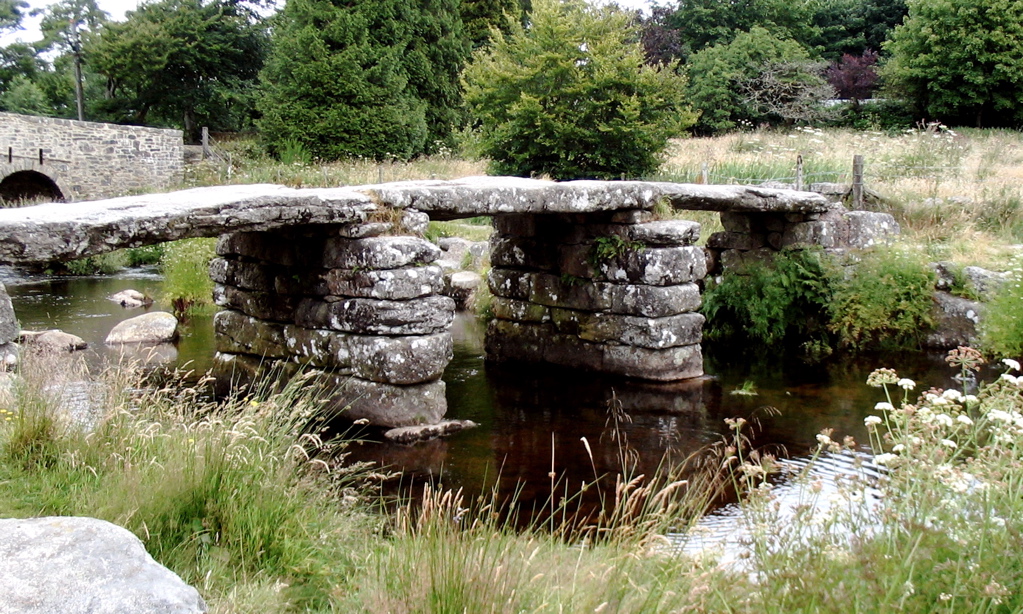
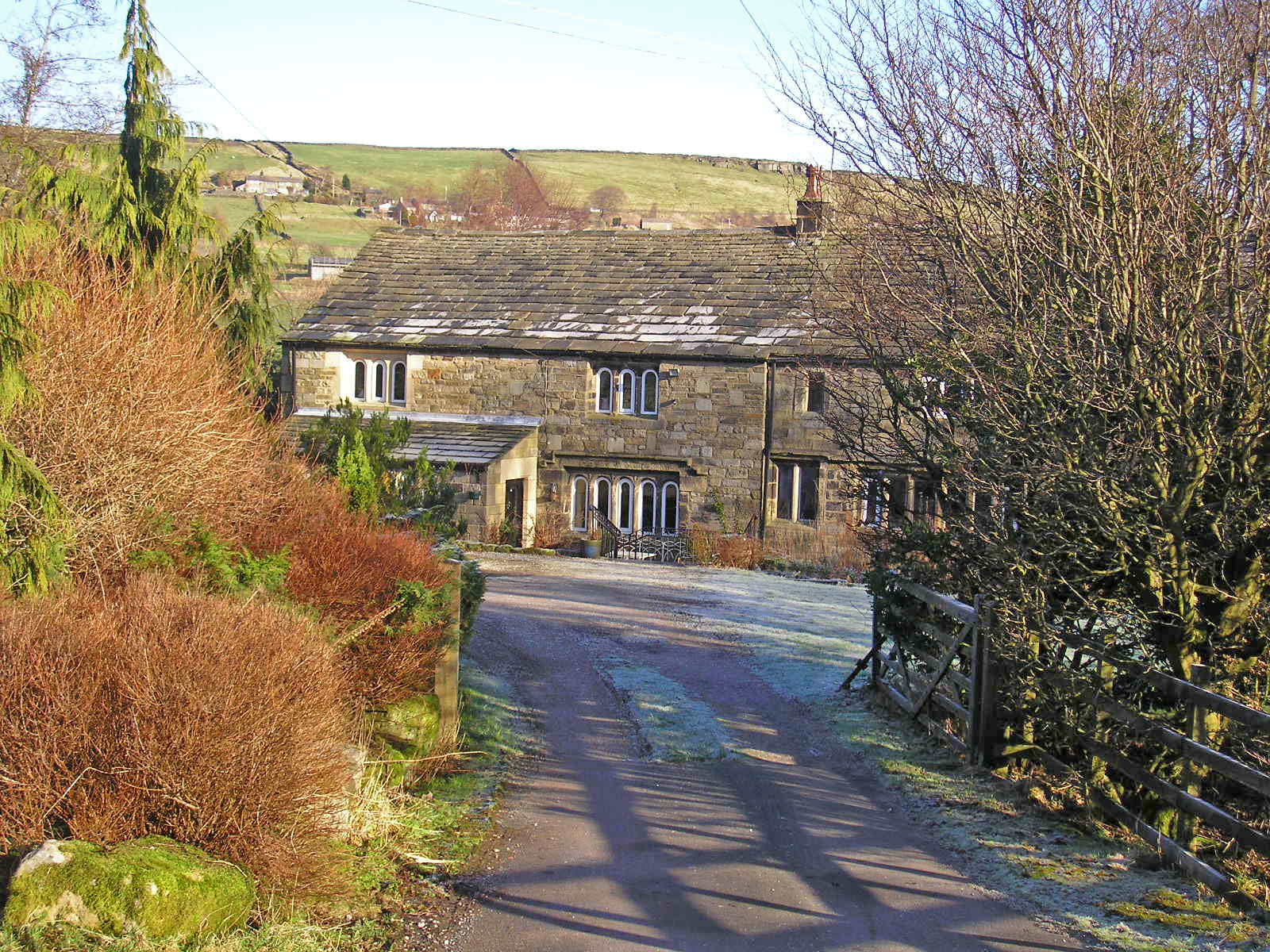
Colden is a hamlet in the civil parish of Heptonstall in Calderdale, West Yorkshire, England. Historically part of the West Riding of Yorkshire, the hamlet consists of scattered houses and farms on high ground west of Heptonstall, above the valley of Colden Water. Colden School is a junior and infants school established in 1878. Colden Water is crossed by two old footbridges, possibly dating from the 17th century. Strines Bridge is a packhorse bridge, and lower down a clapper bridge crosses the stream. Both are Grade II listed buildings. The Pennine Way and Calderdale Way The Calderdale Way is a long-distance footpath in West Yorkshire, England. It was devised in the 1970s to draw attention to attractions in the Calderdale district which was being established at that time. The route is circular and walks can ... both pass through Colden. See also * Listed buildings in Blackshaw References {{authority control Villages in West Yorkshire Geography of Calder ... [...More Info...] [...Related Items...] OR: [Wikipedia] [Google] [Baidu] |
Heptonstall
Heptonstall is a small village and civil parish within the Calderdale borough of West Yorkshire, England, historically part of the West Riding of Yorkshire. The population of Heptonstall, including the hamlets of Colden and Slack Top, is 1,448, increasing to 1,470 at the 2011 Census. The town of Hebden Bridge lies directly to the south-east. Although Heptonstall is part of Hebden Bridge as a post town, it is not within the Hebden Royd town boundaries. The village is on the route of the Calderdale Way, a circular walk around the hills and valleys of Calderdale. History Heptonstall is mentioned in the Domesday book in 1087. The place-name 'Heptonstall' is first recorded as ''Heptonstall'' in the 1274 Wakefield Court Rolls, and in 1316 in the ''Feudal Aids''. The name means "the stall or stable in Hebden". The name 'Hebden' means " rose-hip dene or valley". Heptonstall initially formed part of the manor of Halifax-cum-Heptonstall, itself subinfeudatory to the manor of Wake ... [...More Info...] [...Related Items...] OR: [Wikipedia] [Google] [Baidu] |
Calderdale
Calderdale is a metropolitan borough of West Yorkshire, England, whose population in 2020 was 211,439. It takes its name from the River Calder, and dale, a word for valley. The name Calderdale usually refers to the borough through which the upper river flows, while the actual landform is known as the Calder Valley. Several small valleys contain tributaries of the River Calder. Calderdale covers part of the South Pennines, and the Calder Valley is the southernmost of the Yorkshire Dales, though it is not part of the Yorkshire Dales National Park. The borough was formed in 1974 by the merger of six local government districts, from east to west Brighouse, Elland, Halifax, Sowerby Bridge, Hebden Bridge and Todmorden. Mytholmroyd, together with Hebden Bridge, forms Hebden Royd. Halifax is the commercial, cultural and administrative centre of the borough. Calderdale is served by Calderdale Council, which is headquartered in Halifax, with some functions based in Todmorden. History ... [...More Info...] [...Related Items...] OR: [Wikipedia] [Google] [Baidu] |
West Yorkshire
West Yorkshire is a metropolitan and ceremonial county in the Yorkshire and Humber Region of England. It is an inland and upland county having eastward-draining valleys while taking in the moors of the Pennines. West Yorkshire came into existence as a metropolitan county in 1974 after the reorganisation of the Local Government Act 1972 which saw it formed from a large part of the West Riding of Yorkshire. The county had a recorded population of 2.3 million in the 2011 Census making it the fourth-largest by population in England. The largest towns are Huddersfield, Castleford, Batley, Bingley, Pontefract, Halifax, Brighouse, Keighley, Pudsey, Morley and Dewsbury. The three cities of West Yorkshire are Bradford, Leeds and Wakefield. West Yorkshire consists of five metropolitan boroughs (City of Bradford, Calderdale, Kirklees, City of Leeds and City of Wakefield); it is bordered by the counties of Derbyshire to the south, Greater Manchester to the south-west, Lancash ... [...More Info...] [...Related Items...] OR: [Wikipedia] [Google] [Baidu] |
Historic Counties Of England
The historic counties of England are areas that were established for administration by the Normans, in many cases based on earlier Heptarchy, kingdoms and shires created by the Angles, Saxons, Jutes, Celts and others. They are alternatively known as ancient counties, traditional counties, former counties or simply as counties. In the centuries that followed their establishment, as well as their administrative function, the counties also helped define local culture and identity. This role continued even after the counties ceased to be used for administration after the creation of Administrative counties of England, administrative counties in 1889, which were themselves amended by further local government reforms in the years following. Unlike the partly self-governing Ancient borough, boroughs that covered urban areas, the counties of medieval England existed primarily as a means of enforcing central government power, enabling monarchs to exercise control over local areas throug ... [...More Info...] [...Related Items...] OR: [Wikipedia] [Google] [Baidu] |
West Riding Of Yorkshire
The West Riding of Yorkshire is one of three historic subdivisions of Yorkshire, England. From 1889 to 1974 the administrative county County of York, West Riding (the area under the control of West Riding County Council), abbreviated County of York (WR), was based closely on the historic boundaries. The lieutenancy at that time included the City of York and as such was named West Riding of the County of York and the County of the City of York. Its boundaries roughly correspond to the present ceremonial counties of West Yorkshire, South Yorkshire and the Craven, Harrogate and Selby districts of North Yorkshire, along with smaller parts in Lancashire (for example, the parishes of Barnoldswick, Bracewell, Brogden and Salterforth became part of the Pendle district of Lancashire and the parishes of Great Mitton, Newsholme and Bowland Forest Low became part of the Ribble Valley district also in Lancashire), Cumbria, Greater Manchester and, since 1996, the unitary East Riding of ... [...More Info...] [...Related Items...] OR: [Wikipedia] [Google] [Baidu] |
Colden School - Geograph
Colden may refer to: People *Alexander Colden, first recorded Postmaster of New York City *Cadwallader Colden (1688–1776), physician, farmer, surveyor, botanist, and lieutenant governor of the Province of New York *Cadwallader D. Colden (1769–1834), Colonel in the U.S. Army during the War of 1812, member of New York State Assembly, mayor of New York City, U.S. Representative, and member of New York State Senate *Cadwallader Colden Washburn (1818–1882), a founder of General Mills and a representative from Wisconsin to the United States Congress *Charles J. Colden (1870–1938), a representative from California to the Seventy-third United States Congress *Charles S. Colden (1885–1960), American lawyer and politician *Jane Colden (1724–1766), U.S. botanist *Trevor Colden (b. 1994), a U.S. skateboarder * Colden Earles (b. 2003) Places England *Colden, West Yorkshire, a village in Calderdale *Colden Common, a village and civil parish in Hampshire Isle of Man *Colden, a peak ... [...More Info...] [...Related Items...] OR: [Wikipedia] [Google] [Baidu] |
Packhorse Bridge
A packhorse bridge is a bridge intended to carry packhorses (horses loaded with sidebags or panniers) across a river or stream. Typically a packhorse bridge consists of one or more narrow (one horse wide) masonry arches, and has low Parapet#Bridge parapets, parapets so as not to interfere with the panniers borne by the horses. Multi-arched examples sometimes have triangular Starling (structure), cutwaters that are extended upward to form pedestrian refuges. Packhorse bridges were often built on the trade routes (often called packhorse routes) that formed major transport arteries across Europe and Great Britain until the coming of the toll road, turnpike roads and canals in the 18th century. Before the road-building efforts of Napoleon, all Principal passes of the Alps, crossings of the Alps were on packhorse trails. Travellers' carriages were dismantled and transported over the mountain passes by ponies and mule, mule trains. Definition In the British Isles at least, the definitio ... [...More Info...] [...Related Items...] OR: [Wikipedia] [Google] [Baidu] |
Clapper Bridge
A clapper bridge is an ancient form of bridge found on the moors of the English West Country (Bodmin Moor, Dartmoor and Exmoor) and in other upland areas of the United Kingdom including Snowdonia and Anglesey, Cumbria, Derbyshire, Yorkshire, Lancashire, and in northern Wester Ross and north-west Sutherland in Scotland. It is formed by large flat slabs of stone, often granite or schist. These can be supported on stone piers across rivers, or rest on the banks of streams. History Although often credited with prehistoric origin, most were erected in medieval times, and some in later centuries. They are often situated close to a ford where carts could cross. According to the Dartmoor National Park, the word 'clapper' derives ultimately from an Anglo-Saxon word, , meaning 'bridging the stepping stones'; the ''Oxford English Dictionary'' gives the intermediate Medieval Latin form , , "of Gaulish origin", with an initial meaning of "a pile of stones".French and Provençal ''clapier'' ... [...More Info...] [...Related Items...] OR: [Wikipedia] [Google] [Baidu] |
Grade II Listed Buildings
In the United Kingdom, a listed building or listed structure is one that has been placed on one of the four statutory lists maintained by Historic England in England, Historic Environment Scotland in Scotland, in Wales, and the Northern Ireland Environment Agency in Northern Ireland. The term has also been used in the Republic of Ireland, where buildings are protected under the Planning and Development Act 2000. The statutory term in Ireland is " protected structure". A listed building may not be demolished, extended, or altered without special permission from the local planning authority, which typically consults the relevant central government agency, particularly for significant alterations to the more notable listed buildings. In England and Wales, a national amenity society must be notified of any work to a listed building which involves any element of demolition. Exemption from secular listed building control is provided for some buildings in current use for worship, ... [...More Info...] [...Related Items...] OR: [Wikipedia] [Google] [Baidu] |
Pennine Way
The Pennine Way is a National Trail in England, with a small section in Scotland. The trail stretches for from Edale, in the northern Derbyshire Peak District, north through the Yorkshire Dales and Northumberland National Park and ends at Kirk Yetholm, just inside the Anglo-Scottish border, Scottish border. The path runs along the Pennines, Pennine hills, sometimes described as the "backbone of England". Although not the United Kingdom's longest National Trail (this distinction belongs to the South West Coast Path), it is according to The Ramblers "one of Britain's best known and toughest". History The path was the idea of the journalist and rambler Tom Stephenson (activist), Tom Stephenson, inspired by similar trails in the United States of America, particularly the Appalachian Trail. Stephenson proposed the concept in an article for the ''Daily Herald (UK newspaper), Daily Herald'' in 1935, and lobbied Parliament for the creation of an official trail. The walk was planned ... [...More Info...] [...Related Items...] OR: [Wikipedia] [Google] [Baidu] |
Calderdale Way
The Calderdale Way is a long-distance footpath in West Yorkshire, England. It was devised in the 1970s to draw attention to attractions in the Calderdale district which was being established at that time. The route is circular and walks can be started at any point. The official start is at Clay House in West Vale and the route includes much exposed moorland, woodland paths, a short section of canal towpath and some road sections. It passes through several settlements, including Ripponden, Mankinholes, Todmorden, Heptonstall, Holdsworth, Shelf and Brighouse Brighouse is a town within the metropolitan borough of Calderdale, in West Yorkshire, England. Historically within the West Riding of Yorkshire, it is situated on the River Calder, east of Halifax. It is served by Junction 25 of the M62 m .... One published guidebook divides the walk into four day-long sections. * West Vale–Mankinholes () * Mankinholes–Heptonstall () * Heptonstall–Catherine Slack () * Cather ... [...More Info...] [...Related Items...] OR: [Wikipedia] [Google] [Baidu] |
Listed Buildings In Blackshaw
Blackshaw is a civil parish in the metropolitan borough of Calderdale, West Yorkshire, England. It contains 45 listed buildings that are recorded in the National Heritage List for England. Of these, one is at Grade II*, the middle of the three grades, and the others are at Grade II, the lowest grade. The parish contains the small settlements of Blackshaw Head, Charlestown, and Colden, and is otherwise rural. Most of the listed buildings are houses and cottages, farmhouses, and farm buildings. The other listed buildings include bridges, a tenter ground and apiary An apiary (also known as a bee yard) is a location where beehives of honey bees are kept. Apiaries come in many sizes and can be rural or urban depending on the honey production operation. Furthermore, an apiary may refer to a hobbyist's hives or ..., a public house, a guide post, a milestone, and a boundary stone. __NOTOC__ Key Buildings References Citations Sources * * * * * * * * * * * * * * ... [...More Info...] [...Related Items...] OR: [Wikipedia] [Google] [Baidu] |


