|
Cobitis Ohridana
''Cobitis ohridana'' is a species of ray-finned fish in the true loach family (Cobitidae). It is only found in Albania, Montenegro and North Macedonia.Crivelli (2005) This fish was long believed to be part of the widespread Spined Loach (''C. taenia''). Cladistic analysis of DNA sequence data (nDNA RAG-1 and S7 ribosomal protein intron 1, and mtDNA cytochrome ''b'') confirms that it is properly treated as full species. Its closest living relative might be '' C. zanandreai'' of Lake Fondi and its surroundings in west-central Italy. In that case these species separated probably around 6 million years ago in the Late Miocene, perhaps during the early Messinian salinity crisis. Alternatively, these two might simply be independently derived from a common ancestor in the course of these events but probably somewhat earlier, and appear similar on the molecular level due to convergent evolution.Perdices ''et al.'' (2008) Its natural habitats are Lake Ohrid and Lake Scutari, and the adj ... [...More Info...] [...Related Items...] OR: [Wikipedia] [Google] [Baidu] |
Stanko Karaman
Stanko Luka Karaman (8 December 1889 – 17 May 1959) was a Yugoslav biologist of Bosnian Serb ancestry, researcher on amphipod and isopod crustaceans. In 1926 he founded the Museum of South Serbia (later - Macedonian Museum of Natural History) in Skopje and in 1928, the Zoological Garden of Skopje. Several species are named after him, for example '' Delamarella karamani'' Petkovski, 1957 (Harpacticoida), '' Stygophalangium karamani'' Oudemans, 1933 (Arachnida), or '' Macedonethes stankoi'' I. Karaman, 2003 (Isopoda). Other taxa named ''karamani'' are labeled after his son Gordan S. Karaman, also a carcinologist A carcinologist is a scientist who studies crustaceans or is otherwise involved in carcinology (the science of crustaceans). References {{Reflist, 24em . Carcinologists .... Publications * Pisces Macedoniae, Split 1924 pp. 90 * Komarci Dalmacije i njihovo suzbijanje.- Glasnik Ministarstva narodnog zdravlja, Institut za proucavanje i suzbijanje malarij ... [...More Info...] [...Related Items...] OR: [Wikipedia] [Google] [Baidu] |
Cobitis Zanandreai
''Cobitis zanandreai'' is a species of ray-finned fish in the family Cobitidae. It is found only in Central-Italy. It is threatened by habitat loss Habitat destruction (also termed habitat loss and habitat reduction) is the process by which a natural habitat becomes incapable of supporting its native species. The organisms that previously inhabited the site are displaced or dead, thereby .... References Sources Cobitis Endemic fauna of Italy Fish described in 1965 Taxonomy articles created by Polbot {{Cobitidae-stub ... [...More Info...] [...Related Items...] OR: [Wikipedia] [Google] [Baidu] |
FishBase
FishBase is a global species database of fish species (specifically finfish). It is the largest and most extensively accessed online database on adult finfish on the web.Marine Fellow: Rainer Froese ''Pew Environment Group''. Over time it has "evolved into a dynamic and versatile ecological tool" that is widely cited in scholarly publications. FishBase provides comprehensive species data, including information on taxonomy, geographical distribution, biometrics and morphology, behaviour and habitats, e ... [...More Info...] [...Related Items...] OR: [Wikipedia] [Google] [Baidu] |
IUCN
The International Union for Conservation of Nature (IUCN; officially International Union for Conservation of Nature and Natural Resources) is an international organization working in the field of nature conservation and sustainable use of natural resources. It is involved in data gathering and analysis, research, field projects, advocacy, and education. IUCN's mission is to "influence, encourage and assist societies throughout the world to conserve nature and to ensure that any use of natural resources is equitable and ecologically sustainable". Over the past decades, IUCN has widened its focus beyond conservation ecology and now incorporates issues related to sustainable development in its projects. IUCN does not itself aim to mobilize the public in support of nature conservation. It tries to influence the actions of governments, business and other stakeholders by providing information and advice and through building partnerships. The organization is best known to the wider ... [...More Info...] [...Related Items...] OR: [Wikipedia] [Google] [Baidu] |
Drainage Basin
A drainage basin is an area of land where all flowing surface water converges to a single point, such as a river mouth, or flows into another body of water, such as a lake or ocean. A basin is separated from adjacent basins by a perimeter, the ''drainage divide'', made up of a succession of elevated features, such as ridges and hills. A basin may consist of smaller basins that merge at river confluences, forming a hierarchical pattern. Other terms for a drainage basin are catchment area, catchment basin, drainage area, river basin, water basin, and impluvium. In North America, they are commonly called a watershed, though in other English-speaking places, "watershed" is used only in its original sense, that of a drainage divide. In a closed drainage basin, or endorheic basin, the water converges to a single point inside the basin, known as a sink, which may be a permanent lake, a dry lake, or a point where surface water is lost underground. Drainage basins are similar ... [...More Info...] [...Related Items...] OR: [Wikipedia] [Google] [Baidu] |
Morača River
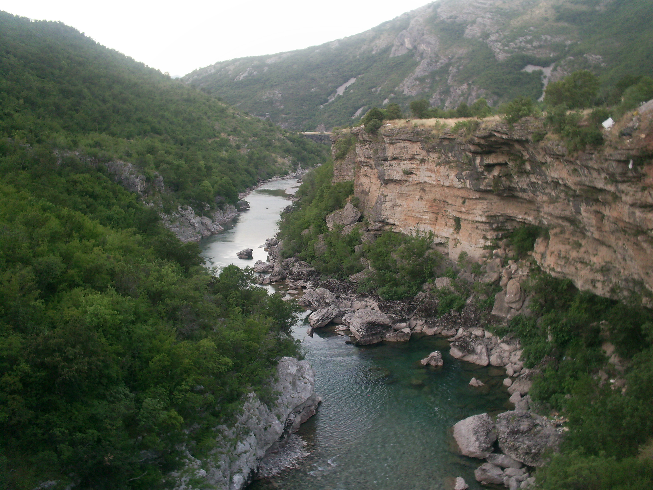
The Morača ( sr-cyrl, Морача, ) is a major river in Montenegro that originates in the northern region in Kolašin Municipality under Mount Rzača. It meanders southwards for before emptying into Lake Skadar. Its drainage basin covers .Statistical Yearbook of Montenegro 2017, Geography Statistical Office of Montenegro In its upper flow the Morača is a fast mountain river. Just north of it merges with its largest tributary, the , which it then cuts a rocky |
Drin (river)
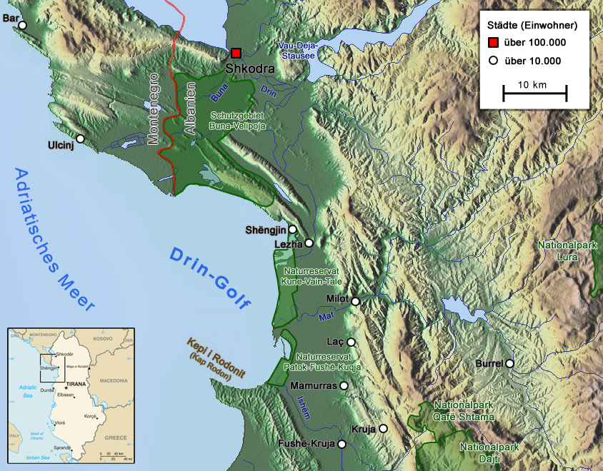
The Drin (; sq, Drin or ; mk, Дрим, Drim ) is a river in Southern and Southeastern Europe with two distributaries one discharging into the Adriatic Sea and the other one into the Buna River. Its catchment area extends across Albania, Kosovo, Serbia, Greece, Montenegro and North Macedonia. The river and its tributaries form the Gulf of Drin, an ocean basin that encompasses the northern Albanian Adriatic Sea Coast. At long, the Drin is the longest river of Albania of which passes across Albania and the remainder through Kosovo and North Macedonia. It starts at the confluence of its two headwaters, namely the Black Drin and White Drin. It originates in the mountainous northern mountain range, flows westwards through the Albanian Alps and Dukagjin Highlands, and eventually drains into the Adriatic Sea, between Shëngjin and Durrës. Numerous lakes and reservoirs are formed by the river or flow into it such as the Fierza Lake and Koman Lake. Located in the Bal ... [...More Info...] [...Related Items...] OR: [Wikipedia] [Google] [Baidu] |
Lake Scutari
Lake Skadar ( sh-Cyrl-Latn, Скадарско језеро, Skadarsko jezero, ; sq, Liqeni i Shkodrës, ) also called Lake Scutari, Lake Shkodër and Lake Shkodra lies on the border of Albania and Montenegro, and is the largest lake in Southern Europe. It is named after the city of Shkodër in northern Albania ( sq, Shkodër or ''Shkodra)''. It is a karst lake. The Montenegrin section of the lake and surrounding land has been designated as a national park, while the Albanian section is a nature reserve and a ramsar site. Geography Lake Skadar is the largest lake in the Balkan Peninsula with a surface area that seasonally fluctuates between and . Lake Skadar itself is located on the western Balkan The lake is located in the border area between Albania and Montenegro, the Montenegrin share of the area of the lake is slightly larger than the Albanian. The lake's water level also varies seasonally from above sea level. The lake extends northwest to southeast, and it is approx ... [...More Info...] [...Related Items...] OR: [Wikipedia] [Google] [Baidu] |
Lake Ohrid
Lake Ohrid ( mk, Охридско Езеро , al, Liqeni i Ohrit , also referred as ''Liqeni i Pogradecit'';) is a lake which straddles the mountainous border between the southwestern part of North Macedonia and eastern Albania. It is one of Europe's deepest and oldest lakes, with a unique aquatic ecosystem of worldwide importance, with more than 200 endemic species. North Macedonia's side of Lake Ohrid was declared a World Heritage Site by UNESCO in 1979, with the site being extended to also include the cultural and historic area of Ohrid in 1980. In 2010, NASA named one of Titan's lakes after it. In 2014, the Ohrid-Prespa Transboundary Reserve between Albania and North Macedonia was added to UNESCO's World Network of Biosphere Reserves. Albania's side of Lake Ohrid was also designated UNESCO world heritage status in 2019. North Macedonia's portion was designated as a protected Ramsar site in 2021, passing all nine criteria for proclamation.Ministry of Environment and Physica ... [...More Info...] [...Related Items...] OR: [Wikipedia] [Google] [Baidu] |
Habitat
In ecology, the term habitat summarises the array of resources, physical and biotic factors that are present in an area, such as to support the survival and reproduction of a particular species. A species habitat can be seen as the physical manifestation of its ecological niche. Thus "habitat" is a species-specific term, fundamentally different from concepts such as environment or vegetation assemblages, for which the term "habitat-type" is more appropriate. The physical factors may include (for example): soil, moisture, range of temperature, and light intensity. Biotic factors will include the availability of food and the presence or absence of predators. Every species has particular habitat requirements, with habitat generalist species able to thrive in a wide array of environmental conditions while habitat specialist species requiring a very limited set of factors to survive. The habitat of a species is not necessarily found in a geographical area, it can be the interior ... [...More Info...] [...Related Items...] OR: [Wikipedia] [Google] [Baidu] |
Convergent Evolution
Convergent evolution is the independent evolution of similar features in species of different periods or epochs in time. Convergent evolution creates analogous structures that have similar form or function but were not present in the last common ancestor of those groups. The cladistic term for the same phenomenon is homoplasy. The recurrent evolution of flight is a classic example, as flying insects, birds, pterosaurs, and bats have independently evolved the useful capacity of flight. Functionally similar features that have arisen through convergent evolution are ''analogous'', whereas ''homologous'' structures or traits have a common origin but can have dissimilar functions. Bird, bat, and pterosaur wings are analogous structures, but their forelimbs are homologous, sharing an ancestral state despite serving different functions. The opposite of convergence is divergent evolution, where related species evolve different traits. Convergent evolution is similar to paralle ... [...More Info...] [...Related Items...] OR: [Wikipedia] [Google] [Baidu] |
Messinian Salinity Crisis
The Messinian salinity crisis (MSC), also referred to as the Messinian event, and in its latest stage as the Lago Mare event, was a geological event during which the Mediterranean Sea went into a cycle of partial or nearly complete desiccation (drying-up) throughout the latter part of the Messinian age of the Miocene epoch, from 5.96 to 5.33 Ma (million years ago). It ended with the Zanclean flood, when the Atlantic reclaimed the basin. Sediment samples from below the deep seafloor of the Mediterranean Sea, which include evaporite minerals, soils, and fossil plants, show that the precursor of the Strait of Gibraltar closed tight about 5.96 million years ago, sealing the Mediterranean off from the Atlantic. This resulted in a period of partial desiccation of the Mediterranean Sea, the first of several such periods during the late Miocene. After the strait closed for the last time around 5.6 Ma, the region's generally dry climate at the time dried the Mediterranean basin out ne ... [...More Info...] [...Related Items...] OR: [Wikipedia] [Google] [Baidu] |


