|
Cloudland Canyon
Cloudland Canyon State Park is a Georgia state park located near Trenton and Cooper Heights on the western edge of Lookout Mountain. One of the largest and most scenic parks in Georgia, it contains rugged geology, and offers visitors a range of vistas across the deep gorge cut through the mountain by Sitton Gulch Creek, where the elevation varies from 800 to over 1,800 feet.Brown (1996), p. 11 Views of the canyon can be seen from the picnic area parking lot, in addition to additional views located along the rim trail. At the bottom of the gorge, two waterfalls cascade across layers of sandstone and shale, ending in small pools below. The park, previously known as Sitton Gulch (or Gulf) or Trenton Gulf, was purchased in stages by the state of Georgia beginning in 1938. Under President Franklin D. Roosevelt, a project of Civilian Conservation Corps during the Great Depression built the first facilities and signs in the park, which opened the following year. Today the par ... [...More Info...] [...Related Items...] OR: [Wikipedia] [Google] [Baidu] |
Trenton, Georgia
Trenton is a city and the only incorporated municipality in Dade County, Georgia, United States—and as such, it serves as the county seat. The population was 2,195 at the 2020 census. Trenton is part of the Chattanooga, Tennessee–GA Metropolitan Statistical Area. History Founded in the 1830s, the area was originally known as Salem. In 1839 Salem was designated the seat of the newly formed Dade County. It was renamed Trenton in 1841. The present name is a transfer from Trenton, the state capital of New Jersey. Geography Trenton is located at (34.875609, −85.508644). The city is located in the northwestern part of the state along Interstate 59, which runs from southwest to northeast to the west of the city, leading northeast 20 mi (32 km) to Chattanooga, Tennessee (via I-59 to I-24), and southwest 128 mi (206 km) to Birmingham, Alabama. U.S. Route 11 and Georgia State Route 136 are the main roads through the center of the city, with U.S. 11 leading ... [...More Info...] [...Related Items...] OR: [Wikipedia] [Google] [Baidu] |
Armuchee
Armuchee ( ) is an unincorporated community in both Floyd County and Chattooga County, Georgia, United States. The community is located along U.S. Route 27, north of Rome. Armuchee has a post office with ZIP code 30105. The Richard B. Russell Airport is in Armuchee. On November 1, 2020 Donald Trump the 45th President of the United States hosted a trump rally at the airport. This was the only visit to Floyd County, Georgia Floyd County is a county located in the northwestern part of the U.S. state of Georgia. As of the 2020 United States Census, the population was 98,584. The county seat is Rome. Floyd County comprises the Rome, GA metropolitan statistical area. ... by a sitting president. History A post office called Armuchee has been in operation since 1837. The community takes its name from nearby Armuchee Creek. References Unincorporated communities in Floyd County, Georgia Unincorporated communities in Georgia (U.S. state) {{FloydCountyGA-geo-stub ... [...More Info...] [...Related Items...] OR: [Wikipedia] [Google] [Baidu] |
Black Tupelo
''Nyssa sylvatica'', commonly known as tupelo, black tupelo, black gum or sour gum, is a medium-sized deciduous tree native to eastern North America from the coastal Northeastern United States and southern Ontario south to central Florida and eastern Texas, as well as Mexico. Names ''Nyssa sylvatica'' genus name, ''Nyssa'', refers to a Greek water nymph; the species epithet ''sylvatica'' refers to its woodland habitat. The species' common name, tupelo, is of Native American origin, coming from the Creek words ''ito'' "tree" and ''opilwa'' "swamp"; it was in use by the mid-18th century. While these trees are often known as simply "tupelo", the fuller name, black tupelo, helps distinguish it from the other species of the tupelo genus ''Nyssa'', some of which have overlapping ranges, such as water tupelo (''N. aquatica'') and swamp tupelo (''N. biflora''). The name "tupelo" is used primarily in the American South; northward and in Appalachia, the tree is more commonly called t ... [...More Info...] [...Related Items...] OR: [Wikipedia] [Google] [Baidu] |
Kalmia Latifolia
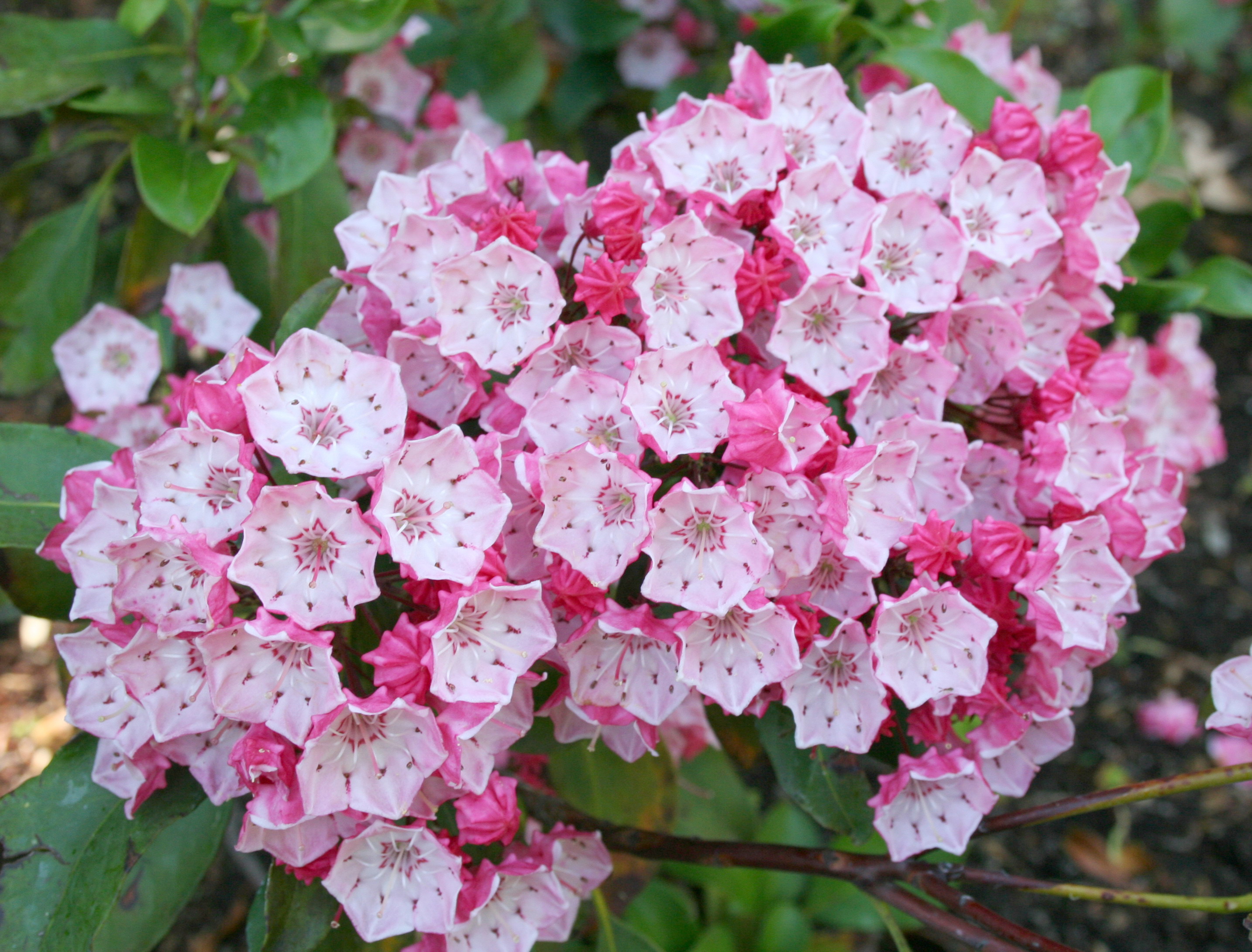
''Kalmia latifolia'', the mountain laurel, calico-bush, or spoonwood, is a species of flowering plant in the heath family Ericaceae, that is native to the eastern United States. Its range stretches from southern Maine south to northern Florida, and west to Indiana and Louisiana. Mountain laurel is the state flower of Connecticut and Pennsylvania. It is the namesake of Laurel County in Kentucky, the city of Laurel, Mississippi, and the Laurel Highlands in southwestern Pennsylvania. Growth ''Kalmia latifolia'' is an evergreen shrub growing tall. The leaves are 3–12 cm long and 1–4 cm wide. The flowers are hexagonal, sometimes appearing to be pentagonal, ranging from light pink to white, and occur in clusters. There are several named cultivars that have darker shades of pink, red and maroon. It blooms in May and June. All parts of the plant are poisonous. The roots are fibrous and matted. The plant is naturally found on rocky slopes and mountainous forest areas. I ... [...More Info...] [...Related Items...] OR: [Wikipedia] [Google] [Baidu] |
Rhododendron
''Rhododendron'' (; from Ancient Greek ''rhódon'' "rose" and ''déndron'' "tree") is a very large genus of about 1,024 species of woody plants in the heath family (Ericaceae). They can be either evergreen or deciduous. Most species are native to eastern Asia and the Himalayan region, but smaller numbers occur elsewhere in Asia, and in North America, Europe and Australia. It is the national flower of Nepal, the state flower of Washington and West Virginia in the United States, the state flower of Nagaland in India, the provincial flower of Jiangxi in China and the state tree of Sikkim and Uttarakhand in India. Most species have brightly colored flowers which bloom from late winter through to early summer. Azaleas make up two subgenera of ''Rhododendron''. They are distinguished from "true" rhododendrons by having only five anthers per flower. Species Description ''Rhododendron'' is a genus of shrubs and small to (rarely) large trees, the smallest species growing to t ... [...More Info...] [...Related Items...] OR: [Wikipedia] [Google] [Baidu] |
Hemlock Falls (Cloudland Canyon)
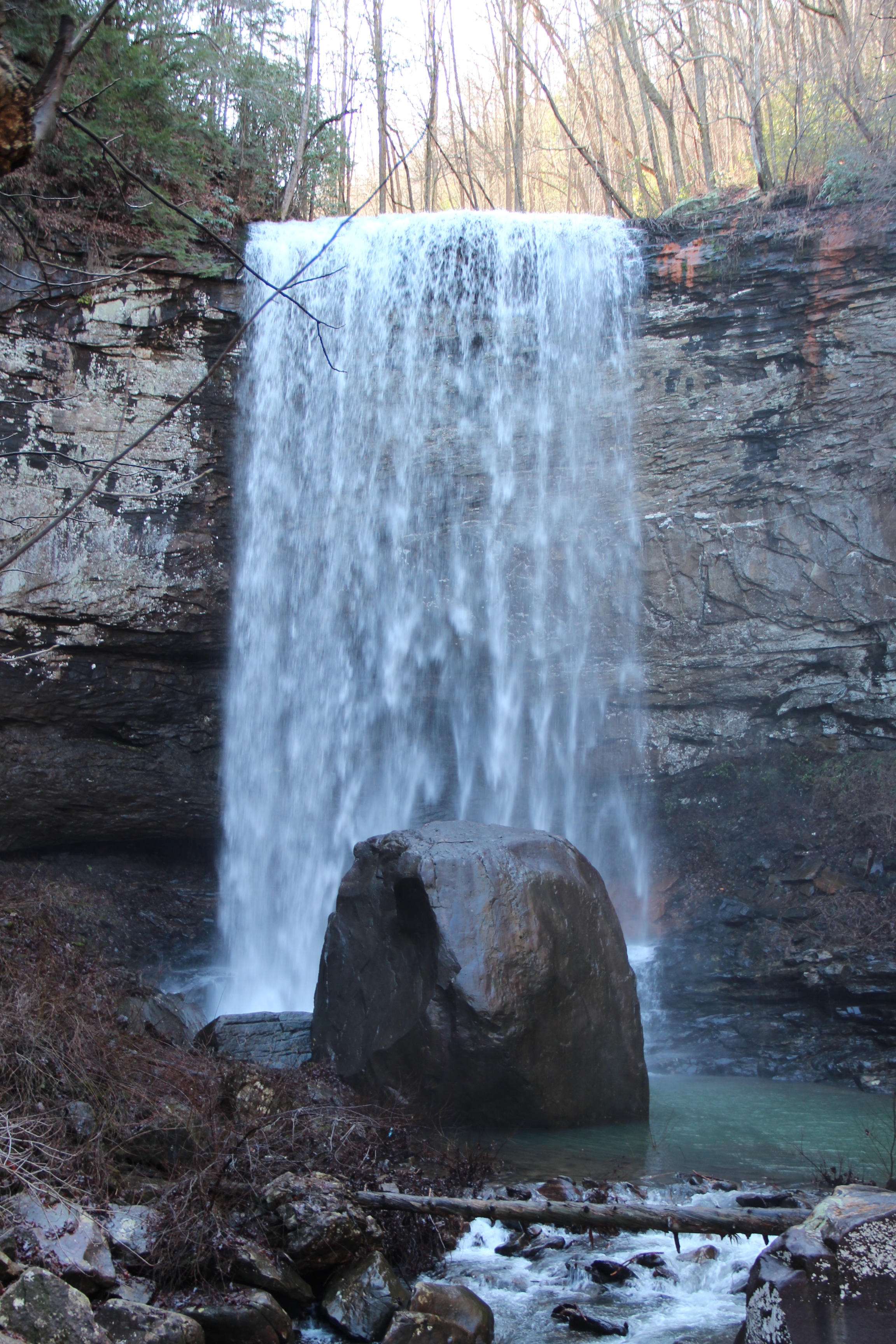
Hemlock Falls is an waterfall located in Cloudland Canyon State Park in Dade County, Georgia. The waterfall, formerly unnamed, was named in a contest.Cherokee Falls for #1 and Hemlock Falls for #2 . Georgia State Parks. Retrieved 2 January 2012. See also * Cherokee Falls *Cloudland Canyon State Park
Cloudland Canyon State Park is a Georgia state park located near Trenton and Cooper Heights on the western edge of Lookout Mountain. One of the largest and most scenic parks in Georgia, it contains rugged g ...
[...More Info...] [...Related Items...] OR: [Wikipedia] [Google] [Baidu] |
Cherokee Falls
Cherokee Falls is a waterfall located in Cloudland Canyon State Park in Dade County, Georgia. The waterfall, formerly unnamed, was named in a contest.Cherokee Falls for #1 and Hemlock Falls for #2 . Georgia State Parks. Retrieved 2 January 2012. See also * *Cloudland Canyon State Park
Cloudland Canyon State Park is a Georgia state park located near Trenton and Cooper Heights on the western edge of Lookout Mountain. One ...
[...More Info...] [...Related Items...] OR: [Wikipedia] [Google] [Baidu] |
Scree
Scree is a collection of broken rock fragments at the base of a cliff or other steep rocky mass that has accumulated through periodic rockfall. Landforms associated with these materials are often called talus deposits. Talus deposits typically have a concave upwards form, where the maximum inclination corresponds to the angle of repose of the mean debris particle size. The exact definition of scree in the primary literature is somewhat relaxed, and it often overlaps with both ''talus'' and ''colluvium''. The term ''scree'' comes from the Old Norse term for landslide, ''skriða'', while the term ''talus'' is a French word meaning a slope or embankment. In high-altitude arctic and subarctic regions, scree slopes and talus deposits are typically adjacent to hills and river valleys. These steep slopes usually originate from late-Pleistocene periglacial processes. Notable scree sites in Eastern North America include the Ice Caves at White Rocks National Recreation Area in southern Ve ... [...More Info...] [...Related Items...] OR: [Wikipedia] [Google] [Baidu] |
Limestone
Limestone ( calcium carbonate ) is a type of carbonate sedimentary rock which is the main source of the material lime. It is composed mostly of the minerals calcite and aragonite, which are different crystal forms of . Limestone forms when these minerals precipitate out of water containing dissolved calcium. This can take place through both biological and nonbiological processes, though biological processes, such as the accumulation of corals and shells in the sea, have likely been more important for the last 540 million years. Limestone often contains fossils which provide scientists with information on ancient environments and on the evolution of life. About 20% to 25% of sedimentary rock is carbonate rock, and most of this is limestone. The remaining carbonate rock is mostly dolomite, a closely related rock, which contains a high percentage of the mineral dolomite, . ''Magnesian limestone'' is an obsolete and poorly-defined term used variously for dolomite, for limes ... [...More Info...] [...Related Items...] OR: [Wikipedia] [Google] [Baidu] |
Cliff
In geography and geology, a cliff is an area of rock which has a general angle defined by the vertical, or nearly vertical. Cliffs are formed by the processes of weathering and erosion, with the effect of gravity. Cliffs are common on coasts, in mountainous areas, escarpments and along rivers. Cliffs are usually composed of rock that is resistant to weathering and erosion. The sedimentary rocks that are most likely to form cliffs include sandstone, limestone, chalk, and dolomite. Igneous rocks such as granite and basalt also often form cliffs. An escarpment (or scarp) is a type of cliff formed by the movement of a geologic fault, a landslide, or sometimes by rock slides or falling rocks which change the differential erosion of the rock layers. Most cliffs have some form of scree slope at their base. In arid areas or under high cliffs, they are generally exposed jumbles of fallen rock. In areas of higher moisture, a soil slope may obscure the talus. Many cliffs also fea ... [...More Info...] [...Related Items...] OR: [Wikipedia] [Google] [Baidu] |
Alleghenian Orogeny
The Alleghanian orogeny or Appalachian orogeny is one of the geological mountain-forming events that formed the Appalachian Mountains and Allegheny Mountains. The term and spelling Alleghany orogeny was originally proposed by H.P. Woodward in 1957. The Alleghanian orogeny occurred approximately 325 million to 260 million years ago over at least five deformation events in the Carboniferous to Permian period. The orogeny was caused by Africa's collision with North America. At the time, these continents did not exist in their current forms: North America was part of the Euramerica super-continent, while Africa was part of Gondwana. This collision formed the super-continent Pangaea, which contained all major continental land masses. The collision provoked the orogeny: it exerted massive stress on what is today the Eastern Seaboard of North America, forming a wide and high mountain chain. Evidence for the Alleghanian orogeny stretches for many hundreds of miles on the surface from ... [...More Info...] [...Related Items...] OR: [Wikipedia] [Google] [Baidu] |


