|
Clifden Limestone Caves
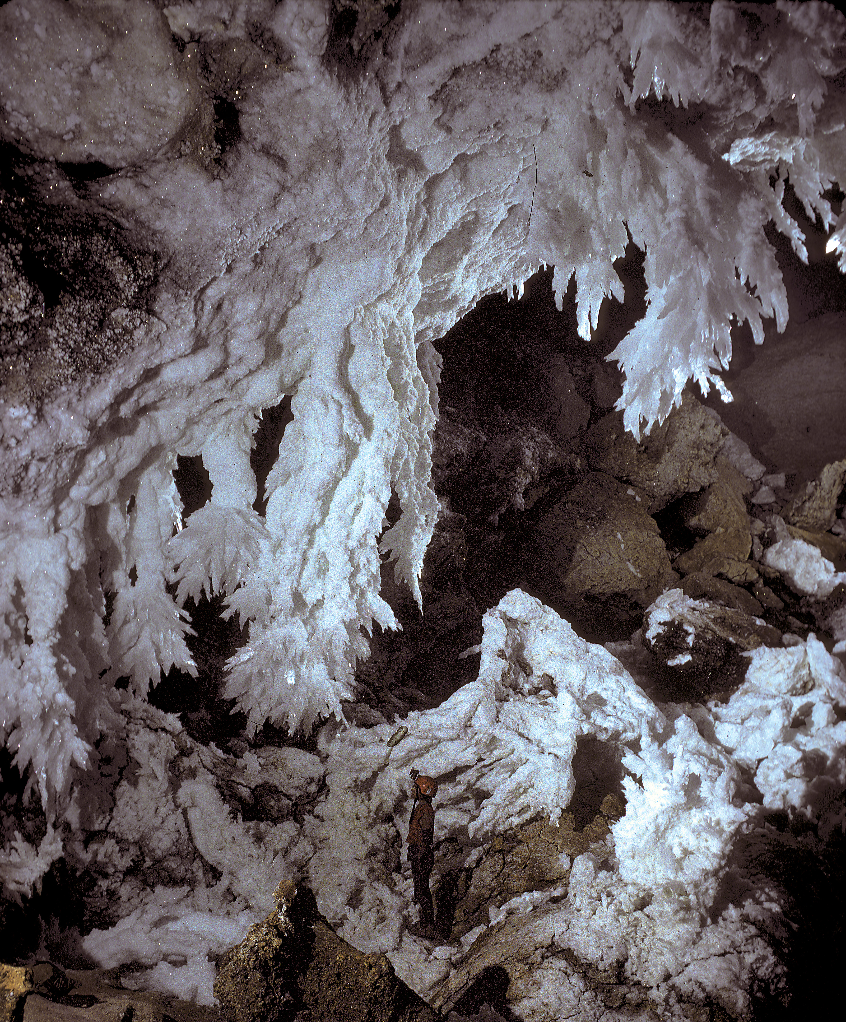
The Clifden Limestone Cave System is in the Western Southland Region of New Zealand, on private land close to the hamlet of Clifden. Geology The cave is formed in Miocene limestone created from the accumulation of shell fragments, sand and pebbles in the Epeiric Zealandia sea. It is a solutional cave. Ecology Glow worms or titiwai (Arachnocampa luminosa ''Arachnocampa luminosa'' (Skuse, 1891), commonly known as New Zealand glowworm or simply glowworm, is a species of fungus gnat endemic to New Zealand. The larval stage and the imago produce a blue-green bioluminescence. The species is known t ...) find a natural habitat in the Clifden Cave System because of its damp environment with little or no wind. Recreation The cave system runs about . A marked through route with fixed ladders is available for properly equipped people who wish to experience caving, and other passages are accessible for experienced cavers. References Caves of New Zealand Landforms of Southl ... [...More Info...] [...Related Items...] OR: [Wikipedia] [Google] [Baidu] |
South Island
The South Island, also officially named , is the larger of the two major islands of New Zealand in surface area, the other being the smaller but more populous North Island. It is bordered to the north by Cook Strait, to the west by the Tasman Sea, and to the south and east by the Pacific Ocean. The South Island covers , making it the world's 12th-largest island. At low altitude, it has an oceanic climate. The South Island is shaped by the Southern Alps which run along it from north to south. They include New Zealand's highest peak, Aoraki / Mount Cook at . The high Kaikōura Ranges lie to the northeast. The east side of the island is home to the Canterbury Plains while the West Coast is famous for its rough coastlines such as Fiordland, a very high proportion of native bush and national parks, and the Fox and Franz Josef Glaciers. The main centres are Christchurch and Dunedin. The economy relies on agriculture and fishing, tourism, and general manufacturing and services. ... [...More Info...] [...Related Items...] OR: [Wikipedia] [Google] [Baidu] |
Southland Region
Southland ( mi, Murihiku) is New Zealand's southernmost region. It consists mainly of the southwestern portion of the South Island and Stewart Island/Rakiura. It includes Southland District, Gore District and the city of Invercargill. The region covers over 3.1 million hectares and spans over 3,400 km of coast. History The earliest inhabitants of Murihiku (meaning "the last joint of the tail") were Māori of the Waitaha iwi, followed later by Kāti Māmoe and Kāi Tahu. Waitaha sailed on the Uruao waka, whose captain Rakaihautū named sites and carved out lakes throughout the area. The Takitimu Mountains were formed by the overturned Kāi Tahu waka Tākitimu. Descendants created networks of customary food gathering sites, travelling seasonally as needed, to support permanent and semi-permanent settlements in coastal and inland regions. In later years, the coastline was a scene of early extended contact between Māori and Europeans, in this case sealers, whalers ... [...More Info...] [...Related Items...] OR: [Wikipedia] [Google] [Baidu] |
New Zealand
New Zealand ( mi, Aotearoa ) is an island country in the southwestern Pacific Ocean. It consists of two main landmasses—the North Island () and the South Island ()—and over 700 smaller islands. It is the sixth-largest island country by area, covering . New Zealand is about east of Australia across the Tasman Sea and south of the islands of New Caledonia, Fiji, and Tonga. The country's varied topography and sharp mountain peaks, including the Southern Alps, owe much to tectonic uplift and volcanic eruptions. New Zealand's capital city is Wellington, and its most populous city is Auckland. The islands of New Zealand were the last large habitable land to be settled by humans. Between about 1280 and 1350, Polynesians began to settle in the islands and then developed a distinctive Māori culture. In 1642, the Dutch explorer Abel Tasman became the first European to sight and record New Zealand. In 1840, representatives of the United Kingdom and Māori chiefs ... [...More Info...] [...Related Items...] OR: [Wikipedia] [Google] [Baidu] |
Clifden, New Zealand
Clifden, New Zealand is a small rural community on the Waiau River, Southland, New Zealand. It is notable for being the site of the Clifden Suspension Bridge (a government Category I historic site) and the Clifden Limestone Caves,New Zealand Department of Conservation – Clifden Caves Brochure. 6 December 2010.New Zealand Department of Conservation – Clifden Caves. /ref> well-known since early European settlers made it a "must see" place to visit. History Cl ...
|
Clifden Caves Map
Clifden (, meaning "stepping stones") is a coastal town in County Galway, Ireland, in the region of Connemara, located on the Owenglin River where it flows into Clifden Bay. As the largest town in the region, it is often referred to as "the Capital of Connemara". Frequented by tourists, Clifden is linked to Galway city by the N59. History 19th century The town was founded at the start of the 19th century by John D'Arcy (1785–1839) who lived in Clifden Castle (built around 1818, now a ruin) west of Clifden. He had inherited the estate in 1804 when it was mostly inhabited by fishermen and farmers. The idea of establishing a town on the coast was first voiced by him in 1812. Bad communications and a lack of private capital prevented fast progress until the 1820s when the potato crop failed in 1821–22 and D'Arcy petitioned the government in Dublin for assistance. The engineer Alexander Nimmo was sent to the area in 1822. He constructed a quay at Clifden (finished in 1831) a ... [...More Info...] [...Related Items...] OR: [Wikipedia] [Google] [Baidu] |
Miocene
The Miocene ( ) is the first geological epoch of the Neogene Period and extends from about (Ma). The Miocene was named by Scottish geologist Charles Lyell; the name comes from the Greek words (', "less") and (', "new") and means "less recent" because it has 18% fewer modern marine invertebrates than the Pliocene has. The Miocene is preceded by the Oligocene and is followed by the Pliocene. As Earth went from the Oligocene through the Miocene and into the Pliocene, the climate slowly cooled towards a series of ice ages. The Miocene boundaries are not marked by a single distinct global event but consist rather of regionally defined boundaries between the warmer Oligocene and the cooler Pliocene Epoch. During the Early Miocene, the Arabian Peninsula collided with Eurasia, severing the connection between the Mediterranean and Indian Ocean, and allowing a faunal interchange to occur between Eurasia and Africa, including the dispersal of proboscideans into Eurasia. During the ... [...More Info...] [...Related Items...] OR: [Wikipedia] [Google] [Baidu] |
Limestone
Limestone ( calcium carbonate ) is a type of carbonate sedimentary rock which is the main source of the material lime. It is composed mostly of the minerals calcite and aragonite, which are different crystal forms of . Limestone forms when these minerals precipitate out of water containing dissolved calcium. This can take place through both biological and nonbiological processes, though biological processes, such as the accumulation of corals and shells in the sea, have likely been more important for the last 540 million years. Limestone often contains fossils which provide scientists with information on ancient environments and on the evolution of life. About 20% to 25% of sedimentary rock is carbonate rock, and most of this is limestone. The remaining carbonate rock is mostly dolomite, a closely related rock, which contains a high percentage of the mineral dolomite, . ''Magnesian limestone'' is an obsolete and poorly-defined term used variously for dolomite, for limes ... [...More Info...] [...Related Items...] OR: [Wikipedia] [Google] [Baidu] |
Exoskeleton
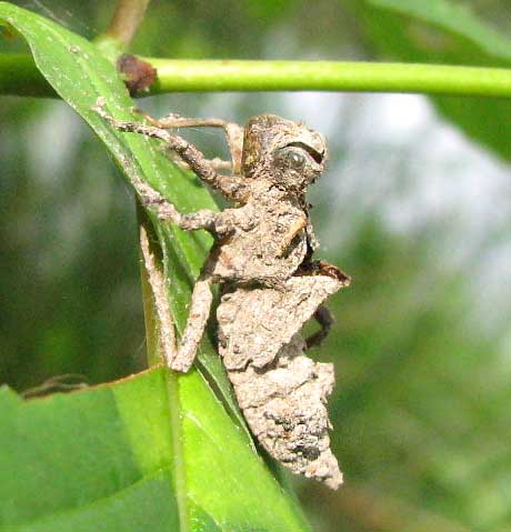
An exoskeleton (from Greek ''éxō'' "outer" and ''skeletós'' "skeleton") is an external skeleton that supports and protects an animal's body, in contrast to an internal skeleton (endoskeleton) in for example, a human. In usage, some of the larger kinds of exoskeletons are known as " shells". Examples of exoskeletons within animals include the arthropod exoskeleton shared by chelicerates, myriapods, crustaceans, and insects, as well as the shell of certain sponges and the mollusc shell shared by snails, clams, tusk shells, chitons and nautilus. Some animals, such as the turtle, have both an endoskeleton and an exoskeleton. Role Exoskeletons contain rigid and resistant components that fulfill a set of functional roles in many animals including protection, excretion, sensing, support, feeding and acting as a barrier against desiccation in terrestrial organisms. Exoskeletons have a role in defense from pests and predators, support and in providing an attachment framework f ... [...More Info...] [...Related Items...] OR: [Wikipedia] [Google] [Baidu] |
Epeiric Sea
An inland sea (also known as an epeiric sea or an epicontinental sea) is a continental body of water which is very large and is either completely surrounded by dry land or connected to an ocean by a river, strait, or "arm of the sea". An inland sea will generally have higher salinity than a freshwater lake, but usually lower salinity than the open ocean. Definition What constitutes an "inland sea" is complex and somewhat necessarily vague. The United States Hydrographic Office defined it as "a body of water nearly or completely surrounded by land, especially if very large or composed of salt water". Geologic engineers Heinrich Ries and Thomas L. Watson say an inland sea is merely a very large lake. Rydén, Migula, and Andersson and Deborah Sandler of the Environmental Law Institute add that an inland sea is "more or less" cut off from the ocean. It may be semi-enclosed, or connected to the ocean by a strait or "arm of the sea". An inland sea is distinguishable from a bay in that ... [...More Info...] [...Related Items...] OR: [Wikipedia] [Google] [Baidu] |
Zealandia (continent)
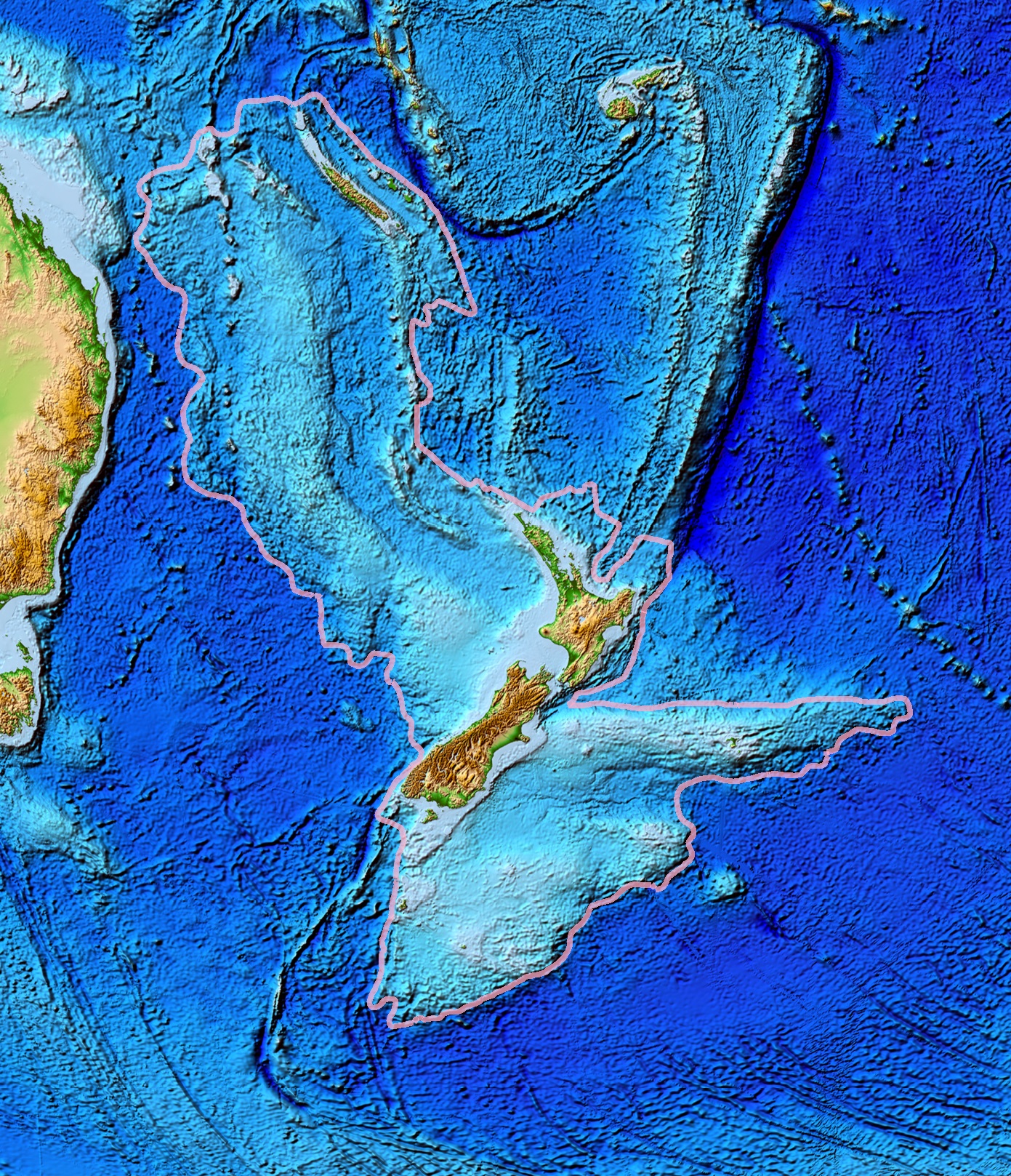
Zealandia (pronounced ), also known as (Māori) or Tasmantis, is an almost entirely submerged mass of continental crust that subsided after breaking away from Gondwanaland 83–79 million years ago.Gurnis, M., Hall, C.E., and Lavier, L.L., 2004, Evolving force balance during incipient subduction: Geochemistry, Geophysics, Geosystems, v. 5, Q07001, https://doi.org/10.01029/02003GC000681 It has been described variously as a submerged continent, a continental fragment (or microcontinent), and a continent. The name and concept for Zealandia was proposed by Bruce Luyendyk in 1995, and satellite imagery shows it to be almost the size of Australia. A 2021 study suggests Zealandia is 1 billion years old, about twice as old as geologists previously thought. By approximately 23 million years ago the landmass may have been completely submerged. Today, most of the landmass (94%) remains submerged beneath the Pacific Ocean. New Zealand is the largest part of Zealandia that is above sea ... [...More Info...] [...Related Items...] OR: [Wikipedia] [Google] [Baidu] |
Solutional Cave
A solutional cave, solution cave, or karst cave is a cave usually formed in the soluble rock limestone. It is the most frequently occurring type of cave. It can also form in other rocks, including chalk, dolomite, marble, salt beds, and gypsum. Process Bedrock is dissolved by natural acid in groundwater that seeps through bedding-planes, faults, joints and so on. Over geological epochs these openings expand as the walls are dissolved to become caves or cave systems. The portions of a solutional cave that are below the water table or the local level of the groundwater will be flooded. Limestone caves The largest and most abundant solutional caves are located in limestone. Limestone caves are often adorned with calcium carbonate formations produced through slow precipitation. These include flowstones, stalactites, stalagmites, helictites, soda straws, calcite rafts and columns. These secondary mineral deposits in caves are called ''speleothems''. Carbonic acid dissoluti ... [...More Info...] [...Related Items...] OR: [Wikipedia] [Google] [Baidu] |
Arachnocampa Luminosa
''Arachnocampa luminosa'' (Skuse, 1891), commonly known as New Zealand glowworm or simply glowworm, is a species of fungus gnat endemic to New Zealand. The larval stage and the imago produce a blue-green bioluminescence. The species is known to dwell in caves and on sheltered banks in native bush where humidity is high. Its Māori name is titiwai, meaning "projected over water". The first written record of the species dates from 1871 when it was collected from a gold mine in New Zealand's Thames region. At first it was thought to be related to the European glowworm beetle (''Lampyris noctiluca'') but, in 1886, a Christchurch teacher showed it was a larva of a gnat, not a beetle. The species was first formally described in 1891 with the species name ''Bolitiphila luminosa'' and was assigned to the family Mycetophilidae. In 1924, it was placed within a new genus of its own, ''Arachnocampa'', because the wing venation of the adults and the behaviour of the larvae differed significant ... [...More Info...] [...Related Items...] OR: [Wikipedia] [Google] [Baidu] |


_-_OMNZ_IV106827_01.jpg)