|
Cirencester And Tewkesbury (UK Parliament Constituency)
Cirencester and Tewkesbury was a parliamentary constituency in Gloucestershire which returned one Member of Parliament (MP) to the House of Commons of the Parliament of the United Kingdom. It was created for the 1918 general election and abolished for the 1997 general election when it was partly replaced by the new constituencies of Cotswold and Tewkesbury. History The only party to have returned an MP for this constituency was the Conservatives, who represented it for most of the seat's existence. The exception was the period from 1951 to 1959, when William Morrison, first elected as a Conservative, became the Speaker of the House of Commons, a role in which the incumbent is traditionally unaffiliated to a party. The seat centred on the towns of Cirencester and Tewkesbury, covering much of the Cotswolds, a picturesque rolling landscape designated an Area of Outstanding Natural Beauty (AONB) in 1966. The seat was divided between the Cotswold (later renamed ''The Cotswolds'') a ... [...More Info...] [...Related Items...] OR: [Wikipedia] [Google] [Baidu] |
Cirencester (UK Parliament Constituency)
Cirencester was a parliamentary constituency in Gloucestershire. From 1571 until 1885, it was a parliamentary borough, which returned two Member of Parliament (MPs) to the House of Commons of the Parliament of the United Kingdom until 1868, and one member between 1868 and 1885. In 1885 the borough was abolished but the name was transferred to the county constituency in which it stood; this constituency was abolished for the 1918 general election. History The town sent Members to Parliament on at least one occasion during the 14th century and again in 1547. Cirencester borough as established in 1571 consisted of part of the parish of Cirencester, a market town in the east of Gloucestershire. In 1831, the population of the borough was 4,420, and the town contained 917 houses. The right to vote was exercised by all resident householders of the borough who were not receiving alms, an unusually liberal franchise for the period in any but the smallest towns, which meant that there w ... [...More Info...] [...Related Items...] OR: [Wikipedia] [Google] [Baidu] |
Geoffrey Clifton-Brown
Sir Geoffrey Robert Clifton-Brown (born 23 March 1953)Burke's Peerage, Baronetage and Knightage, 107th edition, vol. 1, ed. Charles Mosley, Burke's Peerage Ltd, 2003, p. 538 is a British politician serving as Member of Parliament (MP) for The Cotswolds. He also serves as vice-president of the Alliance of European Conservatives and Reformists and as treasurer of the 1922 Committee. Early career Geoffrey Clifton-Brown was born in Cambridge, elder son and eldest of four children of farmer Robert Lawrence Clifton-Brown (1929–2016), of Maltings Farmhouse, Haverhill, Suffolk, a councillor and mayor (2002) of St Edmundsbury, Suffolk, and (Florence) Elizabeth Lindsay (1926–2006), daughter of Ronald Arthur Vestey, of Great Thurlow Hall, Suffolk, DL, High Sheriff of Suffolk in 1961, and grand-daughter of Sir Edmund Hoyle Vestey, 1st Baronet. His paternal grandfather, Lt-Col Geoffrey Benedict Clifton-Brown, late of the 12th Royal Lancers, was MP for Bury St Edmunds, Suffolk from ... [...More Info...] [...Related Items...] OR: [Wikipedia] [Google] [Baidu] |
Dumbleton
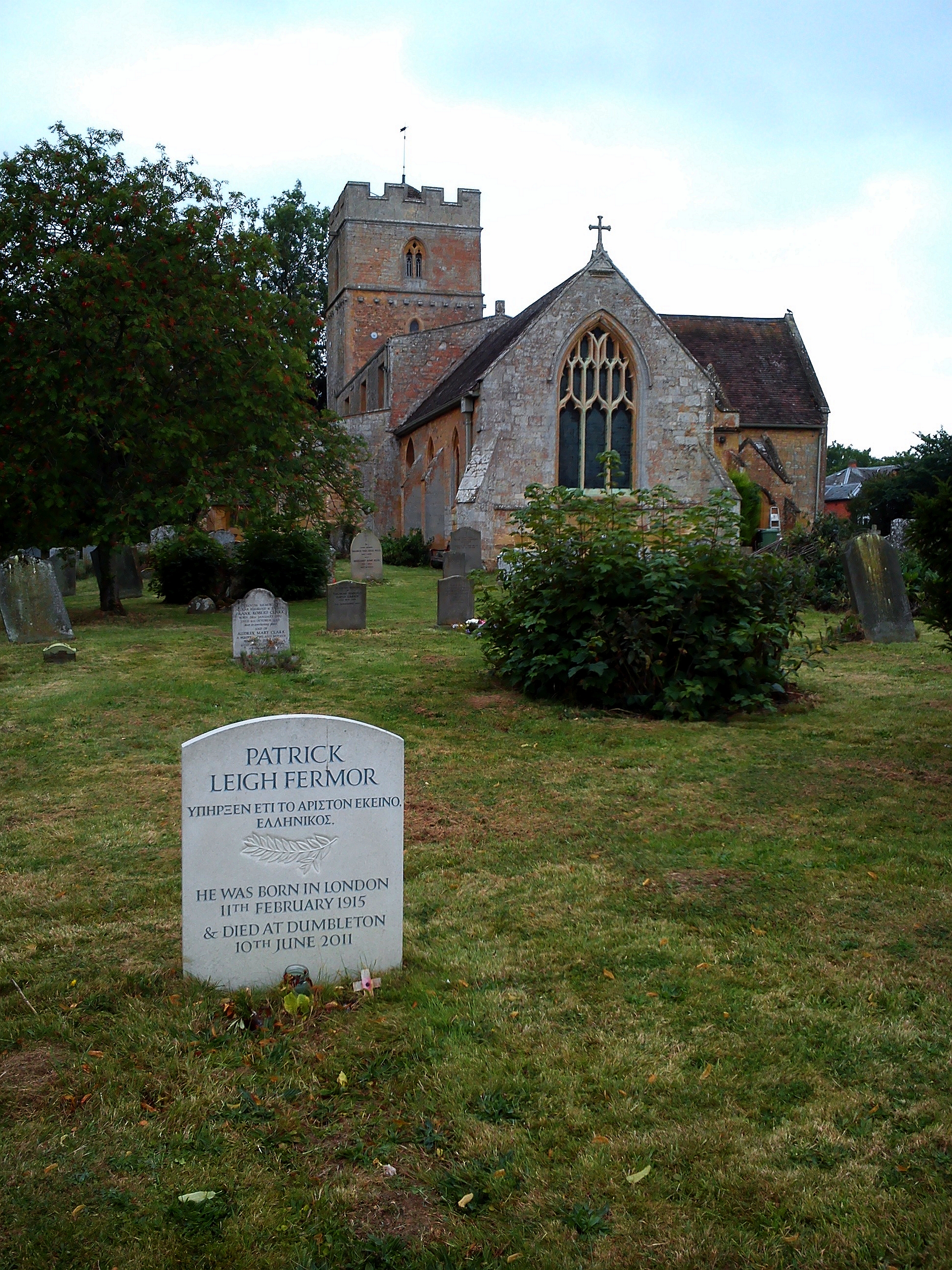
Dumbleton is a village and civil parish in the English county of Gloucestershire. The village is roughly 20 miles from the city of Gloucester. The village is known to have existed in the time of Æthelred I who granted land to Abingdon Abbey, and it is mentioned in the Domesday Book. Dumbleton is on the edge of Dumbleton Hill, a foothill of the Cotswolds and is within the Cotswolds Area of Outstanding Natural Beauty. Dumbleton is mainly residential, although there is a successful Cricket Club, Garden Club, an Infants’ School, a Social Club, a Village Hall, and an Estate Office. The village also contains the main entrance to Dumbleton Hall, which now functions as a hotel. The civil parish includes the villages of Great Washbourne and Wormington, all of which were separate civil parishes until 1935. Parish church St Peter's Church is of Norman origin with mainly 13th-century additions. The chancel was rebuilt in 1862. In 1960 it was designated a Grade I Listed Building. ... [...More Info...] [...Related Items...] OR: [Wikipedia] [Google] [Baidu] |
Moreton-in-Marsh
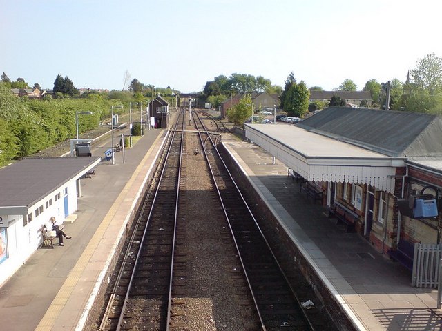
Moreton-in-Marsh is a market town in the Evenlode Valley, within the Cotswolds district and Area of Outstanding Natural Beauty in Gloucestershire, England. The town stands at the crossroads of the Fosse Way Roman road (now the A429) and the A44. It is served by Moreton-in-Marsh railway station on the Cotswold Line. It is relatively flat and low-lying compared with the surrounding Cotswold Hills. The River Evenlode rises near Batsford, runs around the edge of Moreton and meanders towards Oxford, where it flows into the Thames just east of Eynsham. Just over east of Moreton, the Four shire stone marked the boundary of the historic counties of Gloucestershire, Warwickshire, Worcestershire and Oxfordshire, until the re-organisation of the county boundaries in 1931. Since then it marks the meeting place of Gloucestershire, Warwickshire and Oxfordshire. Toponymy Moreton is derived from Old English which means "Farmstead on the Moor" and "in Marsh" is from ''henne'' and ''m ... [...More Info...] [...Related Items...] OR: [Wikipedia] [Google] [Baidu] |
Lechlade
Lechlade () is a town at the southern edge of the Cotswolds in Gloucestershire, England, south of Birmingham and west of London. It is the highest point at which the River Thames is navigable, although there is a right of navigation that continues south-west into Cricklade, in the neighbouring county of Wiltshire. The town is named after the River Leach that joins the Thames near the Trout Inn and St. John's Bridge. The low-lying land is alluvium, Oxford Clay and river gravels and the town is surrounded by lakes created from disused gravel extraction sites, forming parts of the Cotswold Water Park; several have now been designated as Sites of Special Scientific Interest and nature reserves. Human occupation dates from the neolithic, Iron Age and Roman periods and it developed as a trading centre served by river, canal, roads and railway, although the station closed in 1962. The Anglican Church of St Lawrence is a Grade I listed building dating from the 15th century. The deve ... [...More Info...] [...Related Items...] OR: [Wikipedia] [Google] [Baidu] |
Kempsford
Kempsford is a village and civil parish in Gloucestershire, England, about south of Fairford. RAF Fairford is immediately north of the village. The parish, which includes the hamlets of Whelford, Horcott, and Dunfield, had a population around 1,120 at the 2011 census. History The village was known as Kynemereforde, which translates as ''the Ford of the Great Marsh''. The Battle of Kempsford occurred on 16 January 800 AD when Æthelmund led a group of Hwiccians from Mercia in a raid against the Wiltsaetas people of Wessex. However Weoxtan led the Wiltsaetas against them, driving them back across the river. Both leaders were slain. There is a field on the banks of the Thames called Battlefield where spearheads were dug up in 1670, encouraging the view that this is where the battle took place. Sir Thomas Thynne (died 1639) built a new country house at Kempsford, demolishing an important fortified house which in the Middle Ages had defended a crossing of the River Thames. A wh ... [...More Info...] [...Related Items...] OR: [Wikipedia] [Google] [Baidu] |
Fairford
Fairford is a town in Gloucestershire, England. The town lies in the Cotswold hills on the River Coln, east of Cirencester, west of Lechlade and north of Swindon. Nearby are RAF Fairford and the Cotswold Water Park. History Evidence of settlement in Fairford dates back to the 9th century and it received a royal market grant in the 12th century. In the Domesday book, Fairford was listed as ''Fareforde''. In 1066 there were three mills one of which was used in the wool trade in the 13th century. The mill that survives today was built in the 17th century. Governance Fairford has a Parish Council with 13 members. The mayor is James Nicholls. After a boundary review implemented for the 2015 local elections, Fairford was split into two District Council electoral wards called Fairford North Ward (single member) and Lechlade, Kempsford and Fairford South Ward (two member). On Cotswold District Council Fairford North Ward is represented by Liberal Democrat Andrew Doherty and Lechl ... [...More Info...] [...Related Items...] OR: [Wikipedia] [Google] [Baidu] |
Cirencester Abbey
Cirencester Abbey or St Mary's Abbey, Cirencester in Gloucestershire was founded as an Augustinian monastery in 1117 on the site of an earlier church, the oldest-known Saxon church in England, which had itself been built on the site of a Roman structure. The church was greatly enlarged in the 14th century with addition of an ambulatory to the east end. The abbot became mitred 1416. The monastery was suppressed in 1539 and presented to Roger Bassinge. In the twelfth and thirteenth centuries, the abbey fostered the successful writers Robert of Cricklade and Alexander Neckam. They were supported in their work by other canons, including Walter of Mileto and Alexander's nephew Geoffrey Brito. Burials *Regenbald *Thomas Holland, 1st Duke of Surrey and wife Joan Stafford (daughter of Hugh Stafford, 2nd Earl of Stafford Hugh may refer to: *Hugh (given name) Noblemen and clergy French * Hugh the Great (died 956), Duke of the Franks * Hugh Magnus of France (1007–1025), co-King ... [...More Info...] [...Related Items...] OR: [Wikipedia] [Google] [Baidu] |
Blockley
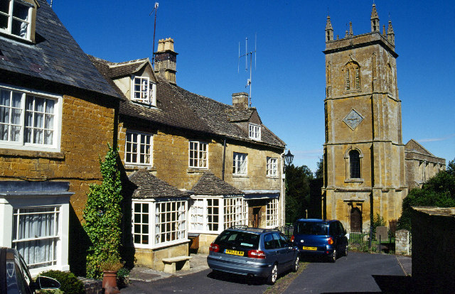
Blockley is a village, civil parish and ecclesiastical parish in the Cotswold district of Gloucestershire, England, about northwest of Moreton-in-Marsh. Until 1931 Blockley was an exclave of Worcestershire. The civil and ecclesiastical parish boundaries are roughly coterminous, and include the hamlets of Draycott, Paxford and Aston Magna, the residential development at Northwick and the deserted hamlets of Upton and Upper Ditchford. Blockley village is on Blockley Brook, a tributary of Knee Brook. Knee Brook forms the northeastern boundary of the parish and is a tributary of the River Stour. History Manor In AD 855 King Burgred of Mercia granted a monastery at Blockley to Ealhhun, Bishop of Worcester for the price of 300 solidi.''Victoria County History'', 1913, pages 265-276 In 1086 the Domesday Book recorded that the Bishop of Worcester held an estate of 38 hides at Blockley. The Bishops of Worcester retained the estate until 1648, during the English Civil War, when t ... [...More Info...] [...Related Items...] OR: [Wikipedia] [Google] [Baidu] |
Winchcombe
Winchcombe () is a market town and civil parish in the Borough of Tewkesbury in the county of Gloucestershire, England, it is 6 miles north-east of Cheltenham. The population was recorded as 4,538 in the 2011 census and estimated at 5,347 in 2019. The town is located in the Cotswolds and has many features and buildings dating back to medieval times. History The Belas Knap Neolithic long barrow on Cleeve Hill above Winchcombe, dates from about 3000 BCE. In Anglo-Saxon times, Winchcombe was a major community in Mercia, favoured by King Coenwulf of Mercia, the others being Lichfield and Tamworth. In the 11th century, the town was briefly the county town of Winchcombeshire. The Anglo-Saxon St Kenelm, said to be a son of Coenwulf, is believed to be buried here. During the Anarchy of the 12th century, a motte-and-bailey castle was built in the early 1140s for Empress Matilda, by Roger Fitzmiles, 2nd Earl of Hereford, but its exact site is unknown. It has been suggested i ... [...More Info...] [...Related Items...] OR: [Wikipedia] [Google] [Baidu] |
Stow-on-the-Wold
Stow-on-the-Wold is a market town and civil parish in Gloucestershire, England, on top of an 800-foot (244 m) hill at the junction of main roads through the Cotswolds, including the Fosse Way (A429), which is of Roman origin. The town was founded by Norman lords to absorb trade from the roads converging there. Fairs have been held by royal charter since 1330; a horse fair is still held on the edge of town nearest to Oddington in May and October each year. History Origins Stow-on-the-Wold, originally called Stow St Edward or Edwardstow after the town's patron saint Edward, probably Edward the Martyr, is said to have originated as an Iron Age fort on this defensive position on a hill. Indeed, there are many sites of similar forts in the area, and Stone Age and Bronze Age burial mounds are common throughout the area. It is likely that Maugersbury was the primary settlement of the parish before Stow was built as a marketplace on the hilltop nearer to the crossroads, to take advantag ... [...More Info...] [...Related Items...] OR: [Wikipedia] [Google] [Baidu] |
Pebworth
Pebworth is a village and civil parish in the county of Worcestershire, lying about 5 miles north-north-west of the town of Chipping Campden in Gloucestershire. Until 1931, the parish – which includes the hamlet of Broad Marston – was itself also in Gloucestershire, as part of Pebworth Rural District. Pebworth is bordered to the north and north-east by the parishes of Dorsington and Long Marston, which are today in Warwickshire. The Priory of Pebworth is a Grade II listed building. History Pebworth is mentioned in the Domesday Book "Hugh de Grandmesnil holds Pebworth. There are two hides and one virgate. Two thegns held it as two manors. There are three ploughs and one villan and one bordar and seven slaves. The same Hugh holds Broad Marston. There are two hides."''Domesday Book: A Complete Transliteration''. London: Penguin, 2003. p.? Pebworth is known as one of the Shakespeare villages. William Shakespeare is said to have joined a party of Stratford folk which se ... [...More Info...] [...Related Items...] OR: [Wikipedia] [Google] [Baidu] |


