|
Chusovaya River
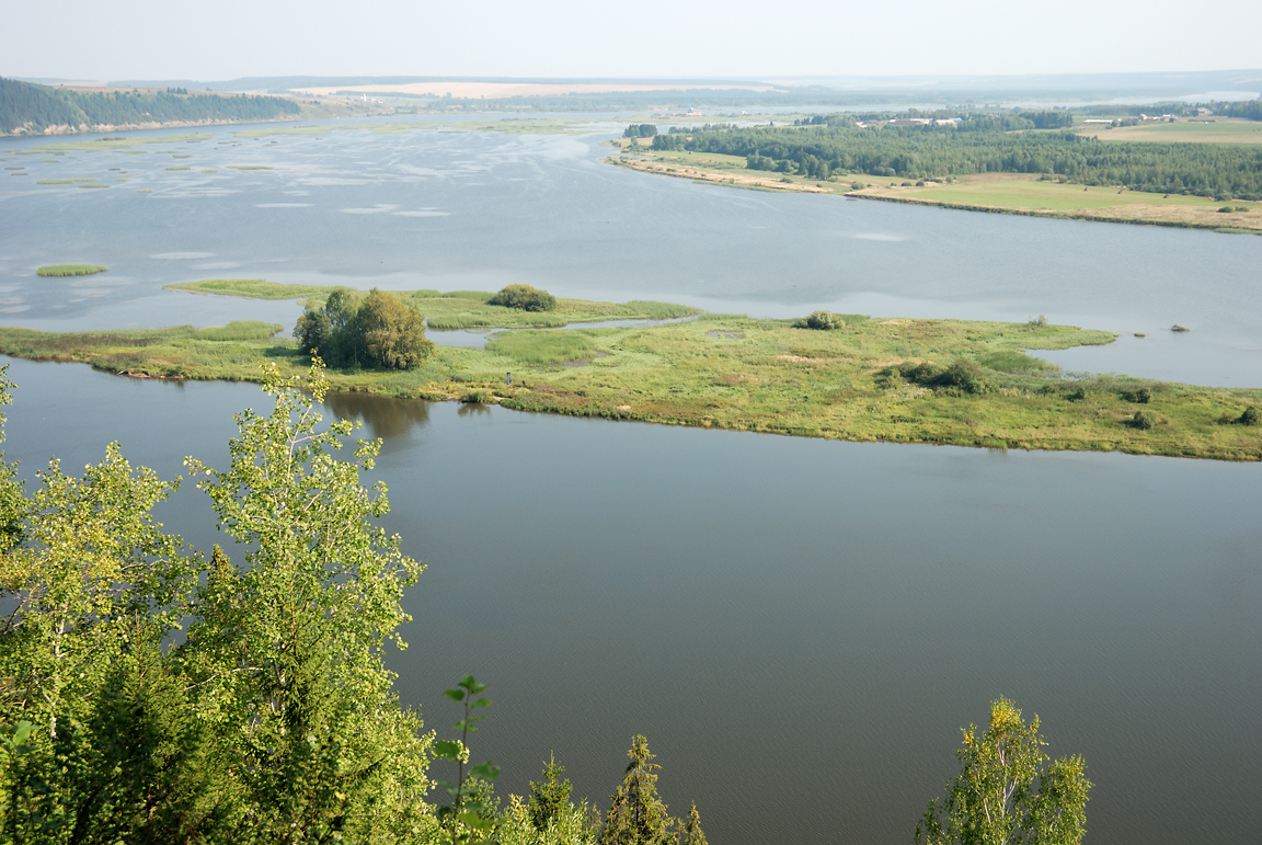
The Chusovaya (russian: Чусова́я) is a river flowing in Perm Krai, Sverdlovsk Oblast and Chelyabinsk Oblast of Russia. A tributary of the Kama, which in turn is a tributary of the Volga, it discharges into the Chusovskoy Cove of the Kamsky Reservoir. The river is remarkable in that it originates on the eastern slopes of the Ural Mountains in Asia, crosses the mountains, and mostly runs on their western slopes in Europe. The Chusovaya River is widely used as a source of water. In particular, its water is taken from the Volchikhinsky Reservoir, , to the Verkhneisetsky Reservoir to supply the major city of Yekaterinburg. Fifteen smaller reservoirs are spread over about 150 tributaries of the river. There are numerous metal and coal mines along the Chusovaya, and the river was intensively used to deliver their production to the western Russia. However, industrial navigation nearly halted with the development of railways in the early 20th century. Chusovoy is the major rem ... [...More Info...] [...Related Items...] OR: [Wikipedia] [Google] [Baidu] |
Ural Mountains
The Ural Mountains ( ; rus, Ура́льские го́ры, r=Uralskiye gory, p=ʊˈralʲskʲɪjə ˈɡorɨ; ba, Урал тауҙары) or simply the Urals, are a mountain range that runs approximately from north to south through western Russia, from the coast of the Arctic Ocean to the river Ural and northwestern Kazakhstan.Ural Mountains Encyclopædia Britannica on-line The mountain range forms part of the conventional boundary between the regions of and |
Chusovoy
Chusovoy (russian: Чусово́й) is a town in Perm Krai, Russia, located at the confluence of the Usva and Vilva Rivers with the Chusovaya River, east of Perm, the administrative center of the krai. Population: History It was founded in 1878 during the construction of the Gornozavodsk railway and with the building of the metallurgical plant. In 1933, it was granted town status. After the construction of the bridge over the Chusovaya River in 1964, the town started to develop on the river's left bank. Administrative and municipal status Within the framework of administrative divisions, it is, together with three work settlements ( Kalino, Lyamino, and Skalny) and seventy rural localities, incorporated as the town of krai significance of Chusovoy—an administrative unit with the status equal to that of the districts.Law #416-67 As a municipal division, the town of Chusovoy, together with the work settlement of Lyamino and two rural localities, is incorporated as ... [...More Info...] [...Related Items...] OR: [Wikipedia] [Google] [Baidu] |
Chusovaya 001
The Chusovaya (russian: Чусова́я) is a river flowing in Perm Krai, Sverdlovsk Oblast and Chelyabinsk Oblast of Russia. A tributary of the Kama, which in turn is a tributary of the Volga, it discharges into the Chusovskoy Cove of the Kamsky Reservoir. The river is remarkable in that it originates on the eastern slopes of the Ural Mountains in Asia, crosses the mountains, and mostly runs on their western slopes in Europe. The Chusovaya River is widely used as a source of water. In particular, its water is taken from the Volchikhinsky Reservoir, , to the Verkhneisetsky Reservoir to supply the major city of Yekaterinburg. Fifteen smaller reservoirs are spread over about 150 tributaries of the river. There are numerous metal and coal mines along the Chusovaya, and the river was intensively used to deliver their production to the western Russia. However, industrial navigation nearly halted with the development of railways in the early 20th century. Chusovoy is the major remai ... [...More Info...] [...Related Items...] OR: [Wikipedia] [Google] [Baidu] |
Ice Jam
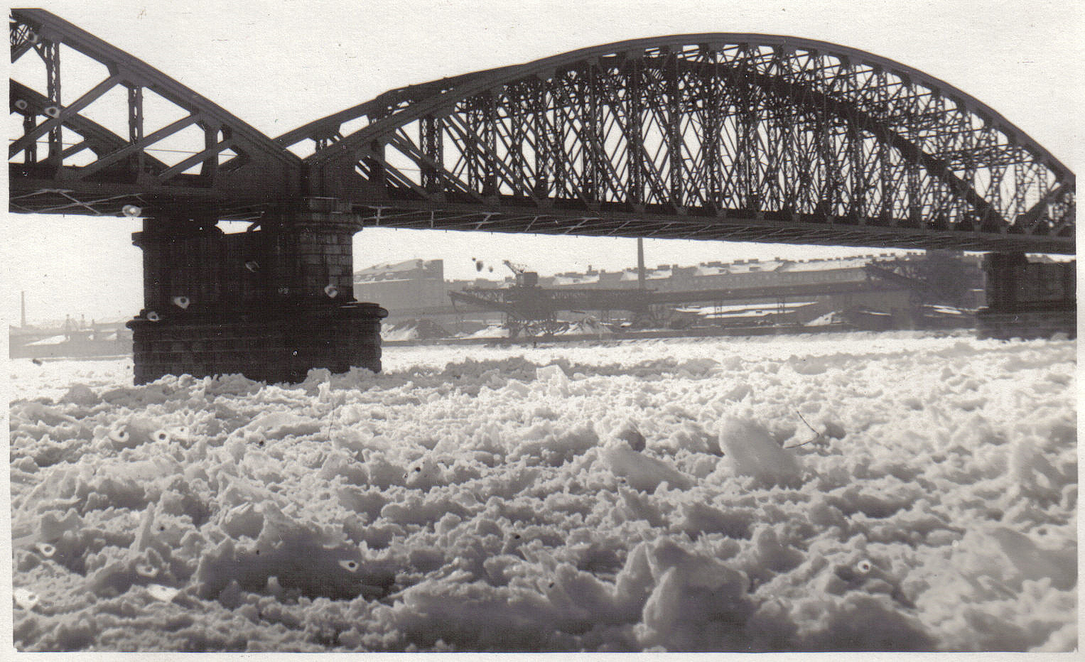
Ice jams occur when a topographic feature of the river causes floating river ice to accumulate and impede further progress downstream with the river current. Ice jams can significantly reduce the flow of a river and cause upstream flooding—sometimes called ice dams. Ice jam flooding can also occur downstream when the jam releases in an outburst flood. In either case, flooding can cause damage to structures on shore. Overview An ice blockage on a river is usually called an ''ice jam,'' but sometimes an ''ice dam''. An ice jam is an obstruction on a river formed by blocks of ice. Defined by the International Association of Hydraulic Research (IAHR) Working Group on River Ice Hydraulics an ice jam is a "stationary accumulation of fragmented ice or frazil that restricts flow" on a river or stream. The jam may effectively create a dam with an accumulation of anchor ice on the bottom of the river. On rivers the obstruction may be a change of width, structure, bend or decrease i ... [...More Info...] [...Related Items...] OR: [Wikipedia] [Google] [Baidu] |
Boulder
In geology, a boulder (or rarely bowlder) is a rock fragment with size greater than in diameter. Smaller pieces are called cobbles and pebbles. While a boulder may be small enough to move or roll manually, others are extremely massive. In common usage, a boulder is too large for a person to move. Smaller boulders are usually just called rocks or stones. The word ''boulder'' derives from ''boulder stone'', from the Middle English ''bulderston'' or Swedish ''bullersten''. Online Etymology Dictionary. Retrieved December 9, 2011, from Dictionary.com website. In places covered by s during |
Rapid
Rapids are sections of a river where the river bed has a relatively steep gradient, causing an increase in water velocity and turbulence. Rapids are hydrological features between a ''run'' (a smoothly flowing part of a stream) and a ''cascade''. Rapids are characterized by the river becoming shallower with some rocks exposed above the flow surface. As flowing water splashes over and around the rocks, air bubbles become mixed in with it and portions of the surface acquire a white color, forming what is called " whitewater". Rapids occur where the bed material is highly resistant to the erosive power of the stream in comparison with the bed downstream of the rapids. Very young streams flowing across solid rock may be rapids for much of their length. Rapids cause water aeration of the stream or river, resulting in better water quality. Rapids are categorized in classes, generally running from I to VI. A Class 5 rapid may be categorized as Class 5.1-5.9. While Class I rapids a ... [...More Info...] [...Related Items...] OR: [Wikipedia] [Google] [Baidu] |
Anhydrite
Anhydrite, or anhydrous calcium sulfate, is a mineral with the chemical formula CaSO4. It is in the orthorhombic crystal system, with three directions of perfect cleavage parallel to the three planes of symmetry. It is not isomorphous with the orthorhombic barium ( baryte) and strontium ( celestine) sulfates, as might be expected from the chemical formulas. Distinctly developed crystals are somewhat rare, the mineral usually presenting the form of cleavage masses. The Mohs hardness is 3.5, and the specific gravity is 2.9. The color is white, sometimes greyish, bluish, or purple. On the best developed of the three cleavages, the lustre is pearly; on other surfaces it is glassy. When exposed to water, anhydrite readily transforms to the more commonly occurring gypsum, (CaSO4·2H2O) by the absorption of water. This transformation is reversible, with gypsum or calcium sulfate hemihydrate forming anhydrite by heating to around under normal atmospheric conditions. Anhydrite is c ... [...More Info...] [...Related Items...] OR: [Wikipedia] [Google] [Baidu] |
Dolomite (rock)
Dolomite (also known as dolomite rock, dolostone or dolomitic rock) is a sedimentary carbonate rock that contains a high percentage of the mineral dolomite, CaMg(CO3)2. It occurs widely, often in association with limestone and evaporites, though it is less abundant than limestone and rare in Cenozoic rock beds (beds less than about 66 million years in age). The first geologist to distinguish dolomite rock from limestone was Belsazar Hacquet in 1778. Most dolomite was formed as a magnesium replacement of limestone or of lime mud before lithification. The geological process of conversion of calcite to dolomite is known as dolomitization and any intermediate product is known as dolomitic limestone. The "dolomite problem" refers to the vast worldwide depositions of dolomite in the past geologic record in contrast to the limited amounts of dolomite formed in modern times. Recent research has revealed sulfate-reducing bacteria living in anoxic conditions precipitate dolomite whic ... [...More Info...] [...Related Items...] OR: [Wikipedia] [Google] [Baidu] |
Limestone
Limestone ( calcium carbonate ) is a type of carbonate sedimentary rock which is the main source of the material lime. It is composed mostly of the minerals calcite and aragonite, which are different crystal forms of . Limestone forms when these minerals precipitate out of water containing dissolved calcium. This can take place through both biological and nonbiological processes, though biological processes, such as the accumulation of corals and shells in the sea, have likely been more important for the last 540 million years. Limestone often contains fossils which provide scientists with information on ancient environments and on the evolution of life. About 20% to 25% of sedimentary rock is carbonate rock, and most of this is limestone. The remaining carbonate rock is mostly dolomite, a closely related rock, which contains a high percentage of the mineral dolomite, . ''Magnesian limestone'' is an obsolete and poorly-defined term used variously for dolomite, for lime ... [...More Info...] [...Related Items...] OR: [Wikipedia] [Google] [Baidu] |
W W Chusovaya Kama Crossing
W, or w, is the twenty-third and fourth-to-last letter of the Latin alphabet, used in the modern English alphabet, the alphabets of other western European languages and others worldwide. It represents a consonant, but in some languages it represents a vowel. Its name in English is ''double-u'',Pronounced in formal situations, but colloquially often , , or , with a silent ''l''. plural ''double-ues''. History The classical Latin alphabet, from which the modern European alphabets derived, did not have the "W' character. The "W" sounds were represented by the Latin letter " V" (at the time, not yet distinct from " U"). The sounds (spelled ) and (spelled ) of Classical Latin developed into a bilabial fricative between vowels in Early Medieval Latin. Therefore, no longer adequately represented the labial-velar approximant sound of Germanic phonology. The Germanic phoneme was therefore written as or ( and becoming distinct only by the Early Modern period) by ... [...More Info...] [...Related Items...] OR: [Wikipedia] [Google] [Baidu] |
Sedimentary Rock
Sedimentary rocks are types of rock that are formed by the accumulation or deposition of mineral or organic particles at Earth's surface, followed by cementation. Sedimentation is the collective name for processes that cause these particles to settle in place. The particles that form a sedimentary rock are called sediment, and may be composed of geological detritus (minerals) or biological detritus (organic matter). The geological detritus originated from weathering and erosion of existing rocks, or from the solidification of molten lava blobs erupted by volcanoes. The geological detritus is transported to the place of deposition by water, wind, ice or mass movement, which are called agents of denudation. Biological detritus was formed by bodies and parts (mainly shells) of dead aquatic organisms, as well as their fecal mass, suspended in water and slowly piling up on the floor of water bodies ( marine snow). Sedimentation may also occur as dissolved minerals precipita ... [...More Info...] [...Related Items...] OR: [Wikipedia] [Google] [Baidu] |
Igneous Rocks
Igneous rock (derived from the Latin word ''ignis'' meaning fire), or magmatic rock, is one of the three main rock types, the others being sedimentary and metamorphic. Igneous rock is formed through the cooling and solidification of magma or lava. The magma can be derived from partial melts of existing rocks in either a planet's mantle or crust. Typically, the melting is caused by one or more of three processes: an increase in temperature, a decrease in pressure, or a change in composition. Solidification into rock occurs either below the surface as intrusive rocks or on the surface as extrusive rocks. Igneous rock may form with crystallization to form granular, crystalline rocks, or without crystallization to form natural glasses. Igneous rocks occur in a wide range of geological settings: shields, platforms, orogens, basins, large igneous provinces, extended crust and oceanic crust. Geological significance Igneous and metamorphic rocks make up 90–95% of the top o ... [...More Info...] [...Related Items...] OR: [Wikipedia] [Google] [Baidu] |


