|
Churchill River (Hudson Bay)
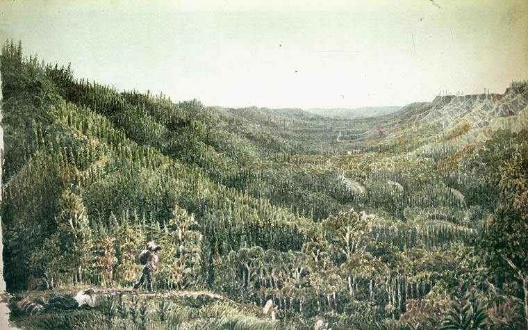
The Churchill River () is a major river in Alberta, Saskatchewan and Manitoba, Canada. From the head of the Churchill Lake it is long. It was named after John Churchill, 1st Duke of Marlborough and governor of the Hudson's Bay Company from 1685 to 1691. The Cree name for the river is ''Missinipi'', meaning "big waters". The Denesuline name for the river is ''des nëdhë́'', meaning "Great River". The river is located entirely within the Canadian Shield. The drainage basin includes a number of lakes in Central-East Alberta which flow into a series of lakes in Saskatchewan and Manitoba. The main tributary, the Beaver River, joins at Lac Île-à-la-Crosse. Nistowiak Falls—the tallest falls in Saskatchewan—are on the Rapid River, which flows north, out of Lac la Ronge into Nistowiak Lake on the Churchill just north of La Ronge. A large amount of flow of the Churchill River after Manitoba–Saskatchewan border comes from the Reindeer River, which flows from Wollas ... [...More Info...] [...Related Items...] OR: [Wikipedia] [Google] [Baidu] |
John Churchill, 1st Duke Of Marlborough
General John Churchill, 1st Duke of Marlborough, 1st Prince of Mindelheim, 1st Count of Nellenburg, Prince of the Holy Roman Empire, (26 May 1650 – 16 June 1722 O.S.) was an English soldier and statesman whose career spanned the reigns of five monarchs. From a gentry family, he served first as a page at the court of the House of Stuart under James, Duke of York, through the 1670s and early 1680s, earning military and political advancement through his courage and diplomatic skill. Churchill's role in defeating the Monmouth Rebellion in 1685 helped secure James on the throne, but he was a key player in the military conspiracy that led to James being deposed during the Glorious Revolution. Rewarded by William III with the title Earl of Marlborough, persistent charges of Jacobitism led to his fall from office and temporary imprisonment in the Tower of London. William recognised his abilities by appointing him as his deputy in Southern Netherlands (modern-day Belgium) be ... [...More Info...] [...Related Items...] OR: [Wikipedia] [Google] [Baidu] |
La Ronge
La Ronge is a northern town in the boreal forest of central Saskatchewan, Canada. Its location is approximately north of Prince Albert where Highway 2 becomes Highway 102. La Ronge lies on the western shore of Lac la Ronge, is adjacent to Lac La Ronge Provincial Park, and is on the edge of the Canadian Shield. This town is also the namesake of the larger La Ronge population centre comprising the community, the Northern Village of Air Ronge and the Kitsakie 156B and Lac La Ronge 156 reserves of the Lac La Ronge First Nation. History The name of La Ronge comes from the lake. The origin of the name is uncertain; the most likely explanation is that early French fur traders named it ''la ronge'' (literally ''the chewed'') because of the large amount of beaver activity along the shoreline—many of the trees would have been chewed down for beaver dam construction. In 1782, Swiss born fur trader Jean-Étienne Waddens had a fur trade post on Lac La Ronge. In March 1782, Wadde ... [...More Info...] [...Related Items...] OR: [Wikipedia] [Google] [Baidu] |
Methye Portage
The Methye Portage or Portage La Loche in northwestern Saskatchewan was one of the most important portages in the old fur trade route across Canada. The portage connected the Mackenzie River basin to rivers that ran east to the Atlantic. It was reached by Peter Pond in 1778 and abandoned in 1883 when steamboats began running on the Athabasca River with links to the railroad. It ranks with Grand Portage as one of the two most important and difficult portages used during the fur trade era. 'Methye' is Cree and 'La Loche' is French for a fish that is called 'burbot' in English. Although 'Methye Portage' is often used the official name since 1957 is Portage La Loche. Both names are used in historical documents, books and journals. Alexander Mackenzie in his book "Voyages from Montreal" used both Portage la Loche and Mithy-Ouinigam Portage (in 1789–1793). History The Methye Portage had been in use by indigenous peoples as a trade route for generations. They introduced it to Pet ... [...More Info...] [...Related Items...] OR: [Wikipedia] [Google] [Baidu] |
Peter Pond
Peter Pond (January 18, 1739 – 1807) was an American explorer, cartographer, merchant and soldier who was a founding member of the North West Company and the Beaver Club. Though he was born and died in Milford, Connecticut, most of his life was spent in northwestern North America. Early life Pond, born on in January 18, 1739 at Milford, Connecticut, began his fur trading career with his father out of Fort Detroit. He traded throughout the regions south of Lake Superior and west of Lake Michigan, which later became Minnesota and Wisconsin. During the French and Indian War, Pond enlisted in the Connecticut Regiment, a provincial infantry unit. Through his business he became acquainted with Alexander Henry the elder, Simon McTavish and the brothers Thomas, Benjamin and Joseph Frobisher. They formed the North West Company (NWC) which developed a fierce rivalry with the Hudson's Bay Company (HBC). In search of new fur resources he explored west of the Great Lakes. In 1776� ... [...More Info...] [...Related Items...] OR: [Wikipedia] [Google] [Baidu] |
Dene
The Dene people () are an Aboriginal peoples in Canada, indigenous group of First Nations in Canada, First Nations who inhabit the northern Boreal forest of Canada, boreal and Arctic regions of Canada. The Dene speak Northern Athabaskan languages. ''Dene'' is the common Athabaskan word for "people". The term "Dene" has two usages. More commonly, it is used narrowly to refer to the Athabaskan speakers of the Northwest Territories and Nunavut in Canada, especially including the Chipewyan (Denesuline), Tlicho (''Dogrib''), Yellowknives (T'atsaot'ine), Slavey people, Slavey (Deh Gah Got'ine or Deh Cho), and Sahtu (the Eastern group in Jeff Leer's classification; part of the Northwestern Canada group in Keren Rice's classification). However, it is sometimes also used to refer to all Northern Athabaskan speakers, who are spread in a wide range all across Alaska and northern Canada. The Southern Athabaskan speakers, however, also refer to themselves by similar words: Navajo people, D ... [...More Info...] [...Related Items...] OR: [Wikipedia] [Google] [Baidu] |
Coureur Des Bois
A coureur des bois (; ) or coureur de bois (; plural: coureurs de(s) bois) was an independent entrepreneurial French-Canadian trader who travelled in New France and the interior of North America, usually to trade with First Nations peoples by exchanging various European items for furs. Some learned the trades and practices of the indigenous peoples. These expeditions were part of the beginning of the fur trade in the North American interior. Initially they traded for beaver coats and furs. However, as the market grew, ''coureurs de bois'' were trapping and trading prime beavers whose skins were to be felted in Europe. Evolution While French settlers had lived and traded alongside Indigenous people since the earliest days of New France, coureurs des bois reached their apex during the second half of the 17th century. After 1681, the independent coureur des bois was gradually replaced by state-sponsored voyageurs, who were workers associated with licensed fur traders. They trave ... [...More Info...] [...Related Items...] OR: [Wikipedia] [Google] [Baidu] |
Nelson River Hydroelectric Project
The Nelson River Hydroelectric Project refers to the construction of a series of dams and hydroelectric power plants on the Nelson River in Northern Manitoba, Canada. The project began to take shape in the late 1950s, with the planning and construction of the Kelsey dam and hydroelectric power station, and later was expanded to include the diversion of the upper Churchill River into the Nelson River and the transformation of Lake Winnipeg, the world's 11th largest freshwater lake, into a hydroelectric reservoir. The project is owned and operated by Manitoba Hydro, the electrical utility in the province. Overview Several sites on the Nelson River, with potential of millions of horsepower, had been identified as early as 1911, but transmission of power to population centres in the south was beyond the state of the art of electric power transmission at that time. Between 1955 and 1960, studies were carried out to determine what resources would be available for future hydraulic gener ... [...More Info...] [...Related Items...] OR: [Wikipedia] [Google] [Baidu] |
Churchill, Manitoba
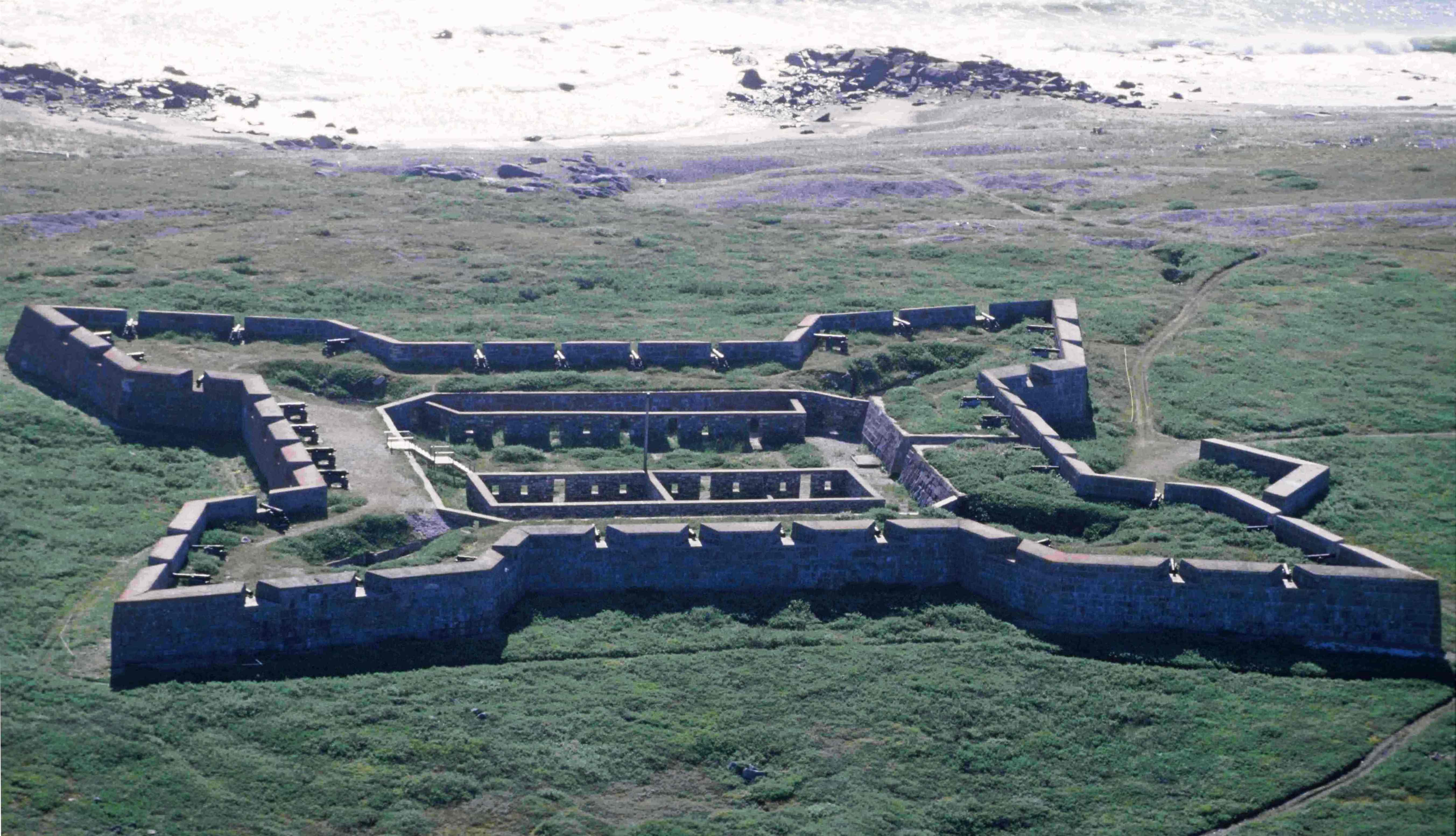
Churchill is a town in northern Manitoba, Canada, on the west shore of Hudson Bay, roughly from the Manitoba–Nunavut border. It is most famous for the many polar bears that move toward the shore from inland in the autumn, leading to the nickname "Polar Bear Capital of the World" that has benefited its burgeoning tourism industry. Geography Churchill is located on Hudson Bay, at the mouth of the Churchill River on the 58th parallel north, far above most Canadian populated areas. Churchill is far from any other towns or cities, with Thompson, approximately to the south, being the closest larger settlement. Manitoba's provincial capital, Winnipeg, is approximately south of Churchill. While not part of the city, Eskimo Point and Eskimo Island are located across river with the former site of the Prince of Wales Fort. History A variety of nomadic Arctic peoples lived and hunted in this region. The Thule people arrived around the year 1000 from the west, the ancestors of the presen ... [...More Info...] [...Related Items...] OR: [Wikipedia] [Google] [Baidu] |
Hudson Bay
Hudson Bay ( crj, text=ᐐᓂᐯᒄ, translit=Wînipekw; crl, text=ᐐᓂᐹᒄ, translit=Wînipâkw; iu, text=ᑲᖏᖅᓱᐊᓗᒃ ᐃᓗᐊ, translit=Kangiqsualuk ilua or iu, text=ᑕᓯᐅᔭᕐᔪᐊᖅ, translit=Tasiujarjuaq; french: baie d'Hudson), sometimes called Hudson's Bay (usually historically), is a large body of saltwater in northeastern Canada with a surface area of . It is located north of Ontario, west of Quebec, northeast of Manitoba and southeast of Nunavut, but politically entirely part of Nunavut. Although not geographically apparent, it is for climatic reasons considered to be a marginal sea of the Arctic Ocean. It Hudson Bay drainage basin, drains a very large area, about , that includes parts of southeastern Nunavut, Alberta, Saskatchewan, Ontario, Quebec, all of Manitoba, and parts of the U.S. states of North Dakota, South Dakota, Minnesota, and Montana. Hudson Bay's southern arm is called James Bay. The Cree language, Eastern Cree name for Hudson an ... [...More Info...] [...Related Items...] OR: [Wikipedia] [Google] [Baidu] |
Nelson River
The Nelson River is a river of north-central North America, in the Canadian province of Manitoba. The river drains Lake Winnipeg and runs before it ends in Hudson Bay. Its full length (including the Saskatchewan River and Bow River) is , it has mean discharge of , and has a drainage basin of , of which is in the United States. Geography The Nelson River flows into Playgreen Lake from Lake Winnipeg then flows from two channels into Cross Lake. The east channel and the Jack River flow from the southeast portion of the lake into Little Playgreen Lake then the Nelson east channel continues in a northerly direction passing through Pipestone Lake on its way to Cross Lake. The west channel flows out of the north ends of Playgreen Lake, Kiskittogisu Lake and Kiskitto Lake into Cross Lake at the Manitoba Hydro's Jenpeg Generating Station and Dam. From Cross Lake it flows through Sipiwesk Lake, Split Lake and Stephens Lake on its way to the Hudson Bay. Since it drains Lake Winni ... [...More Info...] [...Related Items...] OR: [Wikipedia] [Google] [Baidu] |
Southern Indian Lake
Southern Indian Lake is a large lake in northern Manitoba, Canada. It has an area of (including islands) with a surface elevation of . Southern Indian Lake is the fourth largest lake in Manitoba. It has a complex shoreline with many islands, long peninsulas and deep bays.International Lake Environment Committee The Churchill River flows through the lake. The community of is located on the southeast shore, about (by air) north of the city of |
Whitesand Dam
The Whitesand Dam lies on the Reindeer River in Saskatchewan, a tributary of the Churchill River. It regulates the outflow from Reindeer Lake. The dam was built in 1942, as a way of regulating flows to Island Falls dam and hydropower station. Both dams were operated by the Hudson Bay Mining and Smelting company, and were sold to the Saskatchewan Power Corporation in 1983. Flooding caused by the dam has been the subject of a legal battle going back to 2004, particularly focussing on impacts on the Southend community of the Peter Ballantyne Cree Nation. See also *List of dams and reservoirs in Canada This is a list of dams and water reservoirs in Canada. Alberta * Bassano Dam * Bearspaw Dam *Bighorn Dam * Brazeau Dam * Cascade Dam *Dickson Dam * Ghost Dam *Glenmore Reservoir * Interlakes Dam *Milk River Ridge Reservoir * Old Man River Dam * ... References Dams in Saskatchewan Dams completed in 1942 1942 establishments in Saskatchewan {{Saskatchewan-stru ... [...More Info...] [...Related Items...] OR: [Wikipedia] [Google] [Baidu] |


