|
Chios Strait
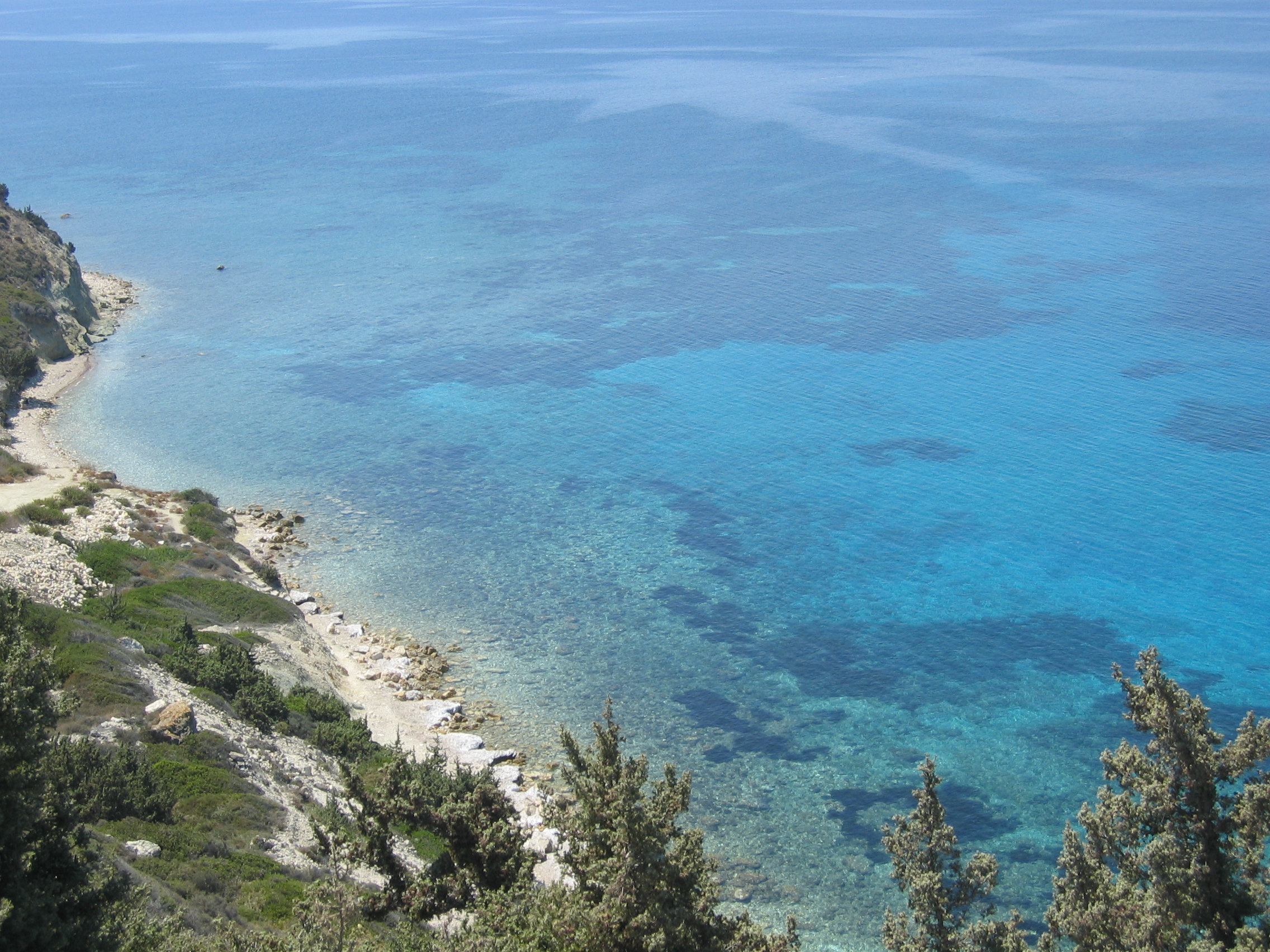
The Chios Strait, or the Chios Channel as referred to by some sources, is a relatively narrow strait in the eastern Aegean Sea that separates the Greek island of Chios from the Anatolian mainland and from the Aegean Region of Turkey. Geography The Chios Strait is approximately 3 nautical miles in width, and it is the body of water that separates Chios from the isthmuses along the western extremity of the Urla-Karaburun-Çeşme Peninsula in Turkey. The peninsula hosts many major districts and cities in İzmir Province, including the municipality of Çeşme, the westernmost city along the peninsula and, therefore, the closest to Chios. Çeşme is one of the northern cities of the Turkish Riviera, and almost its entire coastline is situated along the waters of the strait. In many situations, such as in the photograph to the right, the mountains of Chios and the Chios Strait can easily be viewed from Turkey, and vice versa along the east coast of Chios from settlements such as Karfas. ... [...More Info...] [...Related Items...] OR: [Wikipedia] [Google] [Baidu] |
Strait
A strait is an oceanic landform connecting two seas or two other large areas of water. The surface water generally flows at the same elevation on both sides and through the strait in either direction. Most commonly, it is a narrow ocean channel that lies between two land masses. Some straits are not navigable, for example because they are either too narrow or too shallow, or because of an unnavigable reef or archipelago. Straits are also known to be loci for sediment accumulation. Usually, sand-size deposits occur on both the two opposite strait exits, forming subaqueous fans or deltas. Terminology The terms ''channel'', ''pass'', or ''passage'' can be synonymous and used interchangeably with ''strait'', although each is sometimes differentiated with varying senses. In Scotland, ''firth'' or ''Kyle'' are also sometimes used as synonyms for strait. Many straits are economically important. Straits can be important shipping routes and wars have been fought for control of them. ... [...More Info...] [...Related Items...] OR: [Wikipedia] [Google] [Baidu] |
Turkish Riviera
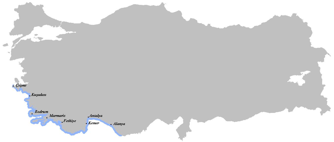
The Turkish Riviera ( tr, Türk Rivierası), also known popularly as the Turquoise Coast, is an area of southwest Turkey encompassing the provinces of Antalya and Muğla, and to a lesser extent Aydın, southern İzmir and western Mersin. The combination of a favorable climate, warm sea, mountainous scenery, fine beaches along more than a of shoreline along the Aegean and Mediterranean waters, and abundant natural and archaeological points of interest makes this stretch of Turkey's coastline a popular national and international tourist destination. Among the archaeological points of interest are two of the Seven Wonders of the Ancient World: The ruins of the Mausoleum of Maussollos in Halicarnassus; and the Temple of Artemis in Ephesus. The Turkish Riviera is also the home of the internationally known Blue Voyage (a.k.a. Carian Cruise), which allows participants to take a week-long trip aboard the local gulet schooners to ancient cities, harbors, tombs, mausolea, and beac ... [...More Info...] [...Related Items...] OR: [Wikipedia] [Google] [Baidu] |
Çeşme District
Çeşme () is a coastal town and the administrative centre of the district of the same name in Turkey's westernmost end, on a promontory on the tip of the peninsula that also carries the same name and that extends inland to form a whole with the wider Urla-Karaburun-Çeşme Peninsula. It is a popular holiday resort and the district center, where two thirds of the district population is concentrated. Çeşme is located 85 km west of İzmir, the largest metropolitan center in Turkey's Aegean Region. There is a six-lane highway connecting the two cities (Otoyol 32). Çeşme district has two neighboring districts, Karaburun to the north and Urla to the east, both of which are also part of İzmir Province. The name "Çeşme" means "fountain" and possibly draws reference from the many Ottoman fountains that are scattered across the city. Name Turkish sources always cited the town and the region as ''Çeşme'' (or Cheshme) which is originally a Persian word since the first sett ... [...More Info...] [...Related Items...] OR: [Wikipedia] [Google] [Baidu] |
Greece–Turkey Border
The Greece–Turkey border ( gr, Σύνορα Ελλάδας–Τουρκίας, translit=Sýnora Elládas–Tourkías, tr, Türkiye–Yunanistan sınırı) is around long, and separates Western Thrace in Greece from East Thrace in Turkey. Course It mostly follows the river Evros. At some places the border does not follow the main course of the river, mainly because the river has been straightened. Barrier It is the external border of the European Union. In 2012, a high border fence was erected along the land border where it is not separated by the river, because of the European migrant crisis. In addition there is a sea border which sometimes goes through straits of a few kilometres width. Aegean dispute Between the two countries, there are political disputes over several aspects of political control over the Aegean space, including the size of territorial waters, air control and the delimitation of economic rights to the continental shelf. These issues are known as t ... [...More Info...] [...Related Items...] OR: [Wikipedia] [Google] [Baidu] |
International Straits
International is an adjective (also used as a noun) meaning "between nations". International may also refer to: Music Albums * ''International'' (Kevin Michael album), 2011 * ''International'' (New Order album), 2002 * ''International'' (The Three Degrees album), 1975 *''International'', 2018 album by L'Algérino Songs * The Internationale, the left-wing anthem * "International" (Chase & Status song), 2014 * "International", by Adventures in Stereo from ''Monomania'', 2000 * "International", by Brass Construction from ''Renegades'', 1984 * "International", by Thomas Leer from ''The Scale of Ten'', 1985 * "International", by Kevin Michael from ''International'' (Kevin Michael album), 2011 * "International", by McGuinness Flint from ''McGuinness Flint'', 1970 * "International", by Orchestral Manoeuvres in the Dark from '' Dazzle Ships'', 1983 * "International (Serious)", by Estelle from '' All of Me'', 2012 Politics * Political international, any transnational organization of ... [...More Info...] [...Related Items...] OR: [Wikipedia] [Google] [Baidu] |
Straits Of Turkey
A strait is an oceanic landform connecting two seas or two other large areas of water. The surface water generally flows at the same elevation on both sides and through the strait in either direction. Most commonly, it is a narrow ocean channel that lies between two land masses. Some straits are not navigable, for example because they are either too narrow or too shallow, or because of an unnavigable reef or archipelago. Straits are also known to be loci for sediment accumulation. Usually, sand-size deposits occur on both the two opposite strait exits, forming subaqueous fans or deltas. Terminology The terms '' channel'', ''pass'', or ''passage'' can be synonymous and used interchangeably with ''strait'', although each is sometimes differentiated with varying senses. In Scotland, ''firth'' or ''Kyle'' are also sometimes used as synonyms for strait. Many straits are economically important. Straits can be important shipping routes and wars have been fought for control of ... [...More Info...] [...Related Items...] OR: [Wikipedia] [Google] [Baidu] |
Straits Of Greece
A strait is an oceanic landform connecting two seas or two other large areas of water. The surface water generally flows at the same elevation on both sides and through the strait in either direction. Most commonly, it is a narrow ocean channel that lies between two land masses. Some straits are not navigable, for example because they are either too narrow or too shallow, or because of an unnavigable reef or archipelago. Straits are also known to be loci for sediment accumulation. Usually, sand-size deposits occur on both the two opposite strait exits, forming subaqueous fans or deltas. Terminology The terms ''channel'', ''pass'', or ''passage'' can be synonymous and used interchangeably with ''strait'', although each is sometimes differentiated with varying senses. In Scotland, ''firth'' or ''Kyle'' are also sometimes used as synonyms for strait. Many straits are economically important. Straits can be important shipping routes and wars have been fought for control of them. ... [...More Info...] [...Related Items...] OR: [Wikipedia] [Google] [Baidu] |
Karaburun Peninsula, Turkey
Karaburun Peninsula is a peninsula in the extreme western end of Turkey, a component of the larger Urla-Karaburun-Çeşme Peninsula. The peninsula carries the same name as the town and ilçe (administrative center), Karaburun, located at a pivotal point in its extremity. It is located west of the city of İzmir, comprised wholly within İzmir Province and is surrounded by the Aegean Sea. The Karaburun peninsula is bounded on the west by the Chios Strait, on the northeast and east by the İzmir Gulf, and on the south by an isthmus in stretching between the village Balıklıova Balıklıova is a small village between Urla and Karaburun, in the Urla district, İzmir Province of Turkey. The meaning of the word Balıklıova comes from a "valley full of fish" (''balık'', "fish"; ''ova'', "valley"). Particularly during su ... in the southeast and the Gerence Bay in the southwest. In antiquity, the peninsula was known as Melaena (Μέλαινα) and famed for its millstone quar ... [...More Info...] [...Related Items...] OR: [Wikipedia] [Google] [Baidu] |
Gulf Of İzmir
The Gulf of İzmir ( tr, İzmir Körfezi), formerly known as the Gulf of Smyrna, is a gulf on the Aegean Sea, with its inlet between the Karaburun Peninsula and the mainland area of Foça. It is in length by in breadth, with an excellent anchorage. The city of İzmir, an important port city of Turkey, surrounds the end of the gulf. Geography The northern limit of the Gulf of İzmir is defined as a 13 nmi line running from Cape Kanlıkaya () of the Karaburun Peninsula, to Cape Aslan () of Foça. The surface area of the gulf is , while its shore length is . Uzunada located in the Gulf of İzmir is Turkey's fourth largest island. Other islands of the gulf include Hekim Island, Foça Islands ( Orak Island, Fener Ada, Incir Ada, Metalik Ada), Çiçek Islands ( Yassıca Island, Pırnarlı Island, İncirli Island, Akça), Karantina Island, Yılan Island, and Büyük Ada. Seventeen rivers empty into the gulf, most notably the Gediz and the Meles. Gediz Delta, which is a Ramsa ... [...More Info...] [...Related Items...] OR: [Wikipedia] [Google] [Baidu] |
Karfas
Karfas ( el, Καρφάς), is a small town on the island of Chios, Greece. Located 7 kilometers south of Chios (town), Karfas is among the most popular destinations on the Island, attracting high amounts of tourism due to its cosmopolitan beaches, studios, residences, clubs, restaurants, and general nightlife. Karfas is approximately 3 kilometers from Chios Island National Airport Chios Island National Airport ( el, Κρατικός Αερολιμένας Χίου) is an airport on the island of Chios in Greece. It is also known as Chios National Airport, "Omiros" or Chios Airport located at the region of Kampos, south of .... Region Karfas is located on the eastern coast just seven kilometers south from Chios Town, and 3 kilometers from the Chios Airport, in the Kambos region. Nearby Karfas, there is a small village called Ayia Ermioni (Άγια Ερμιόνη), which also is a large tourist spot. Demographics According to the 2001 census, Karfas had a permanent resident ... [...More Info...] [...Related Items...] OR: [Wikipedia] [Google] [Baidu] |
Çeşme
Çeşme () is a coastal town and the administrative centre of the district of the same name in Turkey's westernmost end, on a promontory on the tip of the peninsula that also carries the same name and that extends inland to form a whole with the wider Urla-Karaburun-Çeşme Peninsula. It is a popular holiday resort and the district center, where two thirds of the district population is concentrated. Çeşme is located 85 km west of İzmir, the largest metropolitan center in Turkey's Aegean Region. There is a six-lane highway connecting the two cities (Otoyol 32). Çeşme district has two neighboring districts, Karaburun to the north and Urla, İzmir, Urla to the east, both of which are also part of İzmir Province. The name "Çeşme" means "fountain" and possibly draws reference from the many Ottoman Empire, Ottoman fountains that are scattered across the city. Name Turkish sources always cited the town and the region as ''Çeşme'' (or Cheshme) which is originally a Persi ... [...More Info...] [...Related Items...] OR: [Wikipedia] [Google] [Baidu] |
Aegean Sea
The Aegean Sea ; tr, Ege Denizi (Greek language, Greek: Αιγαίο Πέλαγος: "Egéo Pélagos", Turkish language, Turkish: "Ege Denizi" or "Adalar Denizi") is an elongated embayment of the Mediterranean Sea between Europe and Asia. It is located between the Balkans and Anatolia, and covers an area of some 215,000 square kilometres. In the north, the Aegean is connected to the Marmara Sea and the Black Sea by the straits of the Dardanelles and the Bosphorus. The Aegean Islands are located within the sea and some bound it on its southern periphery, including Crete and Rhodes. The sea reaches a maximum depth of 2,639m to the west of Karpathos. The Thracian Sea and the Sea of Crete are main subdivisions of the Aegean Sea. The Aegean Islands can be divided into several island groups, including the Dodecanese, the Cyclades, the Sporades, the Saronic Islands, Saronic islands and the North Aegean islands, North Aegean Islands, as well as Crete and its surrounding islands. The ... [...More Info...] [...Related Items...] OR: [Wikipedia] [Google] [Baidu] |


