|
Challenger Park
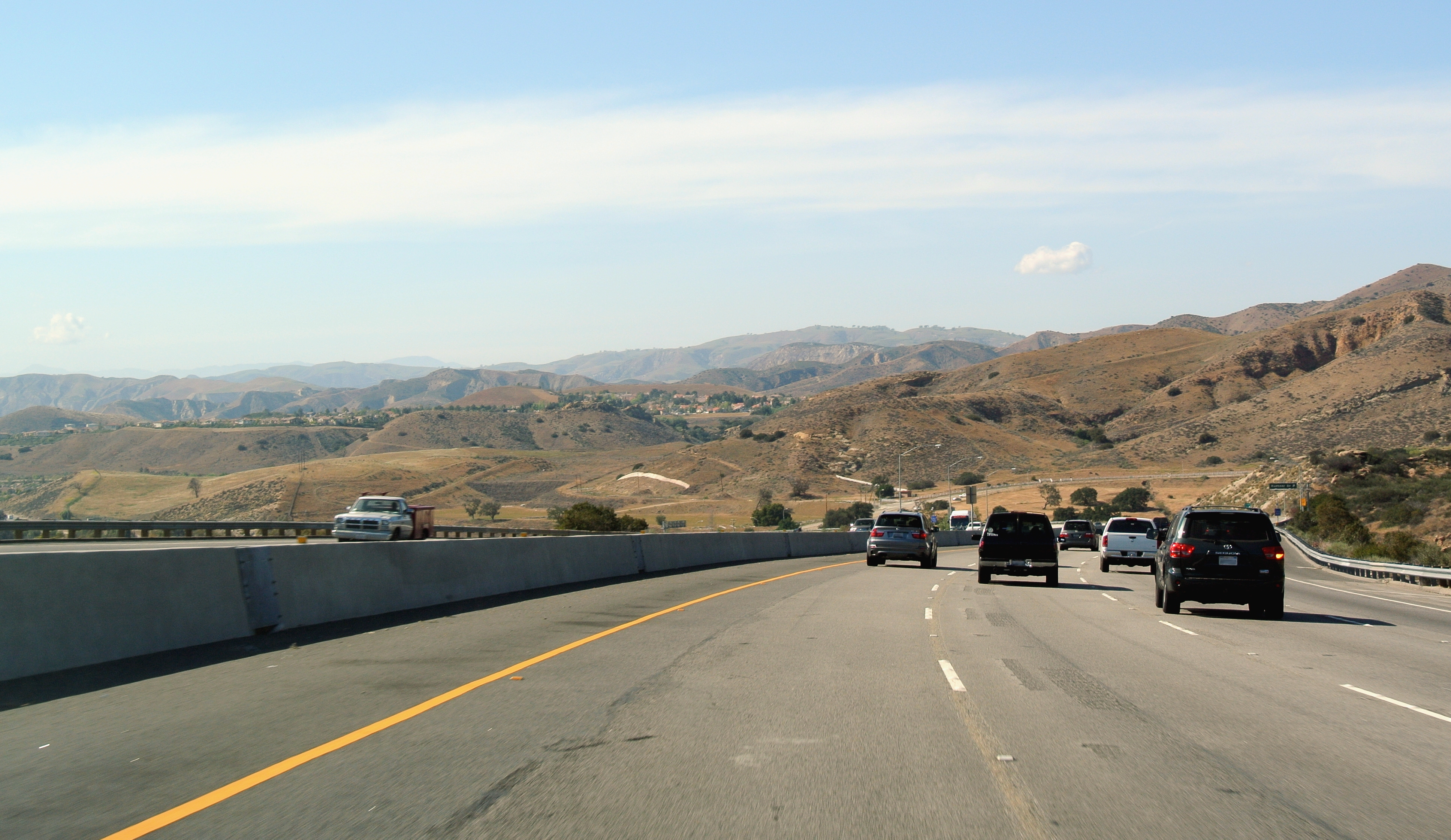
Challenger Park is a located in southern portion of Simi Valley, California in the Simi Hills.Murphy, Kelly (2012). ''Local Multi-Use Trails''. Multi-Use Trails. Page 152. . The park is owned and maintained by the Rancho Simi Recreation and Park District. Challenger Park is used for mountain hiking, mountain biking, jogging, and horseback riding but with a focus on the preservation of wildlife habitat. The scenery lining the trails includes extensive oak woodlands, chaparral, and coastal sage scrub. The terrain varies greatly with rolling green hills and steep mountainous hills and canyons. The park offers miles of trails connecting to Long Canyon, Oak Canyon, Trough Canyon, Lone Oak Canyon, and other adjoining open-space nature areas in the southern section of the Simi Valley. There is a fairly easy hike to Thousand Oaks, CA via Long Canyon trails. To get to Oak Canyon, Old Windmill Park and Coyote Hills Park, you must cross Long Canyon Road. Fences run along the Long Canyon Road ... [...More Info...] [...Related Items...] OR: [Wikipedia] [Google] [Baidu] |
Simi Hills
The Simi Hills are a low rocky mountain range of the Transverse Ranges in eastern Ventura County and western Los Angeles County, of southern California, United States. Geography The Simi Hills are aligned east-west and run for , and average around north-south. The Simi Hills are part of the central Transverse Ranges System. They lie almost entirely within southeastern Ventura County, with some southern and eastern foothills within western Los Angeles County. The Simi Hills are on the western edge of the San Fernando Valley. The Simi Valley lies to the north, and the Conejo Valley lies to the southwest. The San Fernando Valley communities of Chatsworth, West Hills, and Woodland Hills are in the eastern hills and adjacent valley floor in Los Angeles city and county. The cities of Agoura Hills and Westlake Village are also located in Los Angeles County, generally southwest of the Simi Hills. The cities of Thousand Oaks (to the west) and Simi Valley city (to the north) are in ... [...More Info...] [...Related Items...] OR: [Wikipedia] [Google] [Baidu] |
Simi Valley, CA
Simi Valley (; Chumashan languages, Chumash: ''Shimiyi'') is a city in Simi Valley (valley), the valley of the same name in the southeast region of Ventura County, California, United States. Simi Valley is from Downtown Los Angeles, making it part of the Greater Los Angeles Area. The city sits next to Thousand Oaks, California, Thousand Oaks, Moorpark, California, Moorpark, and Chatsworth, Los Angeles, Chatsworth. As of the 2020 United States census, 2020 U.S. Census the population was 126,356, up from 124,243 in 2010. The city of Simi Valley is surrounded by the Santa Susana Mountains and the Simi Hills, west of the San Fernando Valley, and northeast of the Conejo Valley. It grew as a commuter town, commuter bedroom community for the cities in the Los Angeles area, and the San Fernando Valley when a freeway was built over the Santa Susana Pass. The Ronald Reagan Presidential Library, where the Ronald Reagan, former president was buried in 2004, is in Simi Valley. The Reagan Li ... [...More Info...] [...Related Items...] OR: [Wikipedia] [Google] [Baidu] |
Simi Valley, California
Simi Valley (; Chumash: ''Shimiyi'') is a city in the valley of the same name in the southeast region of Ventura County, California, United States. Simi Valley is from Downtown Los Angeles, making it part of the Greater Los Angeles Area. The city sits next to Thousand Oaks, Moorpark, and Chatsworth. As of the 2020 U.S. Census the population was 126,356, up from 124,243 in 2010. The city of Simi Valley is surrounded by the Santa Susana Mountains and the Simi Hills, west of the San Fernando Valley, and northeast of the Conejo Valley. It grew as a commuter bedroom community for the cities in the Los Angeles area, and the San Fernando Valley when a freeway was built over the Santa Susana Pass. The Ronald Reagan Presidential Library, where the former president was buried in 2004, is in Simi Valley. The Reagan Library has hosted Republican primary debates in 2012 and 2016. History Chumash/pre-colonial period Simi Valley was once inhabited by the Chumash people, who also s ... [...More Info...] [...Related Items...] OR: [Wikipedia] [Google] [Baidu] |
Chaparral
Chaparral ( ) is a shrubland plant community and geographical feature found primarily in the U.S. state of California, in southern Oregon, and in the northern portion of the Baja California Peninsula in Mexico. It is shaped by a Mediterranean climate (mild wet winters and hot dry summers) and infrequent, high-intensity crown fires. Chaparral features summer-drought-tolerant plants with hard sclerophyllous evergreen leaves, as contrasted with the associated soft-leaved, drought-deciduous, scrub community of coastal sage scrub, found often on drier, southern facing slopes within the chaparral biome. Three other closely related chaparral shrubland systems occur in central Arizona, western Texas, and along the eastern side of central Mexico's mountain chains (mexical), all having summer rains in contrast to the Mediterranean climate of other chaparral formations. Chaparral comprises 9% of California's wildland vegetation and contains 20% of its plant species. The name comes from th ... [...More Info...] [...Related Items...] OR: [Wikipedia] [Google] [Baidu] |
Coastal Sage Scrub
Coastal sage scrub, also known as coastal scrub, CSS, or soft chaparral, is a low scrubland plant community of the California coastal sage and chaparral subecoregion, found in coastal California and northwestern coastal Baja California. It is within the California chaparral and woodlands ecoregion, of the Mediterranean forests, woodlands, and scrub biome. Characteristics ;Plant community Coastal sage scrub is characterized by low-growing aromatic, and drought-deciduous shrubs adapted to the semi-arid Mediterranean climate of the coastal lowlands. The community is sometimes called "soft chaparral" due to the predominance of soft, drought-deciduous leaves in contrast to the hard, waxy-cuticled leaves on sclerophyllous plants of California's chaparral communities. ;Flora Characteristic shrubs and subshrubs include: * California sagebrush (''Artemisia californica'') * Black sage (''Salvia mellifera'') * White sage (''Salvia apiana'') * California buckwheat (''Eriogonum fascicul ... [...More Info...] [...Related Items...] OR: [Wikipedia] [Google] [Baidu] |
Simi Valley
Simi Valley (; Chumash: ''Shimiyi'') is a city in the valley of the same name in the southeast region of Ventura County, California, United States. Simi Valley is from Downtown Los Angeles, making it part of the Greater Los Angeles Area. The city sits next to Thousand Oaks, Moorpark, and Chatsworth. As of the 2020 U.S. Census the population was 126,356, up from 124,243 in 2010. The city of Simi Valley is surrounded by the Santa Susana Mountains and the Simi Hills, west of the San Fernando Valley, and northeast of the Conejo Valley. It grew as a commuter bedroom community for the cities in the Los Angeles area, and the San Fernando Valley when a freeway was built over the Santa Susana Pass. The Ronald Reagan Presidential Library, where the former president was buried in 2004, is in Simi Valley. The Reagan Library has hosted Republican primary debates in 2012 and 2016. History Chumash/pre-colonial period Simi Valley was once inhabited by the Chumash people, who also s ... [...More Info...] [...Related Items...] OR: [Wikipedia] [Google] [Baidu] |
Thousand Oaks, CA
Thousand Oaks is the second-largest city in Ventura County, California, United States. It is in the northwestern part of Greater Los Angeles, approximately from the city of Los Angeles and from Downtown. It is named after the many oak trees present in the area. The city forms the central populated core of the Conejo Valley. Thousand Oaks was incorporated in 1964, but has since expanded to the west and east. Two-thirds of master-planned community of Westlake and most of Newbury Park were annexed by the city during the late 1960s and 1970s. The Los Angeles County–Ventura County line crosses at the city's eastern border with Westlake Village. The population was 126,966 at the 2020 census, up from 126,683 at the 2010 census. Etymology One of the earliest names used for the area was Conejo Mountain Valley, as used by the founder of Newbury Park, Egbert Starr Newbury, in the 1870s. During the 1920s, today's Thousand Oaks was home to 100 residents. In the 1920s came talks o ... [...More Info...] [...Related Items...] OR: [Wikipedia] [Google] [Baidu] |
Bridle Path (Simi Valley)
Bridle Path is a community in the southwestern area of the City of Simi Valley, in Ventura County, Southern California. The residential development is located in the north−central Simi Hills, east of the southern end of First Street as it turns into Long Canyon Road, and east of the Wood Ranch community.United States National Park Service (1991). ''Cheeseboro Canyon: Environmental Impact Statement''. Northwestern University. Pages 229 and 239. The area was developed in the mid-1970s, during one of Simi Valley's housing development booms. The equestrian community is one of few areas within the city that is zoned for residents to keep horses on their property, The Bridle Path Homeowners Association (HOA) includes owners of the 630 homes within the original community. Nearby neighborhoods along First Street to Fitzgerald Road are sometimes identified as part of the Bridle Path neighborhood. In November 2018, most of the Bridle Path Mountain Park was burned during the Woolsey F ... [...More Info...] [...Related Items...] OR: [Wikipedia] [Google] [Baidu] |
California State Route 118
State Route 118 (SR 118) is a state highway in the U.S. state of California that runs west to east through Ventura and Los Angeles counties. It travels from State Route 126 at the eastern edge of Ventura immediately northwest of Saticoy, then through Saticoy, in Ventura County east to Interstate 210 near Lake View Terrace in Los Angeles. SR 118 crosses the Santa Susana Pass and the northern rim of the San Fernando Valley along its route. Route description SR 118 has two distinguishable sections, which connect at the intersection with State Route 23. The western section of SR 118 goes through the more rural areas of Ventura County. SR 118 begins at an intersection with SR 126 in Ventura as Wells Road and heads southeast, crossing the Santa Clara River as Los Angeles Avenue and intersecting SR 232 in unincorporated Ventura County. The highway continues southeast before intersecting Santa Clara Avenue, where Los Angeles Avenue turns east and passes north of Camarillo. In ... [...More Info...] [...Related Items...] OR: [Wikipedia] [Google] [Baidu] |
California State Route 23
State Route 23 (SR 23) is a state highway in the U.S. state of California that connects the Pacific coast and the Santa Monica Mountains to the Conejo and Santa Clara River valleys. It runs from Pacific Coast Highway ( State Route 1) in Malibu in Los Angeles County to Ventura Street ( State Route 126) in Fillmore in Ventura County. Route description SR 23 consists of three distinct sections. The southern section begins as Decker Canyon Road near Trancas in Malibu, where SR 23 intersects with the Pacific Coast Highway (State Route 1), or "PCH." This portion provides numerous vistas of the Santa Monica Mountains and the Pacific Ocean during the daytime, but extreme caution is advised, especially as the road nears PCH. It is a notoriously dangerous road, and the rusted chassis of cars that have gone over the side can still be seen. Philip Taylor Kramer, bassist with the rock band Iron Butterfly from 1974–1977, allegedly committed suicide by driving his van over the side ... [...More Info...] [...Related Items...] OR: [Wikipedia] [Google] [Baidu] |


.jpg)

