|
Chalamain Gap
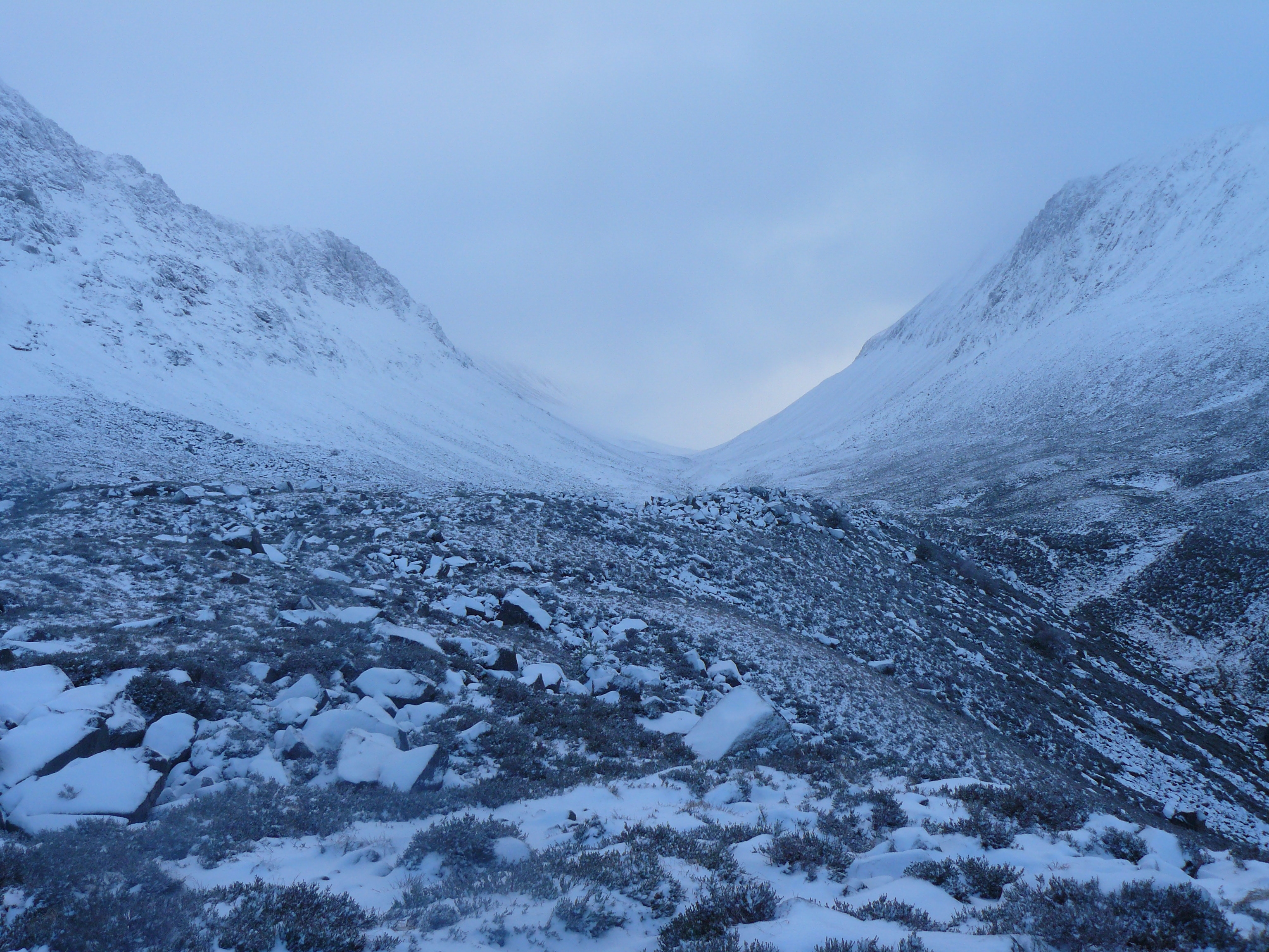
The Lairig Ghru ( gd, Làirig Dhrù) is one of the mountain passes through the Cairngorms of Scotland. The route and mountain pass partially lies on the Mar Lodge Estate. Like many traditional routes, the ends of the route through the Lairig Ghru are like the ends of a frayed rope. From the south the Lairig Ghru can be approached from Braemar though Glen Lui, or Glen Dee, and from Blair Atholl through Glen Tilt. From the north the Lairig Ghru can be approached from Glenmore through the Chalamain Gap, and from Aviemore through the Rothiemurchus Forest by way of the ''Crossroads'' above Allt Drùidh. Name Watson gives the place name "Làirig Dhrù", meaning ''pass of Dhru or Druie'', with the local pronunciation "Laarig Groo". He suggests the "probable" derivation as from ''Drùdhadh'' meaning oozing. Any visitor to the summit of the Lairig Ghru would accept that as a possible derivation because two watercourses, one on each side of the summit, appear to "ooze" from the valley f ... [...More Info...] [...Related Items...] OR: [Wikipedia] [Google] [Baidu] |
The Lecht
The Lecht Ski Centre is an alpine ski area in the Cairngorms in the Scottish Highlands. The ski slopes are set around the mountains Beinn a' Chruinnich, 2,552 ft (778 m) and Meikle Corr Riabhach, 2556 ft (779 m). The Lecht is the smallest ski area in Scotland in terms of area, number of runs and vertical drop and as such is the most suitable for beginners. 15 lifts provide access to 23 groomed pistes. The smooth, grassy terrain of Beinn a' Chruinnich and Meikle Corr Riabhach often allows the Lecht, despite the modest summit elevation, to provide snow sports with marginal snow cover when other ski areas in Scotland, with more mountainous terrain, may be closed. The ski centre has been operating since the mid 1970s. Prior to the acquisition of snow blowers in the late 1970s a small portable ski tow, giving approximately 200 feet (60 metres) of ski run, was often set up in the fields across from the Allargue Arms Hotel near Corgarff just below the snow gates. The Lecht Sk ... [...More Info...] [...Related Items...] OR: [Wikipedia] [Google] [Baidu] |
Bothy
A bothy is a basic shelter, usually left unlocked and available for anyone to use free of charge. It was also a term for basic accommodation, usually for gardeners or other workers on an estate. Bothies are found in remote mountainous areas of Scotland, Northern England, Ulster and Wales. They are particularly common in the Scottish Highlands, but related buildings can be found around the world (for example, in the Nordic countries there are wilderness huts). A bothy was also a semi-legal drinking den in the Isle of Lewis. These, such as ''Bothan Eòrapaidh'', were used until recent years as gathering points for local men and were often situated in an old hut or caravan. In Scots law, bothies are defined in law as: a building of no more than two storeys which— (a)does not have any form of— (i)mains electricity, (ii)piped fuel supply, and (iii)piped mains water supply, (b)is 100 metres or more from the nearest public road (within the meaning of section 151 of the Roads (S ... [...More Info...] [...Related Items...] OR: [Wikipedia] [Google] [Baidu] |
Cairn Toul
Cairn Toul ( gd, Càrn an t-Sabhail, 'hill of the barn') is the fourth-highest mountain in Scotland and all of the British Isles, after Ben Nevis, Ben Macdui and Braeriach. The summit is 1,291 metres (4,236 feet) above sea level. It is in the western massif of the Cairngorms, linked by a bealach at about 1125 m to Braeriach. The mountain towers above the Lairig Ghru pass. Cairn Toul is often climbed together with other peaks. From the south, it may be climbed with The Devil's Point, which lies about 2.5 kilometres south-southeast. Alternatively, it may be climbed from the north, including Braeriach and Sgor an Lochain Uaine. Both routes are long days by Scottish standards: around 15 km (plus return) regardless of whether one starts from Coire Cas above Speyside, or Linn of Dee to the south. The mountain may also be climbed from the west, starting from Achlean in Glen Feshie. This provides for a slighter shorter route (around 27 km for the round trip), ... [...More Info...] [...Related Items...] OR: [Wikipedia] [Google] [Baidu] |
Corrour Bothy
Corrour Bothy is a simple stone building on Mar Lodge Estate, Aberdeenshire, Scotland. It is located below Coire Odhar between The Devil's Point and Cairn Toul on the western side of the River Dee in the Lairig Ghru. The bothy is a single room with a fireplace and chimney in its northern gable. Its dimensions are 19.6 ft (6 m) by 11.8 ft (3.6m) . There is a toilet in the wooden extension to the building. It is used as a mountain refuge and as a starting point for ascents of Munros including The Devil's Point, Cairn Toul, and Braeriach. Name The name ''Corrour'' is used as a name for the locality as well as specifically as a name for the bothy itself, the name being derived from Coire Odhar according to , who continues: In the author gives the local pronunciation as ''Corower'', but without explanation. However in the section "Hints on Gaelic pronunciation" appears to suggest the final-vowels of ''Coire'' (and corrie) are dropped to give ''kor'', and that the '' ... [...More Info...] [...Related Items...] OR: [Wikipedia] [Google] [Baidu] |
River Dee, Aberdeenshire
The River Dee ( gd, Uisge Dhè) is a river in Aberdeenshire, Scotland. It rises in the Cairngorms and flows through southern Aberdeenshire to reach the North Sea at Aberdeen. The area it passes through is known as Deeside, or Royal Deeside in the region between Braemar and Banchory because Queen Victoria came for a visit there in 1848 and greatly enjoyed herself. She and her husband, Prince Albert, built Balmoral Castle there which replaced an older castle. Deeside is a popular area for tourists, due to the combination of scenic beauty and historic and royal associations. It is part of the Cairngorms National Park, and the Deeside and Lochnagar National Scenic Area. The Dee is popular with anglers and is one of the most famous salmon fishing rivers in the world. The New Statistical Account of Scotland attributed the name Dee as having been used as early as the second century AD in the work of the Alexandrian geographer Claudius Ptolemy, as ''Δηοῦα'' (=Deva), meaning ... [...More Info...] [...Related Items...] OR: [Wikipedia] [Google] [Baidu] |
Cairngorm Club
The Cairngorm Club is a mountaineering club, based in Aberdeen, Scotland formed in June 1887. History The Cairngorm Club was founded by Alexander Copland, Rev. Robert Lippe, Alexander Inkson M'Connochie, Rev. C. C. Macdonald, W. A. Hawes, and W. Anderson at Clach Dhion - the Shelter Stone, above Loch A'an in the Cairngorms on 24 June 1887. The date of formation is given as 1889 in the SMC District Guide, and corrected in a later edition. The founders had climbed Ben Macdui and let off fireworks to celebrate the Queen's Jubilee. The first formal meeting was held in Aberdeen on 9 January 1889, re-appointing the office-bearers and forming a committee. The first meet was held on 9 July 1889, staying at Nethy Bridge Hotel and ascending Cairn Gorm and Ben Macdui from Glenmore Lodge. Reverend Lippe served as the first Vice President. The club was registered as a charity on 11 July 2017. The current President (2022) is Garry Wardrope, aged 60. Club huts Derry Lodge The club leased ... [...More Info...] [...Related Items...] OR: [Wikipedia] [Google] [Baidu] |
Glen Dee Route
A glen is a valley, typically one that is long and bounded by gently sloped concave sides, unlike a ravine, which is deep and bounded by steep slopes. Whittow defines it as a "Scottish term for a deep valley in the Highlands" that is "narrower than a strath".. The word is Goidelic in origin: ''gleann'' in Irish and Scottish Gaelic, ''glion'' in Manx. The designation "glen" also occurs often in place names. Etymology The word is Goidelic in origin: ''gleann'' in Irish and Scottish Gaelic, ''glion'' in Manx. In Manx, ''glan'' is also to be found meaning glen. It is cognate with Welsh ''glyn''. Examples in Northern England, such as Glenridding, Westmorland, or Glendue, near Haltwhistle, Northumberland, are thought to derive from the aforementioned Cumbric cognate, or another Brythonic equivalent. This likely underlies some examples in Southern Scotland. As the name of a river, it is thought to derive from the Irish word ''glan'' meaning clean, or the Welsh word ''gleindid' ... [...More Info...] [...Related Items...] OR: [Wikipedia] [Google] [Baidu] |
The Devil's Point
The Devil's Point (Scottish Gaelic: Bod an Deamhain) is a mountain in the Cairngorms of Scotland, lying to the west of the Lairig Ghru pass. The Gaelic name means "Penis of the Demon". The English name is a result of a visit to the area by Queen Victoria. She asked her local ghillie, John Brown, to translate the name; to avoid embarrassment he gave a euphemistic answer. Although The Devil's Point is strikingly distinct when seen from the south, it is a subsidiary peak of Cairn Toul, the summit of which lies some to the north. The easiest route is to follow the path leading up the Coire Odhar from Corrour Bothy, on the eastern side of the mountain. To reach the bothy requires a long walk in; the most usual route is to follow the Lairig Ghru from Linn of Dee, a distance of some . The Devil's Point is often climbed along with Cairn Toul. Sgòr an Lochain Uaine, which lies to the north of Cairn Toul is sometimes called ''The Angel's Peak'', in contrast to The Devil's Point. Refe ... [...More Info...] [...Related Items...] OR: [Wikipedia] [Google] [Baidu] |
Carn A' Mhaim
''Carn'' is the official magazine of the Celtic League. The name, a Celtic word which has been borrowed into English as ' cairn', was chosen for its symbolic value and because it can be found in each of the living Celtic languages. The subtitle is: 'A Link Between the Celtic Nations'. Overview Founded in 1973, ''Carn'' is dedicated to highlighting and furthering the aims of the Celtic League, including language preservation and self-determination for the Six Celtic Nations. The articles are published in English, with articles also in the six Celtic languages: Breton, Cornish, Irish, Manx, Scottish Gaelic, and Welsh, with translations and summaries in English. In the past, articles have also appeared in French. Notable contributors have included the Scottish Gaelic poet Sorley MacLean. The cover of the magazine for a number of years has been a map showing the various Celtic countries, notated with their names in their respective native languages. Editors The editor ... [...More Info...] [...Related Items...] OR: [Wikipedia] [Google] [Baidu] |
Tarmacadam
Tarmacadam is a road surfacing material made by combining crushed stone, tar, and sand, patented by Welsh inventor Edgar Purnell Hooley in 1902. It is a more durable and dust-free enhancement of simple compacted stone macadam surfaces invented by Scottish engineer John Loudon McAdam in the early 1800s. The terms "tarmacadam" and tarmac are also used for a variety of other materials, including tar- grouted macadam, bituminous surface treatments and modern asphalt concrete. Origins Macadam roads pioneered by British engineer John Loudon McAdam in the 1820s are prone to rutting and generating dust. Methods to stabilise macadam surfaces with tar date back to at least 1834 when John Henry Cassell, operating from ''Cassell's Patent Lava Stone Works'' in Millwall, England, patented "lava stone". This method involved spreading tar on the subgrade, placing a typical macadam layer, and finally sealing the macadam with a mixture of tar and sand. Tar-grouted macadam was in use well before ... [...More Info...] [...Related Items...] OR: [Wikipedia] [Google] [Baidu] |


