|
Central Beskidian Piedmont
The Central Beskidian Piedmont ( pl, Pogórze Środkowobeskidzkie) is a geographical region in southeastern Poland. It lies north of the Central Beskids, and belongs to the Outer Eastern Carpathians, representing the northernmost region of the Carpathians. Subdivision The Central Beskidian Piedmont consists of: * Rożnów Piedmont (PL: ''Pogórze Rożnowskie'') * Ciężkowice Piedmont (PL: ''Pogórze Ciężkowickie'') * Strzyżów Piedmont (PL: ''Pogórze Strzyżowskie'') * Dynów Piedmont (PL: ''Pogórze Dynowskie'') * Przemyśl Piedmont (PL: ''Pogórze Przemyskie'') * Gorlice Depression (PL: ''Obniżenie Gorlickie'') * Jasło-Krosno Basin (PL: ''Kotlina Jasielsko-Krośnieńska'') * Jasło Piedmont (PL: ''Pogórze Jasielskie'') * Bukowsko Piedmont (PL: ''Pogórze Bukowskie'') See also * Outer Eastern Carpathians Divisions of the Carpathians are a categorization of the Carpathian mountains system. Below is a detailed overview of the major subdivisions and ranges o ... [...More Info...] [...Related Items...] OR: [Wikipedia] [Google] [Baidu] |
Dunajec
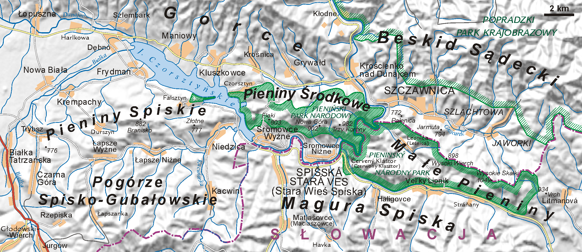
The Dunajec (); Goral dialects: ''Dónajec'') is a river running through northeastern Slovakia and southern Poland. It is also regarded as the main river of the Goral Lands. It is a right tributary of the Vistula River. It begins in Nowy Targ at the junction of two short mountain rivers, Czarny Dunajec and Biały Dunajec (Black and White Dunajec). Dunajec forms the border between Poland and Slovakia for in the Pieniny Środkowe (Slovak: Centrálne Pieniny) range, east of the Czorsztyn reservoir. Geography The Dunajec is long, including its source river Czarny Dunajec,Statistical Yearbook of the Republic of Poland 2017 |
Dynów Piedmont
Dynów () ( uk, Динів, lat, Dinoum, yi, דינאוו) is a small town in Rzeszów County, Subcarpathian Voivodeship, Poland, with a population of 6,058 (02.06.2009). History Dynów was first mentioned in written sources in 1423. At that time, together with other villages, it belonged to the noble Kmita family from Lesser Poland. In 1409, after the death of Voivode of Kraków, Piotr Kmita, the village was handed to his son, Piotr Lunak, who died in 1430. Dynów was granted town charter probably before 1429. In 1448, it became seat of a Roman Catholic parish, but remained a small town, located in the Ruthenian Voivodeship (part of Red Ruthenia) of the Kingdom of Poland. In March 1657, Dynów was captured by Transilvanian army of George II Rakoczi, which burned the town, together with its churches and castle. In 1661, Dynów was plundered again, this time by mercenaries of Mikolaj Ossolinski, who fought his private war with owner of Dynow, Olbracht Grochowski. In 1667, the ... [...More Info...] [...Related Items...] OR: [Wikipedia] [Google] [Baidu] |
Outer Subcarpathian Regions
Outer Subcarpathia ( pl, Podkarpacie Zewnętrzne; uk, Прикарпаття, ''Prykarpattia''; cs, Vněkarpatské sníženiny; german: Karpatenvorland) denotes the depression area at the outer (western, northern and eastern) base of the Carpathian arc, including foothills of the Outer Western Carpathians and Outer Eastern Carpathians. It stretches from northeastern Austria, through eastern Czech Republic, southern Poland, western Ukraine and northeastern Romania. The opposite foothill regions on the inner side of the Carpathian arc are known as ''Inner Subcarpathia'', transitioning further to the Pannonian Basin. Geography The western end is marked by the (northern) Vienna Basin, separating it from the Eastern Alpine Foreland. The adjacent hilly landscape of the Lower Austrian Weinviertel region with its extensive loess layers border on the limestone rock formations of the South-Moravian Carpathians. In the Czech Republic, the depression is situated on the outskirts ... [...More Info...] [...Related Items...] OR: [Wikipedia] [Google] [Baidu] |
Bukowsko Piedmont
Bukowsko (; yi, בוקאווסק, Bikofsk; uk, Буківсько, Bukivsʹko) is a village in Sanok County, Subcarpathian Voivodeship, Poland. It's in the Bukowsko Upland mountains, parish ''in loco'', located near the towns of Medzilaborce and Palota (in northeastern Slovakia). During the Polish–Lithuanian Commonwealth it was in Lesser Poland prowincja. Characteristics Bukowsko is the administrative and cultural centre of the Gmina Bukowsko. It is crossed by the rail road connecting it with Slovakia. It is especially the private sector and service industries that are developing rapidly at this time. It is home to the Uniwersytet Ludowy, opened in 2005, which contains many artworks and effects of the folk handworks inspiration. Bukowsko is situated in the poorest region of Poland. History Settled in prehistoric times, the southern-eastern Poland region that is now Podkarpacie was overrun in pre-Roman times by various tribes, including the Celts, Goths and Vandals (P ... [...More Info...] [...Related Items...] OR: [Wikipedia] [Google] [Baidu] |
Jasło Piedmont
Jasło is a county town in south-eastern Poland with 36,641 inhabitants, as of 31 December 2012. It is situated in the Subcarpathian Voivodeship (since 1999), and it was previously part of Krosno Voivodeship (1975–1998). It is located in Lesser Poland, in the heartland of the Doły (Pits), and its average altitude is 320 metres above sea level, although there are some hills located within the confines of the city. The Patron Saint of the city is Saint Anthony of Padua. History In the early days of Polish statehood, Jasło was part of the Castellany of Biecz, out of which ''Biecz County'' emerged in the 14th century. A list of rectories, created for collecting tithes, a church in "Jassel" in Zręcin deanery, Kraków diocese, is shown in 1328.Sulimierski, Filip, Bronisław Chlebowski, and Władysław Walewski. ''Słownik Geograficzny Królestwa Polskiego I Innych Krajów Słowiańskich: Warszawa 1880-1902''. Translated by William F. "Fred" Hoffman. Warszawa: BUW. Sekcja Dokumen ... [...More Info...] [...Related Items...] OR: [Wikipedia] [Google] [Baidu] |
Gorlice Depression
Gorlice ( uk, Горлиці, translit=''Horlytsi'') is a city and an urban municipality (" gmina") in south eastern Poland with around 29,500 inhabitants (2008). It is situated south east of Kraków and south of Tarnów between Jasło and Nowy Sącz in the Lesser Poland Voivodeship (since 1999), previously in Nowy Sącz Voivodeship (1975–1998). It is the capital of Gorlice County. Geography The city lies between the Ropa and Sękówka river valleys, surrounded by several mountain ranges of the Carpathian Mountains, namely their part called Beskid Niski (Low Beskids) massive. It is located in the heartland of the Doły (Pits), and its average elevation above sea level is , although there are some more considerable hills located within the confines of the city. The city is nowadays situated in a heavily populated region from Jasło, from Nowy Sącz, from Tarnów, and from Kraków. Gorlice is known in uk, as Horlytsi, Горлиці; in yi, גאָרליץ as Gorlitz; a ... [...More Info...] [...Related Items...] OR: [Wikipedia] [Google] [Baidu] |
Przemyśl Piedmont
Przemyśl (; yi, פשעמישל, Pshemishl; uk, Перемишль, Peremyshl; german: Premissel) is a city in southeastern Poland with 58,721 inhabitants, as of December 2021. In 1999, it became part of the Subcarpathian Voivodeship; it was previously the capital of Przemyśl Voivodeship. Przemyśl owes its long and rich history to the advantages of its geographic location. The city lies in an area connecting mountains and lowlands known as the Przemyśl Gate (Brama Przemyska), with open lines of transportation, and fertile soil. It also lies on the navigable San River. Important trade routes that connect Central Europe from Przemyśl ensure the city's importance. The Old Town of Przemyśl is listed as a Historic Monument of Poland. Names Different names in various languages have identified the city throughout its history. Selected languages include: cz, Přemyšl; german: Premissel, Prömsel, Premslen; la, Premislia; uk, Перемишль (Peremyshlj) and (Pshemyslj); ... [...More Info...] [...Related Items...] OR: [Wikipedia] [Google] [Baidu] |
Strzyżów Piedmont
Strzyżów is a town in Strzyżów County, Subcarpathian Voivodeship, Poland, along the Wisłok river valley. Strzyżów is one of the towns within the Strzyżowsko-Dynowskie Foothill, located south-east of Kraków and 30 km from Rzeszów. According to statistics from June 30, 2010 from GUS (the Central Statistical Office in Poland), there are 8,782 inhabitants. History The history of Strzyżów dates back to the 9th century, to the times of the Wiślanie tribe (Vistulans) when a legendary pagan Vistulan prince is said to have built a watchtower by Stobnica and Wisłok river called "Strzeżno", for the defence of eastern borders of his land. In 1279, in Buda (Hungary), the Pope's legate named Bishop Philip confirmed the abbot's right to take a special tax (a tithe) from Czudec and Strzyżów. Strzyżów obtained city rights between 1373 and 1397. The town was surrounded by a soil defence embankment (Zawale Street still exists and it relates to that embankment). Thes ... [...More Info...] [...Related Items...] OR: [Wikipedia] [Google] [Baidu] |
Rożnów, Lesser Poland Voivodeship
Rożnów is a village in the administrative district of Gmina Gródek nad Dunajcem, within Nowy Sącz County, Lesser Poland Voivodeship, in southern Poland. It lies approximately north of Nowy Sącz and south-east of the regional capital Kraków. The village has a population of 1,700. Rożnów Dam Rożnów is the location of a dam on the Dunajec and a power station built in 1935-1941. The dam was constructed originally to prevent flooding after the disastrous 1934 flood in Poland which took the lives of 55 people and caused damages estimated at 60 million interbellum zlotys; the biggest flood in the Second Polish Republic. The construction of the Rożnów Dam resulted in the creation of the |
Ciężkowice Piedmont
Ciężkowice is a town in Tarnów County, Lesser Poland Voivodeship, Poland, with 2,444 inhabitants as of December 2021. It lies in the ''Ciężkowice Foothills'', on the Biała river. The town is located on regional road nr. 977, it also has a rail station (Bogoniowice - Ciężkowice), on a line which goes from Tarnów to the Slovak border crossing at Leluchów. Ciężkowice is home to a sports club ''Ciężkowianka'', founded in 1948. History The history of Ciężkowice dates back to the year 1125, when in a document of Papal legate Gilles de Paris, the village is mentioned as a property of the Tyniec Benedictine Abbey. On February 29, 1348, King Kazimierz Wielki granted it Magdeburg rights town charter. At that time, Ciężkowice was partly inhabited by the German settlers. In the late Middle Ages, Ciężkowice was located on a merchant route from the Kingdom of Hungary to Kraków. Weekly fairs took place here every Wednesday, where local dairy products, clothes, salt, hors ... [...More Info...] [...Related Items...] OR: [Wikipedia] [Google] [Baidu] |
Rożnów Piedmont in Lsser Poland Voivodeship
{{geodis ...
Rożnów may refer to the following places in Poland: *Rożnów, Lower Silesian Voivodeship (south-west Poland) *Rożnów, Lesser Poland Voivodeship (south Poland) *Rożnów, Opole Voivodeship (south-west Poland) *Lake Rożnów Lake Rożnow ( pl, Jezioro Rożnowskie) is an artificial lake, built in 1935–1941. It is located in southernmost part of Poland ( Lesser Poland Voivodeship). The lake was built in the interwar period to regulate the Dunajec river flowing t ... [...More Info...] [...Related Items...] OR: [Wikipedia] [Google] [Baidu] |


