|
Cebu Technological University
Cebu Technological University ( ceb, Unibersidad Teknolohiko sa Sugbo), abbreviated as CTU and also known as Cebu Tech, is a public, non-sectarian, coeducational, state-funded higher education institution located in Cebu, Philippines. CTU was originally a part of the Philippine public high school system and traces its roots to the Manual Arts department of the Cebu Normal School (now the Cebu Normal University), and was founded independently in 1911 as the Cebu Trade School. In 1928, the institution opened its own campus near the Port of Cebu, where its main campus still stands today. The university, since its founding in 1911, was also previously known as ''Cebu Trade School'', ''Cebu School of Arts and Trades'', and ''Cebu State College of Science and Technology'', until, in 2009, by the virtue of Republic Act 9744, it was converted into a state university, and assuming the name ''Cebu Technological University''. The CTU system counts a total of 23 campuses, which consists of ... [...More Info...] [...Related Items...] OR: [Wikipedia] [Google] [Baidu] |
Cebu Normal School
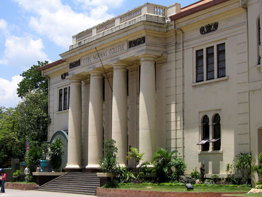
Cebu Normal University ( ceb, Unibersidad Normal sa Sugbo), also referred to by its acronym CNU, is a public university, state research university in Cebu City, Cebu, Philippines established in 1902. CNU is designated by the Commission on Higher Education (CHED) as Center of Excellence (COE) in both Nursing Education and Teacher Education. History Early history CNU was established in 1902 by ''Act No. 74'' of the Philippine Commission as a summer institute of the Philippine Normal University (PNS, then a normal school). It was then called "Cebu Normal School" and was the located at Colegio Logarta building (later Hijos del Pueblo) at the Colon Street by which the Cebu provincial government pays the amount of ₱200 monthly. In 1906, the school became an adjunct to the then Abellana National School#History, Cebu Provincial High School (now Abellana National School) and transferred to the new site. In 1924, the school became independent of PNS, obtained the normal school statu ... [...More Info...] [...Related Items...] OR: [Wikipedia] [Google] [Baidu] |
Abellana National School
Abellana National School (ANS) is located in Cebu City, Philippines. It is a public high school established in the year 1902. History Abellana National School is situated at Osmeña Boulevard, Barangay Sambag II in Cebu City. It was formerly the Cebu State College of Science and Technology ( CSCST) - College of Arts and Trades. On June 10, 1983, it was converted into an extension campus of the CSCST by the passage of Batasang Pambansa Bilang 412, now already known as Abellana National School The school was the first Provincial High School, organized under the authority of Act. No. 372 of the Philippine Commission passed March 6, 1902, and the high school was formally organized in Cebu in 1906. The school at that time offered a purely academic curriculum and it operated until the outbreak of World War II World War II or the Second World War, often abbreviated as WWII or WW2, was a world war that lasted from 1939 to 1945. It involved the vast majority of the world' ... [...More Info...] [...Related Items...] OR: [Wikipedia] [Google] [Baidu] |
Cebu City Medical Center
The Cebu City Medical Center (CCMC) is a hospital in Cebu City. It currently operates inside the Bureau of Fire Protection's Region 7 compound after the hospital's previous building was significantly damaged due to the 2013 Central Visayas earthquake. History The Cebu City Medical Center used to be hosted in a four-storey building and had a capacity of 300 beds which was declared structurally unfit and demolished after sustaining heavy damage due to an earthquake on October 15, 2013. Under the administration of then Mayor Michael Rama, the building was demolished in February 2014. In June 2015, the construction of a new hospital building was approved by the Cebu City government. C.E. Padilla Construction was the contractor awarded to complete the first and second phase of the hospital building project. Operations temporarily moved to the Bureau of Fire Protection's (BFP) Region 7 compound with the parking lot, main building, and gymnasium refurbished as patient wards and other ... [...More Info...] [...Related Items...] OR: [Wikipedia] [Google] [Baidu] |
Camotes Islands
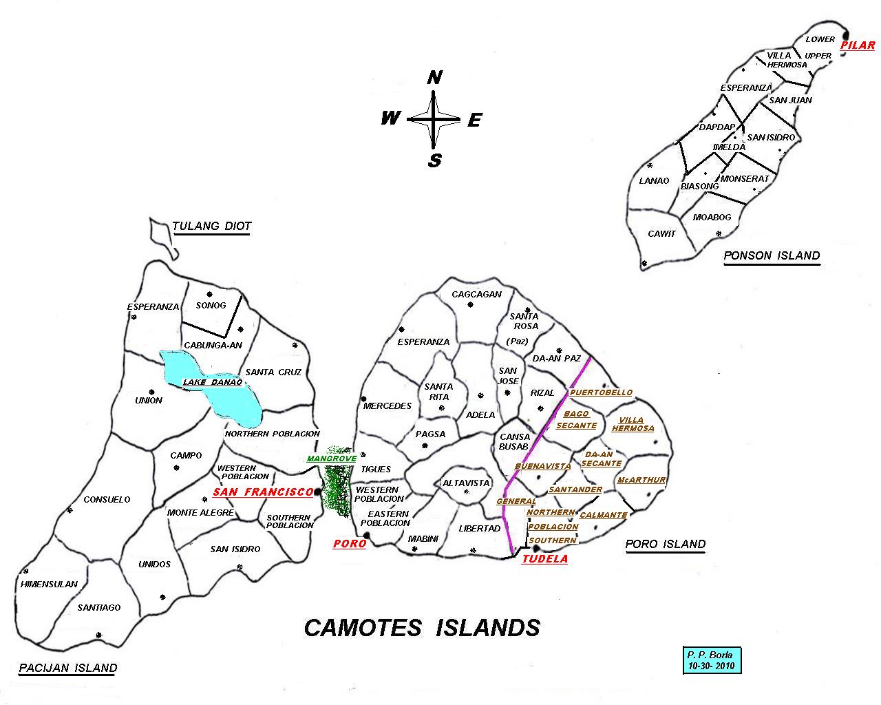
Camotes Islands is a group of islands in the Camotes Sea, Philippines. Combined area is . The island group is located east of Cebu Island, southwest of Leyte Island, and north of Bohol Island. It is from Cebu City and is part of Cebu. According to the 2015 census, it has a population of 102,996. Population has grown % since 1990, equivalent to an annual growth rate of . Nearest landfall, from north end of Ponson island to southern Leyte, is about . From Consuelo port to Danao is as the crow flies. From south of Pacijan to Bohol is about . Sometimes known as the "''Lost Horizon'' of the south", within recent years Camotes has seen increased visitors and tourism and a growing expatriate community. Apart from natural attractions on land, there is also a score of dive sites around the islands. Geography Camotes Islands comprises three major islands and one minor islet, divided between four municipalities. On Poro Island are the municipalities of Poro and Tudela. Pacijan Isla ... [...More Info...] [...Related Items...] OR: [Wikipedia] [Google] [Baidu] |
San Francisco, Cebu
San Francisco, officially the Municipality of San Francisco ( ceb, Lungsod sa San Francisco; tgl, Bayan ng San Francisco), is a 3rd class municipality in the province of Cebu, Philippines. According to the 2020 census, it has a population of 59,236 people. It is one of the municipalities that comprise the Camotes Islands. San Francisco is bordered to the north by the Province of Leyte in the Camotes Sea, to the west is the Camotes Sea Facing Catmon, to the east is the island of Poro with town of Poro and to the south is the Camotes Sea. History Protohistory Carl Guthe, director of the University of Michigan Anthropological Museum, during his 1923-25 collecting trip and explorations of archaeological sites in the Philippines, conducted an archeological dig in a cave site on Tulang. Located on the southeastern coast of the island, the cave measures about . Guthe reported it to contain bone fragments and teeth of about 60 individuals. Associated grave goods included earthenwar ... [...More Info...] [...Related Items...] OR: [Wikipedia] [Google] [Baidu] |
Daanbantayan
Daanbantayan, officially the Municipality of Daanbantayan ( ceb, Lungsod sa Daanbantayan; tgl, Bayan ng Daanbantayan), is a 1st class municipality in the province of Cebu, Philippines. According to the 2020 census, it has a population of 93,502 people. Located at the northern tip of Cebu island, Daanbantayan celebrates its annual fiesta along with the ''Haladaya Festival'' which starts 21 August and ends with street-dancing on 30 August, in honor of Datu Daya, the legendary founder of the town. Daanbantayan is bordered on the north by the Visayan Sea, to the west by Bantayan Island, on the east by the Camotes Sea, and on the south by the town of Medellin. It is from Cebu City. History The name Daanbantayan was derived from two words: the word "''daan''", which means "old" in Cebuano, and the word "''bantayan''", which refers to a place that served as a look out for Moro raiders during the Pre-Hispanic Philippines. The original site of the town might have been at an e ... [...More Info...] [...Related Items...] OR: [Wikipedia] [Google] [Baidu] |
Carmen, Cebu
Carmen, officially the Municipality of Carmen ( ceb, Dakbayan sa Carmen; tgl, Bayan ng Carmen), is a 3rd class municipality in the province of Cebu, Philippines. According to the 2020 census, it has a population of 57,897 people. The town fiesta is celebrated every 28 August in honor of St. Augustine of Hippo. History The town of Carmen was formerly known as Bugho, it became a municipality on June 16, 1851, through the efforts of Facundo Buot. The first municipal president was Fabio Buot when the first elections was held by the Americans in 1899. Geography Carmen is bordered on the north by the town of Catmon, to the west by the town of Tuburan, on the east by the Camotes Sea, and on the south by the City of Danao. It is from Cebu City. Barangays Carmen comprises 21 barangays: Climate Demographics Economy Mandaue City-based Shemberg Marketing Corporation, the world's number one supplier of refined carrageenan since 2005, owns and operates ... [...More Info...] [...Related Items...] OR: [Wikipedia] [Google] [Baidu] |
Argao
Argao, officially the Municipality of Argao ( ceb, Lungsod sa Argao; tgl, Bayan ng Argao), is a 1st class municipality in the province of Cebu, Philippines. According to the 2020 census, it has a population of 78,187 people. Geography The municipality of Argao is located in the southeast of the province of Cebu, from Cebu City. Argao is bordered to the north by the municipality of Sibonga, to the west are the municipalities of Ronda, Alcantara and Moalboal, to the east is the Cebu Strait, and to the south is the municipality of Dalaguete. Barangays Argao comprises 45 barangays: Climate Demographics Economy Tourism The economy of the town of Argao heavily revolves around farming, baking, and tourism. Argao is renowned in Cebu as the "Torta Capital of the Province" because of its local delicacy, the ''Torta'', a Cebuano tart that is inspired from the Spanish tart, but differs in its recipe by using ''tubâ'' or palm wi ... [...More Info...] [...Related Items...] OR: [Wikipedia] [Google] [Baidu] |
Moalboal
Moalboal, officially the Municipality of Moalboal ( ceb, Lungsod sa Moalboal; tgl, Bayan ng Moalboal), is a 4th class municipality in the province of Cebu, Philippines. According to the 2020 census, it has a population of 36,930 people. Extending as a peninsula on the south-western tip of Cebu, Moalboal is bordered to the west by the Tañon Strait. Negros Island can be seen from the western shoreline. Moalboal is located from Cebu City. Moalboal is bordered to the north by the town of Alcantara, to the west is the Tañon Strait, to the east is the town of Argao, and to the south is the town of Badian. Pescador Island, a popular tourist attraction, is part of the municipality. Geography Barangays Moalboal comprises 15 barangays: Climate Demographics Though the majority of the people in Moalboal are Cebuanos, a few members of cultural minorities have found their way there. Bajaus who are similar to Muslim nomads, are often seen in the streets, esp ... [...More Info...] [...Related Items...] OR: [Wikipedia] [Google] [Baidu] |
Tuburan, Cebu
Tuburan, officially the Municipality of Tuburan ( ceb, Lungsod sa Tuburan; tgl, Bayan ng Tuburan), is a 2nd class municipality in the province of Cebu, Philippines. According to the 2020 census, it has a population of 68,167 people. Tuburan was the hometown of the revolutionary leader Arcadio Maxilom. And is also known for its crystal-clear springs, beaches, creeks, rivers, caves and natural attractions. Industrial and domestic products include decorative apparel and fashion accessories made of seashells and coconut shells, wood and other indigenous products. Tubod Festival is held every 13th of June in honor of the parish patron, Saint Anthony of Padua. History Foundation Tuburan was founded in the 1851 by Don Mariano Montebon who came from the town of Sogod. The townsite was first located at Daan Lungsod which is just across the Adela River, north of the present poblacion. Tuburan got its name from the prevalence of springs, which are the sources of potable water for house ... [...More Info...] [...Related Items...] OR: [Wikipedia] [Google] [Baidu] |
Danao, Cebu
Danao, officially the City of Danao ( ceb, Dakbayan sa Danao; fil, Lungsod ng Danao), is a 3rd class component city in the province of Cebu, Philippines. According to the 2020 census, it has a population of 156,321 people. Danao is within the Metro Cebu area. Geography Danao is in the Metro Cebu area and is from Cebu City. It is bordered on the north by Carmen, on the west by Asturias, on the south by Compostela and to the east by the Camotes Sea. Barangays Danao City comprises 42 barangays: Climate Demographics Economy Mining Railways The Cebu railway ran from Danao south to Argao. During World War II, the bridges, tracks and Central Station were bombed so extensively that the railway never recovered, and it closed in 1942. After that, whatever was left after the war was dug up to become the Cebu North Road. Now a new light railway is to be built in Cebu. Sugar The old system of milling sugar cane used to produce ... [...More Info...] [...Related Items...] OR: [Wikipedia] [Google] [Baidu] |
Warehouse
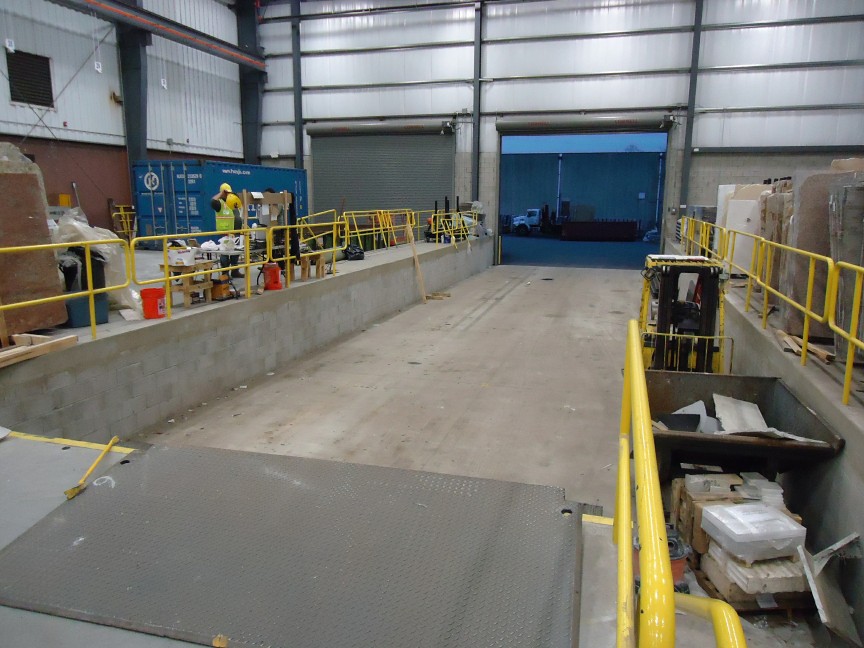
A warehouse is a building for storing goods. Warehouses are used by manufacturers, importers, exporters, wholesalers, transport businesses, customs, etc. They are usually large plain buildings in industrial parks on the outskirts of cities, towns, or villages. Warehouses usually have loading docks to load and unload goods from trucks. Sometimes warehouses are designed for the loading and unloading of goods directly from railways, airports, or seaports. They often have cranes and forklifts for moving goods, which are usually placed on ISO standard pallets and then loaded into pallet racks. Stored goods can include any raw materials, packing materials, spare parts, components, or finished goods associated with agriculture, manufacturing, and production. In India and Hong Kong, a warehouse may be referred to as a "godown". There are also godowns in the Shanghai Bund. History Prehistory and ancient history A warehouse can be defined functionally as a building in whic ... [...More Info...] [...Related Items...] OR: [Wikipedia] [Google] [Baidu] |


