|
Castledaly
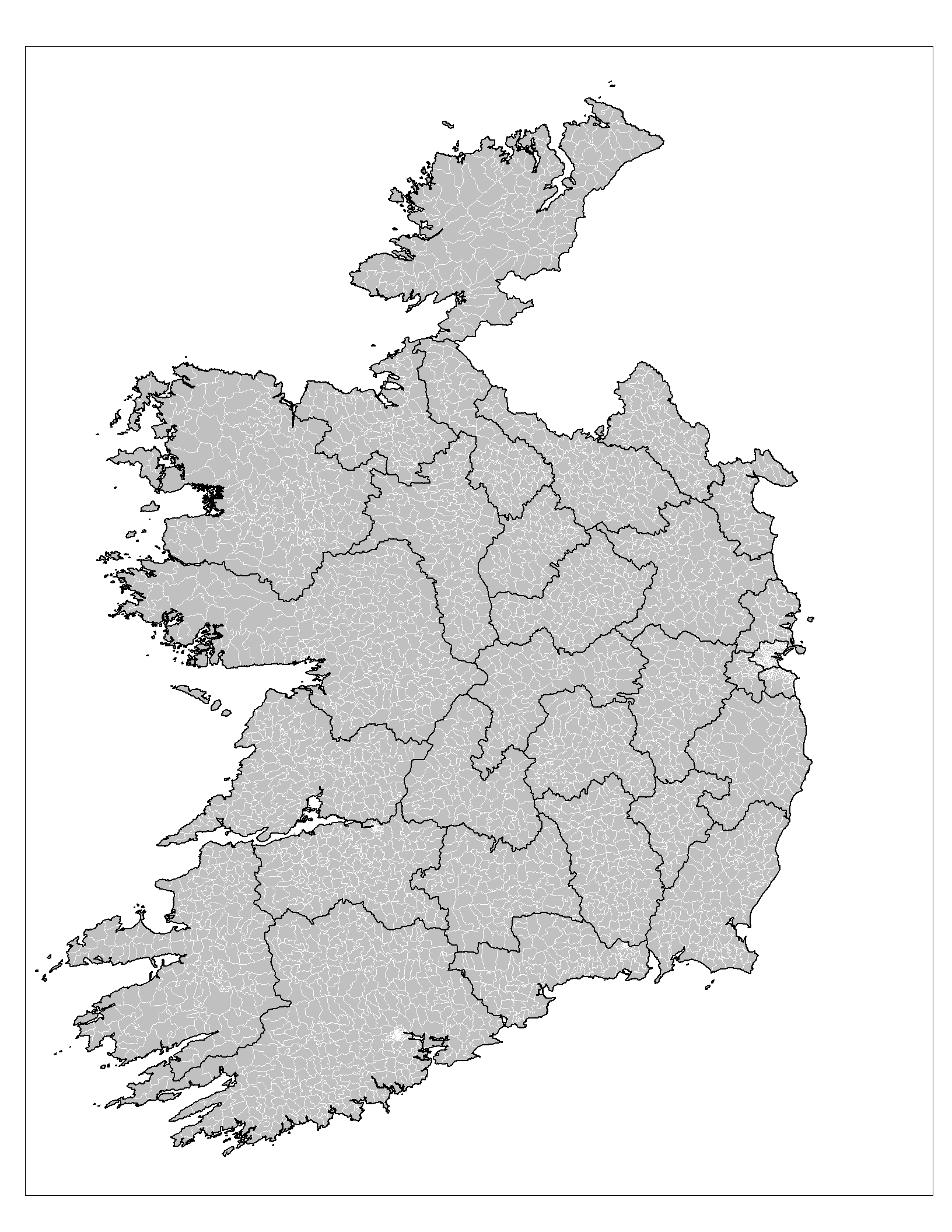
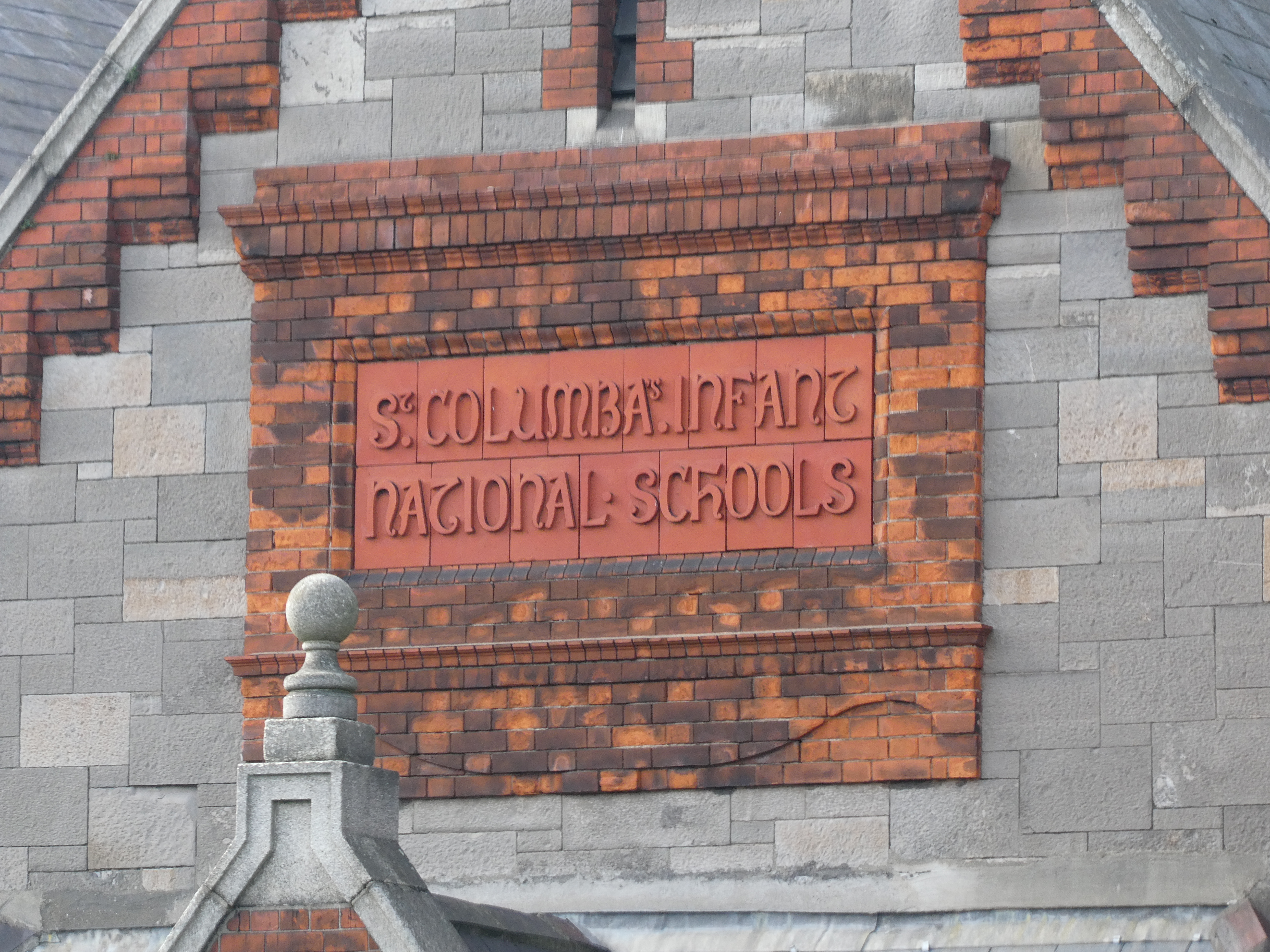
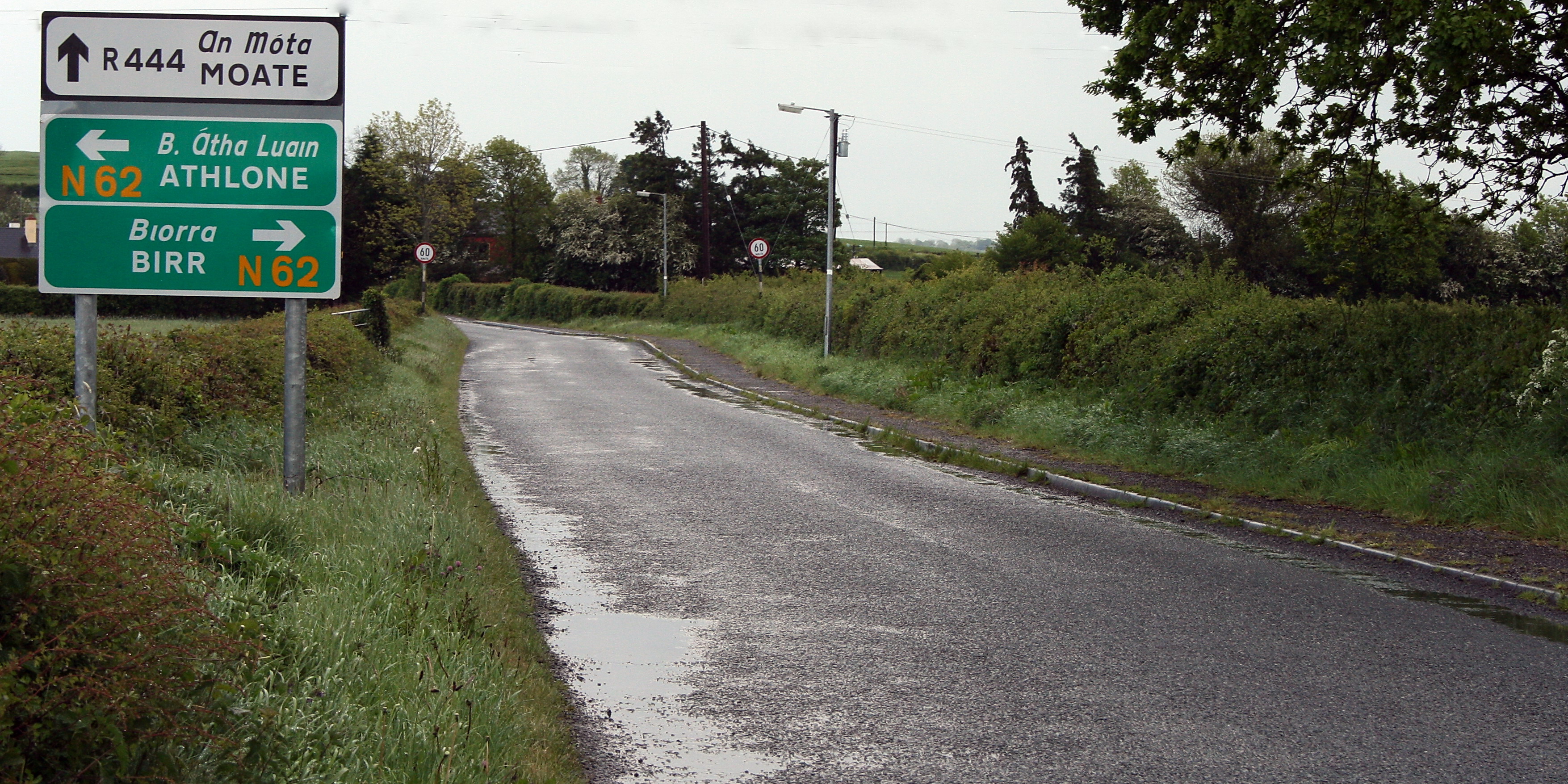
Castledaly () is a village and electoral district in County Westmeath, Ireland. It is located on the R444 regional road 5 km southwest of the town of Moate Moate (; ) is a town in County Westmeath, Ireland. The name ''An Móta'' is derived from the term motte-and-bailey, as the Normans built an example of this type of fortification here. The earthwork is still visible behind the buildings on the m ... and about 13km from Athlone. Village Castledaly village consists of a church, community centre, pub, GAA pitch and walking track and a children's playground. Castledaly Manor, a nearby Georgian stately home built around 1780, is now used as a Christian Camp and Conference Centre. The local national (primary) school, Kilcleagh National School, had approximately 100 pupils enrolled as of 2020. The village has a Tidy Towns committee. See also * List of towns and villages in Ireland References Towns and villages in County Westmeath {{Westmeath-geo-stub ... [...More Info...] [...Related Items...] OR: [Wikipedia] [Google] [Baidu] |
List Of Towns And Villages In The Republic Of Ireland
This is a link page for cities, towns and villages in the Republic of Ireland, including townships or urban centres in Dublin, Cork, Limerick, Galway, Waterford and other major urban areas. Cities are shown in bold; see City status in Ireland for an independent list. __NOTOC__ A B C D E F G H I J K L M N O P Q R S T U V W Y See also *List of places in Ireland ** List of places in the Republic of Ireland **: List of cities, boroughs and towns in the Republic of Ireland, with municipal councils and legally defined boundaries. **: List of census towns in the Republic of Ireland as defined by the Central Statistics Office, sorted by county. Includes non-municipal towns and suburbs outside municipal boundaries. ** List of towns in the Republic of Ireland by population **: List of towns in the Republic of Ireland/2002 Census Records **: List of towns in the Republic of Ireland/2006 Censu ... [...More Info...] [...Related Items...] OR: [Wikipedia] [Google] [Baidu] |
County Westmeath
"Noble above nobility" , image_map = Island of Ireland location map Westmeath.svg , subdivision_type = Sovereign state, Country , subdivision_name = Republic of Ireland, Ireland , subdivision_type1 = Provinces of Ireland, Province , subdivision_name1 = , subdivision_type2 = Regions of Ireland, Region , subdivision_name2 = Eastern and Midland Region, Eastern and Midland , seat_type = County town , seat = Mullingar , parts_type = Largest settlement , parts = Athlone , leader_title = Local government in the Republic of Ireland, Local authority , leader_name = Westmeath County Council , leader_title2 = Dáil constituencies , leader_name2 = , leader_title3 = European Parliament constituencies in the Republic of Ireland, EP constituency , leader_name3 = Midlands–North-West (European Parliament constituenc ... [...More Info...] [...Related Items...] OR: [Wikipedia] [Google] [Baidu] |
Longford–Westmeath (Dáil Constituency)
Longford–Westmeath is a parliamentary constituency represented in Dáil Éireann, the lower house of the Irish parliament or Oireachtas. The constituency elects 4 deputies ( Teachtaí Dála, commonly known as TDs) on the system of proportional representation by means of the single transferable vote (PR-STV). History and boundaries The constituency previously existed from 1921 to 1937 and from 1948 to 1992, but was abolished for the 1992 general election. It was re-created by the Electoral (Amendment) Act 2005 which gave effect to the 2004 ''Constituency Commission Report on Dáil Constituencies'', and was first used in its current form at the 2007 general election. It contains the County Longford portion of the former Longford–Roscommon constituency, and most of the former Westmeath constituency apart from the north-eastern area around Castlepollard and Delvin, which became part of the new Meath West constituency. The Electoral (Amendment) (Dáil Constituencies) Act 2 ... [...More Info...] [...Related Items...] OR: [Wikipedia] [Google] [Baidu] |
Electoral Division (Ireland)
An electoral division (ED, ) is a legally defined administrative area in the Republic of Ireland, generally comprising multiple townlands, and formerly a subdivision of urban and rural districts. Until 1996, EDs were known as district electoral divisions (DEDs, ) in the 29 county council areas and wards in the five county boroughs. Until 1972, DEDs also existed in Northern Ireland. The predecessor poor law electoral divisions were introduced throughout the island of Ireland in the 1830s. The divisions were used as local-government electoral areas until 1919 in what is now the Republic and until 1972 in Northern Ireland. History until partition Electoral divisions originated under the Poor Relief (Ireland) Act 1838 as "poor law electoral divisions": electoral divisions of a poor law union (PLU) returning one or more members to the PLU's board of guardians. The boundaries of these were drawn by Poor Law Commissioners, with the intention of producing areas roughly equivalent in ... [...More Info...] [...Related Items...] OR: [Wikipedia] [Google] [Baidu] |
Tidy Towns (Ireland)
Tidy Towns (Irish: ''Bailte Slachtmhara'') is an annual competition, first held in 1958, organised by the Department of Rural and Community Development in order to honour the tidiest and most attractive cities, towns and villages in the Republic of Ireland. The competition is organised on a national basis, and entrants must complete modules including Overall Developmental Approach (5 Year Plan), The Built Environment, Landscaping, Wildlife & Natural Amenities, Litter Control, Tidiness, Waste Minimisation, Residential Areas, Roads and Streets & Back Areas. The Competition is judged during the summer months (May to August) by an independent adjudicator, who issues each town with a written report complimenting positive development and actions and providing positive suggestions on how the community can improve their general surroundings. This competition covers many aspects of environment and prizes are awarded to winners of all areas. Other than that, there's an overall winner which ... [...More Info...] [...Related Items...] OR: [Wikipedia] [Google] [Baidu] |
National School (Ireland)
In Ireland, a national school () is a type of primary school that is financed directly by the state, but typically administered jointly by the state, a patron body, and local representatives. In national schools, most major policies, such as the curriculum and teacher salaries and conditions, are managed by the state through the Department of Education and Skills. Minor policies of the school are managed by local people, sometimes directed by a member of the clergy, as representative of the patron, through a local 'board of management'. Most primary schools in Ireland fall into this category, which is a pre-independence concept. While there are other forms of primary school in Ireland, including a relatively small number of private denominational schools which do not receive state aid, there were just 34 such private primary schools in 2012, with a combined enrollment of 7,600 pupils. By comparison there were, as of 2019, over 3,200 national schools in Ireland with a combined en ... [...More Info...] [...Related Items...] OR: [Wikipedia] [Google] [Baidu] |
Athlone
Athlone (; ) is a town on the border of County Roscommon and County Westmeath, Ireland. It is located on the River Shannon near the southern shore of Lough Ree. It is the second most populous town in the Midlands Region with a population of 21,349 in the 2016 census. Most of the town lies on the east bank of the river, within the townland of the same name; however, by the terms of the Local Government Act of 1898, six townlands on the west bank of the Shannon, formerly in County Roscommon, were incorporated into the town, and consequently, into the county of Westmeath. Around 100 km west of Dublin, Athlone is near the geographical centre of Ireland, which is north-northwest of the town, in the area of Carnagh East in County Roscommon. History Athlone Castle, situated on the western bank of the River Shannon, is the geographical and historical centre of Athlone. Throughout its early history, the ford of Athlone was strategically important, as south of Athlone the Sha ... [...More Info...] [...Related Items...] OR: [Wikipedia] [Google] [Baidu] |
Moate
Moate (; ) is a town in County Westmeath, Ireland. The name ''An Móta'' is derived from the term motte-and-bailey, as the Normans built an example of this type of fortification here. The earthwork is still visible behind the buildings on the main street. The town later became an important marketplace and Quaker village. It has made the town much more wealthy. There are several extant examples of Quaker houses on the main street, which itself is typical of an Irish marketplace. Location Moate is on the Cloghatanny River, also known as the Moate Stream, which is a tributary of the River Brosna. The confluence between the Cloghatanny and Brosna is to the southeast of Moate. The town is on the R446 road between Kinnegad and Athlone. Before July 2008, this was the N6 road, a national primary route, and Moate was a serious traffic bottleneck. The new M6 motorway bypasses the town. Amenities Moate is a growing town with an amenity and heritage park, a greenway running through t ... [...More Info...] [...Related Items...] OR: [Wikipedia] [Google] [Baidu] |
R444 Road (Ireland)
The R444 road is a regional road in Ireland linking R357 at Shannonbridge, County Offaly with the R446 at Farnagh three kilometers west of Moate in County Westmeath. The road is long. See also *Roads in Ireland *National primary road *National secondary road ReferencesRoads Act 1993 (Classification of Regional Roads) Order 2006– Department of Transport The Department for Transport (DfT) is a department of His Majesty's Government responsible for the English transport network and a limited number of transport matters in Scotland, Wales and Northern Ireland that have not been devolved. The d ... {{Roads in Ireland Regional roads in the Republic of Ireland Roads in County Offaly Roads in County Westmeath ... [...More Info...] [...Related Items...] OR: [Wikipedia] [Google] [Baidu] |
Republic Of Ireland
Ireland ( ga, Éire ), also known as the Republic of Ireland (), is a country in north-western Europe consisting of 26 of the 32 counties of the island of Ireland. The capital and largest city is Dublin, on the eastern side of the island. Around 2.1 million of the country's population of 5.13 million people resides in the Greater Dublin Area. The sovereign state shares its only land border with Northern Ireland, which is part of the United Kingdom. It is otherwise surrounded by the Atlantic Ocean, with the Celtic Sea to the south, St George's Channel to the south-east, and the Irish Sea to the east. It is a unitary, parliamentary republic. The legislature, the , consists of a lower house, ; an upper house, ; and an elected President () who serves as the largely ceremonial head of state, but with some important powers and duties. The head of government is the (Prime Minister, literally 'Chief', a title not used in English), who is elected by the Dáil and appointed by ... [...More Info...] [...Related Items...] OR: [Wikipedia] [Google] [Baidu] |
Irish Grid Reference System
The Irish grid reference system is a system of geographic grid references used for paper mapping in Ireland (both Northern Ireland and the Republic of Ireland). The Irish grid partially overlaps the British grid, and uses a similar co-ordinate system but with a meridian more suited to its westerly location. Usage In general, neither Ireland nor Great Britain uses latitude or longitude in describing internal geographic locations. Instead grid reference systems are used for mapping. The national grid referencing system was devised by the Ordnance Survey, and is heavily used in their survey data, and in maps (whether published by the Ordnance Survey of Ireland, the Ordnance Survey of Northern Ireland or commercial map producers) based on those surveys. Additionally grid references are commonly quoted in other publications and data sources, such as guide books or government planning documents. 2001 recasting: the ITM grid In 2001, the Ordnance Survey of Ireland and the Ordnance Su ... [...More Info...] [...Related Items...] OR: [Wikipedia] [Google] [Baidu] |
Provinces Of Ireland
There have been four Provinces of Ireland: Connacht (Connaught), Leinster, Munster, and Ulster. The Irish language, Irish word for this territorial division, , meaning "fifth part", suggests that there were once five, and at times Kingdom_of_Meath, Meath has been considered to be the fifth province; in the medieval period, however, there were often more than five. The number of provinces and their delimitation fluctuated until 1610, when they were permanently set by the English administration of James VI and I, James I. The provinces of Ireland no longer serve administrative or political purposes but function as historical and cultural entities. Etymology In modern Irish language, Irish the word for province is (pl. ). The modern Irish term derives from the Old Irish (pl. ) which literally meant "a fifth". This term appears in 8th-century law texts such as and in the legendary tales of the Ulster Cycle where it refers to the five kingdoms of the "Pentarchy". MacNeill enumer ... [...More Info...] [...Related Items...] OR: [Wikipedia] [Google] [Baidu] |


.jpg)

