|
Carstensz Glacier
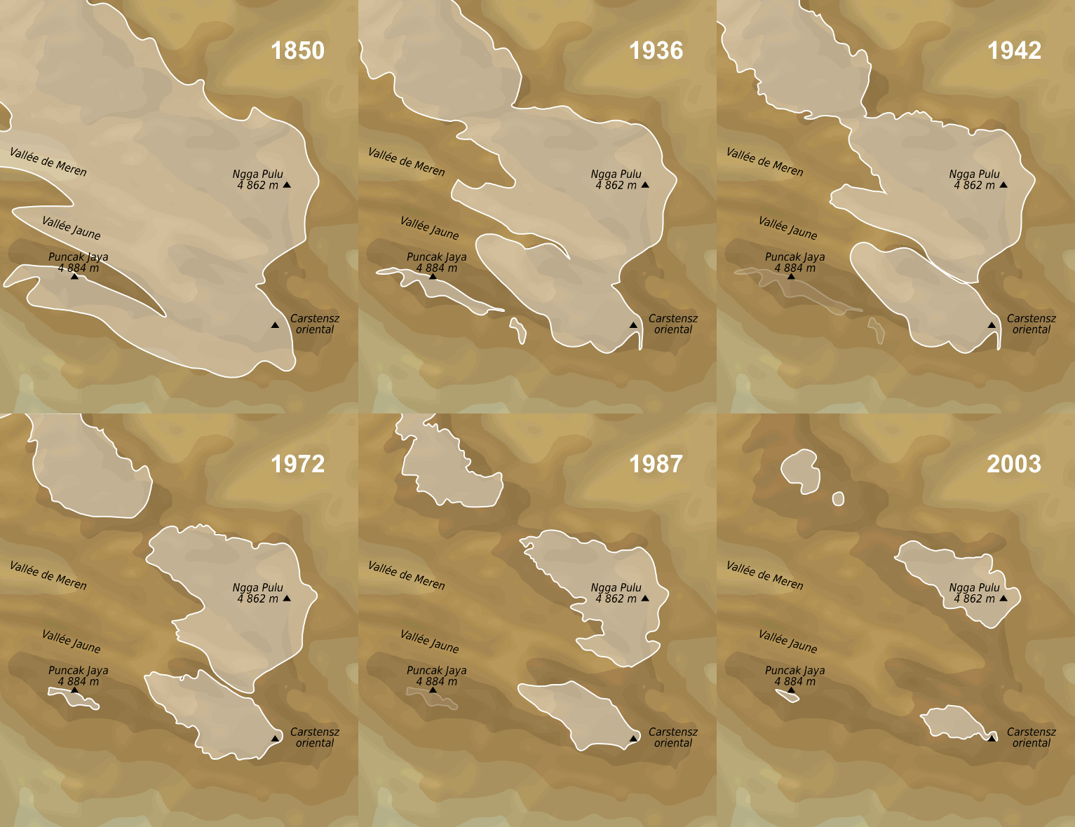
The Carstensz Glacier is near the peak of Puncak Jaya (sometimes called ''Mount Carstensz'' or the ''Carstensz Pyramid'') which is a mountain in the Sudirman Range of the island of New Guinea, territorially the eastern highlands of Central Papua, Indonesia. The glacier is situated at an elevation of approximately and is east of the summit tower of Puncak Jaya. In 2002 the Carstensz Glacier was in length and wide. The glacier is named after the 17th century Dutch explorer Jan Carstenszoon, commonly known as Jan Carstensz. Background Research presented in 2004 of IKONOS satellite imagery of the New Guinean glaciers indicated that in the two years from 2000 to 2002, the Carstensz Glacier had lost a further 6.8% of its surface area. An expedition to the remaining glaciers on Puncak Jaya in 2010 discovered that the ice on the glaciers there is about thick and thinning at a rate of annually. At that rate, the remaining glaciers in the immediate region near Puncak Jaya were expec ... [...More Info...] [...Related Items...] OR: [Wikipedia] [Google] [Baidu] |
Grasberg Mine
The Grasberg mine has one of the largest reserves of gold and copper in the world. It is located in Mimika Regency, Central Papua, Indonesia near Puncak Jaya. It is operated by PT Freeport Indonesia (PTFI, ''see below''), a joint venture between the government of Indonesia, government of Papua, and American company Freeport-McMoRan (FCX). FCX operates under a Contract of Work (CoW) agreement with the government of Indonesia, which allows Freeport to conduct exploration, mining and production activities in a area (Block A). It also conducts exploration activities in a area (Block B). At 31 December 2020 Grasberg had proven and probable mineral reserves of 33.4 billion pounds (15.1 million tonnes) of copper, 28.3 million ounces of gold and 130.6 million ounces of silver. Grasberg has five mining operations: Grasberg open pit, Grasberg Block Cave underground mine, Deep Ore Zone underground mine, Deep Mill Level Zone underground mine, and Big Gossan underground mine. The 202 ... [...More Info...] [...Related Items...] OR: [Wikipedia] [Google] [Baidu] |
Puncak Jaya
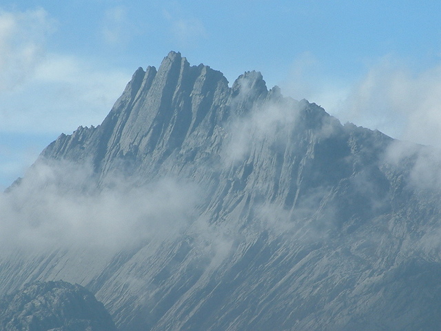
Puncak Jaya (; literally "Glorious Peak") or Carstensz Pyramid, Mount Jayawijaya or Mount Carstensz () on the island of New Guinea, with an elevation of , is the list of islands by highest point, highest mountain peak of an island on Earth. The mountain is located in the Sudirman Range of the highlands of Central Papua, Indonesia, in the southwest of Puncak Jaya Regency. The massive, open cut Grasberg mine, Grasberg gold and copper mine, the world's list of largest gold mines by production, fifth-largest gold mine, is west of Puncak Jaya. Other summits are ''Carstensz East, East Carstensz Peak'' (), ''Sumantri'' () and ''Ngga Pulu'' (). Other names include Nemangkawi in the Amung language, Amungkal language, Carstensz Toppen and Gunung Soekarno.Greater Atlas of the World, Mladinska knjiga, Ljubljana, Slovenia, 1986. It is also the highest point between the Himalayas and the Andes. Some sources claim Papua New Guinea's Mount Wilhelm, , as the highest mountain peak in Oceania, ... [...More Info...] [...Related Items...] OR: [Wikipedia] [Google] [Baidu] |
Sudirman Range
The Sudirman Range, also known as the Snow Mountains,"Sudirman Mountains (Snow Mountains)". Papua Insects Foundation. Accessed 5 August 2021/ref> Dugunduguoo, or Nassau Range is a mountain range in Central Papua province, Indonesia. It is named after the first armed forces commander-in-chief and Indonesian national hero Sudirman. It comprises a western portion of the Maoke Mountains. The highest peak in Oceania and Australasia, Puncak Jaya (4,884 m), is located here, as well as the large Grasberg copper and gold mine, operated by the Freeport company based out of the United States. Other peaks of the Sudirman Range are: * Sumantri (4,870 m) * Ngga Pulu (4,863 m) * Carstensz East (4,820 m or 4,808 m) See also * Lorentz National Park Lorentz National Park is a national park located in Central Papua, Indonesia, in the southwest of western New Guinea. With an area of 25,056 km2 (9,674 mi2), it is the largest national park in Southeast Asia. In 1999 Lorentz was declar ... [...More Info...] [...Related Items...] OR: [Wikipedia] [Google] [Baidu] |
Central Papua
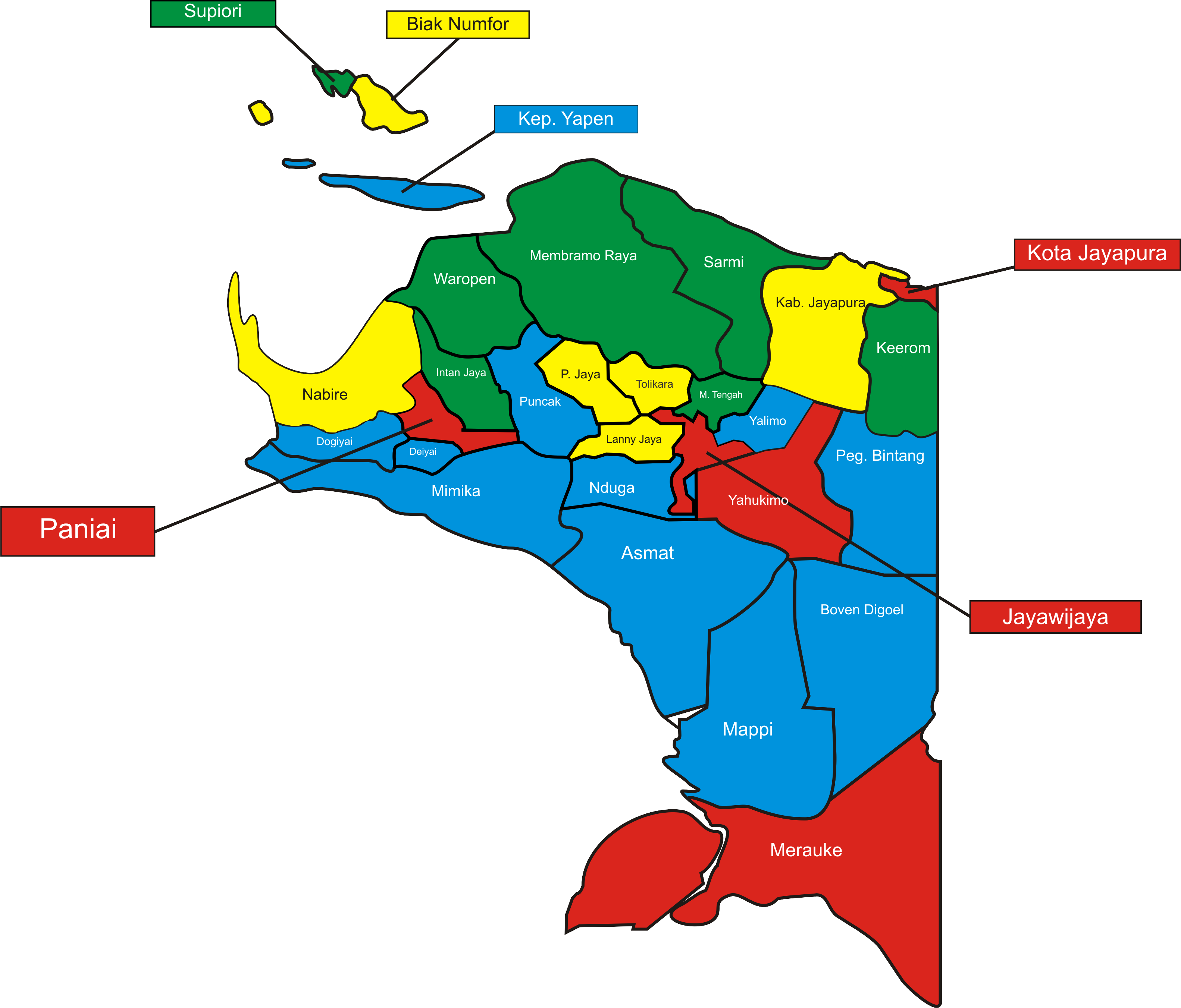
Central Papua, officially the Central Papua Province ( id, Provinsi Papua Tengah) is an Indonesian province located in the central region of Western New Guinea. It was formally established on 11 November 2022 from the former eight western regencies of the province of Papua. It covers an area of 66,130.49 km2 and had an estimated population of about 1,409,000 in mid 2021. It is bordered by the Indonesian provinces of West Papua to the west, the residual Papua to the north, and by Highland Papua and South Papua to the east. The designated administrative capital, Nabire, is the second largest town in Central Papua (after Timika), the economic centre of the province, and the seat of the Central Papua provincial government. The provincial border roughly follows the cultural region of Mee Pago and parts of Saireri. History After the approval of the bill for the creation of the province on 30 June 2022, controversy regarding the capital of the new province resulted in mass demonstra ... [...More Info...] [...Related Items...] OR: [Wikipedia] [Google] [Baidu] |
Indonesia
Indonesia, officially the Republic of Indonesia, is a country in Southeast Asia and Oceania between the Indian and Pacific oceans. It consists of over 17,000 islands, including Sumatra, Java, Sulawesi, and parts of Borneo and New Guinea. Indonesia is the world's largest archipelagic state and the 14th-largest country by area, at . With over 275 million people, Indonesia is the world's fourth-most populous country and the most populous Muslim-majority country. Java, the world's most populous island, is home to more than half of the country's population. Indonesia is a presidential republic with an elected legislature. It has 38 provinces, of which nine have special status. The country's capital, Jakarta, is the world's second-most populous urban area. Indonesia shares land borders with Papua New Guinea, East Timor, and the eastern part of Malaysia, as well as maritime borders with Singapore, Vietnam, Thailand, the Philippines, Australia, Palau, and India ... [...More Info...] [...Related Items...] OR: [Wikipedia] [Google] [Baidu] |
New Guinea
New Guinea (; Hiri Motu Hiri Motu, also known as Police Motu, Pidgin Motu, or just Hiri, is a language of Papua New Guinea, which is spoken in surrounding areas of Port Moresby (Capital of Papua New Guinea). It is a simplified version of Motu, from the Austronesian l ...: ''Niu Gini''; id, Papua, or , historically ) is the List of islands by area, world's second-largest island with an area of . Located in Oceania in the southwestern Pacific Ocean, the island is separated from Mainland Australia, Australia by the wide Torres Strait, though both landmasses lie on the same continental shelf. Numerous smaller islands are located to the west and east. The eastern half of the island is the major land mass of the independent state of Papua New Guinea. The western half, known as Western New Guinea, forms a part of Indonesia and is organized as the provinces of Papua (province), Papua, Central Papua, Highland Papua, South Papua, Southwest Papua, and West Papua (province), West ... [...More Info...] [...Related Items...] OR: [Wikipedia] [Google] [Baidu] |
Jan Carstenszoon
Jan Carstenszoon or more commonly Jan Carstensz In Dutch patronyms ending in -szoon were almost universally abbreviated to -sz was a 17th-century Dutch explorer. In 1623, Carstenszoon was commissioned by the Dutch East India Company to lead an expedition to the southern coast of New Guinea and beyond, to follow up the reports of land sighted further south in the 1606 voyages of Willem Janszoon in the ''Duyfken''. Setting sail from Ambon in the Dutch East Indies with two ships, the yacht ''Pera'' (captained by Carstenszoon) and ''Arnhem'' (captained by Willem Joosten van Colster), the ships travelled along the south coast of New Guinea, then headed south to Cape York Peninsula and the Gulf of Carpentaria. On 14 April 1623, Cape Keerweer was passed. Landing in search of fresh water for his stores, Carstenszoon encountered a party of the local indigenous Australian inhabitants. Carstenszoon described them as "poor and miserable looking people" who had "no knowledge of precious metal ... [...More Info...] [...Related Items...] OR: [Wikipedia] [Google] [Baidu] |
Puncak Jaya Icecap 1936
Puncak or Puncak Pass (Indonesian for "top" or "peak") is a mountain pass in West Java, Indonesia. The pass connects the city of Bogor and Bandung, and is spread within the regencies of Bogor, Cianjur, and Sukabumi. Puncak Pass is located between Mt. Gede-Pangrango in the south, and the Jonggol Mountains in the north. The highest point of the pass is about 1500 m altitude. Puncak is a large conglomeration of districts in Bogor Regency, such as Cisarua, Ciawi, Bogor, Ciawi, Megamendung, Cipanas, Cipanas, Cianjur, Cipanas, etc. All of those districts are unified by the main road, Jalan Raya Puncak. History Puncak () is the name of a pass on the Indonesian island of Java, between Bogor and Bandung. The highland, being cooler than Jakarta, is a popular resort area for the inhabitants of Jakarta who are looking for cooler air. Many Swiss-type chalets were built around Puncak during the pre-World War II colonial period. Today Puncak Pass is surrounded by hotels and resorts. T ... [...More Info...] [...Related Items...] OR: [Wikipedia] [Google] [Baidu] |
Puncak Jaya Glaciers 1850-2003 Evolution Map-fr
Puncak or Puncak Pass (Indonesian for "top" or "peak") is a mountain pass in West Java, Indonesia. The pass connects the city of Bogor and Bandung, and is spread within the regencies of Bogor, Cianjur, and Sukabumi. Puncak Pass is located between Mt. Gede-Pangrango in the south, and the Jonggol Mountains in the north. The highest point of the pass is about 1500 m altitude. Puncak is a large conglomeration of districts in Bogor Regency, such as Cisarua, Ciawi, Megamendung, Cipanas, etc. All of those districts are unified by the main road, Jalan Raya Puncak. History Puncak () is the name of a pass on the Indonesian island of Java, between Bogor and Bandung. The highland, being cooler than Jakarta, is a popular resort area for the inhabitants of Jakarta who are looking for cooler air. Many Swiss-type chalets were built around Puncak during the pre-World War II colonial period. Today Puncak Pass is surrounded by hotels and resorts. Tourism Puncak rests within the mountains ... [...More Info...] [...Related Items...] OR: [Wikipedia] [Google] [Baidu] |
Satellite Imagery
Satellite images (also Earth observation imagery, spaceborne photography, or simply satellite photo) are images of Earth collected by imaging satellites operated by governments and businesses around the world. Satellite imaging companies sell images by licensing them to governments and businesses such as Apple Maps and Google Maps. History The first images from space were taken on Sub-orbital spaceflight, sub-orbital flights. The U.S-launched V-2 flight on October 24, 1946, took one image every 1.5 seconds. With an Apsis, apogee of 65 miles (105 km), these photos were from five times higher than the previous record, the 13.7 miles (22 km) by the Explorer II balloon mission in 1935. The first satellite (orbital) photographs of Earth were made on August 14, 1959, by the U.S. Explorer 6. The first satellite photographs of the Moon might have been made on October 6, 1959, by the Soviet satellite Luna 3, on a mission to photograph the far side of the Moon. The Blue Marble ... [...More Info...] [...Related Items...] OR: [Wikipedia] [Google] [Baidu] |
Puncak Jaya Icecap 1972
Puncak or Puncak Pass (Indonesian for "top" or "peak") is a mountain pass in West Java, Indonesia. The pass connects the city of Bogor and Bandung, and is spread within the regencies of Bogor Regency, Bogor, Cianjur Regency, Cianjur, and Sukabumi Regency, Sukabumi. Puncak Pass is located between Mount Gede, Mt. Gede-Pangrango in the south, and the Jonggol Mountains in the north. The highest point of the pass is about 1500 m altitude. Puncak is a large conglomeration of districts in Bogor Regency, such as Cisarua, Ciawi, Bogor, Ciawi, Megamendung, Cipanas, Cipanas, Cianjur, Cipanas, etc. All of those districts are unified by the main road, Jalan Raya Puncak. History Puncak () is the name of a pass on the Indonesian island of Java, between Bogor and Bandung. The highland, being cooler than Jakarta, is a popular resort area for the inhabitants of Jakarta who are looking for cooler air. Many Swiss-type chalets were built around Puncak during the pre-World War II colonial period. To ... [...More Info...] [...Related Items...] OR: [Wikipedia] [Google] [Baidu] |


