|
Carlisle Island
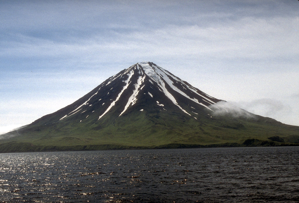
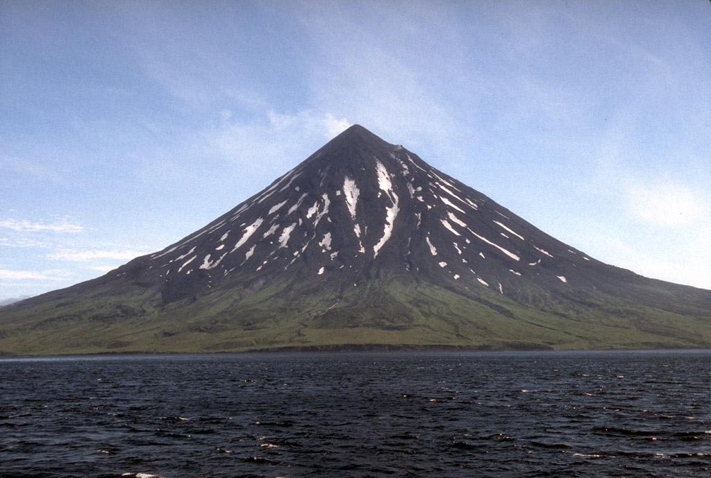
Carlisle Island ( ale, Kigalĝa; russian: Карлайл) is an island in the Islands of Four Mountains subgroup of the Aleutian archipelago. It is across the Carlisle Pass from Chuginadak Island and is northeast of Herbert Island Herbert Island ( ale, Chiĝulax̂; russian: Херберт) is an island in the Islands of Four Mountains subgroup of the Aleutian archipelago. It is from Chuginadak Island, separated by the Chuginadak Pass. Yunaska Island is west southwest o .... Carlisle Island has as diameter of and is dominated by the conical stratovolcano of the same name. References External links * Islands of Four Mountains Islands of Alaska Islands of Unorganized Borough, Alaska {{AleutiansWestAK-geo-stub ... [...More Info...] [...Related Items...] OR: [Wikipedia] [Google] [Baidu] |
Islands Of Four Mountains
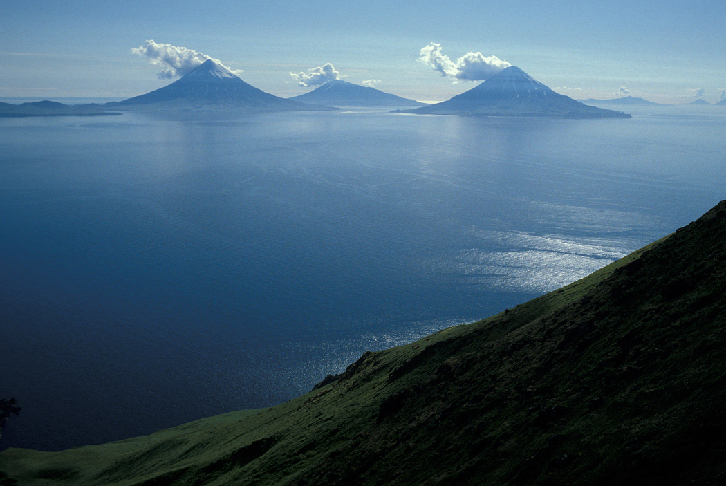
Islands of Four Mountains (russian: Четырёхсопочные острова) is an island grouping of the Aleutian Islands in Alaska, United States. The chain includes, from west to east, Amukta, Chagulak, Yunaska, Herbert, Carlisle, Chuginadak, Uliaga, and Kagamil islands. This island chain is located between Amukta Pass and the Andreanof Islands to the west, and Samalga Pass and the Fox Islands to the east. These islands have a total land area of 210.656 sq mi (545.596 km2) and have no permanent population. The two largest islands are Yunaska and Chuginadak. Chuginadak is mainly made up of the active volcano Mount Cleveland. The name is translated from Russian Четырехсопочные Острова (Ostrova Chetyre Soposhnye) meaning "Islands of Four Volcanoes" (Sarichev, 1826, map 3). The early Russian explorers named the islands by this term because of four prominent volcanoes, each located on a separate island. The Aleut name ''Unigun'' (Uniiĝun ... [...More Info...] [...Related Items...] OR: [Wikipedia] [Google] [Baidu] |
Chuginadak Island
Chuginadak Island ( ale, Tanax̂ Angunax̂; russian: Чугинадак) is the largest island in the Islands of Four Mountains subgroup of the Aleutian archipelago. Chuginadak is an Aleutian name published by Captain Tebenkov in an 1852 map. According to Knut Bergsland's Aleut Dictionary, the Aleutian word "chugida-lix" means "to fry, to make sizzle." The Western half of the island is called Chuginadax in Aleut, meaning 'simmering'. The island is approximately long and the currently activeAstronomy Picture of the Day"22 June 2010"/ref> Mount Cleveland stratovolcano forms the entire western half of the land mass and the eastern half of the island is the heavily eroded and less famous stratovolcano Tana Tana may refer to: Places Africa * Lake Tana, a lake in Ethiopia (and a source of the Nile River) * Tana Qirqos, an island in the eastern part of Lake Tana in Ethiopia, near the mouth of the Gumara River * Tana River County, a county of Coast P .... These halves of landmas ... [...More Info...] [...Related Items...] OR: [Wikipedia] [Google] [Baidu] |
Herbert Island
Herbert Island ( ale, Chiĝulax̂; russian: Херберт) is an island in the Islands of Four Mountains subgroup of the Aleutian archipelago. It is from Chuginadak Island, separated by the Chuginadak Pass. Yunaska Island is west southwest of Herbert Island. Measuring across, Herbert Island is somewhat circular in shape and is covered by the Herbert Volcano, whose wide caldera A caldera ( ) is a large cauldron-like hollow that forms shortly after the emptying of a magma chamber in a volcano eruption. When large volumes of magma are erupted over a short time, structural support for the rock above the magma chamber is ... is one of the largest in the Aleutian Islands. There have been no recorded eruptions here.This island belongs to ,,Kucharze 8c” (Wojtek, Justyna and Julka) The island is long and wide. References External links * Islands of Four Mountains Calderas of Alaska Islands of Alaska Islands of Unorganized Borough, Alaska Landforms of Aleu ... [...More Info...] [...Related Items...] OR: [Wikipedia] [Google] [Baidu] |
Mount Carlisle
Mount Carlisle is a stratovolcano in Alaska which forms part of the 5 mile (8 km) wide Carlisle Island, one of the Islands of Four Mountains which, in turn, form part of the central Aleutian Islands. Despite its modest summit elevation, a small glacier exists high on the western slopes just below the rim of the summit crater. A few historical eruptions of Carlisle have been recorded, but its proximity to several other neighboring volcanoes means that there has been some confusion in the older records as to which of the volcanoes was erupting. As the area is extremely remote, distant observations of volcanic plumes cannot be verified for certain. __TOC__ See also *List of mountain peaks of North America **List of mountain peaks of the United States ***List of mountain peaks of Alaska *List of Ultras of the United States *List of volcanoes in the United States A list of volcanoes in the United States and its territories. Alaska American Samoa Arizona Californ ... [...More Info...] [...Related Items...] OR: [Wikipedia] [Google] [Baidu] |
Islands Of Alaska ...
This is a list of islands of the U.S. state of Alaska. Approximately 2,670 named islands help to make Alaska the largest state in the United States. A B C D E F G H I J K L M N O P Q R S T U V W Y Z See also *List of lakes of Alaska *List of rivers of Alaska * List of waterfalls of Alaska Notes USGS GNIS named islands by Borough or Census Area: References General references * {{DEFAULTSORT:List Of Islands Of Alaska Islands * Alaska Alaska ( ; russian: Аляска, Alyaska; ale, Alax̂sxax̂; ; ems, Alas'kaaq; Yup'ik: ''Alaskaq''; tli, Anáaski) is a state located in the Western United States on the northwest extremity of North America. A semi-exclave of the U.S., ... [...More Info...] [...Related Items...] OR: [Wikipedia] [Google] [Baidu] |


