|
Carinthian Peasant Revolt Of 1478
The Carinthian Peasant Revolt (german: Kärntner Bauernaufstand; sl, koroški kmečki upor) took place in the Duchy of Carinthia (present-day Austria and Slovenia) in 1478. It was the first of several larger peasant revolts in the area of Inner Austria. After several Ottoman raids from 1473 onwards, the rural population established a peasants' association that was an effort to take the defence of the farmers' homes into their own hands and was also aimed against the ruling nobility that had failed to protect the farmers from attacks by marauding Turkish akinji cavalry. The revolt was eventually suppressed. Background The Ottoman forces had entered the Balkan peninsula during the disintegration of the Serbian Empire in the 14th century. In 1389 they defeated a Serbian army at the Battle of Kosovo. Upon the Fall of Constantinople in 1453, Turkish troops advanced northwestwards and in 1469 reached the borders of the Holy Roman Empire entering the southeastern Duchy of Carni ... [...More Info...] [...Related Items...] OR: [Wikipedia] [Google] [Baidu] |
Duchy Of Carinthia
The Duchy of Carinthia (german: Herzogtum Kärnten; sl, Vojvodina Koroška) was a duchy located in southern Austria and parts of northern Slovenia. It was separated from the Duchy of Bavaria in 976, and was the first newly created Imperial State after the original German stem duchies. Carinthia remained a State of the Holy Roman Empire until its dissolution in 1806, though from 1335 it was ruled within the Austrian dominions of the Habsburg dynasty. A constituent part of the Habsburg monarchy and of the Austrian Empire, it remained a Cisleithanian crown land of Austria-Hungary until 1918. By the Carinthian Plebiscite in October 1920, the main area of the duchy formed the Austrian state of Carinthia. History In the seventh century the area was part of the Slavic principality of Carantania, which fell under the suzerainty of Duke Odilo of Bavaria in about 743. The Bavarian stem duchy was incorporated into the Carolingian Empire when Charlemagne deposed Odilo's son Duke Ta ... [...More Info...] [...Related Items...] OR: [Wikipedia] [Google] [Baidu] |
Drava
The Drava or Drave''Utrata Fachwörterbuch: Geographie - Englisch-Deutsch/Deutsch-Englisch'' by Jürgen Utrata (2014). Retrieved 10 Apr 2014. (german: Drau, ; sl, Drava ; hr, Drava ; hu, Dráva ; it, Drava ) is a river in southern Central Europe. With a length of ,Joint Drava River Corridor Analysis Report 27 November 2014 including the Sextner Bach source, it is the fifth or sixth longest tributary of the Danube, after the Tisza, Sava, Prut, Mureș (river), Mureș and perhaps Siret (river), Siret. The Drava drains ... [...More Info...] [...Related Items...] OR: [Wikipedia] [Google] [Baidu] |
Julian Alps
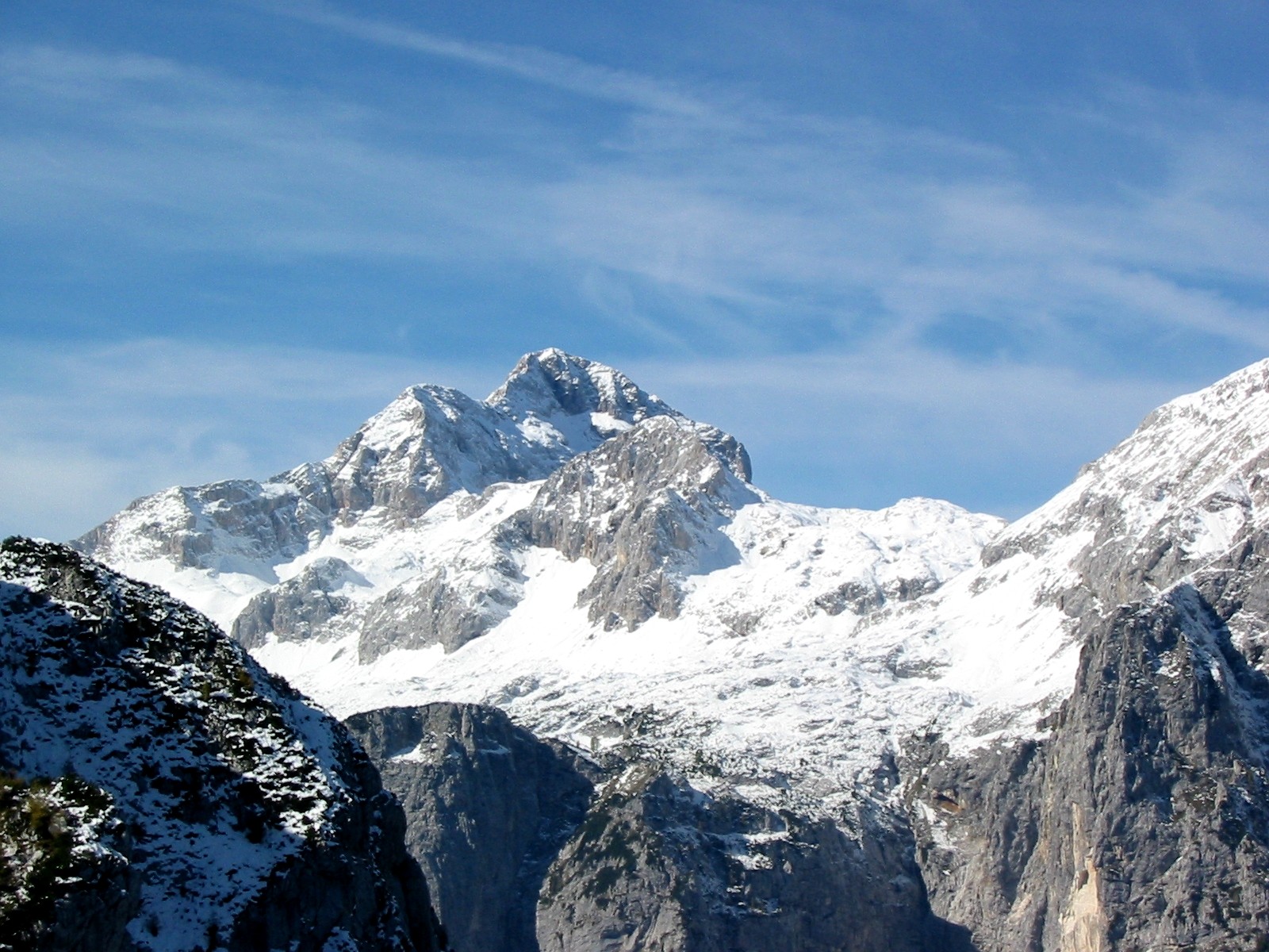
The Julian Alps ( sl, Julijske Alpe, it, Alpi Giulie, , ) are a mountain range of the Southern Limestone Alps that stretch from northeastern Italy to Slovenia, where they rise to 2,864 m at Mount Triglav, the highest peak in Slovenia. A large part of the Julian Alps is included in Triglav National Park. The second highest peak of the range, the 2,755 m high Jôf di Montasio, lies in Italy. The Julian Alps cover an estimated 4,400 km2 (of which 1,542 km2 lies in Italy). They are located between the Sava Valley and Canale Valley. They are divided into the Eastern and Western Julian Alps. Name The Julian Alps were known in antiquity as ''Alpe Iulia'', and also attested as ''Alpes Juliana'' AD 670, ''Alpis Julia'' 734, and ''Alpes Iulias'' in 1090. Like the municipium of ''Forum Julii'' (now Cividale del Friuli) at the foot of the mountains, the range was named after Julius Caesar of the Julian clan, perhaps due to a road built by Julius Caesar and completed by Aug ... [...More Info...] [...Related Items...] OR: [Wikipedia] [Google] [Baidu] |
Gradisca
Gradisca d'Isonzo ( fur, Gardiscja or ''Gardiscje'', sl, Gradišče ob Soči, archaic german: Gradis am Sontig) is a town and ''comune'' of the Province of Gorizia in Friuli-Venezia Giulia, north-eastern Italy. The lawyer, linguist, philologist Philippe Sarchi was born in Gradisca d'Isonzo. Geography The municipality is located in north-eastern Italy on the right bank of the Isonzo River, about southwest of Gorizia. It received town privileges on 14 July 1936. As of 2011, the population of Gradisca is about 6,580. The town is an important centre of the Friulian culture in the Julian Venetia region. History The town's name is a Slavic toponym: in archaic Slovene, ''gradišče'' (cf. gord) was a term indicating a fortified site or a ruin and is a widespread toponym in the Slovene Lands. The strategically-important area on the Isonzo River was probably already settled in Roman times and under the Kingdom of the Lombards, later exposed to the attacks by Hungarian forces on N ... [...More Info...] [...Related Items...] OR: [Wikipedia] [Google] [Baidu] |
Soča
The Soča ( in Slovene) or Isonzo ( in Italian; other names fur, Lusinç, german: Sontig, la, Aesontius or ') is a long river that flows through western Slovenia () and northeastern Italy (). An Alpine river in character, its source lies in the Trenta Valley in the Julian Alps in northwestern Slovenia, at an elevation of . The river runs past the towns of Bovec, Kobarid, Tolmin, Kanal ob Soči, Nova Gorica (where it is crossed by the Solkan Bridge), and Gorizia, entering the Adriatic Sea close to the town of Monfalcone. It has a nival-pluvial regime in its upper course and pluvial-nival in its lower course. Prior to the First World War, the river ran parallel to the border between Kingdom of Italy and the Austro-Hungarian Empire. During World War I, it was the scene of bitter fighting between the two countries, culminating in the Battle of Caporetto in 1917. Name The river was recorded in antiquity as ''Aesontius'', ''Sontius'', and ''Isontius''. Later attestations inc ... [...More Info...] [...Related Items...] OR: [Wikipedia] [Google] [Baidu] |
Spittal An Der Drau
Spittal an der Drau is a town in the western part of the Austrian federal state of Carinthia. It is the administrative centre of Spittal an der Drau District, Austria's second largest district (''Bezirk'') by area. Geography The town is located on the southern slopes of the Gurktal Alps (Nock Mountains), between the Lurnfeld Basin and the Lower Drau Valley. Despite its name, the historic core of Spittal originated on the banks of the small Lieser tributary, which flows into the Drau at the foot of Mt. Goldeck, a peak of the Gailtal Alps south of the town. Its summit can be reached by cable car. The municipal area consists of seven Katastralgemeinden: Amlach, Edling, Großegg, Molzbichl, Olsach, Spittal proper, and St. Peter-Edling. In Großegg (incorporated in 1973), the area of Spittal extends to the southern shore of Lake Millstatt. History The settlement was first mentioned in an 1191 deed issued by Archbishop Adalbert of Salzburg, when the local Carinthian counts Hermann I ... [...More Info...] [...Related Items...] OR: [Wikipedia] [Google] [Baidu] |
Counts Of Ortenburg
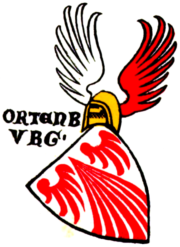
The Counts of Ortenburg (german: Grafen von Ortenburg) were a comital family in the mediaeval Duchy of Carinthia. Though they had roots in Bavarian nobility, an affiliation with the Imperial Counts of Ortenburg, a branch line of the Rhenish Franconian House of Sponheim, is not established.Hausmann, Friedrich (1994). "Die Grafen zu Ortenburg und ihre Vorfahren im Mannesstamm, die Spanheimer in Kärnten, Sachsen und Bayern, sowie deren Nebenlinien" in ''Ostbairische Grenzmarken - Passauer Jahrbuch für Geschichte Kunst und Volkskunde''. Nr. 36, Passau 1994. History Little is known about the reasons the Ortenburgs settled in the Carinthian Lurngau. No charters are available on the creation of the Ortenburg Castle on the northern slope of Mt. Goldeck above the village of Baldramsdorf, nor about the manner in which the Ortenburgs obtained their property. In 1072, one Adalbert of Ortenburg, probably a younger son of Count Hartwig II of Grögling-Hirschberg (d. 1068/69), served a ... [...More Info...] [...Related Items...] OR: [Wikipedia] [Google] [Baidu] |
Old Swiss Confederacy
The Old Swiss Confederacy or Swiss Confederacy (German language, Modern German: ; historically , after the Swiss Reformation, Reformation also , "Confederation of the Swiss") was a loose confederation of independent small states (, German or In the charters of the 14th century described as "communities" (, ), the German term ''Orte'' becomes common in the early 15th century, used alongside "estate" after the Reformation. The French term is used in Fribourg in 1475, and after 1490 is increasingly used in French and Italian documents. It only enters occasional German usage after 1648, and only gains official status as synonym of with the Act of Mediation of 1803. ), initially within the Holy Roman Empire. It is the precursor of the modern state of Switzerland. It formed during the 14th century, from a foundation of the Old Swiss Confederacy, nucleus in what is now Central Switzerland, growth of the Old Swiss Confederacy, expanding to include the cities of Zürich and Bern by ... [...More Info...] [...Related Items...] OR: [Wikipedia] [Google] [Baidu] |
Wernberg
Wernberg ( sl, Vernberk) is a municipality in the district of Villach-Land in the Austrian state of Carinthia. Geography Wernberg lies on the Drava River at the foot of the Ossiach Tauern range, east of Villach, and between Lake Ossiach on the north, Wörthersee on the east, and Lake Faak in the southern part of the municipality. It is located at the northwestern rim of the traditional settlement area of Carinthian Slovenes. The municipal area comprises the cadastral communities of Neudorf (''Nova vas''), Sand (''Pešče''), Trabenig (''Trabenče''), Umberg (''Umbar''), and Wernberg (''Vernberk''). Neighboring municipalities History Archaeological findings indicate an early settlement of the area already in Roman times. A castle near the village of Sternberg, today a ruin, was first mentioned in a deed issued at Saint Paul's Abbey about 1170/80. Wernberg itself first appeared in a document dated 17 November 1227 determining the demolition of a Drava bridge and the transfer of ... [...More Info...] [...Related Items...] OR: [Wikipedia] [Google] [Baidu] |
Villach
Villach (; sl, Beljak; it, Villaco; fur, Vilac) is the seventh-largest city in Austria and the second-largest in the federal state of Carinthia. It is an important traffic junction for southern Austria and the whole Alpe-Adria region. , the population is 61,887. Together with other Alpine towns Villach engages in the Alpine Town of the Year Association for the implementation of the Alpine Convention to achieve sustainable development in the Alpine Arc. In 1997, Villach was the first town to be awarded Alpine Town of the Year. Geography Villach is a statutory city, on the Drau River near its confluence with the Gail tributary, at the western rim of the Klagenfurt basin. The municipal area stretches from the slopes of the Gailtal Alps (Mt. Dobratsch) down to Lake Ossiach in the northeast. The Villach city limits comprise the following districts and villages: }) * Dobrova (''Dobrova'') * Drautschen (''Dravče'') * Drobollach am Faaker See (''Drobolje ob Baškem jezeru'') ... [...More Info...] [...Related Items...] OR: [Wikipedia] [Google] [Baidu] |
Gail (river)
Gail ( sl, Zilja, it, Zeglia) is the name of a river in southern Austria, the largest right tributary of the Drava. Its drainage basin is . Etymology The name ''Gail'' developed from Old High German ''Gîla'', in turn from the form ''*Gīla'' (which was also the source of the Slovene name ''Zilja''). It is likely that the name is of substrate origin, predating the Roman presence in the area. The name is believed to derive from the pre-Romance word ''*gai̯li̯a'' (from the Indo-European root ''*gʰoi̯lo-''), meaning 'foaming (water), powerful'. The river is documented as ''Gila'' in a 1090 deed. The Slovene name ''Zilja'' is also commonly cited because the lower Gail Valley is a traditional settlement area of the Carinthian Slovenes and a language region of the distinct Gail Valley dialect. Course The river source is located east of the Kartitsch Saddle and the Puster Valley in the Tyrolean municipality of Obertilliach. It flows from west to east through the Southern Limestone A ... [...More Info...] [...Related Items...] OR: [Wikipedia] [Google] [Baidu] |


