|
Cape Wrath
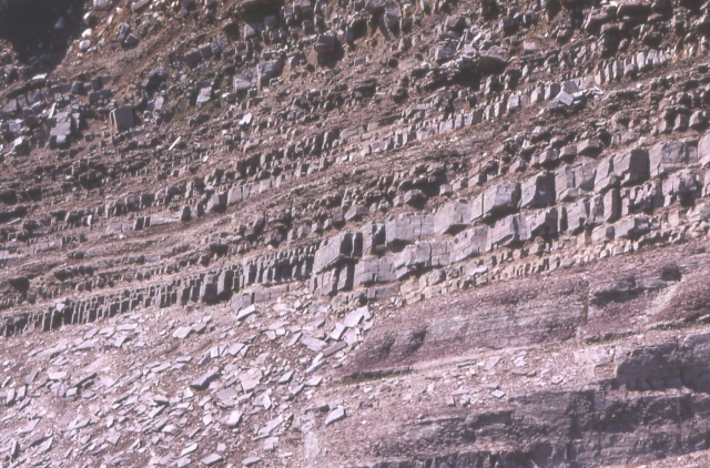
Cape Wrath (, known as ' in Lewis) is a cape in the Durness parish of the county of Sutherland in the Highlands of Scotland. It is the most north-westerly point in Great Britain. The cape is separated from the rest of the mainland by the Kyle of Durness and consists of of moorland wilderness known as the Parph. The first road was built in 1828 by the lighthouse commission across the Parph/Durness. This road connects a passenger ferry that crosses the Kyle of Durness with the buildings on the peninsula. Much of the cape is owned by the Ministry of Defence and is used as a military training area, including as live firing range. Areas of it are also designated as a Site of Special Scientific Interest, a Special Protection Area, a Special Area of Conservation and a Special Landscape Area. Etymology The name Cape Wrath is derived from Old Norse ' ("turning point"), accordingly, ''wrath'' is pronounced (''a'' as in ''cat''). [...More Info...] [...Related Items...] OR: [Wikipedia] [Google] [Baidu] [Amazon] |
Cape (geography)
In geography, a cape is a headland, peninsula or promontory extending into a body of water, usually a sea. A cape usually represents a marked change in trend of the Coast, coastline, often making them important landmarks in sea navigation. This also makes them prone to natural forms of erosion, mainly tidal actions, resulting in a relatively short geological lifespan. Formation Capes can be formed by Glacier, glaciers, Volcano, volcanoes, and changes in sea level. Erosion plays a large role in each of these methods of formation. Coastal erosion by waves and currents can create capes by wearing away softer rock and leaving behind harder rock formations. Movements of the Earth's crust can uplift land, forming capes. For example, the Cape of Good Hope was formed by tectonic forces. Volcanic eruptions can create capes by depositing lava that solidifies into new landforms. Cape Verde, (also known as Cabo Verde) is an example of a volcanic cape. Glaciers can carve out capes by erod ... [...More Info...] [...Related Items...] OR: [Wikipedia] [Google] [Baidu] [Amazon] |
Shieling
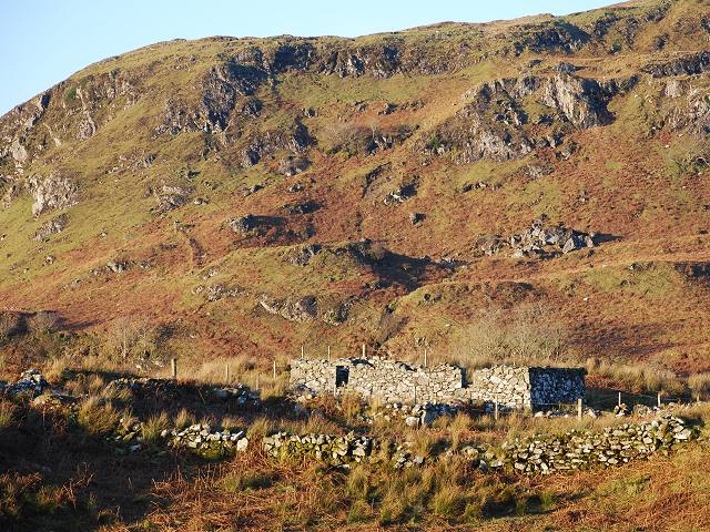
A shieling () is a hut or collection of huts on a seasonal pasture high in the hills, once common in wild or sparsely populated places in Scotland. Usually rectangular with a doorway on the south side and few or no windows, they were often constructed of dry stone or turf. More loosely, the term may denote a seasonal mountain pasture for the grazing of cattle in summer. Seasonal pasturage implies transhumance between the shieling and a valley settlement in winter. Many Scottish songs have been written about life in shielings, often concerning courtship and love. The ruins of shielings are abundant landscape features across Scotland, particularly the Highlands. Etymology A "shieling" is a summer dwelling on a seasonal pasture high in the hills. The first recorded use of the term is from 1568. The word "shieling" comes from "shiel", from the forms ''schele'' or ''shale'' in the Northern dialect of Middle English, likely related to Old Frisian ''skul'' meaning "hiding place" a ... [...More Info...] [...Related Items...] OR: [Wikipedia] [Google] [Baidu] [Amazon] |
UNESCO
The United Nations Educational, Scientific and Cultural Organization (UNESCO ) is a List of specialized agencies of the United Nations, specialized agency of the United Nations (UN) with the aim of promoting world peace and International security, security through international cooperation in education, arts, sciences and culture. It has 194 Member states of UNESCO, member states and 12 associate members, as well as partners in the Non-governmental organization, non-governmental, Intergovernmental organization, intergovernmental and private sector. Headquartered in Paris, France, UNESCO has 53 regional field offices and 199 National Commissions for UNESCO, national commissions. UNESCO was founded in 1945 as the successor to the League of Nations' International Committee on Intellectual Cooperation.English summary). UNESCO's founding mission, which was shaped by the events of World War II, is to advance peace, sustainable development and human rights by facilitating collaboratio ... [...More Info...] [...Related Items...] OR: [Wikipedia] [Google] [Baidu] [Amazon] |
North West Highlands Geopark
The North West Highlands Geopark is a International Network of Geoparks, geopark in the Scottish Highlands. Awarded UNESCO geopark status in 2004, it was Scotland's first geopark, featuring some of the oldest rock (geology), rocks in Europe, around 3,000 million years old. The park contains many notable geological features, such as the Moine Thrust Belt and Smoo Cave and covers an area of around . Geography The park is located in the extreme north-west of Scotland and includes parts of Sutherland and Wester Ross, including Cape Wrath. The area is one of the most sparsely inhabited in Europe, and is largely treeless. The park's eastern boundary generally follows the Moine Thrust Belt, otherwise the park is generally bounded by the north and west coasts of Scotland, with a few islands included in the park, such as the Summer Isles. Notable features The Moine Thrust Belt was formed between 430 and 500 million years ago. The belt includes Precambrian Moine Supergroup, Moine rocks w ... [...More Info...] [...Related Items...] OR: [Wikipedia] [Google] [Baidu] [Amazon] |
Sea Stack
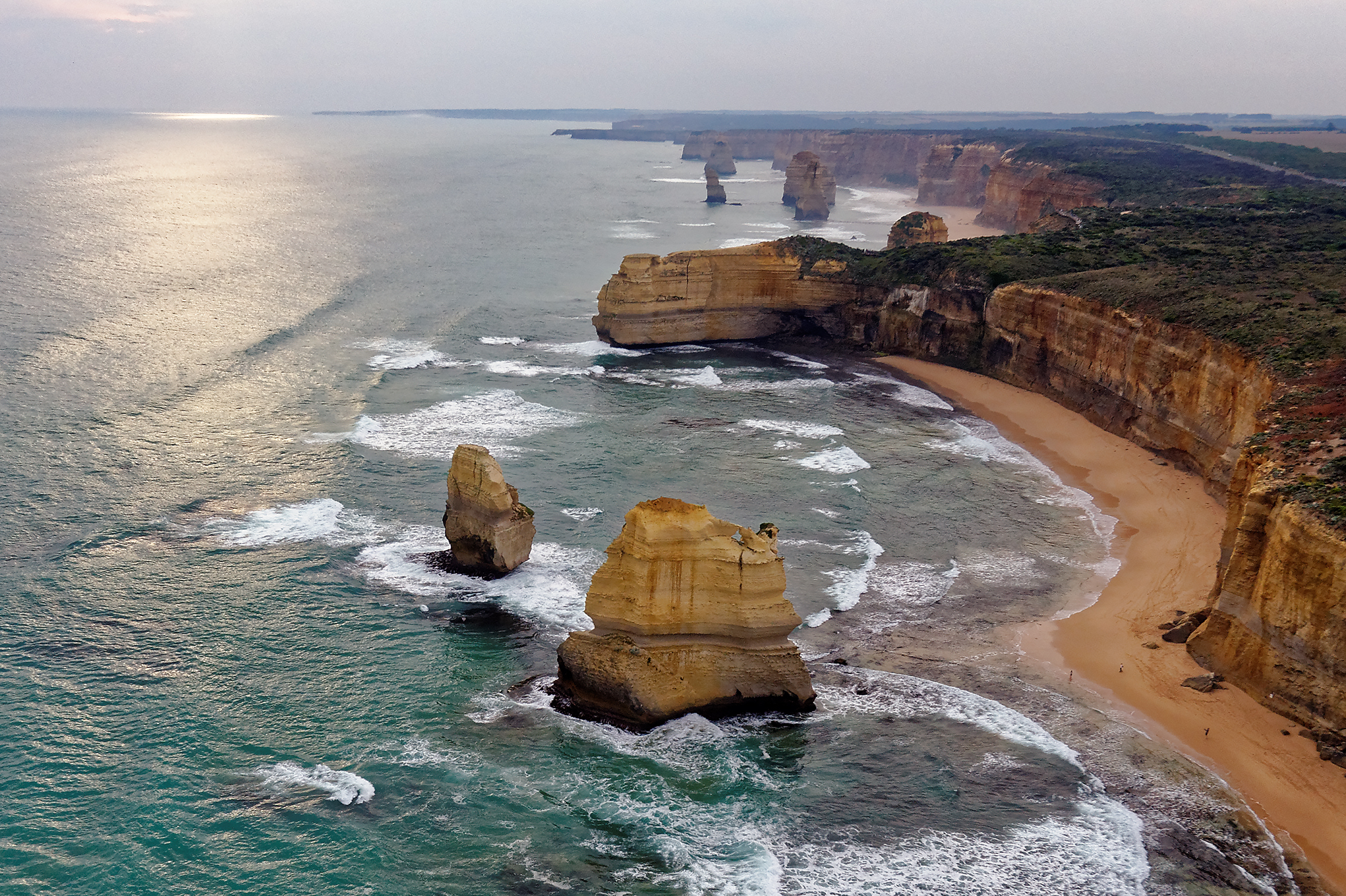
A stack or sea stack is a geological landform consisting of a steep and often vertical column or columns of rock in the sea near a coast, formed by wave erosion. Stacks are formed over time by wind and water, processes of coastal geomorphology. britannica.com They are formed when part of a is by hydraulic action, which is the force of the sea or water crashing against the rock. The force of the water weakens cracks in the headland, causing them to later collapse, ... [...More Info...] [...Related Items...] OR: [Wikipedia] [Google] [Baidu] [Amazon] |
Lewisian Gneiss
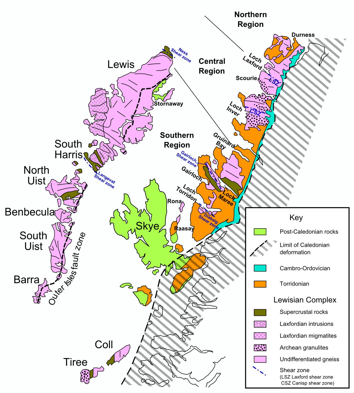
The Lewisian complex or Lewisian gneiss is a suite of Precambrian metamorphic rocks that outcrop in the northwestern part of Scotland, forming part of the Hebridean terrane and the North Atlantic Craton. These rocks are of Archaean and Paleoproterozoic age, ranging from 3.0–1.7 billion years ( Ga). They form the basement on which the Stoer Group, Wester Ross Supergroup and probably the Loch Ness Supergroup sediments were deposited. The Lewisian consists mainly of granitic gneisses with a minor amount of supracrustal rocks. Rocks of the Lewisian complex were caught up in the Caledonian orogeny, appearing in the hanging walls of many of the thrust faults formed during the late stages of this tectonic event. Distribution The main outcrops of the Lewisian complex are on the islands of the Outer Hebrides, including Lewis, from which the complex takes its name. It is also exposed on several islands of the Inner Hebrides, small islands north of the Scottish mainland and ... [...More Info...] [...Related Items...] OR: [Wikipedia] [Google] [Baidu] [Amazon] |
Torridonian Sandstone
The Torridon Group is a series of Tonian (lower Neoproterozoic) arenaceous and argillaceous sedimentary rocks, which occur extensively in the Northwest Highlands of Scotland. These strata are particularly well exposed in the district of upper Loch Torridon, a circumstance which suggested the name Torridon Sandstone, first applied to these rocks by James Nicol (geologist), James Nicol. Stratigraphy, Stratigraphically, they lie Unconformity, unconformably on gneisses of the Lewisian complex and sandstones of the lithologically similar Mesoproterozoic Stoer Group and their outcrop extent is restricted to the Hebridean terrane. Lithology The dominant lithology of the Torridon Group is red and brown sandstone, often arkose, arkosic, with subsidiary amounts of shale, particularly towards the top of the sequence, with coarse Conglomerate (geology), conglomerates and breccias locally at the base. Some of the materials of these rocks were derived from the underlying Lewisian complex, Le ... [...More Info...] [...Related Items...] OR: [Wikipedia] [Google] [Baidu] [Amazon] |
Inverness
Inverness (; ; from the , meaning "Mouth of the River Ness") is a city in the Scottish Highlands, having been granted city status in 2000. It is the administrative centre for The Highland Council and is regarded as the capital of the Highlands. Historically it served as the county town of the Counties of Scotland, county of Inverness-shire. Inverness lies near two important battle sites: the 11th century, 11th-century battle of Blar Nam Feinne, Blàr nam Fèinne against Norway which took place on the Aird, and the 18th century Battle of Culloden which took place on Culloden, Highland#Battlefield of Culloden, Culloden Moor. It is the northernmost city in the United Kingdom and lies within the Great Glen (Gleann Mòr) at its northeastern extremity where the River Ness enters the Beauly Firth. With human settlement dating back to at least 5,800 BC, Inverness was an established self-governing settlement by the 6th century with the first Royal Charter being granted by Dabíd mac ... [...More Info...] [...Related Items...] OR: [Wikipedia] [Google] [Baidu] [Amazon] |
Highland Region
Highland (, ; ) is a council area in the Scottish Highlands and is the largest local government area in both Scotland and the United Kingdom. It was the 7th most populous council area in Scotland at the 2011 census. It has land borders with the council areas of Aberdeenshire, Argyll and Bute, Moray and Perth and Kinross. The wider upland area of the Scottish Highlands after which the council area is named extends beyond the Highland council area into all the neighbouring council areas plus Angus and Stirling. The Highland Council is based in Inverness, the area's largest settlement. The area is generally sparsely populated, with much of the inland area being mountainous with numerous lochs. The area includes Ben Nevis, the highest mountain in the British Isles. Most of the area's towns lie close to the eastern coasts. Off the west coast of the mainland the council area includes some of the Inner Hebrides, notably the Isle of Skye. Name Unlike the other council areas of Scotl ... [...More Info...] [...Related Items...] OR: [Wikipedia] [Google] [Baidu] [Amazon] |
Cliffs East Of Cape Wrath - Geograph
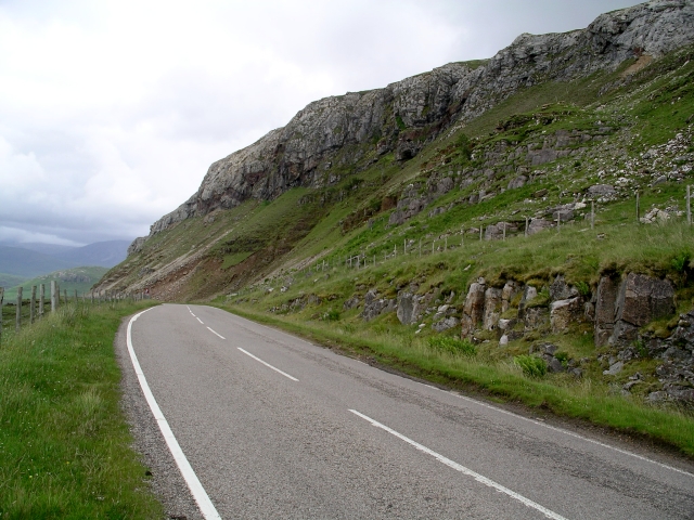
In geography and geology, a cliff or rock face is an area of rock which has a general angle defined by the vertical, or nearly vertical. Cliffs are formed by the processes of weathering and erosion, with the effect of gravity. Cliffs are common on coasts, in mountainous areas, escarpments and along rivers. Cliffs are usually composed of rock that is resistant to weathering and erosion. The sedimentary rocks that are most likely to form cliffs include sandstone, limestone, chalk, and dolomite. Igneous rocks such as granite and basalt also often form cliffs. An escarpment (or scarp) is a type of cliff formed by the movement of a geologic fault, a landslide, or sometimes by rock slides or falling rocks which change the differential erosion of the rock layers. Most cliffs have some form of scree slope at their base. In arid areas or under high cliffs, they are generally exposed jumbles of fallen rock. In areas of higher moisture, a soil slope may obscure the talus. Many cliffs ... [...More Info...] [...Related Items...] OR: [Wikipedia] [Google] [Baidu] [Amazon] |
Yorkshire Post
''The Yorkshire Post'' is a daily broadsheet newspaper, published in Leeds, Yorkshire, England. It primarily covers stories from Yorkshire, although its masthead carries the slogan "Yorkshire's National Newspaper". It was previously owned by Johnston Press and is now owned by National World. Founded in 1754, it is one of the oldest newspapers in the country. The paper's head office is in Whitehall Road, Leeds and the current editor is James Mitchinson. It considers itself "one of Britain's most trusted and historic newsbrands." History The paper was founded in 1754, as the '' Leeds Intelligencer'', making it one of Britain's first daily newspapers. The ''Leeds Intelligencer'' was a weekly newspaper until it was purchased by a group of Conservatives in 1865 who set up the Yorkshire Conservative Newspaper Company Limited then published daily under the current name. The first issue of ''The Yorkshire Post'', on 2 July 1866, included the following statement: The newspaper ... [...More Info...] [...Related Items...] OR: [Wikipedia] [Google] [Baidu] [Amazon] |
Scapa Flow
Scapa Flow (; ) is a body of water in the Orkney Islands, Scotland, sheltered by the islands of Mainland, Graemsay, Burray,S. C. George, ''Jutland to Junkyard'', 1973. South Ronaldsay and Hoy. Its sheltered waters have played an important role in travel, trade and conflict throughout the centuries. Vikings anchored their longships in Scapa Flow more than a thousand years ago. It was the United Kingdom's chief naval base during the First and Second World wars, but the facility was closed in 1956. Since the scuttling of the German fleet after World War I, its wrecks and their marine habitats form an internationally acclaimed diving location. Scapa Flow hosts an oil port, the Flotta oil terminal. In good weather, its roadstead (water of moderate conditions) allows ship-to-ship transfers of crude oil product. The world's first ship-to-ship transfer of liquefied natural gas (LNG) took place in Scapa Flow in 2007 transferring 132,000m³ of LNG. This occurred in 2007 by ... [...More Info...] [...Related Items...] OR: [Wikipedia] [Google] [Baidu] [Amazon] |


