|
Cape Taputapu
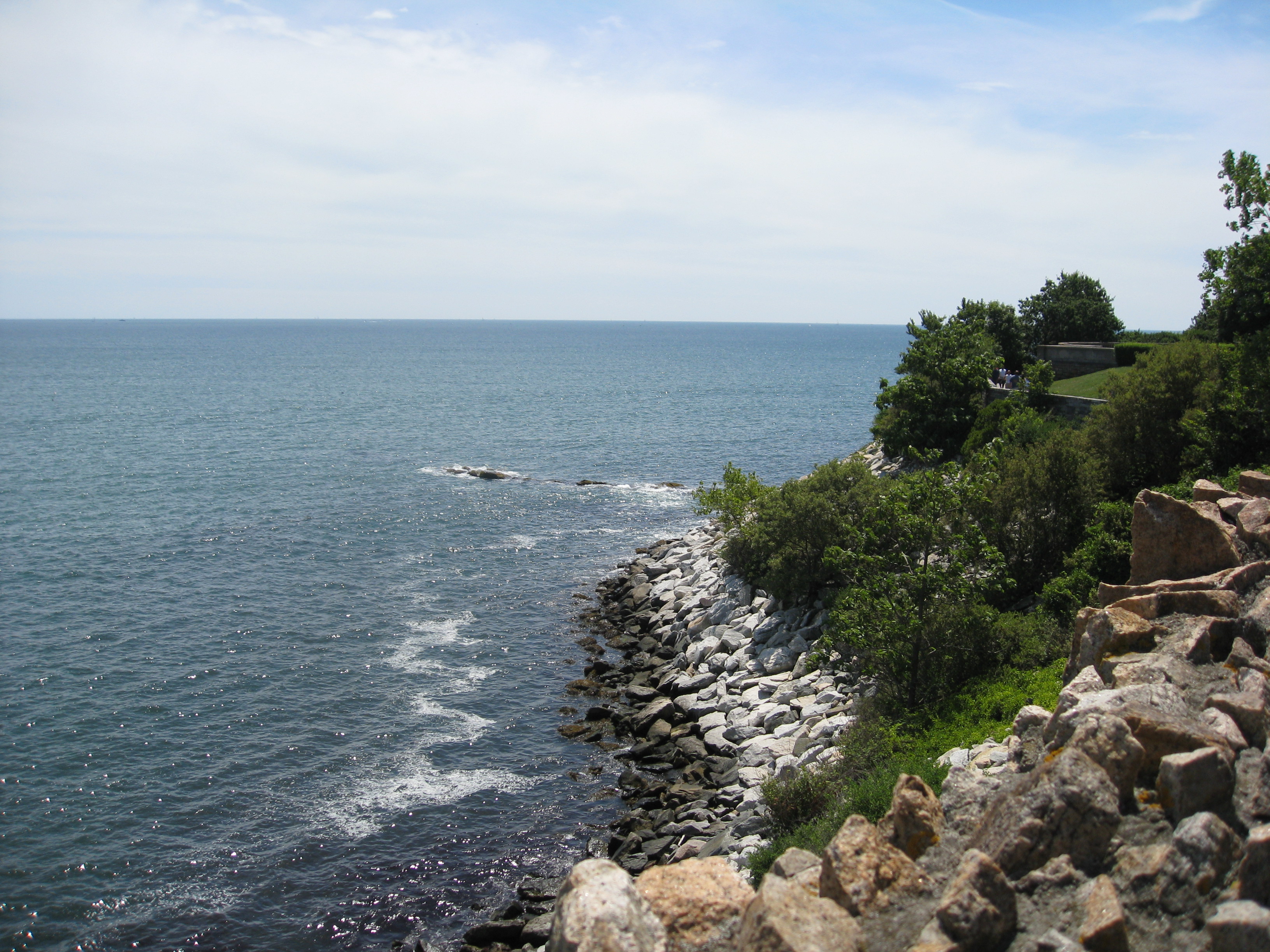
Cape Taputapu (Samoan: Tolotolo i Taputapu) is the name of a cape located in the Western District of American Samoa. Located in Tutuila, it is the island's westernmost point. The cape was designated as a National Natural Landmark in 1972. Cape Taputapu is an important site in Samoan legends and also the location of a fruit bat colony. The coastline represents geologic features and an important habitat for intertidal flora and fauna. Taputapu is also the name of a nearby islet known as Taputapu Island. Taputapu means forbidden in Samoan, and the cape was named so as it was the only site on Tutuila where paper mulberry trees were found. The discoverers wanted to keep the site and bark for themselves so they could sell it to other parts of American Samoa. The cape's shoreline features volcanic rocks and blowholes created by the strong wave activity which also created Tutuila Island as a whole. It can be hiked during times of low tide, from a trail located in the village of Poloa. ... [...More Info...] [...Related Items...] OR: [Wikipedia] [Google] [Baidu] |
American Samoa
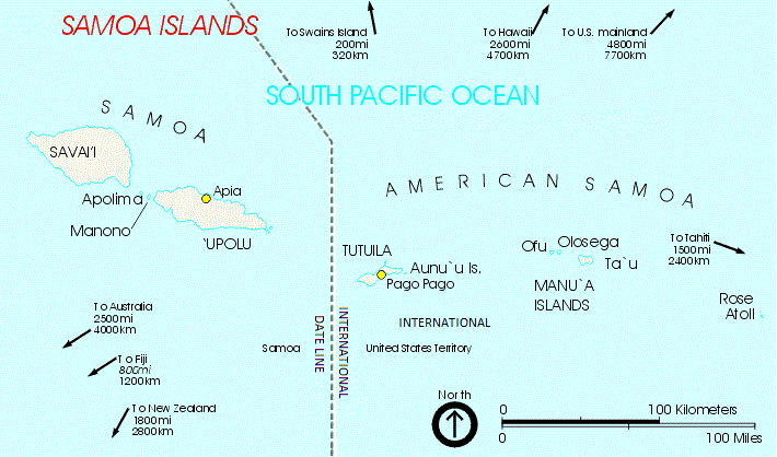
American Samoa ( sm, Amerika Sāmoa, ; also ' or ') is an unincorporated territory of the United States located in the South Pacific Ocean, southeast of the island country of Samoa. Its location is centered on . It is east of the International Date Line, while Samoa is west of the Line. The total land area is , slightly more than Washington, D.C. American Samoa is the southernmost territory of the United States and one of two U.S. territories south of the Equator, along with the uninhabited Jarvis Island. Tuna products are the main exports, and the main trading partner is the rest of the United States. American Samoa consists of five main islands and two coral atolls. The largest and most populous island is Tutuila, with the Manuʻa Islands, Rose Atoll and Swains Island also included in the territory. All islands except for Swains Island are part of the Samoan Islands, west of the Cook Islands, north of Tonga, and some south of Tokelau. To the west are the islands of the Wall ... [...More Info...] [...Related Items...] OR: [Wikipedia] [Google] [Baidu] |
Poloa, American Samoa
Poloa is a village in American Samoa. It is located at the west side of Tutuila in the Alataua District. The village has 193 residents in 2010. The main denominations in the area are Methodist and Christian. Poloa has one elementary school. It is located in Lealataua County. According to history, Since American culture was introduced, many Poloa villagers worked at shipyards of Germans and Americans. Poloa is at the western terminus of American Samoa Highway 001. It is situated on a narrow coastal plain on Tutuila Island's western tip, nine miles west of Pago Pago. The village is made up of wood-frame homes and traditional fales. A school is located at the shoreline, approximately 700 ft. south of the village center. This elementary school has an enrollment of around 160 and also serves Poloa's neighboring villages. Due to the village's flatlands being ideal for development, the school was erected near the shore. Etymology The name ''Poloa'' denotes that once the sun sets over ... [...More Info...] [...Related Items...] OR: [Wikipedia] [Google] [Baidu] |
Cape (geography)
In geography, a cape is a headland or a promontory of large size extending into a body of water, usually the sea.Whittow, John (1984). ''Dictionary of Physical Geography''. London: Penguin, 1984, p. 80. . A cape usually represents a marked change in trend of the Coast, coastline, often making them important landmarks in sea navigation. This also makes them prone to natural forms of erosion, mainly tidal actions, which results in them having a relatively short geological lifespan. Capes can be formed by glaciers, volcanoes, and changes in sea level. Erosion plays a large role in each of these methods of formation. List of some well-known capes Gallery File:Cape Cornwall.jpg, Cape Cornwall, England File:Nasa photo cape fear.jpg, Satellite image of Cape Fear, North Carolina File:Cape McLear, Malawi (2499273862).jpg, Cape MacLear, Malawi File:Cape horn.png, Map depicting Cape Horn at the southernmost portion of South America File:Spain.Santander.Cabo.Mayor.jpeg, Photograph o ... [...More Info...] [...Related Items...] OR: [Wikipedia] [Google] [Baidu] |
Western District, American Samoa
The Western District is one of the primary divisions of American Samoa. It consists of the western portion of Tutuila Island. It has a land area of 74.781 km2 (28.873 sq mi) and contains 29 villages plus a part of Nu'uuli village. Among these is the largest village of American Samoa, Tafuna, at its eastern end. The district's total population as of the 2010 census was 31,329. Dental and medical care to residents of the Western District are offered by Tafuna Community Health Center. District divisions *Lealataua County * Leasina County *Tualatai County * Tualauta County Demographics Western District of Tutuila was first recorded beginning with the 1900 U.S. Census. No census was taken in 1910, but a special census was taken in 1912. Regular decennial censuses were taken beginning in 1920. See also *Eastern District, American Samoa The Eastern District is one of the primary Administrative divisions of American Samoa, districts of American Samoa. It consists of the eas ... [...More Info...] [...Related Items...] OR: [Wikipedia] [Google] [Baidu] |
Tutuila
Tutuila is the main island of American Samoa (and its largest), and is part of the archipelago of Samoan Islands. It is the third largest island in the Samoan Islands chain of the Central Pacific. It is located roughly northeast of Brisbane, Australia and lies over to the northeast of Fiji. It contains a large, natural harbor, Pago Pago Harbor, where Pago Pago, the capital of American Samoa, is situated. Pago Pago International Airport is also located on Tutuila. The island’s land expanse is about 68% of the total land area of American Samoa. With 56,000 inhabitants, it is also home to 95% of the population of American Samoa. The island has six terrestrial and three marine ecosystems. Tutuila has mountainous regions, the highest point of which is ). The island is attractive to tourists because of its beaches, coral reefs, and World War II relics, as well as its suitability for sporting activities such as scuba diving, snorkeling, and hiking. Etymology It is said that the nam ... [...More Info...] [...Related Items...] OR: [Wikipedia] [Google] [Baidu] |
National Natural Landmark
The National Natural Landmarks (NNL) Program recognizes and encourages the conservation of outstanding examples of the natural history of the United States. It is the only national natural areas program that identifies and recognizes the best examples of biological and geological features in both public and private ownership. The program was established on May 18, 1962, by United States Secretary of the Interior Stewart Udall. The program aims to encourage and support voluntary preservation of sites that illustrate the geological and ecological history of the United States. It also hopes to strengthen the public's appreciation of the country's natural heritage. As of January 2021, 602 sites have been added to the National Registry of Natural Landmarks. The registry includes nationally significant geological and ecological features in 48 states, American Samoa, Guam, Puerto Rico, and the U.S. Virgin Islands. The National Park Service administers the NNL Program and if reques ... [...More Info...] [...Related Items...] OR: [Wikipedia] [Google] [Baidu] |
Fruit Bat
Megabats constitute the family Pteropodidae of the order Chiroptera (bats). They are also called fruit bats, Old World fruit bats, or—especially the genera ''Acerodon'' and ''Pteropus''—flying foxes. They are the only member of the superfamily Pteropodoidea, which is one of two superfamilies in the suborder Yinpterochiroptera. Internal divisions of Pteropodidae have varied since subfamilies were first proposed in 1917. From three subfamilies in the 1917 classification, six are now recognized, along with various tribes. As of 2018, 197 species of megabat had been described. The leading theory of the evolution of megabats has been determined primarily by genetic data, as the fossil record for this family is the most fragmented of all bats. They likely evolved in Australasia, with the common ancestor of all living pteropodids existing approximately 31 million years ago. Many of their lineages probably originated in Melanesia, then dispersed over time to mainland Asia, th ... [...More Info...] [...Related Items...] OR: [Wikipedia] [Google] [Baidu] |
Intertidal
The intertidal zone, also known as the foreshore, is the area above water level at low tide and underwater at high tide (in other words, the area within the tidal range). This area can include several types of Marine habitat, habitats with various species of Marine life, life, such as seastars, Sea urchin, sea urchins, and many species of coral with regional differences in biodiversity. Sometimes it is referred to as the ''littoral zone'' or ''shore, seashore'', although those can be defined as a wider region. The well-known area also includes steep rocky Cliff, cliffs, sandy Beach, beaches, Bog, bogs or wetlands (e.g., vast Mudflat, mudflats). The area can be a narrow strip, as in Pacific island, Pacific islands that have only a narrow tidal range, or can include many meters of shoreline where shallow beach slopes interact with high tidal excursion. The peritidal zone is similar but somewhat wider, extending from above the highest tide level to below the lowest. Organisms in t ... [...More Info...] [...Related Items...] OR: [Wikipedia] [Google] [Baidu] |
Samoan Language
Samoan ( or ; ) is a Polynesian language spoken by Samoans of the Samoan Islands. Administratively, the islands are split between the sovereign country of Samoa and the United States territory of American Samoa. It is an official language, alongside English, in both jurisdictions. It is widely spoken across the Pacific region, heavily so in New Zealand and also in Australia and the United States. Among the Polynesian languages, Samoan is the most widely spoken by number of native speakers. Samoan is spoken by approximately 260,000 people in the archipelago and with many Samoans living in diaspora in a number of countries, the total number of speakers worldwide was estimated at 510,000 in 2015. It is the third-most widely spoken language in New Zealand, where 2.2% of the population, 101,900 people, were able to speak it as of 2018. The language is notable for the phonological differences between formal and informal speech as well as a ceremonial form used in Samoan oratory. Cla ... [...More Info...] [...Related Items...] OR: [Wikipedia] [Google] [Baidu] |
List Of National Natural Landmarks In American Samoa
This is a list of National Natural Landmarks (NNL) in American Samoa. All locations are on communally owned lands. {{DEFAULTSORT:National Natural Landmarks in American Samoa * American Samoa American Samoa ( sm, Amerika Sāmoa, ; also ' or ') is an unincorporated territory of the United States located in the South Pacific Ocean, southeast of the island country of Samoa. Its location is centered on . It is east of the Internationa ... American Samoa-related lists ... [...More Info...] [...Related Items...] OR: [Wikipedia] [Google] [Baidu] |
Landforms Of American Samoa
A landform is a natural or anthropogenic land feature on the solid surface of the Earth or other planetary body. Landforms together make up a given terrain, and their arrangement in the landscape is known as topography. Landforms include hills, mountains, canyons, and valleys, as well as shoreline features such as bays, peninsulas, and seas, including submerged features such as mid-ocean ridges, volcanoes, and the great ocean basins. Physical characteristics Landforms are categorized by characteristic physical attributes such as elevation, slope, orientation, stratification, rock exposure and soil type. Gross physical features or landforms include intuitive elements such as berms, mounds, hills, ridges, cliffs, valleys, rivers, peninsulas, volcanoes, and numerous other structural and size-scaled (e.g. ponds vs. lakes, hills vs. mountains) elements including various kinds of inland and oceanic waterbodies and sub-surface features. Mountains, hills, plateaux, and plains are the fo ... [...More Info...] [...Related Items...] OR: [Wikipedia] [Google] [Baidu] |


.jpg)