|
Cape Renard
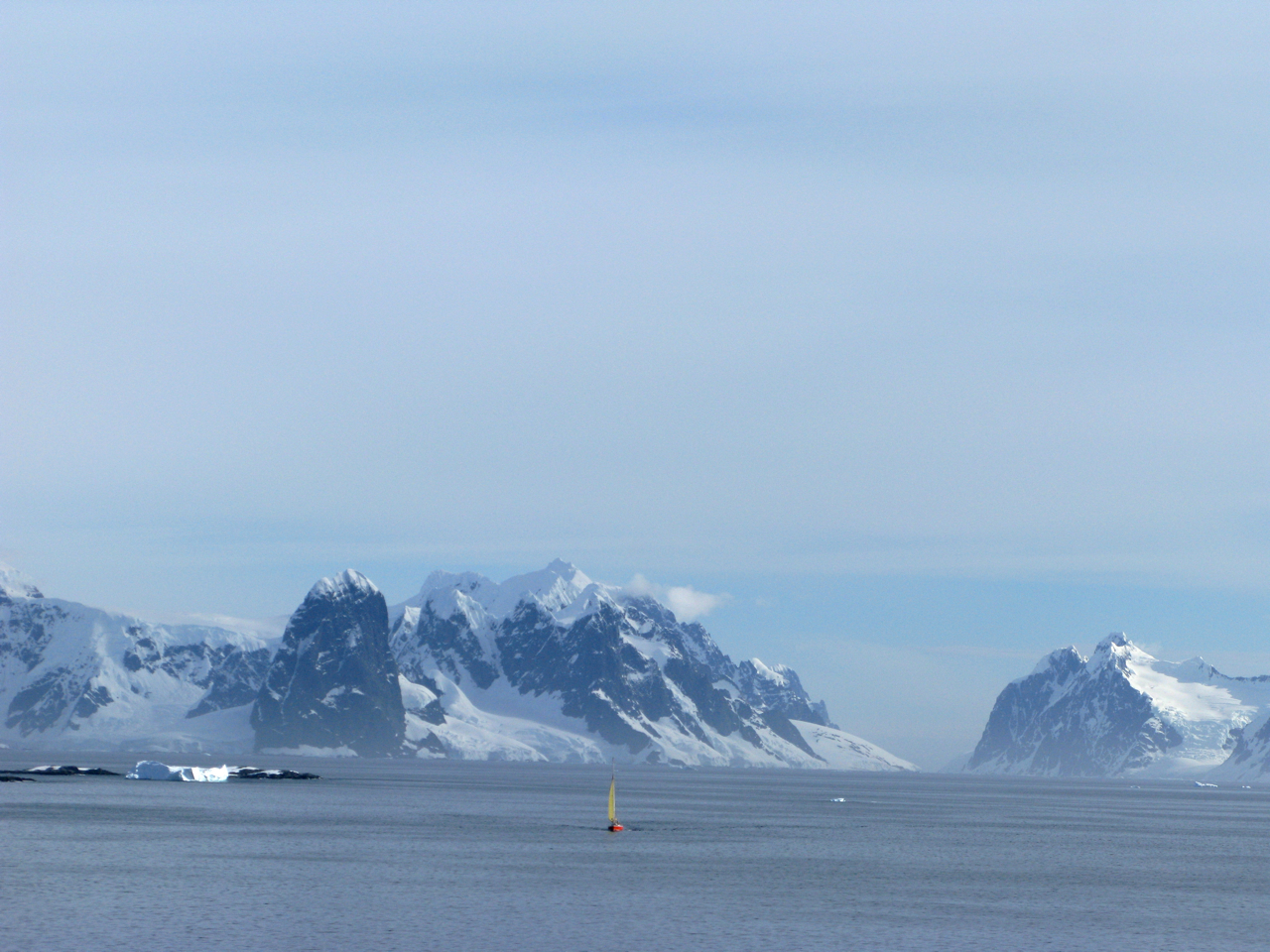
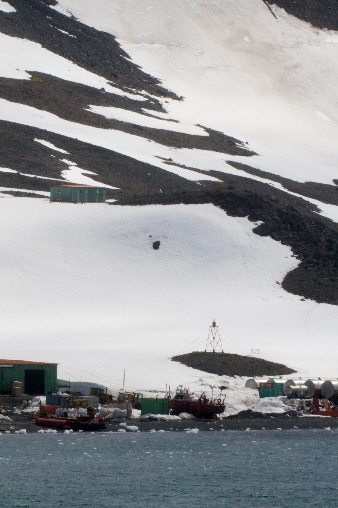
Cape Renard () is a cape forming the south side of the entrance to Flandres Bay and separating the Danco Coast, Danco and Graham Coasts on the west coast of Antarctic Peninsula. Situated on the minor Renard Island just off the north extremity of Kyiv Peninsula, and surmounted by Una's Peaks. Discovered in 1898 by the Belgian Antarctic Expedition under Gerlache and named by him for Professor Alphonse François Renard, A. Renard, a member of the Belgica Commission and of the Belgian Royal Academy. Azufre Point lies about 3 miles (5 km) southeast. Maps Antarctic Digital Database (ADD).Scale 1:250000 topographic map of Antarctica. Scientific Committee on Antarctic Research (SCAR). Since 1993, regularly upgraded and updated. See also * List of lighthouses in Antarctica References Cape Renard.SCAR Composite Gazetteer of Antarctica [...More Info...] [...Related Items...] OR: [Wikipedia] [Google] [Baidu] |
Flandres Bay
Flandres Bay is a large bay lying between Cape Renard and Cape Willems, along the west coast of Graham Land, Antarctica. It was explored in 1898 by the Belgian Antarctic Expedition under Gerlache, who named it, probably after the historical area of Flanders Flanders (, ; Dutch: ''Vlaanderen'' ) is the Flemish-speaking northern portion of Belgium and one of the communities, regions and language areas of Belgium. However, there are several overlapping definitions, including ones related to cultu .... References Bays of Graham Land Danco Coast {{DancoCoast-geo-stub ... [...More Info...] [...Related Items...] OR: [Wikipedia] [Google] [Baidu] |
Belgica Commission
Gallia Belgica ("Belgic Gaul") was a province of the Roman Empire located in the north-eastern part of Roman Gaul, in what is today primarily northern France, Belgium, and Luxembourg, along with parts of the Netherlands and Germany. In 50 BC, after the conquest by Julius Caesar during his Gallic Wars, it became one of the three parts of Gaul (Tres Galliae), the other two being Gallia Aquitania and Gallia Lugdunensis. An official Roman province was later created by emperor Augustus in 22 BC. The province was named for the Belgae, as the largest tribal confederation in the area, but also included the territories of the Treveri, Mediomatrici, Leuci, Sequani, Helvetii and others. The southern border of Belgica, formed by the Marne and Seine rivers, was reported by Caesar as the original cultural boundary between the Belgae and the Celtic Gauls, whom he distinguished from one another. The province was re-organised several times, first increased and later decreased in size. Diocletian ... [...More Info...] [...Related Items...] OR: [Wikipedia] [Google] [Baidu] |
Renard Cape
Renard may refer to: Fictional characters and art * Reynard, anthropomorphic fox of European folklore *Renard, or Reynardine, a fox-like character in webcomic ''Gunnerkrigg Court'' * ''Renard'' (Stravinsky), 1916 opera-ballet by Igor Stravinsky premiered by the Ballets Russes with choreography by Bronislava Nijinska *Renard, the Anarchist, villain from the James Bond movie ''The World Is Not Enough'' *Renard IV, the King of Foxville in L. Frank Baum's '' The Road to Oz'', called "King Dox" by Button-Bright *Maria Renard, fictional character in the ''Castlevania'' video game series *Halcyon Renard, character from the cartoon ''Gargoyles'' *Sean Renard, character from the television series '' Grimm'' *"Le Renard Subtil", Magua in ''The Last of the Mohicans'' *Renard Queenston, an alias under Lapfox Trax that produces raggacore People * Renard (surname), including a list of people with the name * Alan II, Duke of Brittany (died 952), known as ''Le Renard'' * Renard Cox (born 197 ... [...More Info...] [...Related Items...] OR: [Wikipedia] [Google] [Baidu] |
Composite Gazetteer Of Antarctica
The Composite Gazetteer of Antarctica (CGA) of the Scientific Committee on Antarctic Research (SCAR) is the authoritative international gazetteer containing all Antarctic toponyms published in national gazetteers, plus basic information about those names and the relevant geographical features. The Gazetteer includes also parts of the International Hydrographic Organization (IHO) General Bathymetric Chart of the Oceans (GEBCO) gazetteer for under-sea features situated south of 60° south latitude. , the overall content of the CGA amounts to 37,893 geographic names for 19,803 features including some 500 features with two or more entirely different names, contributed by the following sources: {, class="wikitable sortable" ! Country ! Names , - , United States , 13,192 , - , United Kingdom , 5,040 , - , Russia , 4,808 , - , New Zealand , 2,597 , - , Australia , 2,551 , - , Argentina , 2,545 , - , Chile , 1,866 , - , Norway , 1,706 , - , Bulgaria , 1,450 , - , Ge ... [...More Info...] [...Related Items...] OR: [Wikipedia] [Google] [Baidu] |
List Of Lighthouses In Antarctica
This is a list of lighthouses in Antarctica. Lighthouses See also * Lists of lighthouses and lightvessels References External links * {{Lighthouses Antarctica Lighthouses A lighthouse is a tower, building, or other type of physical structure designed to emit light from a system of lamps and lenses and to serve as a beacon for navigational aid, for maritime pilots at sea or on inland waterways. Lighthouses mark ... ... [...More Info...] [...Related Items...] OR: [Wikipedia] [Google] [Baidu] |
Azufre Point
Azufre Point () is a headland lying southeast of Cape Renard on the south side of Flandres Bay, on the west coast of Graham Land. It was first charted by the Belgian Antarctic Expedition under Adrien de Gerlache, 1897–99, and later charted by the Argentine Antarctic Expedition (1954) and named "Punta Azufre" ("sulfur Sulfur (or sulphur in British English) is a chemical element with the symbol S and atomic number 16. It is abundant, multivalent and nonmetallic. Under normal conditions, sulfur atoms form cyclic octatomic molecules with a chemical formula ... point"). References * Headlands of Graham Land Danco Coast {{DancoCoast-geo-stub ... [...More Info...] [...Related Items...] OR: [Wikipedia] [Google] [Baidu] |
Belgian Royal Academy
{{Disambiguation ...
Belgian may refer to: * Something of, or related to, Belgium * Belgians, people from Belgium or of Belgian descent * Languages of Belgium, languages spoken in Belgium, such as Dutch, French, and German *Ancient Belgian language, an extinct language formerly spoken in Gallia Belgica *Belgian Dutch or Flemish, a variant of Dutch *Belgian French, a variant of French *Belgian horse (other), various breeds of horse *Belgian waffle, in culinary contexts * SS ''Belgian'', a cargo ship in service with F Leyland & Co Ltd from 1919 to 1934 *''The Belgian'', a 1917 American silent film See also * *Belgica (other) *Belgic (other) Belgic may refer to: * an adjective referring to the Belgae, an ancient confederation of tribes * a rarer adjective referring to the Low Countries or to Belgium * , several ships with the name * Belgic ware, a type of pottery * Belgic Confession, a ... [...More Info...] [...Related Items...] OR: [Wikipedia] [Google] [Baidu] |
Alphonse François Renard
Alphonse Francois Renard (27 September 18429 July 1903), Belgian geologist and petrographer, was born at Ronse, in East Flanders, on 27 September 1842. He was educated for the church of Rome, and from 1866 to 1869 he was superintendent at the college de la Paix, Namur. In 1870 he entered the Jesuit Training College at the old abbey of Maria Laach in the Eifel, and there, while engaged in studying philosophy and science, he became interested in the geology of the district, and especially in the volcanic rocks. Thenceforth he worked at chemistry and mineralogy, and qualified himself for those petrographical researches for which he was distinguished. In 1874 he became professor of chemistry and geology in the college of the Belgian Jesuits at Leuven, a few years later he was appointed one of the curators of the Royal Natural History Museum at Brussels, and in 1882 he relinquished his post at Louvain. In 1888 he was chosen professor of geology at the University of Ghent, and retaine ... [...More Info...] [...Related Items...] OR: [Wikipedia] [Google] [Baidu] |
Danco Coast
The Danco Coast () is the portion of the west coast of the Antarctic Peninsula between Cape Sterneck and Cape Renard. This coast was explored in January and February 1898 by the Belgian Antarctic Expedition under Adrien de Gerlache, who named it for Lieutenant Emile Danco who died on the expedition. The coast is bordered by the Aguirre Passage which separates it from Lemaire Island. Places on the Danco Coast * Brabazon Point * Salvesen Cove Geology The Danco Coast Tectonic Block includes the Upper Permian-Triassic Trinity Peninsula Group, consisting of over 1000 m of metaturbidites folded during the Gondwanide orogeny. This group is overlain by the Lower Cretaceous Antarctic Peninsula Volcanic Group, with up to 2000 m of basaltic and andesitic lavas, tuffs and agglomerates, which were folded and faulted during the Tertiary. These two groups were intruded by the Berriasian-Cenomanian granite and gabbro sills of the Andean Instrusive Suite. A system of hypabbysal dykes ... [...More Info...] [...Related Items...] OR: [Wikipedia] [Google] [Baidu] |
Belgian Antarctic Expedition
The Belgian Antarctic Expedition of 1897–1899 was the first expedition to winter in the Antarctic region. Led by Adrien de Gerlache de Gomery aboard the RV ''Belgica'', it was the first Belgian Antarctic expedition and is considered the first expedition of the Heroic Age of Antarctic Exploration. Among its members were Frederick Cook and Roald Amundsen, explorers who would later attempt the respective conquests of the North and South Poles. Preparation and surveying In 1896, after a period of intensive lobbying, Adrien Victor Joseph de Gerlache de Gomery purchased the Norwegian-built whaling ship ''Patria'', which, following an extensive refit, he renamed . Gerlache had worked together with the Geographical Society of Brussels to organize a national subscription, but was able to outfit his expedition only after the Belgian government voted in favor of two large subsidies, making it a state-supported undertaking. With a multinational crew that included Roald Amundsen from ... [...More Info...] [...Related Items...] OR: [Wikipedia] [Google] [Baidu] |
Una's Peaks
Una Peaks,John Splettstoesser (2009). Una Peaks: a long overdue Antarctic geographical naming. Polar Record, 45, pp 177-179. doi:10.1017/S0032247408008036abstract/ref> formerly known as Cape Renard Towers, are two towers of basalt, each topped by a cap of ice, guarding the northern entrance to the Lemaire Channel on the Antarctic Peninsula. With the highest summit at , The formation has been long colloquially known as "Una's Tits". The peaks appear on a British Antarctic Territory stamp although they are not identified as such. The individual towers are referred to as "buttresses". Una Spivey was the name of a secretary in the governor's office in Stanley, Falkland Islands who was working for what is now the British Antarctic Survey. The tallest tower has only been summited once; this was by a German team in 1999 (Kurt Albert, Stefan Glowacz, Hans Martin Götz, Gerhard Heidorn, Holger Heuber and Jürgen Knappe). See also *Lemaire Channel *Breast shaped hills References S ... [...More Info...] [...Related Items...] OR: [Wikipedia] [Google] [Baidu] |


