|
Cape Keraudren
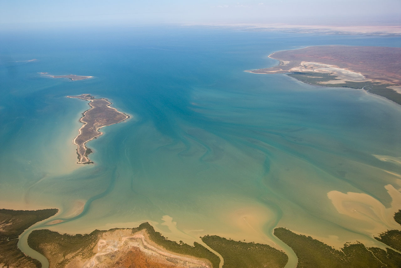
Cape Keraudren is a coastal headland on the northern coast of Western Australia. The rocky cape forms the western end of Eighty Mile Beach, and the eastern end of the Pilbara Coast.Thackway R, Cresswell ID. 1998. Interim Marine and Coastal Regionalisation for Australia: An Ecosystem-based Classification for Marine and Coastal Environments. Version 3.3. Canberra (Australia): Environment Australia, Commonwealth Department of the Environment. The waters around the cape have a coral reefs, sponge gardens, and seaweed and seagrass beds."Cape Keraudren". ''Explore Parks WA'', Parks and Wildlife Service, Government of Western Australia. Accessed 20 July 2021. https://parks.dpaw.wa.gov.au/site/cape-keraudren The cape is at the southwestern end of Eighty Mile Beach Marine Park. Cape Keraudren Coastal Reserve, immediately south of the cape, is managed by the local shire, and has campsites, toilets, rubbish bins and an on-site ranger. The cape is culturally significant to the local Ngarl ... [...More Info...] [...Related Items...] OR: [Wikipedia] [Google] [Baidu] |
Headland
A headland, also known as a head, is a coastal landform, a point of land usually high and often with a sheer drop, that extends into a body of water. It is a type of promontory. A headland of considerable size often is called a cape.Whittow, John (1984). ''Dictionary of Physical Geography''. London: Penguin, 1984, pp. 80, 246. . Headlands are characterised by high, breaking waves, rocky shores, intense erosion, and steep sea cliff. Headlands and bays are often found on the same coastline. A bay is flanked by land on three sides, whereas a headland is flanked by water on three sides. Headlands and bays form on discordant coastlines, where bands of rock of alternating resistance run perpendicular to the coast. Bays form when weak (less resistant) rocks (such as sands and clays) are eroded, leaving bands of stronger (more resistant) rocks (such as chalk, limestone, and granite) forming a headland, or peninsula. Through the deposition of sediment within the bay and the erosion of the ... [...More Info...] [...Related Items...] OR: [Wikipedia] [Google] [Baidu] |
Western Australia
Western Australia (commonly abbreviated as WA) is a state of Australia occupying the western percent of the land area of Australia excluding external territories. It is bounded by the Indian Ocean to the north and west, the Southern Ocean to the south, the Northern Territory to the north-east, and South Australia to the south-east. Western Australia is Australia's largest state, with a total land area of . It is the second-largest country subdivision in the world, surpassed only by Russia's Sakha Republic. the state has 2.76 million inhabitants percent of the national total. The vast majority (92 percent) live in the south-west corner; 79 percent of the population lives in the Perth area, leaving the remainder of the state sparsely populated. The first Europeans to visit Western Australia belonged to the Dutch Dirk Hartog expedition, who visited the Western Australian coast in 1616. The first permanent European colony of Western Australia occurred following the ... [...More Info...] [...Related Items...] OR: [Wikipedia] [Google] [Baidu] |
Time-lapse Of Sunset, Moonset And Sunrise At Cape Keraudren, Western Australia From September 2022
Time-lapse photography is a technique in which the frequency at which film frames are captured (the frame rate) is much lower than the frequency used to view the sequence. When played at normal speed, time appears to be moving faster and thus ''lapsing''. For example, an image of a scene may be captured at 1 frame per second but then played back at 30 frames per second; the result is an apparent ''30 times'' speed increase. Similarly, film can also be played at a much lower rate than at which it was captured, which slows down an otherwise fast action, as in slow motion or high-speed photography. Processes that would normally appear subtle and slow to the human eye, such as the motion of the sun and stars in the sky or the growth of a plant, become very pronounced. Time-lapse is the extreme version of the cinematography technique of ''undercranking''. Stop motion animation is a comparable technique; a subject that does not actually move, such as a puppet, can repeatedly be move ... [...More Info...] [...Related Items...] OR: [Wikipedia] [Google] [Baidu] |
Eighty Mile Beach
Eighty Mile Beach, also spelled Eighty-mile Beach or 80-mile Beach, lies along the north-west coast of Western Australia about half-way between the towns of Broome, Western Australia, Broome and Port Hedland, Western Australia, Port Hedland. It is a beach some in length, forming the coastline where the Great Sandy Desert approaches the Indian Ocean. It is one of the most important sites for migratory wader, shorebirds, or waders, in Australia, and is recognised as a wetland of international importance under the Ramsar Convention, Ramsar Convention on Wetlands. History Traditional ownership and usage The southern section of Eighty Mile Beach is part of the traditional territory of the Nyangumarta people, who maintain a strong connection to the area with many songs, stories and ceremonies associated with sites along and in the vicinity of the beach. In June 2009 the Federal Court of Australia determined that the Nyangumarta People were the valid native title holders of th ... [...More Info...] [...Related Items...] OR: [Wikipedia] [Google] [Baidu] |
Pilbara Coast
The Pilbara Coast is the coastline of Western Australia's Pilbara region. It is often referred to as the North West Coast of Western Australia. It is a complex array of river mouths, ports, peninsulas, and islands. Geography North West Cape forms the western end of the Pilbara Coast. According to the ICMRA, the Pilbara Coast ends at Cape Keraudren, a rocky headland that forms the western end of Eighty Mile Beach. Others end it further east at Wallal. Lagoons protected by barrier islands, embayments, river deltas, and rocky headlands are the main coastal features. The Pilbara's intermittent rivers, including the Ashburton, Fortescue, Yule, and De Grey, have deposited sediment to form river deltas. There are many coastal islands, including the near-shore Dampier Archipelago, a cluster of rocky islands and reefs. The larger offshore islands include Barrow Island and the Montebello Islands.Thackway R, Cresswell ID. 1998. Interim Marine and Coastal Regionalisation for Austral ... [...More Info...] [...Related Items...] OR: [Wikipedia] [Google] [Baidu] |
Ngarla
The Ngarla are an Aboriginal Australian people of the Pilbara region of Western Australia. Country Norman Tindale estimated their territory, to the west of Port Hedland, at around , describing it as lying along the coast to the west of Solitary Island as far as the mouth of the De Grey River. He set their upriver boundary between Kudingaranga (Mulyie Station) and Tjaljaranja (otherweise known as ''Taluirina Pool''). Their traditional inland extension was said to run up to Yarrie. Social organisation The Ngarla had a four class system:- Males-----Females-----Children. * ''Poorungnoo'' marries a ''Parrijari'' producing ''Kiamoona.'' * ''Banakoo''marries a Kiamoona, giving birth to ''Parrijari'' * ''Parrijari'' marries ''Poorungnoo'' producing ''Banakoo.'' * ''Kiamoona'' marries ''Banakoo'' producing ''Poorungnoo.'' History of contact White colonisation of Ngarla domains began in 1864. Over the following two years, smallpox (''boola'') swept through the area killing off large ... [...More Info...] [...Related Items...] OR: [Wikipedia] [Google] [Baidu] |
Traditional Owners
Native title is the designation given to the common law doctrine of Aboriginal title in Australia, which is the recognition by Australian law that Indigenous Australians (both Aboriginal Australian and Torres Strait Islander people) have rights and interests to their land that derive from their traditional laws and customs. The concept recognises that in certain cases there was and is a continued beneficial legal interest in land held by Indigenous peoples which survived the acquisition of radical title to the land by the Crown at the time of sovereignty. Native title can co-exist with non-Aboriginal proprietary rights and in some cases different Aboriginal groups can exercise their native title over the same land. The foundational case for native title in Australia was ''Mabo v Queensland (No 2)'' (1992). One year after the recognition of the legal concept of native title in ''Mabo'', the Keating Government formalised the recognition by legislation with the enactment by the Au ... [...More Info...] [...Related Items...] OR: [Wikipedia] [Google] [Baidu] |
Rabbit-proof Fence
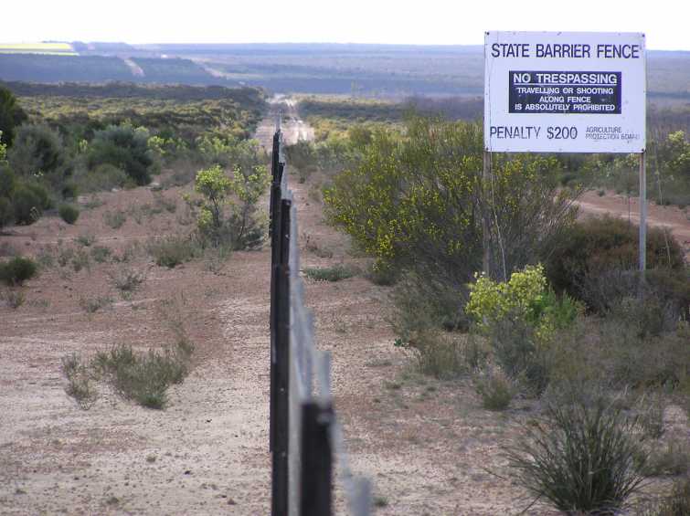
The State Barrier Fence of Western Australia, formerly known as the Rabbit-Proof Fence, the State Vermin Fence, and the Emu Fence, is a pest-exclusion fence constructed between 1901 and 1907 to keep rabbits, and other agricultural pests from the east, out of Western Australian pastoral areas. There are three fences in Western Australia: the original No. 1 Fence crosses the state from north to south, No. 2 Fence is smaller and further west, and No. 3 Fence is smaller still and runs east–west. The fences took six years to build. When completed, the rabbit-proof fence (including all three fences) stretched . The cost to build each kilometre of fence at the time was about $250 (). When it was completed in 1950, the No. 1 Fence was the longest unbroken fence in the world. History Rabbits were introduced to Australia by the First Fleet in 1788, but they became a problem after October 1859, when Thomas Austin released 24 wild rabbits from England for hunting purposes, believing ... [...More Info...] [...Related Items...] OR: [Wikipedia] [Google] [Baidu] |
Pierre François Keraudren
Pierre François Keraudren (15 May 1769 - 16 August 1858) was a scientist and physician in the French Navy. He was a native of Brest. Biography From 1813 to 1845 he served as Inspector General to the Health Department of the Navy. Keraudren was a member of the ''Académie de Médecine'', a consulting physician to Louis-Philippe and a member of the Moscow Society of Naturalists. He also belonged to medical, literary and scientific societies of Madrid, Louvain, Bologna, Orléans, Marseille, Toulon and Rochefort. On July 10, 1816 he was knighted in the '' Ordre de Saint-Michel''. Honours * Keraudren Island is located west of Australia at . * Cape Keraudren in the north-west of Australia was charted in 1801 and is located at at the southern end of Eighty Mile Beach. Keraudren served as the ship's official physician to the 1800–1803 Baudin expedition to Australia. * Cape Keraudren at the north of Hunter Island in the north-west of Tasmania at . * The trumpet manucode, a spec ... [...More Info...] [...Related Items...] OR: [Wikipedia] [Google] [Baidu] |
Baudin Expedition To Australia
The Baudin expedition of 1800 to 1803 was a French expedition to map the coast of New Holland (now Australia). Nicolas Baudin was selected as leader in October 1800. The expedition started with two ships, '' Géographe'', captained by Baudin, and ''Naturaliste'' captained by Jacques Hamelin, and was accompanied by nine zoologists and botanists, including Jean-Baptiste Leschenault de la Tour, François Péron and Charles-Alexandre Lesueur as well as the geographer Pierre Faure. Expedition Napoléon Bonaparte, as First Consul, formally approved the expedition "to the coasts of New Holland", after receiving a delegation consisting of Baudin and eminent members of thInstitut National des Sciences et Artson 25 March 1800. The explicit purpose of the voyage was to be "observation and research relating to Geography and Natural History." The Baudin expedition departed Le Havre, France, on 19 October 1800. Because of delays in receiving his instructions and problems encountered in Is ... [...More Info...] [...Related Items...] OR: [Wikipedia] [Google] [Baidu] |


