|
Cape Haze Pioneer Trail
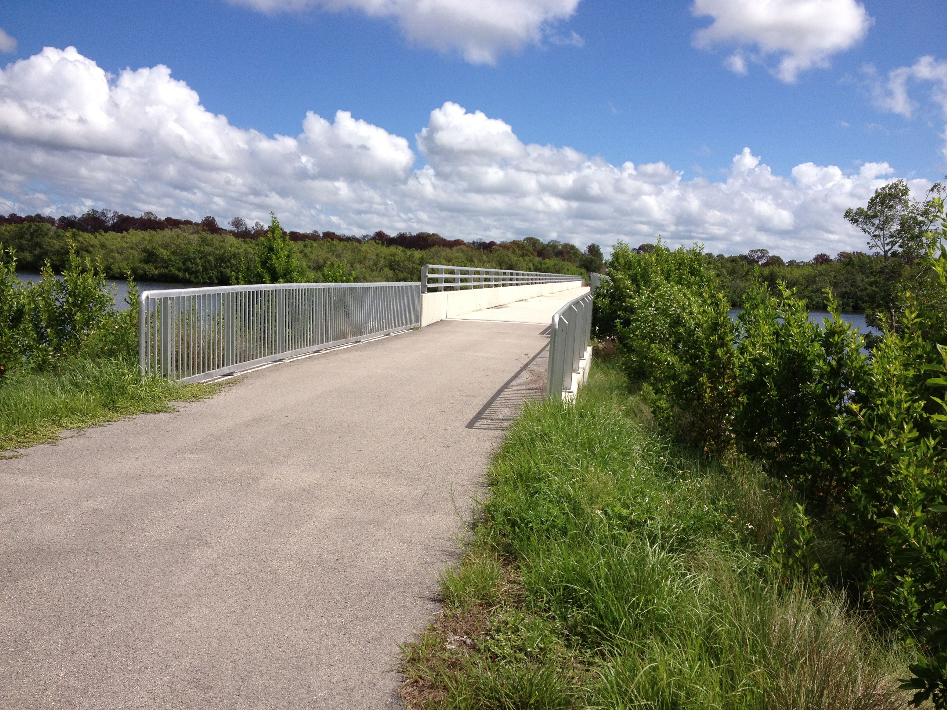
The Cape Haze Pioneer Trail is an rail trail in Charlotte County, Florida on the Cape Haze peninsula running from western Port Charlotte to Placida. A vast majority of the trail runs along the right of way of the former Charlotte Harbor and Northern Railway. Route description The trail begins at the intersection of State Road 776 and Pinedale Drive in western Port Charlotte. It runs south along Pinedale Drive briefly before shifting east on to the former railroad corridor. It then proceeds south along the railroad corridor, passing near Rotonda West and crossing over Coral Creek near Coral Creek Airport. At the Coral Creek Country Club, the trail leaves the railroad corridor and runs alongside County Road 771 to Placida, terminating just north of the Boca Grande Causeway. From here, bicyclists can continue across the causeway to Gasparilla Island and the Boca Grande Bike Path The Boca Grande Bike Path is a 6.5 mile multi-use path in Boca Grande, Florida on Gasparilla Isla ... [...More Info...] [...Related Items...] OR: [Wikipedia] [Google] [Baidu] |
Placida, Florida
Placida is an unincorporated community in Charlotte County, Florida Charlotte County is a U.S. county located in the U.S. state of Florida. As of the 2020 census, the population was 186,847. Its county seat is Punta Gorda. Charlotte County comprises the Punta Gorda, FL Metropolitan Statistical Area, which is ..., United States. It is located near where County Road 771 becomes County Road 775, and the Coral Creek meets Gasparilla Sound. Placida is part of the Sarasota-Bradenton-Punta Gorda Combined Statistical Area. The ZIP Code for Placida is 33946. Geography Placida is located at (26.83194, -82.265). Placida has an elevation of 3 feet. References Unincorporated communities in Charlotte County, Florida Unincorporated communities in Florida Populated places on the Intracoastal Waterway in Florida {{CharlotteCountyFL-geo-stub ... [...More Info...] [...Related Items...] OR: [Wikipedia] [Google] [Baidu] |
Coral Creek Airport
Coral Creek Airport (FAA LID: FA54) is a private-use airport located 2 miles (3 km) northeast of Boca Grande, a community on Gasparilla Island in southwest Florida, United States. The airport itself is located in Placida in Charlotte County (specifically, on the Cape Haze Peninsula), about a mile north of the separately-owned Coral Creek Club. The airport is privately owned by BK IV AS, L.L.C. The airfield is composed of a single asphalt runway connected to a ramp and two hangars via a single taxiway. There is one FBO for the airport, known as Boca Grande Jet Center. The office is attached to the main hangar which is connected to the public road by a private driveway. Services for the airport are restricted to members-only with limited guest accommodations. Permission is needed to land; however, the pattern is uncontrolled and there is no tower. History Coral Creek Airport opened as Rotonda International Airport in the mid-1960s. It was purchased in 2003 and, subsequently, ... [...More Info...] [...Related Items...] OR: [Wikipedia] [Google] [Baidu] |
Rail Trails In Florida
Rail or rails may refer to: Rail transport *Rail transport and related matters *Rail (rail transport) or railway lines, the running surface of a railway Arts and media Film * ''Rails'' (film), a 1929 Italian film by Mario Camerini * ''Rail'' (1967 film), a film by Geoffrey Jones for British Transport Films *'' Mirattu'' or ''Rail'', a Tamil-language film and its Telugu dub Magazines * ''Rail'' (magazine), a British rail transport periodical * ''Rails'' (magazine), a former New Zealand based rail transport periodical Other arts *The Rails, a British folk-rock band * Rail (theater) or batten, a pipe from which lighting, scenery, or curtains are hung Technology *Rails framework or Ruby on Rails, a web application framework *Rail system (firearms), a mounting system for firearm attachments *Front engine dragster *Runway alignment indicator lights, a configuration of an approach lighting system *Rule Augmented Interconnect Layout, a specification for expressing guidelines for prin ... [...More Info...] [...Related Items...] OR: [Wikipedia] [Google] [Baidu] |
Hiking Trails In Florida
Hiking is a long, vigorous walk, usually on trails or footpaths in the countryside. Walking for pleasure developed in Europe during the eighteenth century.AMATO, JOSEPH A. "Mind over Foot: Romantic Walking and Rambling." In ''On Foot: A History of Walking'', 101-24. NYU Press, 2004. Accessed March 1, 2021. http://www.jstor.org/stable/j.ctt9qg056.7. Religious pilgrimages have existed much longer but they involve walking long distances for a spiritual purpose associated with specific religions. "Hiking" is the preferred term in Canada and the United States; the term "walking" is used in these regions for shorter, particularly urban walks. In the United Kingdom and the Republic of Ireland, the word "walking" describes all forms of walking, whether it is a walk in the park or backpacking in the Alps. The word hiking is also often used in the UK, along with rambling , hillwalking, and fell walking (a term mostly used for hillwalking in northern England). The term bushwalking is ende ... [...More Info...] [...Related Items...] OR: [Wikipedia] [Google] [Baidu] |
Wildflower Preserve (Florida)
Wildflower Preserve is an 80-acre preserve located on the Cape Haze peninsula in Charlotte County, Florida. It was formerly used as a golf course. The property includes upland habitats and fresh water ponds that feed into Lemon Creek and on to Lemon Bay Lemon Bay is a long, narrow and shallow body of water covering 8,000 acres in Charlotte County, Florida and Sarasota County, Florida. It is protected as the Lemon Bay Aquatic Preserve, designated in 1986. It is one of five Charlotte Harbor Aquatic .... Lemon Bay Conservancy (includes map of area) References Protected areas of Charlotte County, Florida[...More Info...] [...Related Items...] OR: [Wikipedia] [Google] [Baidu] |
Placida Bunk House
''Placida'' is a genus of very small or minute sea slugs, marine opisthobranch gastropod mollusks in the family Limapontiidae.WoRMS : Placida accessed : 13 October 2010] Although similar in appearance to nudibranchs, species in this genus are actually Sacoglossans. Species Species within this genus include: * '' Placida aoteana'' (Powell, 1937) * '' Placida babai'' Ev. Marcus, 1982[...More Info...] [...Related Items...] OR: [Wikipedia] [Google] [Baidu] |
Boca Grande Bike Path
The Boca Grande Bike Path is a 6.5 mile multi-use path in Boca Grande, Florida on Gasparilla Island. The northern portion of the path runs on the former right of way of the Charlotte Harbor and Northern Railway, which operated on Gasparilla Island from 1907 to 1981. As Florida's first rail trail, it was principally built for bicycles, but pedestrians also use it. Golf carts are also permitted on the path. Another trail exists on the mainland portion of the railroad line known as the Cape Haze Pioneer Trail. History The former Charlotte Harbor and Northern Railway was abandoned in 1981 after the closure of the phosphate port on the south end of the island. Bayard Sharp, an heir of the Du Pont family who controlled the Gasparilla Inn, saw the need for a bike path after one of his employees had been killed on a bicycle on the island. Sharp managed to acquire the railroad's right of way and built the path on it. The trail was dedicated on February 23, 1985. The Gasparilla Isla ... [...More Info...] [...Related Items...] OR: [Wikipedia] [Google] [Baidu] |
Boca Grande Causeway
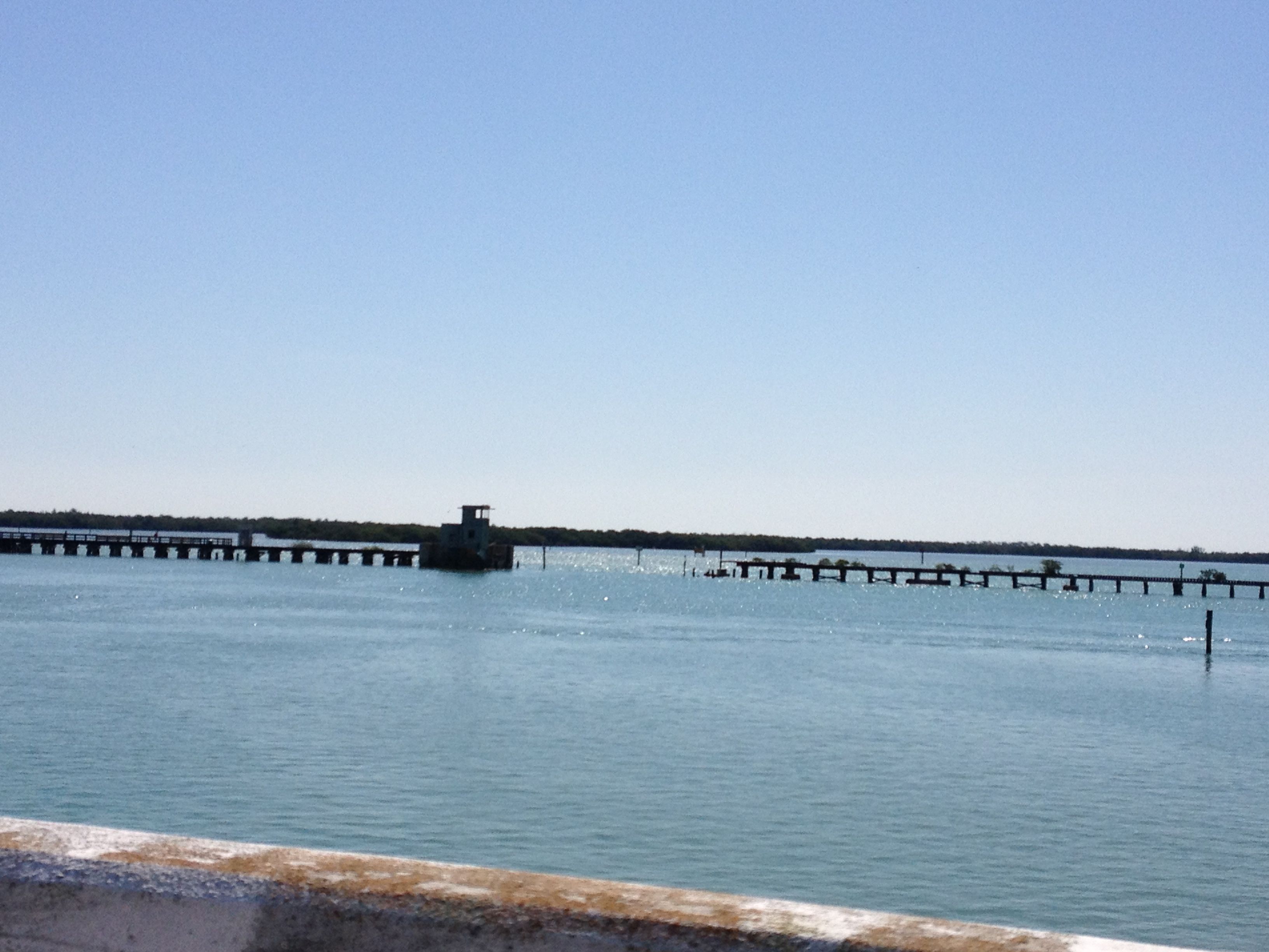
The Boca Grande Causeway is a causeway located in Charlotte County, Florida, connecting the community of Boca Grande on Gasparilla Island with the mainland near Placida. The causeway crosses Gasparilla Sound and consists of three bridges, and is the only vehicular access to the island. History The Boca Grande Causeway originally opened in 1958 after six years of construction, replacing a vehicle ferry service. The causeway and its original bridges were built parallel to the now abandoned Charlotte Harbor and Northern Railway. Passenger rail service to the island was discontinued by the railroad shortly after the causeway opened. While the railroad was abandoned in 1981, the adjacent trestles remain mostly intact today and are visible from the causeway. The Causeway was privately built, but was sold to the Gasparilla Island Bridge Authority, a government agency created to oversee operation of the causeway, in 1998. The northernmost bridge (connecting to the mainland) includes ... [...More Info...] [...Related Items...] OR: [Wikipedia] [Google] [Baidu] |
Rotonda West, Florida
Rotonda West is an unincorporated, deed-restricted community situated in Charlotte County, Florida, United States. The 2020 U.S. Census Bureau lists it as the Rotonda census-designated place, with a population of 10,114. It is part of the Sarasota-Bradenton-Punta Gorda Combined Statistical Area. It was developed and named Rotonda West by Cavanagh Communities Corporation, which purchased the land in 1969. That developer also bought land for a projected but never developed community named Rotonda East in southern Martin County and northern Palm Beach County. The land selected for that development was swamp land and it was not considered wise to drain those wetlands due to changing views on the ecological value of wetlands, and the Army Corps of Engineers refused a permit, so the Rotonda East project was abandoned. The area was part of ranch lands prior to development for housing in the 1970s. Although the community's layout mimics that of temporary World War II airfields, there ... [...More Info...] [...Related Items...] OR: [Wikipedia] [Google] [Baidu] |
Charlotte Harbor And Northern Railway
The Charlotte Harbor and Northern Railway is a historic railroad line that at its greatest extent serviced Gasparilla Island in Charlotte Harbor and a major shipping port that once operated there. The railroad's principal purpose was to transport phosphate mined along the Peace River and in the Bone Valley region of Central Florida to the port to be shipped. It also brought passengers to the island community of Boca Grande on Gasparilla Island, and is largely responsible for making Boca Grande the popular tourist destination it is today. Part of the line remains in service today between Mulberry and Arcadia, which is now owned and operated by CSX Transportation. Today, it makes up CSX's Achan Subdivision and part of their Brewster Subdivision. Route At its greatest extent, the Charlotte Harbor and Northern Railway ran from Mulberry to the southern tip of Gasparilla Island, a distance of nearly 100 miles. From Mulberry, the line proceeded south in a mostly straight traje ... [...More Info...] [...Related Items...] OR: [Wikipedia] [Google] [Baidu] |
Florida State Road 776
State Road 776 (SR 776) is a state highway serving southern Sarasota County and northwestern Charlotte County, Florida. It acts as a loop road of U.S. Route 41 (US 41) that bypasses North Port. Route description From its western terminus with US 41/ SR 45 (Tamiami Trail) near South Venice, SR 776 travels along Englewood Road through Woodmere and North Indiana Avenue in Englewood. This segment was originally a portion of SR 775. After entering Charlotte County, SR 776 continues eastward as McCall Road before turning to the northeast near Charlotte Beach. The State Road crosses Myakka River before becoming El Jobean Road in El Jobean. The eastern terminus of SR 776 is an intersection with the Tamiami Trail and County Road 771 (CR 771) in Murdock, just south of North Port. A northeastern continuation from the eastern end of SR 776 is Bachman Boulevard, which continues until an intersection with Hillsborough Boulevard at the boundary between Charlotte Cou ... [...More Info...] [...Related Items...] OR: [Wikipedia] [Google] [Baidu] |
Cape Haze Trail Coral Creek
A cape is a clothing accessory or a sleeveless outer garment which drapes the wearer's back, arms, and chest, and connects at the neck. History Capes were common in medieval Europe, especially when combined with a hood in the chaperon. They have had periodic returns to fashion - for example, in nineteenth-century Europe. Roman Catholic clergy wear a type of cape known as a ferraiolo, which is worn for formal events outside a ritualistic context. The cope is a liturgical vestment in the form of a cape. Capes are often highly decorated with elaborate embroidery. Capes remain in regular use as rainwear in various military units and police forces, in France for example. A gas cape was a voluminous military garment designed to give rain protection to someone wearing the bulky gas masks used in twentieth-century wars. Rich noblemen and elite warriors of the Aztec Empire would wear a tilmàtli; a Mesoamerican cloak/cape used as a symbol of their upper status. Cloth and c ... [...More Info...] [...Related Items...] OR: [Wikipedia] [Google] [Baidu] |


