|
Canyon Fire 2
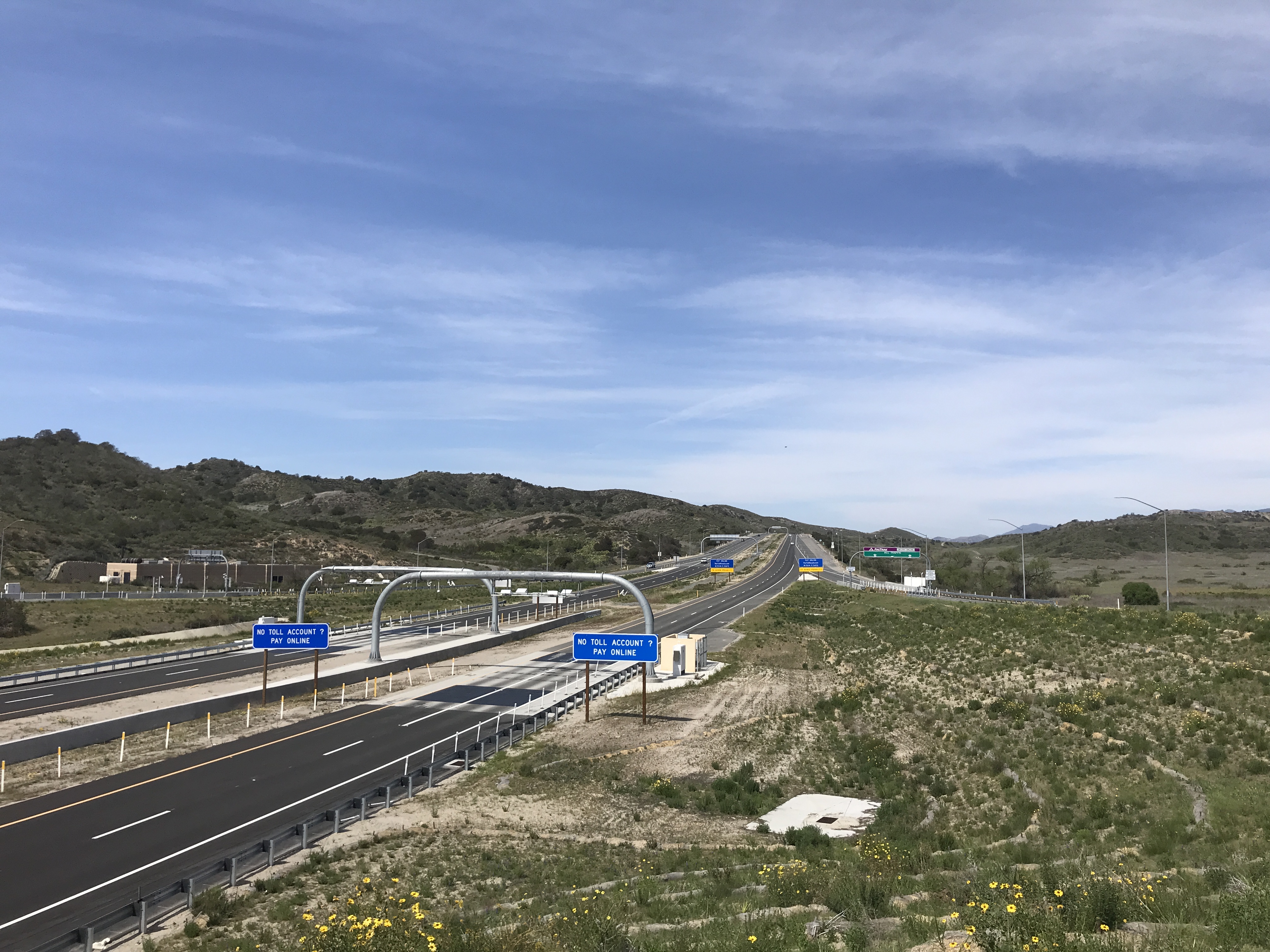
The Canyon Fire 2, also known as the Canyon 2 Fire, was a wildfire that burned in the Anaheim Hills area of the city of Anaheim in Orange County, California. The fast-moving brush fire broke out on October 9, 2017, around 9:45 A.M. PDT near the 91 Freeway and Gypsum Canyon Road. It leaped over the Route 241 toll road, raced up a ridge, and set fire to several homes. In total, about 16,570 were ordered to evacuate their homes in Anaheim, Orange, and Tustin but returned when the evacuation order was lifted on October 12. By noon on the day the fire began, it had burned . By 2:30, fueled by high winds and low humidity, it had burned and was 0 percent contained. As of 6:00 a.m. October 10 it had burned and at least 24 structures had been damaged and a dozen homes destroyed. On October 15, the fire was reportedly 90 percent contained. A total of had been burned, with 25 structures destroyed and another 55 damaged. Canyon Fire 2 was declared 100% contained on October 17 ... [...More Info...] [...Related Items...] OR: [Wikipedia] [Google] [Baidu] |
Anaheim, California
Anaheim ( ) is a city in northern Orange County, California, part of the Los Angeles metropolitan area. As of the 2020 United States Census, the city had a population of 346,824, making it the most populous city in Orange County, the 10th-most populous city in California, and the 56th-most populous city in the United States. Anaheim is the second-largest city in Orange County in terms of land area, and is known for being the home of the Disneyland Resort, the Anaheim Convention Center, and two major sports teams: the Los Angeles Angels baseball team and the Anaheim Ducks ice hockey club. Anaheim was founded by fifty German families in 1857 and incorporated as the second city in Los Angeles County on March 18, 1876; Orange County was split off from Los Angeles County in 1889. Anaheim remained largely an agricultural community until Disneyland opened in 1955. This led to the construction of several hotels and motels around the area, and residential districts in Anaheim soon fol ... [...More Info...] [...Related Items...] OR: [Wikipedia] [Google] [Baidu] |
United States
The United States of America (U.S.A. or USA), commonly known as the United States (U.S. or US) or America, is a country primarily located in North America. It consists of 50 states, a federal district, five major unincorporated territories, nine Minor Outlying Islands, and 326 Indian reservations. The United States is also in free association with three Pacific Island sovereign states: the Federated States of Micronesia, the Marshall Islands, and the Republic of Palau. It is the world's third-largest country by both land and total area. It shares land borders with Canada to its north and with Mexico to its south and has maritime borders with the Bahamas, Cuba, Russia, and other nations. With a population of over 333 million, it is the most populous country in the Americas and the third most populous in the world. The national capital of the United States is Washington, D.C. and its most populous city and principal financial center is New York City. Paleo-Americ ... [...More Info...] [...Related Items...] OR: [Wikipedia] [Google] [Baidu] |
Pacific Time Zone
The Pacific Time Zone (PT) is a time zone encompassing parts of western Canada, the western United States, and western Mexico. Places in this zone observe standard time by subtracting eight hours from Coordinated Universal Time ( UTC−08:00). During daylight saving time, a time offset of UTC−07:00 is used. In the United States and Canada, this time zone is generically called the Pacific Time Zone. Specifically, time in this zone is referred to as Pacific Standard Time (PST) when standard time is being observed (early November to mid-March), and Pacific Daylight Time (PDT) when daylight saving time (mid-March to early November) is being observed. In Mexico, the corresponding time zone is known as the ''Zona Noroeste'' (Northwest Zone) and observes the same daylight saving schedule as the U.S. and Canada. The largest city in the Pacific Time Zone is Los Angeles, whose metropolitan area is also the largest in the time zone. The zone is two hours ahead of the Hawaii–Aleut ... [...More Info...] [...Related Items...] OR: [Wikipedia] [Google] [Baidu] |
Anaheim Hills
Anaheim Hills is a planned community encompassing the eastern portions of the city of Anaheim, in Orange County, California. History Prior to the development, a few scattered low-density neighborhoods existed in the area, including Peralta Hills and Mohler Loop (tracts that still exist today) that were developed primarily in the 1940s and 1950s. The remaining portions of Anaheim Hills were primarily developed in the 1970s after rancher and land owner Louis Nohl sold his massive parcel in the foothills east of Anaheim. The area was taken over by Texaco Industries in 1970 when the company announced plans to develop an expansive and upscale master planned community of 7,000 homes, estates, and townhomes. The original master plan included a proposal for three new lakes with high-density condominiums clustered around these water features. The initial master plan proved unsustainable due to the topography and geology of the area. Construction of the community began in 1971 and was bran ... [...More Info...] [...Related Items...] OR: [Wikipedia] [Google] [Baidu] |
Orange County, California
Orange County is located in the Los Angeles metropolitan area in Southern California. As of the 2020 census, the population was 3,186,989, making it the third-most-populous county in California, the sixth-most-populous in the United States, and more populous than 19 American states and Washington, D.C. Although largely suburban, it is the second-most-densely-populated county in the state behind San Francisco County. The county's three most-populous cities are Anaheim, Santa Ana, and Irvine, each of which has a population exceeding 300,000. Santa Ana is also the county seat. Six cities in Orange County are on the Pacific coast: Seal Beach, Huntington Beach, Newport Beach, Laguna Beach, Dana Point, and San Clemente. Orange County is included in the Los Angeles-Long Beach- Anaheim Metropolitan Statistical Area. The county has 34 incorporated cities. Older cities like Old Town Tustin, Santa Ana, Anaheim, Orange, and Fullerton have traditional downtowns dating back to the 19th ... [...More Info...] [...Related Items...] OR: [Wikipedia] [Google] [Baidu] |
California State Route 91
State Route 91 (SR 91) is a major east–west state highway in the U.S. state of California that serves several regions of the Greater Los Angeles urban area. A freeway throughout its entire length, it officially runs from Vermont Avenue in Gardena, just west of the junction with the Harbor Freeway ( Interstate 110, I-110), east to Riverside at the junction with the Pomona ( SR 60 west of SR 91) and Moreno Valley (SR 60 and I-215 east of SR 91) freeways. Though signs along the portion from Vermont Avenue west to Pacific Coast Highway (SR 1) in Hermosa Beach along Artesia Boulevard are still signed as SR 91, the California Department of Transportation (Caltrans) no longer controls this portion of the highway, as this segment was relinquished to local jurisdictions in 2003. SR 91 inherited its route number from the mostly decommissioned U.S. Route 91 (US 91), which passed through the Inland Empire in a northeasterly direction on ... [...More Info...] [...Related Items...] OR: [Wikipedia] [Google] [Baidu] |
California State Route 241
State Route 241 (SR 241) is a state highway in Orange County, California that is a toll road for its entire length. Its southern half from near Las Flores to near Irvine is the Foothill Transportation Corridor, while its northern half to SR 91 on the Anaheim–Yorba Linda border forms part of the Eastern Transportation Corridor system with SR 133 and SR 261. SR 241 is one of the highest elevated highways in Orange County and provides scenic views of both the Santa Ana Mountains and the cites below, passing through 12 different cities and regions along its length. Legislatively, SR 241 is defined to run south to I-5 at San Onofre State Beach on the border with San Diego County. A plan to construct this portion was opposed due to environmental concerns. The county maintains the toll-free Los Patrones Parkway that extends the right-of-way south to Rancho Mission Viejo, but local officials do not intend to hand over control of the parkway to the state ... [...More Info...] [...Related Items...] OR: [Wikipedia] [Google] [Baidu] |
Orange, California
Orange is a city located in North Orange County, California. It is approximately north of the county seat, Santa Ana, California, Santa Ana. Orange is unusual in this region because many of the homes in its Old Town District were built before 1920. While many other cities in the region demolished such houses in the 1960s, Orange decided to preserve them. The small city of Villa Park, California, Villa Park is surrounded by the city of Orange. The population was 139,911 as of 2020 United States Census, 2020. History Members of the Tongva and Juaneño/Luiseño ethnic group long inhabited this area. After the 1769 expedition of Gaspar de Portolá, an expedition out of San Blas, Nayarit, Mexico, led by Father Junípero Serra, named the area Vallejo de Santa Ana (Valley of Saint Anne). On November 1, 1776, Mission San Juan Capistrano became the area's first permanent European settlement in Alta California, New Spain. In 1801, the Spanish Empire granted to José Antonio Yorba, w ... [...More Info...] [...Related Items...] OR: [Wikipedia] [Google] [Baidu] |
Tustin, California
Tustin is a city located in Orange County, California, in the Los Angeles metropolitan area. In 2020, Tustin had a population of 80,276. The city is located next to the county seat, Santa Ana, and does not include the unincorporated community of North Tustin. History Members of the Tongva and Juaneño/Luiseño nations long inhabited this area. After the 1769 expedition of Gaspar de Portolà, a Spanish expedition led by Father Junipero Serra named the area Vallejo de Santa Ana (Valley of Saint Anne). On November 1, 1776, Mission San Juan Capistrano became the area's first permanent European settlement in Alta California, New Spain. In 1801, the Spanish Empire granted to José Antonio Yorba, which he named Rancho San Antonio. Yorba's great rancho included the lands where the cities and communities of Olive, Orange, Villa Park, Santa Ana, Tustin, Costa Mesa and Newport Beach stand today. Smaller ranchos evolved from this large rancho including the Rancho Santiago de Sant ... [...More Info...] [...Related Items...] OR: [Wikipedia] [Google] [Baidu] |
Corona, California
Corona (Spanish for "Crown") is a city in Riverside County, California, United States. At the 2020 census, the city had a population of 157,136, up from 152,374 at the 2010 census. The cities of Norco and Riverside lie to the north and northeast, Chino Hills and Yorba Linda to the northwest, Anaheim to the west, Cleveland National Forest and the Santa Ana Mountains to the southwest, and unincorporated Riverside County along the rest of the city's borders. Downtown Corona is approximately southeast of Downtown Los Angeles and north-northwest of San Diego. Corona, located along the western edge of Southern California's Inland Empire region, is known as the "Circle City" due to Grand Boulevard's circular layout. It is one of the most residential cities in the Inland Empire, but also has a large industrial portion on the northern half, being the headquarters of companies such as Fender Musical Instruments Corporation, Monster Beverage Corporation, and supercar manufacturer ... [...More Info...] [...Related Items...] OR: [Wikipedia] [Google] [Baidu] |
2017 California Wildfires
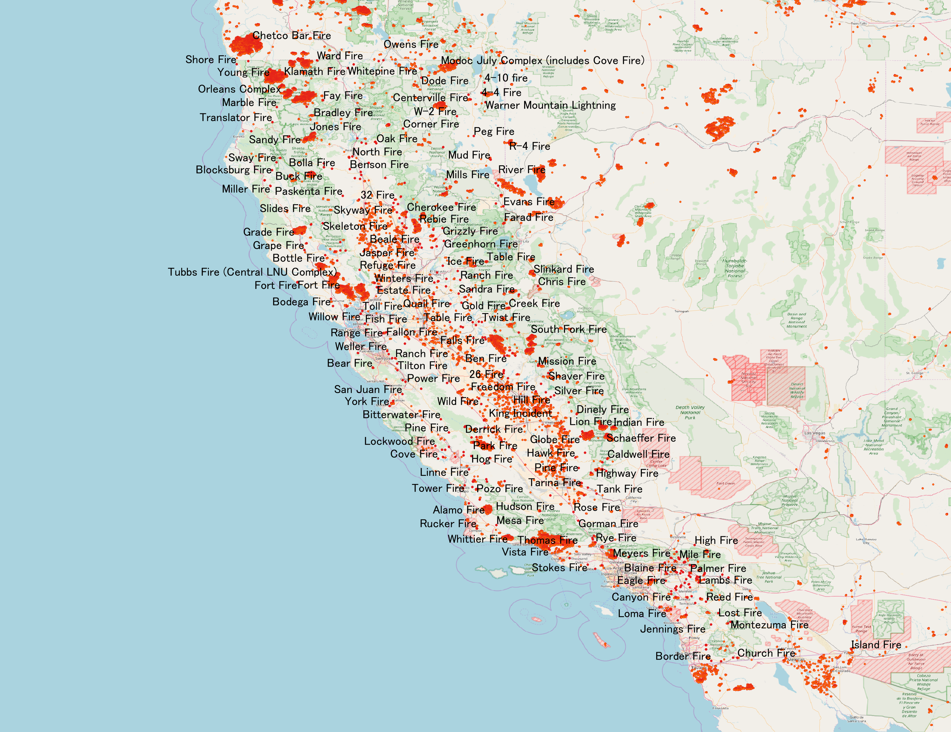
In terms of property damage, 2017 was the most destructive wildfire season on record in California at the time, surpassed by only the 2018 season and the 2020 season, with a total of 9,560 fires burning of land, according to the California Department of Forestry and Fire Protection, including five of the 20 most destructive wildland-urban interface fires in the state's history. Throughout 2017, the fires destroyed or damaged more than 10,000 structures in the state (destroyed 9,470, damaged 810), a higher tally than the previous nine years combined. State data showed that the large wildfires killed 47 people – 45 civilians and 2 firefighters – almost higher than the previous 10 years combined. The total property damage and total amount of burned land were both surpassed by the 2018 California wildfires. Throughout the early months of 2017, there was heavy rainfall over most of California, which triggered widespread flooding, thus temporarily mitigating the state's histor ... [...More Info...] [...Related Items...] OR: [Wikipedia] [Google] [Baidu] |
2018 Southern California Mudflows
A series of mudflows occurred in Southern California in early January 2018, particularly affecting areas northwest of Montecito in Santa Barbara County. The incident was responsible for 23 deaths, although the body of one of the victims has never been found. Approximately 163 people were hospitalized with various injuries, including four in critical condition. The disaster occurred one month after a series of major wildfires. The conflagrations devastated steep slopes, which caused loss of vegetation and destabilization of the soil and greatly facilitated subsequent mudflows. The mudflows caused at least $177 million (2018 USD) in property damage, and cost at least $7 million in emergency responses and another $43 million (2018 USD) to clean up. Background The 2017 California wildfire season was at the time the most destructive in California's history, with approximately 9,133 wildfires that burned over and killed 46 people. At the beginning of December, the Santa Ana winds f ... [...More Info...] [...Related Items...] OR: [Wikipedia] [Google] [Baidu] |


