|
Canoga Park, Los Angeles
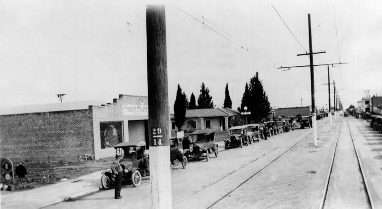
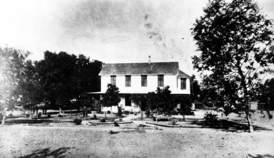
Canoga Park is a neighborhood in the San Fernando Valley region of the City of Los Angeles, California. Before the Mexican–American War, the district was part of a Ranchos of California, rancho, and after the American victory it was converted into wheat farms and then subdivided, with part of it named Owensmouth as a town founded in 1912. It joined Los Angeles in 1917 and was renamed Canoga Park on March 1, 1931, after Canoga, New York. History Pre-American history The area of present-day Canoga Park was the homeland of Native Americans in the United States, Native Americans in the Tongva people, Tongva-Fernandeño and Chumash people, Chumash-Venturaño tribes, that lived in the Simi Hills and along to the tributaries of the Los Angeles River. They traded with the north Valley Tataviam people, Tataviam-Fernandeño people. Native American civilizations inhabited the Valley for an estimated 8,000 years. Their culture left the Burro Flats Painted Cave nearby. From 1797 to 1846, ... [...More Info...] [...Related Items...] OR: [Wikipedia] [Google] [Baidu] |
Canoga, New York
Canoga is a hamlet in the Town of Fayette, Seneca County, New York, United States, along Cayuga Lake. It is located southeast of the town of Seneca Falls, at an elevation of . The primary cross roads where the hamlet is located are N.Y. Route 89 and Canoga Road (CR 121). The word Canoga, or "Ga-no-geh" as called by native Cayuga people, means "place of the sweet water".Canoga Creek Farm & Conservancy Retrieved Aug. 3, 2018. Canoga and the immediate area is home to some members of the Cayuga Nation.Cayuga Nation Retrieved Aug. 3, 2018. Nearby at Canoga Cemetery is a historical mo ... [...More Info...] [...Related Items...] OR: [Wikipedia] [Google] [Baidu] |
University Of California Press
The University of California Press, otherwise known as UC Press, is a publishing house associated with the University of California that engages in academic publishing. It was founded in 1893 to publish scholarly and scientific works by faculty of the University of California, established 25 years earlier in 1868. As the publishing arm of the University of California system, the press publishes over 250 new books and almost four dozen multi-issue journals annually, in the humanities, social sciences, and natural sciences, and maintains approximately 4,000 book titles in print. It is also the digital publisher of Collabra and Luminos open access (OA) initiatives. The press has its administrative office in downtown Oakland, California, an editorial branch office in Los Angeles, and a sales office in New York City, New York, and distributes through marketing offices in Great Britain, Asia, Australia, and Latin America. A Board consisting of senior officers of the University of Cali ... [...More Info...] [...Related Items...] OR: [Wikipedia] [Google] [Baidu] |
Isaac Newton Van Nuys
Isaac Newton Van Nuys (; November 20, 1836 – February 12, 1912) was an American businessman, farmer and rancher who owned the entire southern portion of the San Fernando Valley, an area 15 miles long and 6 miles wide. With the approach of the Owens River aqueduct and the possibility of intensive small farming, Los Angeles speculators, including Harry Chandler of the ''Los Angeles Times'', combined to buy out Van Nuys in 1909 and develop the San Fernando Valley. A development syndicate bought him out in 1911 and founded the town of Van Nuys in 1911. Its namesake was made the community's honorary godfather and died a year later. His legacy includes the town, schools, streets, libraries, and a Liberty Ship named in his honor. Early life Isaac Van Nuys was born in West Sparta, New York, the son of Peter Van Nuys and Harriet Kerr. His father was born in Millstone, New Jersey, on February 7, 1808, moved to West Sparta in 1822, became a farmer, and eventually owned . He also s ... [...More Info...] [...Related Items...] OR: [Wikipedia] [Google] [Baidu] |
Isaac Lankershim
Isaac Lankershim (c. 1819 – April 10, 1882) was an American landowner and pioneer in California. He was the owner of 60,000 acres in Los Angeles County, California. Early life Sources from during his life vary on Lankershim's birth year and place. He was born into a Jewish family in the Kingdom of Bavaria, in either the towns of Scheinfeld, Nuremberg, or Albertkunstadt, and on April 8, between 1818 and 1820. Career Lankershim settled in St. Louis, Missouri and worked in the grain and livestock shipping business. In 1854, Lankershim moved west to the Napa Valley in California. A year later, in 1855, he sowed and harvested 1,000 acres of wheat in Solano County, California. Shortly after, he expanded to over 14,000 acres near Fresno, California. In 1868, he purchased a bigger ranch in San Diego, California and grew wheat. In 1860, the rest of his family moved from St. Louis to California, and he established an office in San Francisco, California. In the late 1860s, Lankershi ... [...More Info...] [...Related Items...] OR: [Wikipedia] [Google] [Baidu] |
Pío Pico
Don (honorific), Don Pío de Jesús Pico IV (May 5, 1801 – September 11, 1894) was a California politician, ranchero, and entrepreneur, famous for serving as the List of governors of California before 1850, last governor of Alta California under Mexican rule from 1845 to 1846. He briefly held the governorship during a disputed period in 1832. A member of the prominent Pico family of California, he was one of the wealthiest men in California at the time and a hugely influential figure in Californian society, continuing as a citizen of the nascent U.S. state of California. His legacy can be seen in the numerous places named after him, such as the city of Pico Rivera, California, Pico Rivera, Pico Boulevard in Los Angeles, Pio Pico State Historic Park, and numerous schools that bear his name. Early years Ancestry Pío Pico was of Indigenous peoples of the Americas, Native American, Spaniards, Spanish, Italians, Italian, and Africans, African ancestry. His earliest known ancesto ... [...More Info...] [...Related Items...] OR: [Wikipedia] [Google] [Baidu] |
Rancho El Escorpión
Rancho El Escorpión was a Mexican land grant in present day Los Angeles County, California given in 1845 by Governor Pío Pico to three Chumash Native Americans - Odón Chijulla, Urbano, and Mañuel. Santa Susana Pass State Historic Park (SSPSHP); Ethnohistory ; p. 46. The half league square shaped Rancho El Escorpión was located at the west end of the on Bell Creek against the |
Rancho Ex-Mission San Fernando
Rancho Ex-Mission San Fernando was a Mexican land grant in present-day Los Angeles County, California, granted in 1846 by Governor Pío Pico to Eulogio F. de Celis. The grant derives its name from the secularized Mission San Fernando Rey de España, but was called ex-Mission because of a division made of the lands held in the name of the mission—the church retaining the grounds immediately around, and all of the lands outside of this were called ex-Mission lands. The grant encompassed most of the present-day San Fernando Valley. History Mission secularization and land After Mexico's independence from Spain in 1821, the Mexican Congress passed a '' Decree for the Secularization of the Missions of the Californias'' on August 17, 1833, in an effort to prevent the influence of the formerly Spanish system in the California territories, allow secular use of the rich and valuable mission lands, and to legislate the emancipation of the indigenous mission wards. Governor José Fig ... [...More Info...] [...Related Items...] OR: [Wikipedia] [Google] [Baidu] |
Mexican War Of Independence
The Mexican War of Independence (, 16 September 1810 – 27 September 1821) was an armed conflict and political process resulting in Mexico's independence from the Spanish Empire. It was not a single, coherent event, but local and regional struggles that occurred within the same period, and can be considered a List of wars of independence, revolutionary civil war. It culminated with the drafting of the Declaration of Independence (Mexico), Declaration of Independence of the Mexican Empire in Mexico City on September 28, 1821, following the collapse of royal government and the military triumph of forces for independence. Mexican independence from Spain was not an inevitable outcome of the relationship between the Spanish Empire and its most valuable overseas possession, but events in Spain had a direct impact on the outbreak of the armed insurgency in 1810 and the course of warfare through the end of the conflict. Napoleon, Napoleon Bonaparte's Peninsular War, invasion of Spa ... [...More Info...] [...Related Items...] OR: [Wikipedia] [Google] [Baidu] |
Mission San Fernando Rey De España
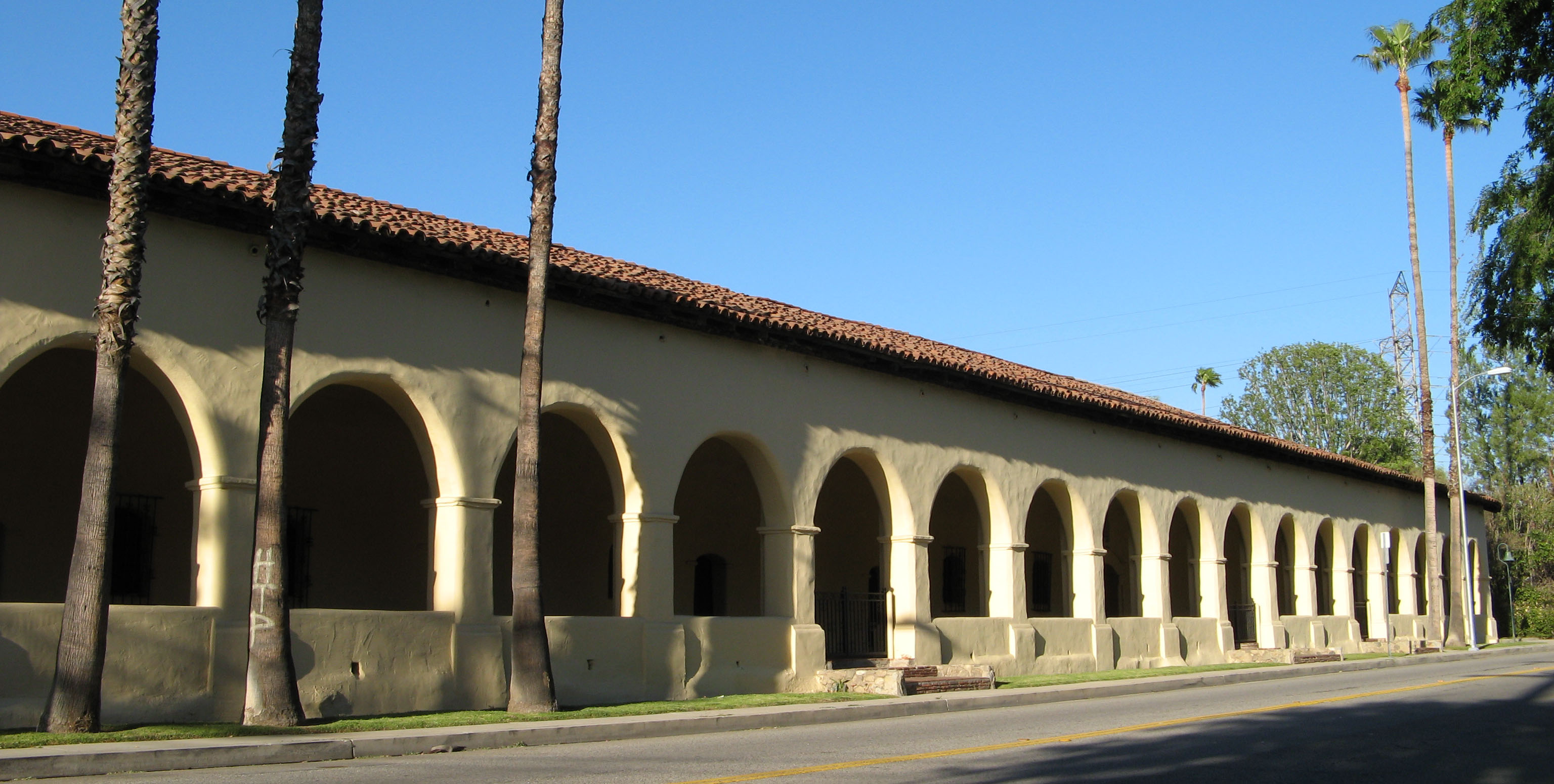
Mission San Fernando Rey de España is a Spanish missions in California, Spanish mission in the Mission Hills, Los Angeles, Mission Hills community of Los Angeles, California. The mission was founded on September 8, 1797 at the site of Achooykomenga, and was the seventeenth of the twenty-one Spanish missions established in Alta California. Named for Ferdinand III of Castile, Saint Ferdinand, the mission is the namesake of the nearby city of San Fernando, California, San Fernando and the San Fernando Valley. The mission was Secularization, secularized in 1834 and returned to the Catholic Church in 1861; it became a working church in 1920. Today the mission grounds function as a museum; the church is a chapel of ease of the Roman Catholic Archdiocese of Los Angeles, Archdiocese of Los Angeles. History In 1769, the Spanish Portolá expedition, Portolà expedition – the first Europeans to see inland areas of California – traveled north through the San Fernando Valley. On Augu ... [...More Info...] [...Related Items...] OR: [Wikipedia] [Google] [Baidu] |
Burro Flats Painted Cave
The Burro Flats site is a painted cave site located near Burro Flats, in the Simi Hills of eastern Ventura County, California, United States. The Rock art of the Chumash people, Chumash-style "main panel" and the surrounding 25-acres were listed on the National Register of Historic Places in 1976, with a boundary decrease in 2020. The main panel includes dozens of pictographs in a variety of colors. The cave is in the mountains, near the bi-lingual Chumash/Fernandeno village of Huwam/Jucjauynga. The Burro Flats painted cave and the rest of the former Santa Susana Field Laboratory are not accessible to the public. Pictographs Among the pictographs are two human figures wearing feathered headdresses. There are also "raked Anthropomorphism, anthropomorph" motifs, possible comet figures, and many more naturalistic elements. The Burro Flats cave pictographs are some of the best-preserved Native American art in Southern California. Archaeologists estimate the paintings to be several ... [...More Info...] [...Related Items...] OR: [Wikipedia] [Google] [Baidu] |
Tataviam People
The Tataviam (Kitanemuk: ''people on the south slope'') are a Native American group in Southern California. The ancestral land of the Tataviam people includes northwest present-day Los Angeles County and southern Ventura County, primarily in the upper basin of the Santa Clara River, the Santa Susana Mountains, and the Sierra Pelona Mountains. They are distinct from the Kitanemuk and the Gabrielino-Tongva peoples. Their tribal government is based in San Fernando, California, and includes the Executive Branch, the Legislative Branch, the Tribal Senate, and the Council of Elders. The current Tribal President of the Fernandeño Tataviam Band of Mission Indians is Rudy Ortega Jr., who is a descendant of the village of Tochonanga. The Tataviam are not federally recognized, which has prevented the tribe from being seen as sovereign and erased the identity of tribal members. The tribe has established an ''Acknowledge Rent'' campaign to acknowledge "the financial hardships placed ... [...More Info...] [...Related Items...] OR: [Wikipedia] [Google] [Baidu] |
Los Angeles River
The Los Angeles River (), historically known as by the Tongva and the by the Spanish, is a major river in Los Angeles County, California. Its headwaters are in the Simi Hills and Santa Susana Mountains, and it flows nearly from Canoga Park, Los Angeles, California, Canoga Park through the San Fernando Valley, downtown Los Angeles, and the Gateway Cities to its mouth in Long Beach, California, Long Beach, where it flows into San Pedro Bay (California), San Pedro Bay. While the river was once free-flowing and frequently flooding, forming alluvial flood plains along its banks, it currently flows through a concrete channel on a fixed course, which was built after a series of devastating floods in the early 20th century. Before the opening of the Los Angeles Aqueduct, the river was the primary source of fresh water for the city. Although the Los Angeles region still receives some water from the river and other local sources, most of the water supply flows from several aqueducts ... [...More Info...] [...Related Items...] OR: [Wikipedia] [Google] [Baidu] |


