|
Canine Hills
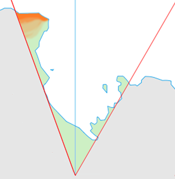
The Canine Hills () are a line of mostly snow-covered hills and ridges trending northwest–southeast for and forming the eastern half of Molar Massif in the Bowers Mountains, a major mountain range situated in Victoria Land, Antarctica. They were named by the New Zealand Antarctic Place-Names Committee in 1983 from a proposal by geologist M.G. Laird, after canine teeth, in association with other tooth-related names nearby: Molar Massif and Incisor Ridge. The hills lie situated on the Pennell Coast Pennell Coast is that portion of the coast of Antarctica between Cape Williams and Cape Adare. To the west of Cape Williams lies Oates Coast, and to the east and south of Cape Adare lies Borchgrevink Coast. Named by New Zealand Antarctic Place- ..., a portion of Antarctica lying between Cape Williams and Cape Adare. References Hills of Victoria Land Pennell Coast {{VictoriaLand-geo-stub ... [...More Info...] [...Related Items...] OR: [Wikipedia] [Google] [Baidu] |
Molar Massif
Molar Massif () is a large mountain massif immediately east of the Lanterman Range in the Bowers Mountains of Antarctica. It was mapped by the United States Geological Survey from ground surveys and U.S. Navy air photos, 1960–1964. The descriptive name was applied by the Advisory Committee on Antarctic Names; when viewed in plan, the outline of the massif resembles a molar tooth. Features Geographical features include: * Canine Hills * Dentine Peak * Evison Glacier * Husky Pass * Incisor Ridge * Leap Year Glacier * Tobogganers Icefall * Wisdom Hills Further reading * Gunter Faure, Teresa M. Mensing, The Transantarctic Mountains: Rocks, Ice, Meteorites and Water', P 136 * Edmund Stump, The Ross Orogen of the Transantarctic Mountains', P 49 External links Molar Massifon USGS website Molar Massifon AADC website Molar Massifon SCAR A scar (or scar tissue) is an area of fibrous tissue that replaces normal skin after an injury. Scars result from the biological ... [...More Info...] [...Related Items...] OR: [Wikipedia] [Google] [Baidu] |
Bowers Mountains
__NOTOC__ Bowers Mountains () is a group of north–south trending mountains in Antarctica, about 145 km (90 mi) long and 56 km (35 mi) wide, bounded by the coast on the north and by the Rennick, Canham, Black and Lillie glaciers in other quadrants. The seaward end was first sighted in February 1911 from the ''Terra Nova'', under Lt. Harry L.L. Pennell, RN, and was subsequently named "Bowers Hills" in honour of Henry Robertson Bowers who perished with Captain Robert Falcon Scott on their return from the South Pole in 1912. The mountain range is one of the most extensive topographical features within Victoria Land. The feature was photographed from U.S. Navy aircraft in 1946-47 and 1960–62, and was surveyed and mapped by the United States Geological Survey (USGS) in 1962–63. The name was amended to Bowers Mountains upon USGS mapping which showed the group to be a major one with peaks rising to nearly 2,600 metres. The major topographical feature lies sit ... [...More Info...] [...Related Items...] OR: [Wikipedia] [Google] [Baidu] |
Victoria Land
Victoria Land is a region in eastern Antarctica which fronts the western side of the Ross Sea and the Ross Ice Shelf, extending southward from about 70°30'S to 78°00'S, and westward from the Ross Sea to the edge of the Antarctic Plateau. It was discovered by Captain James Clark Ross in January 1841 and named after Queen Victoria. The rocky promontory of Minna Bluff is often regarded as the southernmost point of Victoria Land, and separates the Scott Coast to the north from the Hillary Coast of the Ross Dependency to the south. The region includes ranges of the Transantarctic Mountains and the McMurdo Dry Valleys (the highest point being Mount Abbott in the Northern Foothills), and the flatlands known as the Labyrinth. The Mount Melbourne is an active volcano in Victoria Land. Early explorers of Victoria Land include James Clark Ross and Douglas Mawson. In 1979, scientists discovered a group of 309 meteorites in Antarctica, some of which were found near the Allan Hills in ... [...More Info...] [...Related Items...] OR: [Wikipedia] [Google] [Baidu] |
Antarctica
Antarctica () is Earth's southernmost and least-populated continent. Situated almost entirely south of the Antarctic Circle and surrounded by the Southern Ocean, it contains the geographic South Pole. Antarctica is the fifth-largest continent, being about 40% larger than Europe, and has an area of . Most of Antarctica is covered by the Antarctic ice sheet, with an average thickness of . Antarctica is, on average, the coldest, driest, and windiest of the continents, and it has the highest average elevation. It is mainly a polar desert, with annual precipitation of over along the coast and far less inland. About 70% of the world's freshwater reserves are frozen in Antarctica, which, if melted, would raise global sea levels by almost . Antarctica holds the record for the lowest measured temperature on Earth, . The coastal regions can reach temperatures over in summer. Native species of animals include mites, nematodes, penguins, seals and tardigrades. Where vegetation o ... [...More Info...] [...Related Items...] OR: [Wikipedia] [Google] [Baidu] |
New Zealand Antarctic Place-Names Committee
New Zealand Antarctic Place-Names Committee (NZ-APC) is an adjudicating committee established to authorize the naming of features in the Ross Dependency on the Antarctic continent. It is composed of the members of the New Zealand Geographic Board plus selected specialists on Antarctica. This committee works in collaboration with similar place-naming authorities in Australia, Great Britain and the United States to reach concurrence on each decision. The NZ-APC committee was established in 1956. Names attributed by the committee * Alberich Glacier, named after Alberich, king of the elves and chief of the Nibelungen * Arena Saddle, named in conjunction with Arena Valley * Brawhm Pass, named after the six party members of the University of New South Wales expeditions of 1964–65 and 1966–67 * Caliper Cove, named for descriptive features * Canada Stream, named in conjunction with Canada Glacier * Cape Crossfire, named for descriptive features * Cuneiform Cliffs, named for des ... [...More Info...] [...Related Items...] OR: [Wikipedia] [Google] [Baidu] |
Canine Teeth
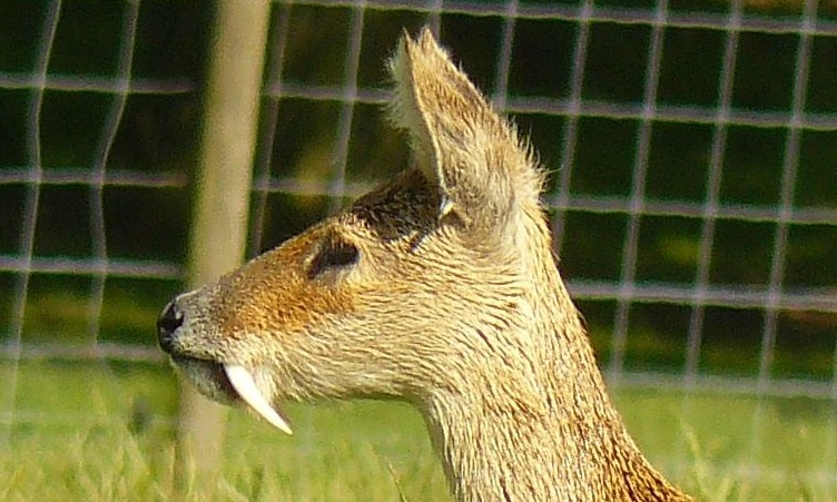
In mammalian oral anatomy, the canine teeth, also called cuspids, dog teeth, or (in the context of the upper jaw) fangs, eye teeth, vampire teeth, or vampire fangs, are the relatively long, pointed teeth. They can appear more flattened however, causing them to resemble incisors and leading them to be called ''incisiform''. They developed and are used primarily for firmly holding food in order to tear it apart, and occasionally as weapons. They are often the largest teeth in a mammal's mouth. Individuals of most species that develop them normally have four, two in the upper jaw and two in the lower, separated within each jaw by incisors; humans and dogs are examples. In most species, canines are the anterior-most teeth in the maxillary bone. The four canines in humans are the two maxillary canines and the two mandibular canines. Details There are generally four canine teeth: two in the upper (maxillary) and two in the lower (mandibular) arch. A canine is placed laterally t ... [...More Info...] [...Related Items...] OR: [Wikipedia] [Google] [Baidu] |
Incisor Ridge
Incisor Ridge () is a ridge, long, forming the southwestern segment of Molar Massif in the Bowers Mountains of Antarctica. It was named in association with Molar Massif by the New Zealand Antarctic Place-Names Committee in 1983 on the proposal of geologist M.G. Laird. The topographical feature lies situated on the Pennell Coast, a portion of Antarctica lying between Cape Williams and Cape Adare Cape Adare is a prominent cape of black basalt forming the northern tip of the Adare Peninsula and the north-easternmost extremity of Victoria Land, East Antarctica. Description Marking the north end of Borchgrevink Coast and the west e .... References Ridges of Victoria Land Pennell Coast {{VictoriaLand-geo-stub ... [...More Info...] [...Related Items...] OR: [Wikipedia] [Google] [Baidu] |
Pennell Coast
Pennell Coast is that portion of the coast of Antarctica between Cape Williams and Cape Adare. To the west of Cape Williams lies Oates Coast, and to the east and south of Cape Adare lies Borchgrevink Coast. Named by New Zealand Antarctic Place-Names Committee (NZ-APC) in 1961 after Lieutenant Harry Pennell, Royal Navy, commander of the Terra Nova, the expedition ship of the British Antarctic Expedition, 1910–13. Pennell engaged in oceanographic work in the Ross Sea during this period. In February 1911 he sailed along this coast in exploration and an endeavor to land the Northern Party led by Lieutenant Victor Campbell. The name is also used more loosely to refer to both the coast itself and the hinterland extending south to the watershed of the Southern Cross Mountains to the southeast and the Usarp Mountains to the west. Major features of the coast include the 250-kilometer long Rennick Glacier (one of Antarctica's largest glaciers), the Anare Mountains, and the norther ... [...More Info...] [...Related Items...] OR: [Wikipedia] [Google] [Baidu] |
Cape Williams
Cape Williams () is an ice-covered cape in Antarctica. It is the termination of Buell Peninsula at the east side of the terminus of Lillie Glacier at the lower ends of George Glacier and Zykov Glacier. The peninsula is 15 nautical miles (28 km) long and is situated at the extremity of the Pennell Coast portion of Victoria Land, lying between Cape Williams and Cape Adare Cape Adare is a prominent cape of black basalt forming the northern tip of the Adare Peninsula and the north-easternmost extremity of Victoria Land, East Antarctica. Description Marking the north end of Borchgrevink Coast and the west e .... It was discovered in February 1911 when the Terra Nova of the British Antarctic Expedition, 1910–13, explored the area westward of Cape North, and it was named for William Williams, Chief Engine-room Artificer on the Terra Nova. Headlands of Victoria Land Pennell Coast {{VictoriaLand-geo-stub ... [...More Info...] [...Related Items...] OR: [Wikipedia] [Google] [Baidu] |
Cape Adare
Cape Adare is a prominent cape of black basalt forming the northern tip of the Adare Peninsula and the north-easternmost extremity of Victoria Land, East Antarctica. Description Marking the north end of Borchgrevink Coast and the west end of Pennell Coast, the cape separates the Ross Sea to the east from the Southern Ocean to the west, and is backed by the high Admiralty Mountains. Cape Adare was an important landing site and base camp during early Antarctic exploration. Off the coast to the northeast are the Adare Seamounts and the Adare Trough. History Captain James Ross discovered Cape Adare in January 1841 and named it after his friend the Viscount Adare (the title is derived from Adare, Ireland). In January 1895, Norwegian explorers Henrik Bull and Carsten Borchgrevink from the ship '' Antarctic'' landed at Cape Adare as the first documented landing on Antarctica, collecting geological specimens. Borchgrevink returned to the cape leading his own expedition i ... [...More Info...] [...Related Items...] OR: [Wikipedia] [Google] [Baidu] |
Hills Of Victoria Land
A hill is a landform that extends above the surrounding terrain. It often has a distinct summit. Terminology The distinction between a hill and a mountain is unclear and largely subjective, but a hill is universally considered to be not as tall, or as steep as a mountain. Geographers historically regarded mountains as hills greater than above sea level, which formed the basis of the plot of the 1995 film '' The Englishman who Went up a Hill but Came down a Mountain''. In contrast, hillwalkers have tended to regard mountains as peaks above sea level. The ''Oxford English Dictionary'' also suggests a limit of and Whittow states "Some authorities regard eminences above as mountains, those below being referred to as hills." Today, a mountain is usually defined in the UK and Ireland as any summit at least high, while the official UK government's definition of a mountain is a summit of or higher. Some definitions include a topographical prominence requirement, typically ... [...More Info...] [...Related Items...] OR: [Wikipedia] [Google] [Baidu] |


