|
Camp Bay, Gibraltar
Camp Bay (or El Quarry in Llanito) is a small rocky beach in the British Overseas Territories, British Overseas Territory of Gibraltar. It is located off Rosia Road along the territory's west coast overlooking the Bay of Gibraltar. Parson's Lodge Battery overlooks the northern end of the bay. Artificial reef Camp Bay is home to what is claimed to be Europe's first artificial reef. The reef was created by activists who were concerned at the scarcity of Marine biology#Reefs, marine life. The early experiments of floating out and sinking derelict cars merely demonstrated the power of local storms and currents. A second attempt used ships that were no longer required. Some were vessels that would have been abandoned in deep water, but the activists persuaded people to sink them in shallower waters. Significant donations were floating harbours and the large cable ship known as the ''482''. These ships now create a haven for marine life and are a destination for thousands of divers ea ... [...More Info...] [...Related Items...] OR: [Wikipedia] [Google] [Baidu] |
Llanito
''Llanito'' or ''Yanito'' () is a form of Andalusian Spanish heavily laced with words from English and other languages, such as Ligurian; it is spoken in the British overseas territory of Gibraltar. It is commonly marked by a great deal of code switching between Andalusian Spanish and British English and by the use of Anglicisms and loanwords from other Mediterranean languages and dialects. The English language is becoming increasingly dominant in Gibraltar, with the younger generation speaking little or no Llanito despite learning Spanish in school. ''Llanito'' is a Spanish word meaning "little plain". Gibraltarians also call themselves ''Llanitos''. Etymology The etymology of the term is uncertain. In Spanish, means "little flatland" and has been interpreted as "people of the flatlands". It is thought that the inhabitants of La Línea with important social and economic ties with Gibraltar, were actually the first to be referred to as since La Línea lies in the pla ... [...More Info...] [...Related Items...] OR: [Wikipedia] [Google] [Baidu] |
Beach
A beach is a landform alongside a body of water which consists of loose particles. The particles composing a beach are typically made from rock, such as sand, gravel, shingle, pebbles, etc., or biological sources, such as mollusc shells or coralline algae. Sediments settle in different densities and structures, depending on the local wave action and weather, creating different textures, colors and gradients or layers of material. Though some beaches form on inland freshwater locations such as lakes and rivers, most beaches are in coastal areas where wave or current action deposits and reworks sediments. Erosion and changing of beach geologies happens through natural processes, like wave action and extreme weather events. Where wind conditions are correct, beaches can be backed by coastal dunes which offer protection and regeneration for the beach. However, these natural forces have become more extreme due to climate change, permanently altering beaches at very rapid ... [...More Info...] [...Related Items...] OR: [Wikipedia] [Google] [Baidu] |
British Overseas Territories
The British Overseas Territories (BOTs), also known as the United Kingdom Overseas Territories (UKOTs), are fourteen dependent territory, territories with a constitutional and historical link with the United Kingdom. They are the last remnants of the former British Empire and do not form part of the United Kingdom itself. The permanently inhabited territories are internally Self-governance, self-governing, with the United Kingdom retaining responsibility for Defence (military), defence and foreign relations. Three of the territories are inhabited only by a transitory population of military or scientific personnel. All but one of the rest are listed by the Special Committee on Decolonization, UN Special Committee on Decolonization as United Nations list of non-self-governing territories, non-self-governing territories. All fourteen have the Monarchy of the United Kingdom, British monarch as head of state. three territories (the Falkland Islands, Gibraltar and the Akrotiri an ... [...More Info...] [...Related Items...] OR: [Wikipedia] [Google] [Baidu] |
Gibraltar
) , anthem = " God Save the King" , song = " Gibraltar Anthem" , image_map = Gibraltar location in Europe.svg , map_alt = Location of Gibraltar in Europe , map_caption = United Kingdom shown in pale green , mapsize = , image_map2 = Gibraltar map-en-edit2.svg , map_alt2 = Map of Gibraltar , map_caption2 = Map of Gibraltar , mapsize2 = , subdivision_type = Sovereign state , subdivision_name = , established_title = British capture , established_date = 4 August 1704 , established_title2 = , established_date2 = 11 April 1713 , established_title3 = National Day , established_date3 = 10 September 1967 , established_title4 = Accession to EEC , established_date4 = 1 January 1973 , established_title5 = Withdrawal from the EU , established_date5 = 31 January 2020 , official_languages = English , languages_type = Spoken languages , languages = , capital = Westside, Gibraltar (de facto) , coordinates = , largest_settlement_type = largest district , l ... [...More Info...] [...Related Items...] OR: [Wikipedia] [Google] [Baidu] |
Rosia Road
Rosia Road is a western road in the British Overseas Territory of Gibraltar. It connects with Boyd Street in the north and flows in a north–south direction, joining Keightley Way in the south. Rosia Road is the site of the Naval dockyard, Nelson's Anchorage the shipyard Gibdock, the headquarters of the Royal Gibraltar Police, Napier of Magdala Battery, Parson's Lodge Battery, the Victualling Yard The Commissioners for the Victualling of the Navy, often called the Victualling Commissioners or Victualling Board, was the body responsible under the Navy Board for victualling ships of the British Royal Navy. It oversaw the vast operation of ..., and the demolished Rosia Water Tanks. References Streets in Gibraltar {{Europe-road-stub ... [...More Info...] [...Related Items...] OR: [Wikipedia] [Google] [Baidu] |
Bay Of Gibraltar
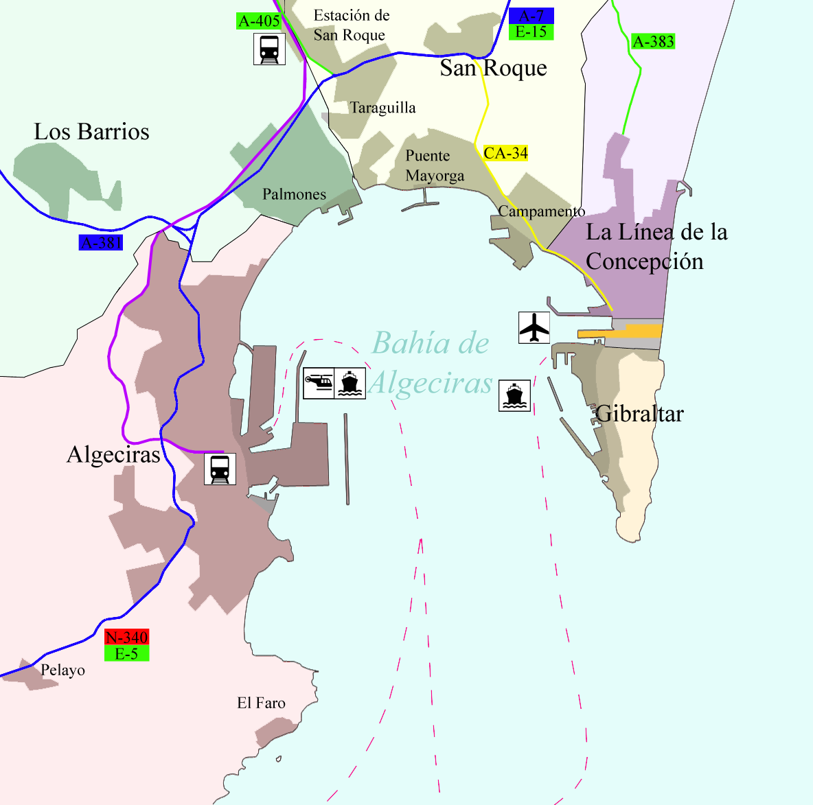
The Bay of Gibraltar ( es, Bahía de Algeciras), is a bay at the southern end of the Iberian Peninsula. It is around long by wide, covering an area of some , with a depth of up to in the centre of the bay. It opens to the south into the Strait of Gibraltar and the Mediterranean Sea. The shoreline is densely settled. From west to east, the shore is divided between the Spanish municipalities of Algeciras, Los Barrios, San Roque, La Línea de la Concepción and the British Overseas Territory of Gibraltar. The larger part of the shoreline is Spanish territory, with part of the eastern half of the bay belonging to Gibraltar. The east and west entrances to the bay are marked respectively by the Europa Point Lighthouse at Europa Point, Gibraltar and the Punta Carnero Lighthouse in Punta Carnero to the west of Algeciras. History The area around the Bay of Gibraltar has been inhabited for millennia and the bay itself has been used by merchant shipping for at least 3,000 years. Th ... [...More Info...] [...Related Items...] OR: [Wikipedia] [Google] [Baidu] |
Parson's Lodge Battery
Parson's Lodge Battery is a coastal battery and fort in the British Overseas Territory of Gibraltar. History The Moors had been in Gibraltar, and the Spanish had occupied The Rock for over 250 years. In 1704, the British took possession and, by 1720, they had installed a pair each of 18-pounder (8.1 kg) and 12-pounder (5.4 kg) guns. By 1744, there were over 20 guns around Rosia Bay. Parson's Lodge Battery was originally named the 9th Rosia Battery. The Parson's Lodge name is first recorded in 1761 and reputedly refers to the dwelling of the parson of a church and hermitage named St. John the Green. In early October 1840, Major-General John Thomas Jones arrived to inspect the defences of Gibraltar. He remained on the rock until June 1841, when he returned to England. Jones advised on improvements for Parson's Lodge Battery, which caused eight guns to be installed in 1842. At the height of its military importance, the battery had three rifled muzzle-loading gun ... [...More Info...] [...Related Items...] OR: [Wikipedia] [Google] [Baidu] |
Camp Bay - Panoramic
Camp may refer to: Outdoor accommodation and recreation * Campsite or campground, a recreational outdoor sleeping and eating site * a temporary settlement for nomads * Camp, a term used in New England, Northern Ontario and New Brunswick to describe a cottage * Military camp * Summer camp, typically organized for groups of children or youth * Tent city, a housing facility often occupied by homeless people or protesters Areas of imprisonment or confinement * Concentration camp * Extermination camp * Federal prison camp, a minimum-security United States federal prison facility * Internment camp, also called a concentration camp, resettlement camp, relocation camp, or detention camp * Labor camp * Prisoner-of-war camp ** Parole camp guards its own soldiers as prisoners of war Gatherings of people * Camp, a mining community * Camp, a term commonly used in the titles of technology-related unconferences * Camp meeting, a Christian gathering which originated in 19th-century America ... [...More Info...] [...Related Items...] OR: [Wikipedia] [Google] [Baidu] |
Artificial Reef
An artificial reef is a human-created underwater structure, typically built to promote marine life in areas with a generally featureless bottom, to control erosion, block ship passage, block the use of trawling nets, or improve surfing. Many reefs are built using objects that were built for other purposes, such as by sinking oil rigs (through the Rigs-to-Reefs program), scuttling ships, or by deploying rubble or construction debris. Other artificial reefs are purpose-built (e.g. the reef balls) from PVC or concrete. Shipwrecks may become artificial reefs when preserved on the seafloor. Regardless of construction method, artificial reefs generally provide hard surfaces where algae and invertebrates such as barnacles, corals, and oysters attach; the accumulation of attached marine life in turn provides intricate structures and food for assemblages of fish. History The construction of artificial reefs began in ancient times. Persians blocked the mouth of the Tigris River to ... [...More Info...] [...Related Items...] OR: [Wikipedia] [Google] [Baidu] |
Marine Biology
Marine biology is the scientific study of the biology of marine life, organisms in the sea. Given that in biology many phyla, families and genera have some species that live in the sea and others that live on land, marine biology classifies species based on the environment rather than on taxonomy. A large proportion of all life on Earth lives in the ocean. The exact size of this ''large proportion'' is unknown, since many ocean species are still to be discovered. The ocean is a complex three-dimensional world covering approximately 71% of the Earth's surface. The habitats studied in marine biology include everything from the tiny layers of surface water in which organisms and abiotic items may be trapped in surface tension between the ocean and atmosphere, to the depths of the oceanic trenches, sometimes 10,000 meters or more beneath the surface of the ocean. Specific habitats include estuaries, coral reefs, kelp forests, seagrass meadows, the surrounds of seamounts and therm ... [...More Info...] [...Related Items...] OR: [Wikipedia] [Google] [Baidu] |


