|
Camiers
Camiers () is a commune in the Pas-de-Calais department in Hauts-de-France in France. Geography The area of the commune is . The village of Camiers itself is small and stands just inland from the dunes on the south-west and west-facing coast just north of Étaples. The space between the village and the mouth of the River Canche is occupied by a nature reserve in the dunes. The local solid geology is the Cretaceous plateau of Artois with the Boulonnais just to the north. In its highest part, the commune rises onto the Upper Cretaceous at 176 metres but most lies on the levelled marine sand which in the medieval period, was off-shore. The coastal road, the D940 now by-passes the village to the west while the main traffic between Calais and Abbeville is carried by the Autoroute A16 on the higher ground to the east. The Autoroute briefly passes through the eastern extremity of the commune. History Camiers belonged to the Lordship of Noailles. However the waters of the lagoon ... [...More Info...] [...Related Items...] OR: [Wikipedia] [Google] [Baidu] |
Machine Gun Corps
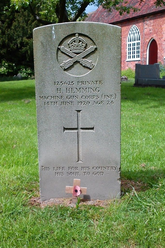
The Machine Gun Corps (MGC) was a corps of the British Army, formed in October 1915 in response to the need for more effective use of machine guns on the Western Front in the First World War. The Heavy Branch of the MGC was the first to use tanks in combat and was subsequently turned into the Tank Corps, later called the Royal Tank Regiment. The MGC remained in existence after the war until it was disbanded in 1922. Formation At the outbreak of the First World War in August 1914, the tactical potential of machine guns was not appreciated by the British Armed Forces. The prevalent attitude of senior ranks at the outbreak of the Great War can be summed up by the opinion of an officer expressed a decade earlier that a single battery of machine guns per army corps was a sufficient level of issue. Despite the evidence of fighting in Manchuria (1905 onwards) the army therefore went to war with each infantry battalion and cavalry regiment containing a machine gun section of just two ... [...More Info...] [...Related Items...] OR: [Wikipedia] [Google] [Baidu] |
Communes Of The Pas-de-Calais Department
The following is a list of the 890 communes of the Pas-de-Calais department of France. The communes cooperate in the following intercommunalities (as of 2020):BANATIC Périmètre des EPCI à fiscalité propre. Accessed 3 July 2020. * * * |
Communauté D'agglomération Des Deux Baies En Montreuillois
The Communauté d'agglomération des Deux Baies en Montreuillois is a ''communauté d'agglomération'', an intercommunal structure, in the Pas-de-Calais department, in the Hauts-de-France region, northern France. It was created in January 2017 by the merger of the former communautés de communes Montreuillois, Opale Sud and Mer et Terres d'Opale. 31 August 2016, p 59 Its seat is in Montreuil.CA des Deux B ... [...More Info...] [...Related Items...] OR: [Wikipedia] [Google] [Baidu] |
Grantham
Grantham () is a market and industrial town in the South Kesteven district of Lincolnshire, England, situated on the banks of the River Witham and bounded to the west by the A1 road. It lies some 23 miles (37 km) south of the Lincoln and 22 miles (35 km) east of Nottingham. The population in 2016 was put at 44,580. The town is the largest settlement and the administrative centre of South Kesteven District. Grantham was the birthplace of the UK Prime Minister Margaret Thatcher. Isaac Newton was educated at the King's School. The town was the workplace of the UK's first warranted female police officer, Edith Smith in 1914. The UK's first running diesel engine was made there in 1892 and the first tractor in 1896. Thomas Paine worked there as an excise officer in the 1760s. The villages of Manthorpe, Great Gonerby, Barrowby, Londonthorpe and Harlaxton form outlying suburbs of the town. Etymology Grantham's name is first attested in the Domesday Book (1086); its orig ... [...More Info...] [...Related Items...] OR: [Wikipedia] [Google] [Baidu] |
Belton House
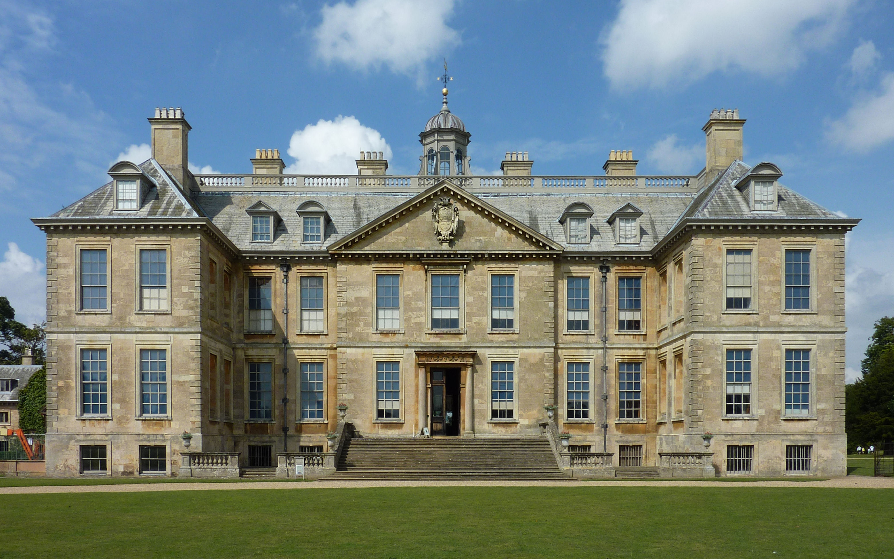
Belton House is a Grade I listed country house in the parish of Belton near Grantham in Lincolnshire, England, built between 1685 and 1688 by Sir John Brownlow, 3rd Baronet. It is surrounded by formal gardens and a series of avenues leading to follies within a larger wooded park. Belton has been described as a compilation of all that is finest of Carolean architecture, the only truly vernacular style of architecture that England had produced since the Tudor period.Nicolson, 148. It is considered to be a complete example of a typical English country house. For about three centuries until 1984, Belton House was the seat successively of the Brownlow family, which had first acquired land in the area in the late 16th century, and of its heirs the Cust family (in 1815 created Earl Brownlow). Despite his great wealth Sir John Brownlow, 3rd Baronet, chose to build a comparatively modest house rather than one of the grand Baroque palaces being built by others at the time. The contempo ... [...More Info...] [...Related Items...] OR: [Wikipedia] [Google] [Baidu] |
British Expeditionary Force (World War I)
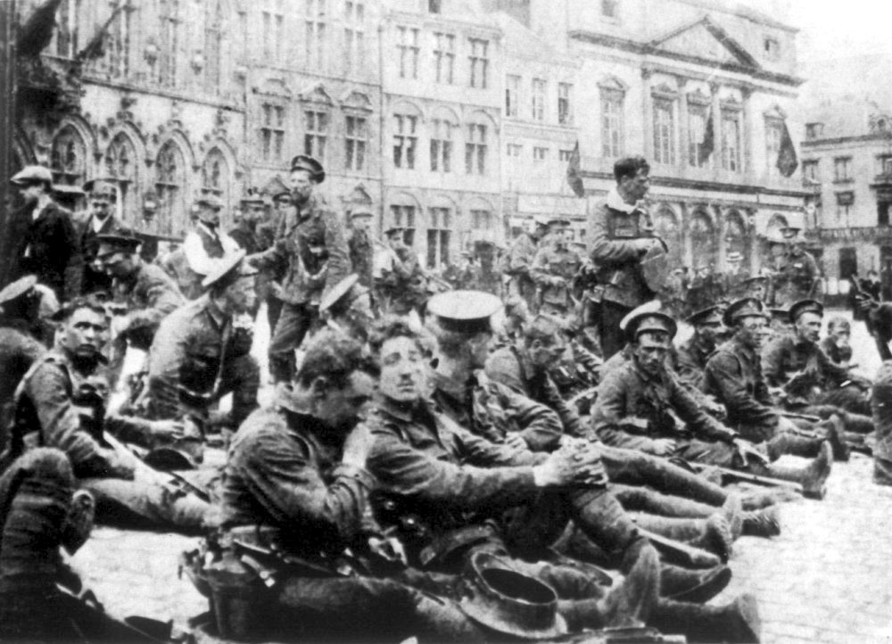
The British Expeditionary Force (BEF) was the six-divisions the British Army sent to the Western Front during the First World War. Planning for a British Expeditionary Force began with the 1906–1912 Haldane reforms of the British Army carried out by the Secretary of State for War Richard Haldane following the Second Boer War (1899–1902). The term ''British Expeditionary Force'' is often used to refer only to the forces present in France prior to the end of the First Battle of Ypres on 22 November 1914. By the end of 1914—after the battles of Mons, Le Cateau, the Aisne and Ypres—the existent BEF had been almost exhausted, although it helped stop the German advance.Chandler (2003), p. 211 An alternative endpoint of the BEF was 26 December 1914, when it was divided into the First and Second Armies (a Third, Fourth and Fifth being created later in the war). "British Expeditionary Force" remained the official name of the British armies in France and Flanders thro ... [...More Info...] [...Related Items...] OR: [Wikipedia] [Google] [Baidu] |
World War I
World War I (28 July 1914 11 November 1918), often abbreviated as WWI, was one of the deadliest global conflicts in history. Belligerents included much of Europe, the Russian Empire, the United States, and the Ottoman Empire, with fighting occurring throughout Europe, the Middle East, Africa, the Pacific, and parts of Asia. An estimated 9 million soldiers were killed in combat, plus another 23 million wounded, while 5 million civilians died as a result of military action, hunger, and disease. Millions more died in genocides within the Ottoman Empire and in the 1918 influenza pandemic, which was exacerbated by the movement of combatants during the war. Prior to 1914, the European great powers were divided between the Triple Entente (comprising France, Russia, and Britain) and the Triple Alliance (containing Germany, Austria-Hungary, and Italy). Tensions in the Balkans came to a head on 28 June 1914, following the assassination of Archduke Franz Ferdin ... [...More Info...] [...Related Items...] OR: [Wikipedia] [Google] [Baidu] |
A16 Autoroute
The A16 Autoroutes of France, autoroute – also known as ''L'Européenne'' and forming between Abbeville and Dunkirk a part of the larger ''Autoroute des estuaires'' – is a motorway in northern France. The motorway, which has a total length of , starts at a junction with the N104 Francilienne near Attainville in Île-de-France and ends at the Belgium, Belgian frontier near Bray-Dunes, serving en route Beauvais, Amiens, Abbeville, Boulogne-sur-Mer, Calais and Dunkirk in Hauts-de-France. From its starting point near Paris, the A16 runs in a northerly direction, continues north parallel to the English Channel from Abbeville and then in an easterly direction along the North Sea coast. It is one of the two main routes between the Port of Calais/Channel Tunnel and Paris, the other being the A26 autoroute, A26 and A1 autoroute, A1 route to the east. The vast majority of the motorway was built in the 1990s to relieve the congested Route nationale 1, RN1 between Paris and the Côte ... [...More Info...] [...Related Items...] OR: [Wikipedia] [Google] [Baidu] |
Autoroutes Of France
The ''autoroute'' (, highway or motorway) system in France consists largely of toll roads (76% of the total). It is a network of of motorways as of 2014. On road signs, autoroute destinations are shown in blue, while destinations reached through a combination of autoroutes are shown with an added autoroute logo. Toll autoroutes are signalled with the word ''péage'' (toll or toll plaza). Length Numbering scheme Unlike other motorway systems, there is no systematic numbering system, but there is a clustering of Autoroute numbers based on region. A1, A3, A4, A5, A6, A10, A13, A14, A15, A16 radiate clockwise from Paris with A2, A11, and A12 branching from A1, A10, and A13, respectively. A7 begins in Lyon, where A6 ends. A8 and A9 begin from the A7. The 20s are found in northern France. The 30s are found in eastern France. The 40s are found near the Alps. The 50s are in the southeast, near the French Riviera. The 60s are found in southern France. The 70s are found in the ce ... [...More Info...] [...Related Items...] OR: [Wikipedia] [Google] [Baidu] |
Abbeville
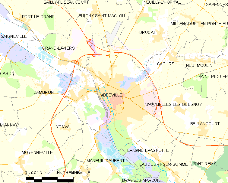
Abbeville (, vls, Abbekerke, pcd, Advile) is a commune in the Somme department and in Hauts-de-France region in northern France. It is the chef-lieu of one of the arrondissements of Somme. Located on the river Somme, it was the capital of Ponthieu. Its inhabitants are called the ''Abbevillois''. Geography Location Abbeville is located on the river Somme, from its modern mouth in the English Channel. The majority of the town is located on the east bank of the Somme, as well as on an island. It is located at the head of the Abbeville Canal, and is northwest of Amiens and approximately from Paris. It is also as the crow flies from the and the English Channel. In the medieval period, it was the lowest crossing point on the Somme and it was nearby that Edward III's army crossed shortly before the Battle of Crécy in 1346. Just halfway between Rouen and Lille, it is the historical capital of the County of Ponthieu and maritime Picardy. Quarters, hamlets and local ... [...More Info...] [...Related Items...] OR: [Wikipedia] [Google] [Baidu] |
Calais
Calais ( , , traditionally , ) is a port city in the Pas-de-Calais department, of which it is a subprefecture. Although Calais is by far the largest city in Pas-de-Calais, the department's prefecture is its third-largest city of Arras. The population of the city proper is 72,929; that of the urban area is 149,673 (2018).Comparateur de territoire: Aire d'attraction des villes 2020 de Calais (073), Commune de Calais (62193) INSEE Calais overlooks the Strait of Dover, the narrowest point in the |
Communes Of France
The () is a level of administrative division in the French Republic. French are analogous to civil townships and incorporated municipalities in the United States and Canada, ' in Germany, ' in Italy, or ' in Spain. The United Kingdom's equivalent are civil parishes, although some areas, particularly urban areas, are unparished. are based on historical geographic communities or villages and are vested with significant powers to manage the populations and land of the geographic area covered. The are the fourth-level administrative divisions of France. vary widely in size and area, from large sprawling cities with millions of inhabitants like Paris, to small hamlets with only a handful of inhabitants. typically are based on pre-existing villages and facilitate local governance. All have names, but not all named geographic areas or groups of people residing together are ( or ), the difference residing in the lack of administrative powers. Except for the municipal arrondi ... [...More Info...] [...Related Items...] OR: [Wikipedia] [Google] [Baidu] |
