|
Cambridgeport, Massachusetts
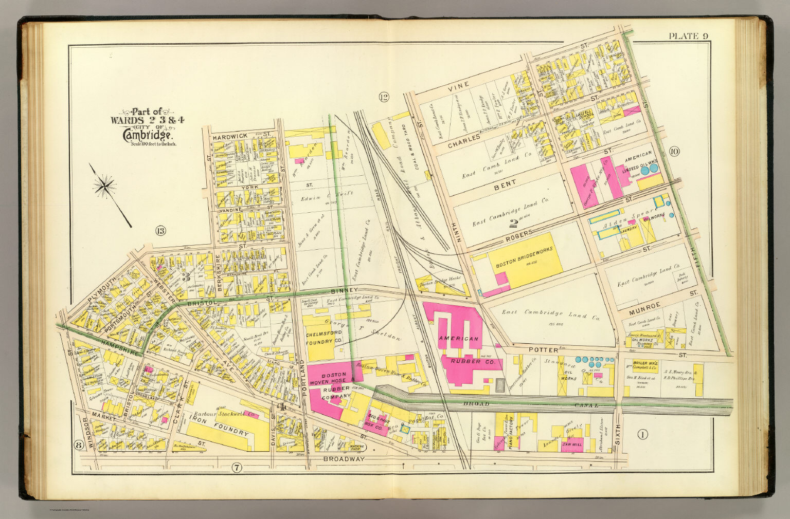
Cambridgeport is one of the neighborhoods of Cambridge, Massachusetts. It is bounded by Massachusetts Avenue, the Charles River, the Grand Junction Railroad, and River Street. The neighborhood contains predominantly residential homes, many of the triple decker style common in New England. Central Square (Cambridge), Central Square, at the northernmost part of Cambridgeport, is an active commercial district and transportation hub, and University Park at MIT, University Park is a collection of renovated or recently constructed office and apartment buildings. The neighborhood also includes Fort Washington (Massachusetts), Fort Washington Park, several Massachusetts Institute of Technology, MIT buildings, and Magazine Beach. The neighborhood is Area 5 of Cambridge. History The Fig Newton cookie (named after nearby Newton, Massachusetts) was first manufactured in Cambridgeport in 1891 at the F. A. Kennedy Steam Bakery. Portions of the neighborhood would have been demolished as part ... [...More Info...] [...Related Items...] OR: [Wikipedia] [Google] [Baidu] |
Newton, Massachusetts
Newton is a city in Middlesex County, Massachusetts, United States. It is approximately west of downtown Boston. Newton resembles a patchwork of thirteen villages, without a city center. According to the 2020 U.S. Census, the population of Newton was 88,923. History Newton was settled in 1630 as part of "the newe towne", which was renamed Cambridge in 1638. Roxbury minister John Eliot persuaded the Native American people of Nonantum, a sub-tribe of the Massachusett led by a sachem named Waban, to relocate to Natick in 1651, fearing that they would be exploited by colonists. Newton was incorporated as a separate town, known as Cambridge Village, on December 15, 1681, then renamed Newtown in 1691, and finally Newton in 1766. It became a city on January 5, 1874. Newton is known as ''The Garden City''. In ''Reflections in Bullough's Pond'', Newton historian Diana Muir describes the early industries that developed in the late 18th and early 19th centuries in a series of mills b ... [...More Info...] [...Related Items...] OR: [Wikipedia] [Google] [Baidu] |
Riverside, Cambridge
Riverside, also known as "Area 7", is a neighborhood of Cambridge, Massachusetts bounded by Massachusetts Avenue on the east, River Street on the south, the Charles River The Charles River ( Massachusett: ''Quinobequin)'' (sometimes called the River Charles or simply the Charles) is an river in eastern Massachusetts. It flows northeast from Hopkinton to Boston along a highly meandering route, that doubles b ... on the west, and JFK Street on the north. In 2005 it had a population of 11,201 residents in 3,341 households, and the average household income was $40,753. References Cambridge Police Department Neighborhoods in Cambridge, Massachusetts {{MiddlesexCountyMA-geo-stub ... [...More Info...] [...Related Items...] OR: [Wikipedia] [Google] [Baidu] |
MIT Campus (Area 2), Cambridge
The area around the campus of the Massachusetts Institute of Technology, or MIT, makes up Area 2 of Cambridge, Massachusetts Cambridge ( ) is a city in Middlesex County, Massachusetts, United States. As part of the Boston metropolitan area, the cities population of the 2020 U.S. census was 118,403, making it the fourth most populous city in the state, behind Boston, .... Area 2 is bounded by Main Street and Broadway on the north, the railroad tracks on the west, and the Charles River on the south and east. Its population in 2005 was 5,486 residents living in 794 households. The average household income was $37,287. References Cambridge Police Department Neighborhoods in Cambridge, Massachusetts {{MiddlesexCountyMA-geo-stub ... [...More Info...] [...Related Items...] OR: [Wikipedia] [Google] [Baidu] |
Area 4, Cambridge
The Port, formerly Area 4, is a neighborhood of Cambridge, Massachusetts, roughly between Central Square, Inman Square, and MIT. It is bounded on the south by Massachusetts Avenue, on the west by Prospect Street, on the north by Hampshire Street, and on the east by the Grand Junction Railroad tracks.Cambridge Police Department Area 4 is a densely populated residential neighborhood with about 7,000 residents. History and name  Prior to the
 [...More Info...] [...Related Items...] OR: [Wikipedia] [Google] [Baidu] |
Boston University Bridge
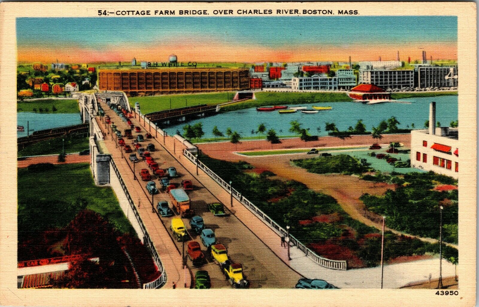
The Boston University Bridge, originally the Cottage Farm Bridge and commonly referred to as the BU Bridge, is a steel truss through arch bridge with a suspended deck carrying Route 2 over the Charles River, connecting the Boston University campus to Cambridge, Massachusetts. The bridge, with the Grand Junction Railroad Bridge directly underneath it, is incorrectly rumored to be the only place in the world where a boat can sail under a train driving under a car driving under an airplane. Other such places include the Steel Bridge in Portland, Oregon, and the 25 de Abril Bridge in Lisbon, although both those bridges are on the same span. In this case the rail and road traffic are on separate bridges. History The Boston University Bridge was designed by Andrew Canzanelli and built by The Phoenix Bridge Company in 1927, replacing an 1850s drawbridge known as the Brookline Bridge. Canzanelli also designed the Weeks footbridge and the first shell constructed on the Esplana ... [...More Info...] [...Related Items...] OR: [Wikipedia] [Google] [Baidu] |
Francis Sargent
Francis Williams Sargent (July 29, 1915 – October 22, 1998) was an American politician who served as the 64th governor of Massachusetts from 1969 to 1975. A member of the Republican Party, he previously served as the 63rd Lieutenant Governor of Massachusetts from 1967 to 1971. In 1969, he became acting governor when John Volpe resigned to become Secretary of Transportation under the Nixon Administration. In 1970, he was elected governor in his own right, defeating the Democratic Party's nominee Kevin White. He lost reelection in 1974 to Democrat Michael Dukakis, who would go on to be the Democratic Party's nominee for President in 1988. Early life, education, and early career Sargent was born in 1915 in Hamilton, Massachusetts, the son of Margery (Lee) and Francis Williams Sargent. He was known for his sharp wit and self-deprecating manner. A Republican, "Sarge" graduated from Charles River School, and then Noble and Greenough School. Sargent was a student in the archite ... [...More Info...] [...Related Items...] OR: [Wikipedia] [Google] [Baidu] |
Interstate 695 (Massachusetts)
The Inner Belt in Boston was a planned six-lane, limited-access highway that would have run through parts of Boston, Brookline, Cambridge, and Somerville. Original plan The highway would have been called Interstate 695 and would have provided a circumferential route inside the Route 128 corridor. A 1955 plan suggested this routing: * Connection with Interstate 93 in Charlestown at Yard 8, what is now Inner Belt Road, Somerville * Paralleling Washington Street, Somerville * Connection with Northwest Expressway/U.S. 3/MA 2 (unbuilt) in Union Square, Somerville * Along Elm Street past Inman Square * Past Central Square, Cambridge through Cambridgeport paralleling Brookline Street * Crossing the Charles River at the Boston University Bridge, replacing the local street bridge with a two-level local and elevated highway bridge, or bypassing the bridge with a tunnel * Connection with the Western Expressway (Massachusetts Turnpike) near the Charles River * Running under the Back Bay Fe ... [...More Info...] [...Related Items...] OR: [Wikipedia] [Google] [Baidu] |
Fig Newton
Newtons are a Nabisco-trademarked version of a pastry filled with sweet fruit paste. "Fig Newtons" are the most popular variety (fig rolls filled with fig paste). They are produced by an extrusion process. Their distinctive shape is a characteristic that has been adopted by competitors, including generic fig bars sold in many markets. The product was invented by Charles Roser and baked at the F. A. Kennedy Steam Bakery for the first time in 1891. History Until the late 19th century, many physicians believed that most illnesses were related to digestion problems, and recommended a daily intake of biscuits and fruit. Fig rolls were the ideal solution to this advice. They were a locally produced and handmade product, brought to the U.S. by British immigrants. That was until a Philadelphia baker and fig lover, Charles Roser, invented a process in 1891 which inserted fig paste into a thick pastry dough. Cambridgeport, Massachusetts–based Kennedy Biscuit Company purchased the Ros ... [...More Info...] [...Related Items...] OR: [Wikipedia] [Google] [Baidu] |
Cambridge, Massachusetts
Cambridge ( ) is a city in Middlesex County, Massachusetts, United States. As part of the Boston metropolitan area, the cities population of the 2020 U.S. census was 118,403, making it the fourth most populous city in the state, behind Boston, Worcester, and Springfield. It is one of two de jure county seats of Middlesex County, although the county's executive government was abolished in 1997. Situated directly north of Boston, across the Charles River, it was named in honor of the University of Cambridge in England, once also an important center of the Puritan theology embraced by the town's founders. Harvard University, the Massachusetts Institute of Technology (MIT), Lesley University, and Hult International Business School are in Cambridge, as was Radcliffe College before it merged with Harvard. Kendall Square in Cambridge has been called "the most innovative square mile on the planet" owing to the high concentration of successful startups that have emerged in the vicinity ... [...More Info...] [...Related Items...] OR: [Wikipedia] [Google] [Baidu] |
Magazine Beach
Magazine Beach is an American riverside park in Cambridge, Massachusetts. It is located on the left bank of the Charles River, across Memorial Drive from Cambridgeport, and opposite Agganis Arena and other Boston University facilities on the far bank. Magazine Beach is Cambridge's second largest park, being about stretching along the river from Pleasant Street to the BU Bridge. The park includes a free outdoor swimming pool (Veteran's Memorial Pool) as well as ball fields, exercise equipment, picnic areas, and other typical urban park features. The Paul Dudley White Bike Path runs through the park. The park's namesake, a gunpowder magazine from 1818, is in the park. It is the oldest building in the Charles River Reservation. There was a swimming beach at the park in the early and mid 20th century, attracting about 60,000 swimmers in a season, but swimming in the Charles River became dangerous due to pollution, and was forbidden in 1949. History In pre-colonial times, the area ... [...More Info...] [...Related Items...] OR: [Wikipedia] [Google] [Baidu] |


.jpg)