|
Calverton (other) (1900-1940), pen name of American writer and political activist George Goetz
{{dab, geodis ...
Calverton may refer to: Places * Calverton, Milton Keynes, United Kingdom * Calverton, Nottinghamshire, United Kingdom * Calverton, Maryland, United States of America * Calverton, New York, United States of America * Calverton, Virginia, United States of America People * V. F. Calverton Victor Francis Calverton was the pseudonym of George Goetz (1900–1940), an unaffiliated American left-radical writer and literary critic. Life Calverton was born (named George Goetz), in Baltimore in 1900, the son of Charles and Ida Janette Geige ... [...More Info...] [...Related Items...] OR: [Wikipedia] [Google] [Baidu] |
Calverton, Milton Keynes
Calverton is a civil parish in the unitary authority area of the City of Milton Keynes, Buckinghamshire, England and just outside the Milton Keynes urban area, near Stony Stratford. The parish consists of one village, Lower Weald and two hamlets: Upper Weald and Middle Weald. Lower Weald is the largest of the three settlements, and Manor Farm, the parish church and the former parochial school are within its boundaries. The settlement name is Old English, and means 'farm where calves are reared'. In the Domesday Book of 1086 the village was recorded as ''Calvretone''. The west side of nearby Stony Stratford was once included with the ecclesiastic parish of Calverton (the east side being in Wolverton). "The manorial rights over the west side were held with those of Calverton, hichled to the manor of Calverton being often called 'the manor of Calverton with Stony Stratford', and the fair and market of Stony Stratford were included among its appurtenances, until an Act of Parliament ... [...More Info...] [...Related Items...] OR: [Wikipedia] [Google] [Baidu] |
Calverton, Nottinghamshire
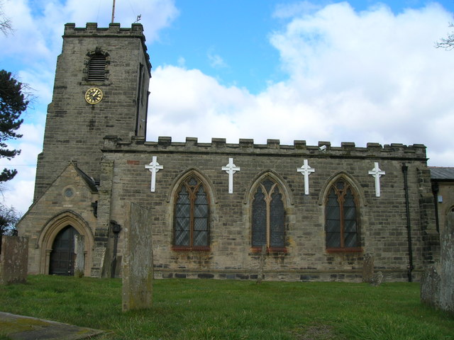
Calverton () is a village and civil parish in Nottinghamshire, of some , in the Gedling district, about 7 miles north-east of Nottingham, and 10 miles south-east of Mansfield. England, and situated, like nearby Woodborough and Lambley, on one of the small tributaries of the Dover Beck. The 2011 census found 7,076 inhabitants in 2,987 households. About two miles to the north of the village is the site of the supposed deserted settlement of Salterford. The parish is bounded on the south-east by Woodborough, to the south-west by Arnold, Papplewick and Ravenshead, to the north by Blidworth, and to the north-east by Oxton and Epperstone. During most of its existence Calverton was a forest village, in that part of Sherwood known as Thorney Wood Chase, with a rural economy limited by a lack of grazing land, in which handicrafts (like woodworking and the knitting of stockings), must in consequence have assumed a more than usual importance. The parliamentary enclosure of 1780 brought ... [...More Info...] [...Related Items...] OR: [Wikipedia] [Google] [Baidu] |
Calverton, Maryland
Calverton is an unincorporated area and census-designated place located on the boundary between Montgomery and Prince George's counties, Maryland, in the United States. At the 2020 census, it had a population of 17,316. Geography As an unincorporated area, Calverton's boundaries are not officially defined. Calverton is, however, recognized by the United States Census Bureau as a census-designated place, and by the United States Geological Survey as a populated place located at (39.057009, −76.944805) and is part of the Baltimore/Washington area. Calverton is located between Beltsville and Silver Spring, with Laurel, Hillandale and Adelphi being in close proximity. The Prince George's County side of Calverton (postal code 20705) is a neighborhood of Beltsville, while the Montgomery County side (postal code 20904) identifies with Silver Spring. According to the United States Census Bureau, Calverton has a total area of , of which , or 0.44%, is water. Demographics ... [...More Info...] [...Related Items...] OR: [Wikipedia] [Google] [Baidu] |
Calverton, New York
Calverton is a hamlet and census-designated place (CDP) on eastern Long Island in Suffolk County, New York, United States. The population was 6,510 at the 2010 census. Most of Calverton is in the Town of Riverhead, while the area south of the Peconic River is a mostly undeveloped smaller portion in the Town of Brookhaven. History Calverton was first referred to as " Baiting Hollow Station" when the Long Island Rail Road arrived in 1844. The station closed in 1958, but the sheltered shed for the station remained standing as of 2007. The area's Native American name was ''Conungum'' or ''Kanungum'', meaning "fixed line" or "boundary". In 1868, the Calverton post office opened, named for Bernard J. Calvert. It remained a small farming community specializing in cranberries, which grew in swampy areas along the Peconic River until the Navy purchase. Calverton's history is tied closely to Naval Weapons Industrial Reserve Plant, Calverton. In 1953, the United States Navy purchased ar ... [...More Info...] [...Related Items...] OR: [Wikipedia] [Google] [Baidu] |
Calverton, Virginia
Calverton is a census-designated place (CDP) in Fauquier County, Virginia, United States. The population as of the 2010 census was 239. The village runs along Virginia State Route 28 and its crossroad, Bristersburg Road. Calverton has a Southern States store, a small country store, and post office. Its ZIP code is 20138. The Calverton Historic District was listed on the National Register of Historic Places in 2010. Calverton may have been named after Calvert County, Maryland. Gilbert Bastable's family moved to the Warrenton Junction area from Maryland between 1850 and 1860, and Bastable lived in Calvert County prior to returning to Virginia after the Civil War. Geography Calverton is located in southeastern Fauquier County, between Catlett to the northeast and Midland to the southwest, all along Virginia Route 28. Warrenton, the county seat, is to the northwest via Casanova Road and Meetze Road. According to the U.S. Census Bureau, the Calverton CDP has a total area of ... [...More Info...] [...Related Items...] OR: [Wikipedia] [Google] [Baidu] |
