|
Callide Valley Railway Line
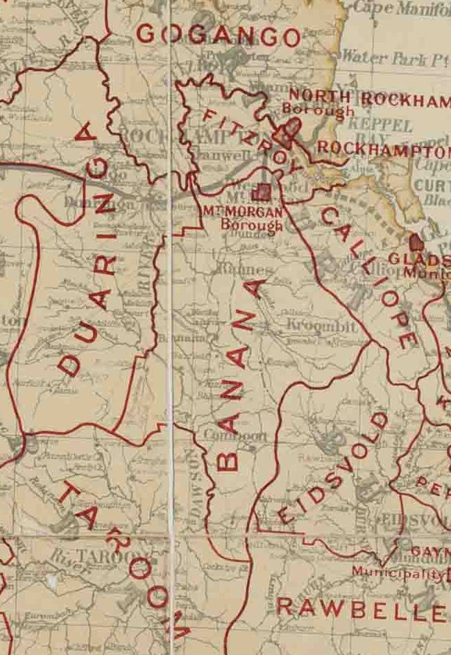
The Callide Valley railway line ran from Rannes to Lawgi in Queensland, Australia. The Callide Valley lies to the south-west of Rockhampton in Central Queensland. History There were grand plans to link Monto by railway with the south, east and north. Links with Maryborough to the south and Gladstone to the east materialised but the northern link terminated at Lawgi some 70 kilometres away. Rannes was already linked by rail to Rockhampton by the Dawson Valley railway line via Mount Morgan and a branch line from Rannes to Lawgi provided access to the rich Callide Valley and justified its construction. Opening The first stage commenced from Rannes, heading south-east to Callide (originally called Callidi) and opened on 3 May 1924. Stops en route were Jooro, Goovigen, Jambin and Argoon. A mixed train ran twice a week from Baralaba, west of Rannes on the Dawson Valley branch, to Callide and connected at Rannes with a service northeast to Rockhampton. A 22 kilometre ... [...More Info...] [...Related Items...] OR: [Wikipedia] [Google] [Baidu] |
Rannes, Queensland
Rannes is a rural town in the west of the locality of Goovigen in the Shire of Banana, Queensland, Australia. Geography Rannes is in Central Queensland between Wowan and Banana on the Leichhardt Highway and the Don River. History Rannes was established as a pastoral sheep station property in April 1853 by Scottish brothers James, Norman and Charles Leith Hay. The brothers were the offspring of Peninsula War veteran Andrew Leith Hay and the grandsons of General Alexander Leith Hay of Leith Hall. They were the first Europeans to occupy the region and at that time Rannes was the northern-most outpost of British colonisation in Eastern Australia. The brothers named the property Rannes after a Leith Hay family manor house located near Buckie in Scotland. On 11 May 1853, James Leith Hay sent a letter to Lieutenant John Murray, reporting that two of his shepherds had been murdered by Aborigine men and requested the services of the Native Police. On 16 May, Murray and a section of ... [...More Info...] [...Related Items...] OR: [Wikipedia] [Google] [Baidu] |
Baralaba, Queensland
Baralaba is a rural town and locality in the Shire of Banana in central Queensland, Australia. In the , Baralaba had a population of 314 people. Geography The Dawson River forms the western boundary of the locality. The town is located in the north-west corner of the locality beside the river. The Neville Hewitt weir on the river at the town creates a wide river for irrigation and recreation. The town is located west of the Leichhardt Highway. History The town's name is derived from an Aboriginal word meaning "high mountain" referring to nearby Mount Ramsay. Baralaba Provisional School opened on 19 August 1918. It became a state school on 1 March 1922. In 1964, a secondary department was added. Baralaba Post Office opened by April 1924 (a receiving office had been open since about 1919). Lily State School opened in 1925 and closed circa 1927. In May 1941, an Honour Board commemorating those who served in World War II was unveiled at the Returned and Services League of A ... [...More Info...] [...Related Items...] OR: [Wikipedia] [Google] [Baidu] |
Shire Of Banana
The Shire of Banana is a local government area located in the Capricorn region of Queensland, Australia, inland from the regional city of Gladstone. The shire was named after the first township in the region (Banana), which in turn was named for the burial site of a huge dun coloured bullock named 'Banana'. The council sits in the town of Biloela, which is the largest town in the Shire. Major industries in the shire include coal mining, beef production, power generation, dryland cropping and irrigation cropping such as lucerne and cotton. History Banana Division was created on 11 November 1879 as one of 74 divisions around Queensland under the ''Divisional Boards Act 1879'' with a population of 2155. The name ''Banana'' does not relate to the fruit, but rather the area was named after a dun-coloured bullock called ''Banana''. On 20 April 1881 part of Banana Division was separated to create Duaringa Division. With the passage of the ''Local Authorities Act 1902'', Bana ... [...More Info...] [...Related Items...] OR: [Wikipedia] [Google] [Baidu] |
Goovigen
Goovigen is a rural town and locality in the Shire of Banana, Queensland, Australia. In the , the locality of Goovigen had a population of 215 people. A second town, Rannes (), is also within the locality of Goovigen, near its western boundary. Koorngoo is a neighbourhood () within the locality, just west of centre, based around a former railway station. Geography The town is towards the south-east of the locality, approximately north west of the state capital, Brisbane. The Burnett Highway enters the locality from the north ( Dixalea) and exits to the east ( Jambin) without coming close to either of the two towns. The Leichhardt Highway enters the locality from the south-west ( Kokotunga / Woolein) and then. forms the south-west boundary of the locality and passes immediately west of the town of Rannes before exiting to the west ( Dumpy Creek). The now-closed Callide Valley railway line ran through the locality which was served by a number of now-abandoned railway stati ... [...More Info...] [...Related Items...] OR: [Wikipedia] [Google] [Baidu] |
Rannes Railway Station
Goovigen is a rural town and locality in the Shire of Banana, Queensland, Australia. In the , the locality of Goovigen had a population of 215 people. A second town, Rannes (), is also within the locality of Goovigen, near its western boundary. Koorngoo is a neighbourhood () within the locality, just west of centre, based around a former railway station. Geography The town is towards the south-east of the locality, approximately north west of the state capital, Brisbane. The Burnett Highway enters the locality from the north ( Dixalea) and exits to the east ( Jambin) without coming close to either of the two towns. The Leichhardt Highway enters the locality from the south-west ( Kokotunga / Woolein) and then. forms the south-west boundary of the locality and passes immediately west of the town of Rannes before exiting to the west ( Dumpy Creek). The now-closed Callide Valley railway line ran through the locality which was served by a number of now-abandoned railway stati ... [...More Info...] [...Related Items...] OR: [Wikipedia] [Google] [Baidu] |
Moura Railway Line
The Moura railway line is a railway in central Queensland, connecting several coal mines to the port of Gladstone. It connects the remnants of several lines that previously connected to Rockhampton, originally by a rack railway. History The Dawson Valley railway line was built from near Rockhampton, opening in 1898, and the Callide Valley railway line opened in 1917, both having a north–south alignment. In 1953, a spur line opened to serve the Callide Mine, and another to serve the Moura coal mine opened in 1963, both mines shipping coal to Gladstone via Rockhampton, a ~270 km distance. As coal volumes grew a direct line to Gladstone was proposed, and the 151 km Moura Short Line opened in 1968, being the first 'S' (Special) class line in Queensland, with an 18 tonne axle load at the time. It commenced at Graham railway station (in Calliope) on the Monto line, connecting to the Callide Valley line (and the Callide Coalfields) at Earlsfield railway station (in Jambi ... [...More Info...] [...Related Items...] OR: [Wikipedia] [Google] [Baidu] |
Queensland Government
The Queensland Government is the democratic administrative authority of the Australian state of Queensland. The Government of Queensland, a parliamentary constitutional monarchy was formed in 1859 as prescribed in its Constitution, as amended from time to time. Since the Federation of Australia in 1901, Queensland has been a State of Australia, with the Constitution of Australia regulating the relationships between all state and territory governments and the Australian Government. Under the Australian Constitution, all states and territories (including Queensland) ceded powers relating to certain matters to the federal government. The government is influenced by the Westminster system and Australia's federal system of government. The Governor of Queensland, as the representative of Charles III, King of Australia, holds nominal executive power, although in practice only performs ceremonial duties. In practice executive power lies with the Premier and Cabinet. The Cabinet of ... [...More Info...] [...Related Items...] OR: [Wikipedia] [Google] [Baidu] |
Mount Scoria, Queensland
Thangool is a rural town and locality in the Shire of Banana, Queensland, Australia. In the , the locality of Thangool had a population of 741 people. Geography Thangool is north west of the state capital, Brisbane and south of the Shire administrative centre, Biloela. Kariboe is a neighbourhood (). Mount Scoria is a neighbourhood (). Thangool has the following named ranges: * Banana Range () in the south-west of the locality * Dawes Range () in the south-east of the locality Thangool has the following named mountains: * Mount Lookerbie () * Mount Scoria () * Mount Sugarloaf () * Prospect Peak () The former Callide Valley railway line ran through the locality and had the following three now-abandoned railway stations: * Thangool railway station () * Kariboe railway station () * Mount Scoria railway station () The predominant land use is grazing on native vegetation with a small amount of crop growing. History The Thangool area was originally home to the Kangulu A ... [...More Info...] [...Related Items...] OR: [Wikipedia] [Google] [Baidu] |
Great Depression
The Great Depression (19291939) was an economic shock that impacted most countries across the world. It was a period of economic depression that became evident after a major fall in stock prices in the United States. The economic contagion began around September and led to the Wall Street stock market crash of October 24 (Black Thursday). It was the longest, deepest, and most widespread depression of the 20th century. Between 1929 and 1932, worldwide gross domestic product (GDP) fell by an estimated 15%. By comparison, worldwide GDP fell by less than 1% from 2008 to 2009 during the Great Recession. Some economies started to recover by the mid-1930s. However, in many countries, the negative effects of the Great Depression lasted until the beginning of World War II. Devastating effects were seen in both rich and poor countries with falling personal income, prices, tax revenues, and profits. International trade fell by more than 50%, unemployment in the U.S. rose to 23% and ... [...More Info...] [...Related Items...] OR: [Wikipedia] [Google] [Baidu] |
Terminal Train Station
A train station, railway station, railroad station or depot is a railway facility where trains stop to load or unload passengers, freight or both. It generally consists of at least one platform, one track and a station building providing such ancillary services as ticket sales, waiting rooms and baggage/freight service. If a station is on a single-track line, it often has a passing loop to facilitate traffic movements. Places at which passengers only occasionally board or leave a train, sometimes consisting of a short platform and a waiting shed but sometimes indicated by no more than a sign, are variously referred to as "stops", "flag stops", " halts", or "provisional stopping places". The stations themselves may be at ground level, underground or elevated. Connections may be available to intersecting rail lines or other transport modes such as buses, trams or other rapid transit systems. Terminology In British English, traditional terminology favours ''railway station'' ... [...More Info...] [...Related Items...] OR: [Wikipedia] [Google] [Baidu] |
Passenger Train
A passenger train is a train used to transport people along a railroad line. These trains may consist of unpowered passenger railroad cars (also known as coaches or carriages) hauled by one or more locomotives, or may be self-propelled; self propelled passenger trains are known as multiple units or railcars. Passenger trains stop at stations or depots, where passengers may board and disembark. In most cases, passenger trains operate on a fixed schedule and have priority over freight trains. Passenger trains may be made up of a number of passenger cars hauled by one or more locomotives, or may be made up of self-propelled railcars. Car design and the general safety of passenger trains have dramatically evolved over time, making travel by rail remarkably safe. Some passenger trains, both long-distance and short-distance, use bi-level (double-decker) cars to carry more passengers per train. Passenger trains hauled by locomotives are more expensive to operate than multiple uni ... [...More Info...] [...Related Items...] OR: [Wikipedia] [Google] [Baidu] |


.jpg)
