|
California Aqueduct
The Governor Edmund G. Brown California Aqueduct is a system of canals, tunnels, and pipelines that conveys water collected from the Sierra Nevada Mountains and valleys of Northern and Central California to Southern California. Named after California Governor Edmund Gerald "Pat" Brown Sr., the over aqueduct is the principal feature of the California State Water Project. The aqueduct begins at the Clifton Court Forebay at the southwestern corner of the Sacramento–San Joaquin River Delta. The aqueduct then heads south, eventually splitting into three branches: the Coastal Branch, ending at Lake Cachuma in Santa Barbara County; the West Branch, conveying water to Castaic Lake in Los Angeles County; and the East Branch, connecting Silverwood Lake in San Bernardino County. The Department of Water Resources (DWR) operates and maintains the California Aqueduct, including one pumped-storage hydroelectric plant, Gianelli Power Plant. Gianelli is located at the base of San Luis Dam ... [...More Info...] [...Related Items...] OR: [Wikipedia] [Google] [Baidu] |
Delta–Mendota Canal
The Delta–Mendota Canal is a aqueduct in central California, United States. The canal was designed and completed in 1951 by the U.S. Bureau of Reclamation as part of the Central Valley Project. It carries freshwater to replace San Joaquin River water which is diverted into the Madera Canal and Friant-Kern Canal at Friant Dam. The canal begins at the C.W. Bill Jones Pumping Plant (formerly the Tracy Pumping Plant). Water is lifted from the Sacramento-San Joaquin Delta at the Clifton Court Forebay. The canal runs southward along the western edge of the San Joaquin Valley, parallel to the California Aqueduct, and diverges to the east after passing the San Luis Reservoir, receiving more water and eventually emptying into the San Joaquin River near the city of Mendota. The canal travels through 6 state counties, Alameda, San Joaquin, Stanislaus, Merced, and Fresno counties. History After years of drought, the state of California highlighted the importance of a large-scale ... [...More Info...] [...Related Items...] OR: [Wikipedia] [Google] [Baidu] |
Sacramento–San Joaquin River Delta
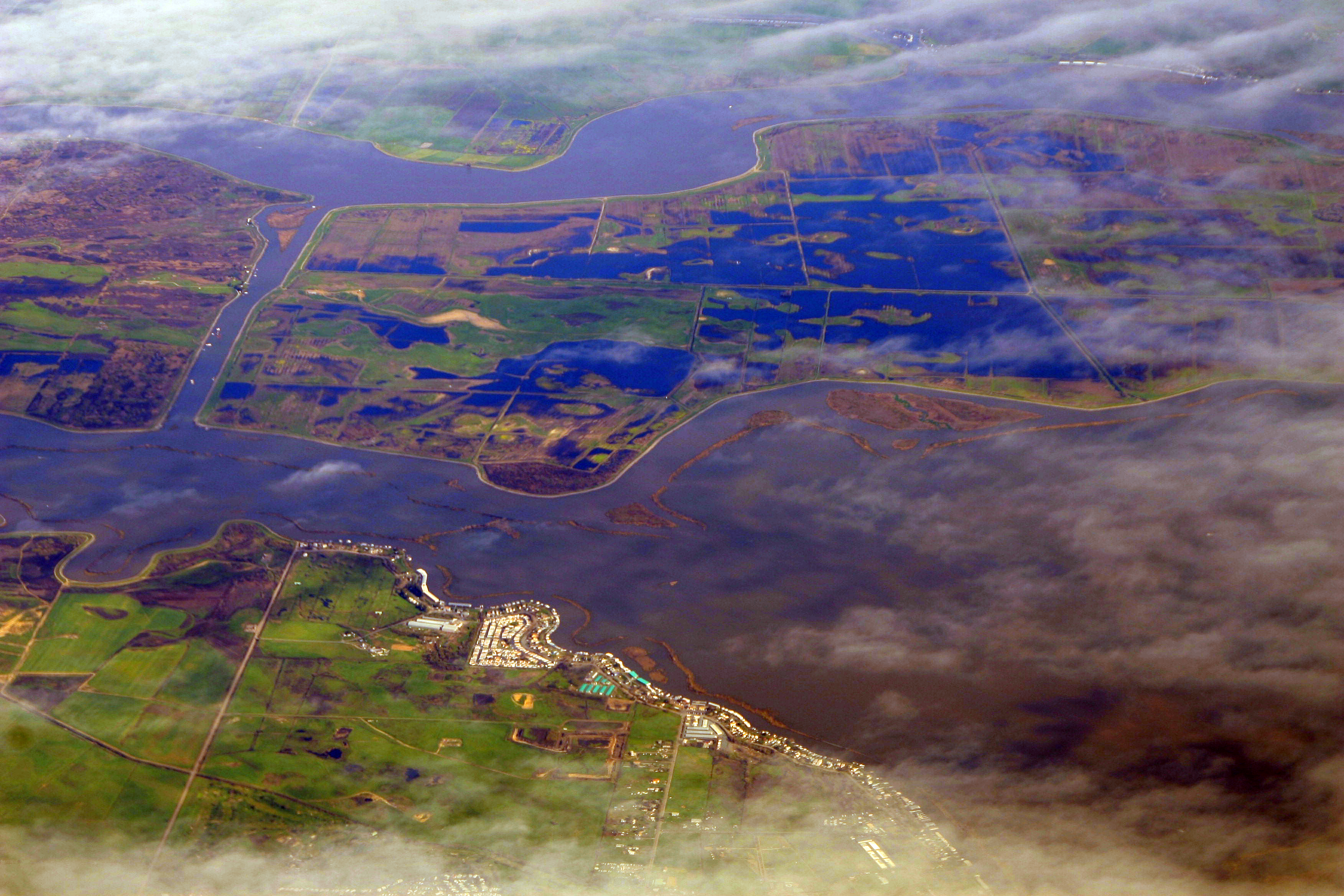
The Sacramento–San Joaquin River Delta, or California Delta, is an expansive inland river delta and estuary in Northern California. The Delta is formed at the western edge of the Central Valley by the confluence of the Sacramento and San Joaquin rivers and lies just east of where the rivers enter Suisun Bay, which flows into San Francisco Bay and then the Pacific Ocean via San Pablo Bay. The Delta is recognized for protection by the California Bays and Estuaries Policy. Sacramento–San Joaquin Delta was designated a National Heritage Area on March 12, 2019. The city of Stockton is located on the San Joaquin River on the eastern edge of the delta. The total area of the Delta, including both land and water, is about . Its population is around 500,000 residents. The Delta was formed by the raising of sea level following glaciation, leading to the accumulation of Sacramento and San Joaquin River sediments behind the Carquinez Strait, the sole outlet from the Central Valley ... [...More Info...] [...Related Items...] OR: [Wikipedia] [Google] [Baidu] |
Coast Ranges
The Pacific Coast Ranges (officially gazetted as the Pacific Mountain System in the United States) are the series of mountain ranges that stretch along the West Coast of North America from Alaska south to Northern and Central Mexico. Although they are commonly thought to be the westernmost mountain range of the continental United States and Canada, the geologically distinct Insular Mountains of Vancouver Island lie further west. The Pacific Coast Ranges are part of the North American Cordillera (sometimes known as the Western Cordillera, or in Canada, as the Pacific Cordillera and/or the Canadian Cordillera), which includes the Rocky Mountains, the Columbia Mountains, the Interior Mountains, the Interior Plateau, the Sierra Nevada, the Great Basin mountain ranges, and other ranges and various plateaus and basins. The Pacific Coast Ranges designation, however, only applies to the Western System of the Western Cordillera,S. Holland, ''Landforms of British Columbia'', BC Govt. 197 ... [...More Info...] [...Related Items...] OR: [Wikipedia] [Google] [Baidu] |
I-5 Between Tracy And Patterson CA
Interstate 5 (I-5) is the main north–south Interstate Highway on the West Coast of the United States, running largely parallel to the Pacific coast of the contiguous U.S. from Mexico to Canada. It travels through the states of California, Oregon, and Washington, serving several large cities on the U.S. West Coast, including San Diego, Los Angeles, Sacramento, Portland, and Seattle. It is the only continuous Interstate highway to touch both the Mexican and the Canadian borders. Upon crossing the Mexican border at its southern terminus, I-5 continues to Tijuana, Baja California, as Mexico Federal Highway 1 (Fed. 1). Upon crossing the Canadian border at its northern terminus, it continues to Vancouver as British Columbia Highway 99 (BC 99). I-5 was originally created in 1956 as part of the Interstate Highway System, but it was predated by several auto trails and highways built in the early 20th century. The Pacific Highway auto trail was built in ... [...More Info...] [...Related Items...] OR: [Wikipedia] [Google] [Baidu] |
San Joaquin Fault
The San Joaquin Fault is a seismically active geological structure in the California Central Valley. East of the San Joaquin fault there is a flow pattern of alluvium that has been reported to be a mud flow. This flow pattern was deposited in the early Holocene or the late Pleistocene age.Bartow, ''Geologic map of the East Flank of the Diablo Range from Hospital Creek to Poverty Flats'' (1985) See also *Hospital Creek, a tributary of the San Joaquin River draining the eastern slopes of part of the Diablo Range. *Ingram Creek Ingram Creek, originally Arroyo de la Suerte, is a U.S. Geological Survey. National Hydrography Dataset high-resolution flowline dataThe National Map , accessed March 11, 2011 tributary of the San Joaquin River in Stanislaus County, in the San Joaqu ..., a tributary of the San Joaquin River. References Geography of the Central Valley (California) Seismic faults of California {{US-geology-stub ... [...More Info...] [...Related Items...] OR: [Wikipedia] [Google] [Baidu] |
Farallon Plate
The Farallon Plate was an ancient oceanic plate. It formed one of the three main plates of Panthalassa, alongside the Phoenix Plate and Izanagi Plate, which were connected by a triple junction. The Farallon Plate began subducting under the west coast of the North American Plate—then located in modern Utah—as Pangaea broke apart and after the formation of the Pacific Plate at the centre of the triple junction during the Early Jurassic. It is named for the Farallon Islands, which are located just west of San Francisco, California. Over time, the central part of the Farallon Plate was completely subducted under the southwestern part of the North American Plate. The remains of the Farallon Plate are the Juan de Fuca, Explorer and Gorda Plates, subducting under the northern part of the North American Plate; the Cocos Plate subducting under Central America; and the Nazca Plate subducting under the South American Plate. The Farallon Plate is also responsible for transporting old i ... [...More Info...] [...Related Items...] OR: [Wikipedia] [Google] [Baidu] |
Subduction
Subduction is a geological process in which the oceanic lithosphere is recycled into the Earth's mantle at convergent boundaries. Where the oceanic lithosphere of a tectonic plate converges with the less dense lithosphere of a second plate, the heavier plate dives beneath the second plate and sinks into the mantle. A region where this process occurs is known as a subduction zone, and its surface expression is known as an arc-trench complex. The process of subduction has created most of the Earth's continental crust. Rates of subduction are typically measured in centimeters per year, with the average rate of convergence being approximately two to eight centimeters per year along most plate boundaries. Subduction is possible because the cold oceanic lithosphere is slightly denser than the underlying asthenosphere, the hot, ductile layer in the upper mantle underlying the cold, rigid lithosphere. Once initiated, stable subduction is driven mostly by the negative buoyancy of the de ... [...More Info...] [...Related Items...] OR: [Wikipedia] [Google] [Baidu] |
Land Subsidence
Subsidence is a general term for downward vertical movement of the Earth's surface, which can be caused by both natural processes and human activities. Subsidence involves little or no horizontal movement, which distinguishes it from slope movement. Processes that lead to subsidence include dissolution of underlying carbonate rock by groundwater; gradual compaction of sediments; withdrawal of fluid lava from beneath a solidified crust of rock; mining; pumping of subsurface fluids, such as groundwater or petroleum; or warping of the Earth's crust by tectonic forces. Subsidence resulting from tectonic deformation of the crust is known as tectonic subsidence and can create accommodation for sediments to accumulate and eventually lithify into sedimentary rock. Ground subsidence is of global concern to geologists, geotechnical engineers, surveyors, engineers, urban planners, landowners, and the public in general.National Research Council, 1991. ''Mitigating losses from land subsi ... [...More Info...] [...Related Items...] OR: [Wikipedia] [Google] [Baidu] |
Castaic Dam
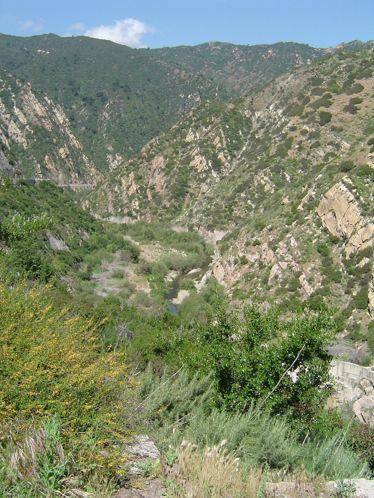
Castaic Dam is an embankment dam in northwestern Los Angeles County, California, in the unincorporated area of Castaic. Although located on Castaic Creek, a major tributary of the Santa Clara River, Castaic Creek provides little of its water. The lake is the terminus of the West Branch of the California Aqueduct, part of the State Water Project. The dam was built by the California Department of Water Resources and construction was completed in 1973. The lake has a capacity of and stores drinking water for the western portion of the Greater Los Angeles Area. Dimensions Castaic is an earth-fill dam with its surfaces covered with boulders and cobble-sized rocks to prevent erosion. The dam is high above the streambed, above the foundations, and long, containing of material. The maximum thickness of the base is . Flood waters are released through an ungated, concrete overflow spillway on the west side of the dam, emptying into a stilling basin called Castaic Lagoon (colloquiall ... [...More Info...] [...Related Items...] OR: [Wikipedia] [Google] [Baidu] |
Los Angeles Department Of Water And Power
The Los Angeles Department of Water and Power (LADWP) is the largest municipal utility in the United States with 8,100 megawatts of electric generating capacity (2021-2022) and delivering an average of 435 million gallons of water per day to more than four million residents and local businesses in the City of Los Angeles. It was founded in 1902 to supply water to residents and businesses in the Los Angeles and surrounding communities. In 1917, it began to deliver electricity to portions of the city. It has been involved in a number of controversies and media portrayals over the years, including the 1928 St. Francis Dam failure and the books ''Water and Power'' and ''Cadillac Desert''. History Private operators By the middle of the 19th century, Los Angeles's rapid population growth magnified problems with the city's water distribution system. At that time, a system of open, often polluted ditches, was reasonably effective at supplying water for agricultural production but was n ... [...More Info...] [...Related Items...] OR: [Wikipedia] [Google] [Baidu] |
Reservoir
A reservoir (; from French ''réservoir'' ) is an enlarged lake behind a dam. Such a dam may be either artificial, built to store fresh water or it may be a natural formation. Reservoirs can be created in a number of ways, including controlling a watercourse that drains an existing body of water, interrupting a watercourse to form an embayment within it, through excavation, or building any number of retaining walls or levees. In other contexts, "reservoirs" may refer to storage spaces for various fluids; they may hold liquids or gasses, including hydrocarbons. ''Tank reservoirs'' store these in ground-level, elevated, or buried tanks. Tank reservoirs for water are also called cisterns. Most underground reservoirs are used to store liquids, principally either water or petroleum. Types Dammed valleys Dammed reservoirs are artificial lakes created and controlled by a dam A dam is a barrier that stops or restricts the flow of surface water or underground streams ... [...More Info...] [...Related Items...] OR: [Wikipedia] [Google] [Baidu] |
San Luis Reservoir
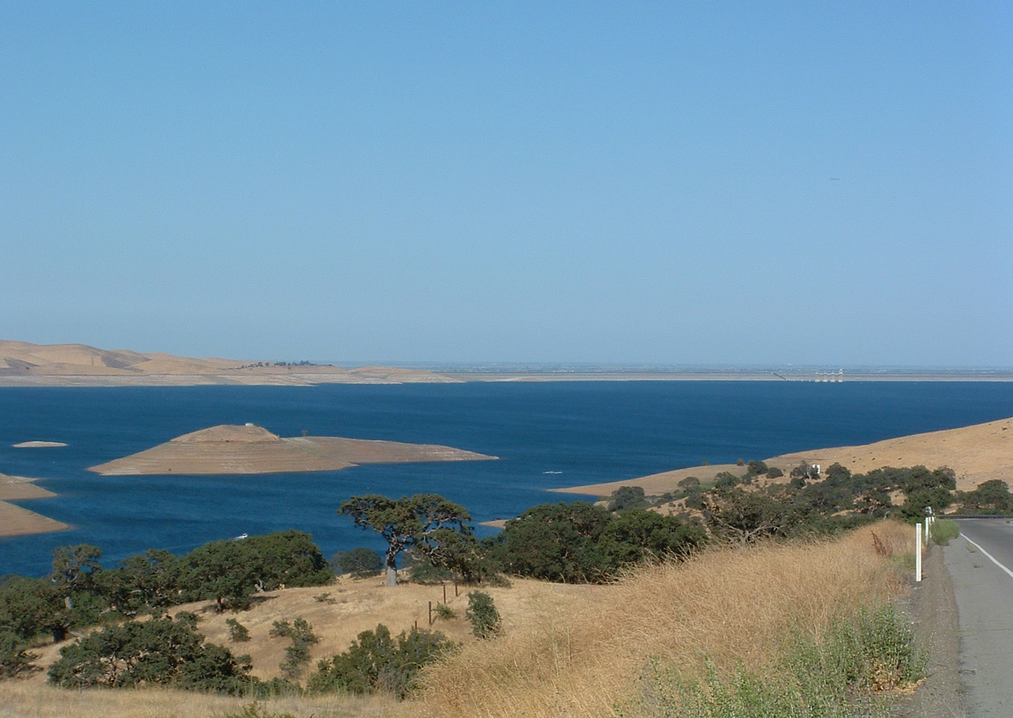
The San Luis Reservoir is an artificial lake on San Luis Creek in the eastern slopes of the Diablo Range of Merced County, California, approximately west of Los Banos on State Route 152, which crosses Pacheco Pass and runs along its north shore. It is the fifth largest reservoir in California. The reservoir stores water taken from the San Joaquin-Sacramento River Delta. Water is pumped uphill into the reservoir from the O'Neill Forebay which is fed by the California Aqueduct and is released back into the forebay to continue downstream along the aqueduct as needed for farm irrigation and other uses. Depending on water levels, the reservoir is approximately long from north to south at its longest point, and five miles (8 km) wide. At the eastern end of the reservoir is the San Luis Dam, the fourth largest embankment dam in the United States, which allows for a total capacity of . Pacheco State Park lies along its western shores. Completed in 1967 on land formerly part ... [...More Info...] [...Related Items...] OR: [Wikipedia] [Google] [Baidu] |


