|
Brancaster
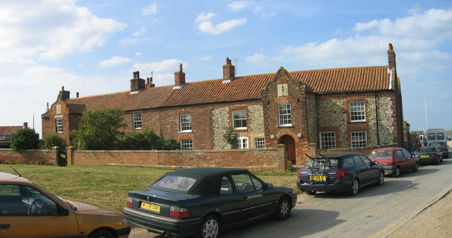
Brancaster is a village and civil parish on the north coast of the English county of Norfolk. The civil parish of Brancaster comprises Brancaster itself, together with Brancaster Staithe and Burnham Deepdale. The three villages form a more or less continuous settlement along the A149 at the edge of the Brancaster Manor marshland and the Scolt Head Island National Nature Reserve. The villages are located about 3 miles (5 km) west of Burnham Market, 22 miles (35 km) north of the town of King's Lynn and 31 miles (50 km) north-west of the city of Norwich. The civil parish has an area of 8.27 square miles (21.43 km2) and in the 2011 census had a population of 797 in 406 households. For the purposes of local government, the parish falls within the district of King's Lynn and West Norfolk. Janet Lake, the clerk to Brancaster Parish Council, has recently reached 50 years of service in the post. The villages name means 'Roman site of Branodunum', where the ori ... [...More Info...] [...Related Items...] OR: [Wikipedia] [Google] [Baidu] |
Brancaster Outlet North View With Wind Farm
Brancaster is a village and civil parish on the north coast of the English county of Norfolk. The civil parish of Brancaster comprises Brancaster itself, together with Brancaster Staithe and Burnham Deepdale. The three villages form a more or less continuous settlement along the A149 road, A149 at the edge of the Brancaster Manor marshland and the Scolt Head Island NNR, Scolt Head Island National Nature Reserve. The villages are located about 3 miles (5 km) west of Burnham Market, 22 miles (35 km) north of the town of King's Lynn and 31 miles (50 km) north-west of the city of Norwich. The civil parish has an area of 8.27 square miles (21.43 km2) and in the United Kingdom Census 2001, 2011 census had a population of 797 in 406 households. For the purposes of local government, the parish falls within the Non-metropolitan district, district of King's Lynn and West Norfolk. Janet Lake, the clerk to Brancaster Parish Council, has recently reached 50 years of servic ... [...More Info...] [...Related Items...] OR: [Wikipedia] [Google] [Baidu] |
Brancaster Staithe
Brancaster Staithe is a village on the north coast of the English county of Norfolk. Brancaster Staithe merges with Burnham Deepdale, forming one village. Brancaster Staithe is in the civil parish of Brancaster, together with Burnham Deepdale and Brancaster itself. The three villages form a more or less continuous settlement along the A149 at the edge of the Brancaster Manor marshland and the Scolt Head Island National Nature Reserve. Brancaster Staithe merges into Burnham Deepdale. Although separate villages, the two act as one, sharing facilities. Brancaster Staithe has the main harbour access, sailing club, sailing school, The White Horse pub & hotel and The Jolly Sailors pub. Burnham Deepdale has the church, St Mary's, and the majority of the shopping, Deepdale Cafe, Dalegate Market and the tourism accommodation facilities of Deepdale Backpackers & Camping. Both villages offer accommodation in holiday cottages, hostels, camping, hotels and bed & breakfasts. Village life ... [...More Info...] [...Related Items...] OR: [Wikipedia] [Google] [Baidu] |
Branodunum
Branodunum was an ancient Roman fort to the east of the modern English village of Brancaster in Norfolk. Its Roman name derives from the local Celtic language, and may mean "fort of the raven". History The fort, built in the 230s, became later part of the Saxon Shore fortification system. It was built to guard the Wash approaches and is of a typical rectangular ''castrum'' layout. According to the 4th-century document '' Notitia Dignitatum'', the fort was garrisoned by the ''Equites Dalmatae Brandodunenses'' (" Dalmatian cavalry of Bran dunum"), although a tile found on the site stamped '' Cohors I Aquitanorum'' suggests that its original garrison was the "First cohort from Aquitania". There is possible evidence (burials and grave goods) of later Saxon use of the site. According to the National Trust notice boards present on the site of the fort, the fort is within a rectangular field to the east of the current village of Brancaster; there is no urban development on the fort' ... [...More Info...] [...Related Items...] OR: [Wikipedia] [Google] [Baidu] |
Royal West Norfolk Golf Club
Royal West Norfolk Golf Club is a golf club in Brancaster, Norfolk, England, about east of Hunstanton, between Brancaster Bay and the salt marshes. The links course opened in 1892. Simon Rayner is a professional at the club. The "Royal" club name is named after Edward VII, who was the Prince of Wales at the time of opening. There are significant environmental issues involved with managing the club and surrounding marshes. Brancaster West Marshes are a Site of Special Scientific Interest and a Special Protection Area under the European Union Birds Directive, because they provide an important habitat for birds. Due to sea level rise, efforts to mitigate coastal erosion are in place in the area. Earth flood embankments were built nearby in 1978 to protect again storm surges, and there has also been the need for the course to implement defensive measures of its own. The original course was laid out by Horace Hutchinson, but due to the fragility of the marshland and coast, it h ... [...More Info...] [...Related Items...] OR: [Wikipedia] [Google] [Baidu] |
Scolt Head Island NNR
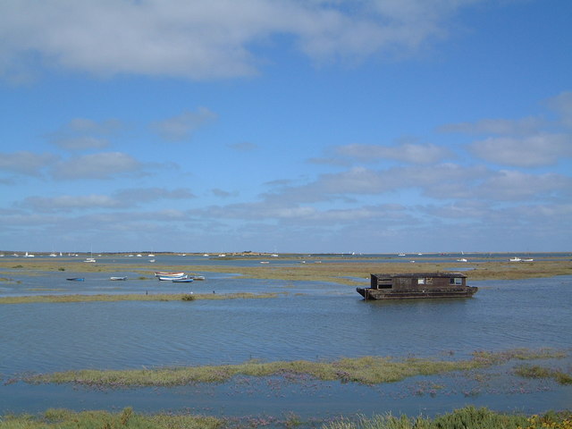
Scolt Head Island is an offshore barrier island between Brancaster and Wells-next-the-Sea in north Norfolk. It is in the parish of Burnham Norton and is accessed by a seasonal ferry from the village of Overy Staithe. The shingle and sand island appears to have originated from a former spit extending from the coast, and longshore drift means that it is slowly moving to the west and inshore. The island comprises sand dunes, salt marsh, intertidal sand and mud flats, and shingle. It supports internationally important numbers of breeding Sandwich and little terns, and nationally significant populations of common and Arctic terns, as well as wintering waders and wildfowl. It has a number of uncommon plants adapted to its harsh environments. It was bought by the National Trust in 1923, and became a national nature reserve. It was subsumed into the North Norfolk Coast SSSI in 1986. The larger area is now additionally protected through Natura 2000, Special Protection Area (SPA) an ... [...More Info...] [...Related Items...] OR: [Wikipedia] [Google] [Baidu] |
Burnham Deepdale
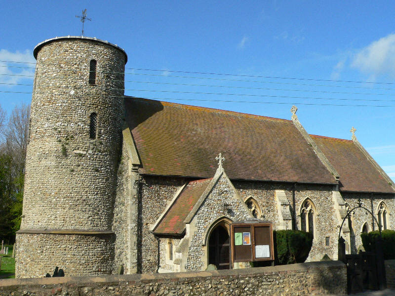
Burnham Deepdale is a village on the north coast of the English county of Norfolk. Burnham Deepdale is in the civil parish of Brancaster, along with Brancaster Staithe. The three villages form a more or less continuous settlement along the A149, at the edge of the Brancaster Manor marshland and the Scolt Head Island National Nature Reserve. History Burnham Deepdale's name is of Anglo-Saxon origin and derives from the Old English for a settlement along the River Burn with a deep valley. Geography The village is one of the original seven Burnhams, which include Burnham Norton, Burnham Overy, Burnham Sutton, Burnham Thorpe, Burnham Ulph and Burnham Westgate. St Mary's Church Burnham Deepdale's Parish church is one of Norfolk's 124 remaining Anglo-Saxon round-tower churches, and is dedicated to Saint Mary. St Mary's was significantly remodelled in the 1870s by Frederick Preedy. Buildings and amenities Burnham Deepdale is home to the 'Deepdale Cafe'. Deepdale Cafe. (20 ... [...More Info...] [...Related Items...] OR: [Wikipedia] [Google] [Baidu] |
Brancaster Manor
Brancaster Manor is a saltmarsh owned by the National Trust near Brancaster, Norfolk covering 810 ha (2,000 acres).Ryan (1969) p 165 It was originally purchased by the Brancaster Memorial Trust in 1964,Rodgers ''et al'' (2010 ) p.167 and transferred to the National Trust in 1967. It is leased to Brancaster Staithe Fishermen's Society.Paston-Williams (2006) p. 80 It was designated as a Site of Special Scientific Interest (SSSI) in 1968, and in 1986 it was subsumed into the North Norfolk Coast Site of Special Scientific Interest. The larger area is now additionally protected through Natura 2000, Special Protection Area (SPA) and Ramsar Ramsar may refer to: * Places so named: ** Ramsar, Mazandaran, city in Iran ** Ramsar, Rajasthan, village in India * Eponyms of the Iranian city: ** Ramsar Convention concerning wetlands, signed in Ramsar, Iran ** Ramsar site, wetland listed in ... listings, and is part of the Norfolk Coast Area of Outstanding Natural Beauty (AONB). ... [...More Info...] [...Related Items...] OR: [Wikipedia] [Google] [Baidu] |
Saxon Shore Forts
The Saxon Shore ( la, litus Saxonicum) was a military command of the late Roman Empire, consisting of a series of fortifications on both sides of the Channel. It was established in the late 3rd century and was led by the "Count of the Saxon Shore". In the late 4th century, his functions were limited to Britain, while the fortifications in Gaul were established as separate commands. Several Saxon Shore forts survive in east and south-east England. Background During the latter half of the 3rd century, the Roman Empire faced a grave crisis. Internally, it was weakened by civil wars, the violent succession of brief emperors, and secession in the provinces, while externally it faced a new wave of attacks by barbarian tribes. Most of Britain had been part of the empire since the mid-1st century. It was protected from raids in the north by the Hadrianic and Antonine Walls, while a fleet of some size was also available. However, as the frontiers came under increasing external pres ... [...More Info...] [...Related Items...] OR: [Wikipedia] [Google] [Baidu] |
King's Lynn And West Norfolk
King's Lynn and West Norfolk is a local government district with borough status in Norfolk, England. Its council is based in the town of King's Lynn. The population of the Local Authority at the 2011 Census was 147,451. History The district was formed in 1974 by the merger of the Municipal Borough of King's Lynn, Hunstanton and Downham Market urban districts along with Docking Rural District, Downham Rural District, Freebridge Lynn Rural District and Marshland Rural District. The district was originally known as just West Norfolk, and adopted its present name in 1981. Politics Elections to the borough council are held every four years, with all of the 55 councillors, representing 42 wards, on the council being elected at each election. After being under no overall control from the 1999 election, the Conservative party gained a majority at the 2003 election and has held one ever since, although losing a large number of seats due to the resurgence of the Independent Gro ... [...More Info...] [...Related Items...] OR: [Wikipedia] [Google] [Baidu] |
Holcombe Ingleby
Holcombe Ingleby (18 March 1854 – 6 August 1926) was an English solicitor and Conservative Party politician. He was mayor of the borough of King's Lynn in Norfolk, and for eight years a Member of Parliament (MP) for King's Lynn. Born on 18 March 1854, he was the son of the distinguished Shakespearian scholar, Clement Mansfield Ingleby (1823–1886) and his wife, Sarah Oakes (d. 3 January 1906), of whom he contributed an interesting memoir to the ''Dictionary of National Biography''. Ingleby died 6 August 1926 at Sedgeford Hall, Norfolk, at the age of 72. From his father — originally a Birmingham man who settled near Ilford, in Essex — Holcombe Ingleby inherited everything except the ill health which interfered so much with the elder Ingleby's work; he had wealth for instance, some antiquarian tastes, much musical knowledge, and a fine voice. He went up to Corpus Christi College, Oxford, and took honours in History. After entering at Inner Temple, he changed his mi ... [...More Info...] [...Related Items...] OR: [Wikipedia] [Google] [Baidu] |
North West Norfolk (UK Parliament Constituency)
North West Norfolk is a constituency represented in the House of Commons of the UK Parliament since 2019 by James Wild, a Conservative. History Under the Redistribution of Seats Act 1885, the three two-member county divisions of Norfolk were replaced with six single-member divisions, including the newly created North-Western Division of Norfolk, largely formed from parts of the abolished Western Division. It was abolished at the next redistribution of seats under the provisions of the Representation of the People Act 1918, when it was largely absorbed by the expanded county constituency of King's Lynn. It was re-established for the February 1974 general election, replacing the abolished King's Lynn constituency. The first MP in the re-established constituency was Christopher Brocklebank-Fowler, who had gained King's Lynn, largely a bellwether seat, from one of Harold Wilson's government colleagues in the Labour Party. He therefore effectively held the seat in the two 1974 ... [...More Info...] [...Related Items...] OR: [Wikipedia] [Google] [Baidu] |
Burnham Market
Burnham Market is an English village and civil parish near the north coast of Norfolk. It is one of the Burnhams, a group of three adjacent villages that were merged: Burnham Sutton, Burnham Ulph and Burnham Westgate. In 2022, Burnham Market was rated among the "20 most beautiful villages in the UK and Ireland" by Condé Nast Traveler in 2020. Geography According to the 2011 Census, Burnham Market had a population of 877 people, which fell to 724 people by the 2021 Census. The parish belongs to the district of King's Lynn and West Norfolk. History Burnham Market's name is of Anglo-Saxon origin and derives from the Old English for settlement on the River Burn where there is a market. In 1952, the West Norfolk Junction Railway, which ran through the village, was closed. This railway had linked with Holkham, Wells-next-the-Sea, Hunstanton and Kings Lynn. The station still stands on the road to North Creake. Burnham Westgate Hall is a Grade II listed country house buil ... [...More Info...] [...Related Items...] OR: [Wikipedia] [Google] [Baidu] |


_from_Scolt_Head_Island_-_geograph.org.uk_-_611309.jpg)


