|
Avonmouth
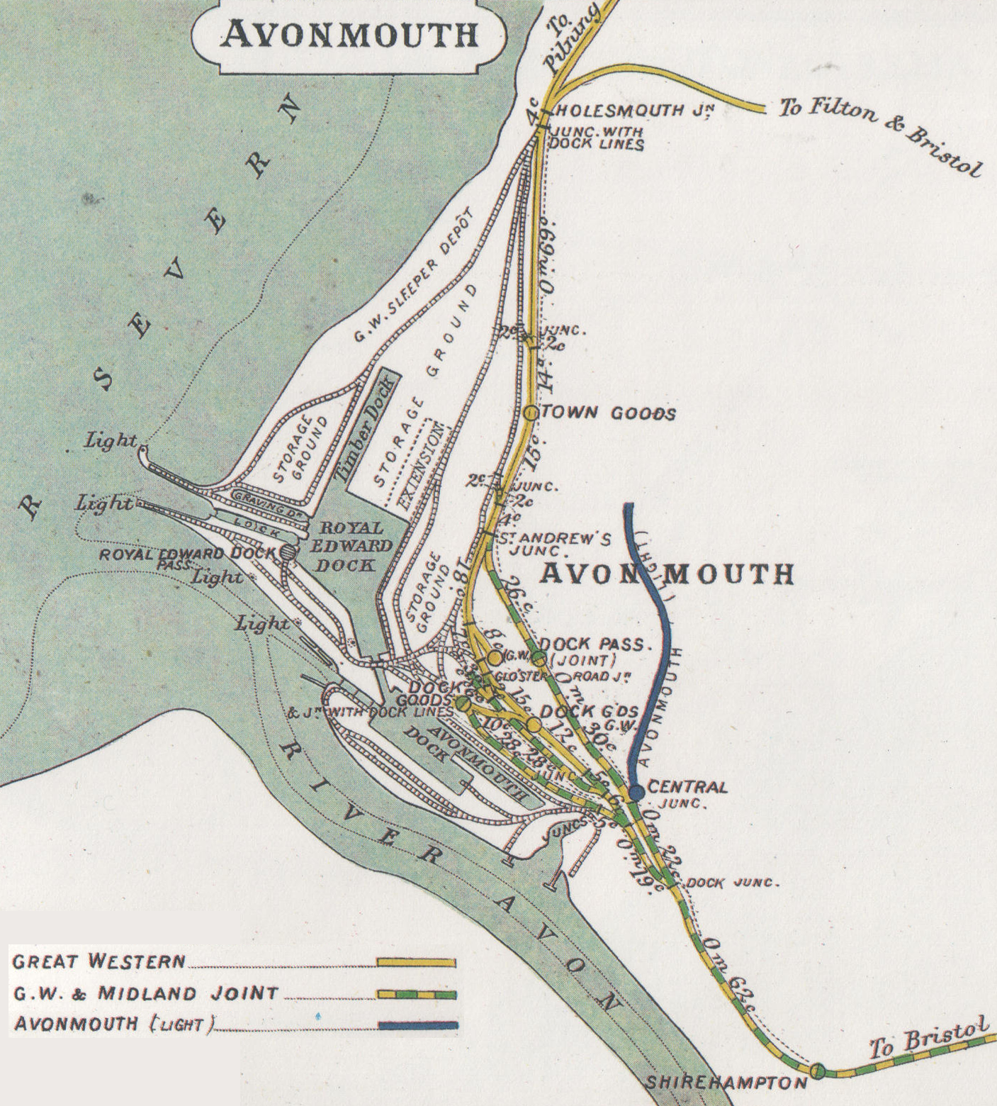
Avonmouth is a port and outer suburb of Bristol, England, facing two rivers: the reinforced north bank of the final stage of the Avon which rises at sources in Wiltshire, Gloucestershire and Somerset; and the eastern shore of the Severn Estuary. Strategically the area has been and remains an important part of the region's maritime economy particularly for larger vessels for the unloading and exporting of heavier goods as well as in industry including warehousing, light industry, electrical power and sanitation. The area contains a junction of and is connected to the south by the M5 motorway and other roads, railway tracks and paths to the north, south-east and east. The council ward of Avonmouth and Lawrence Weston is as drawn a simplified name as it includes Shirehampton and the western end of Lawrence Weston. Geography Avonmouth is approximately rectangular, its length favouring the Severn shore and sits on the same bank as the city centre from which it lies west-north- ... [...More Info...] [...Related Items...] OR: [Wikipedia] [Google] [Baidu] |
Avonmouth Docks
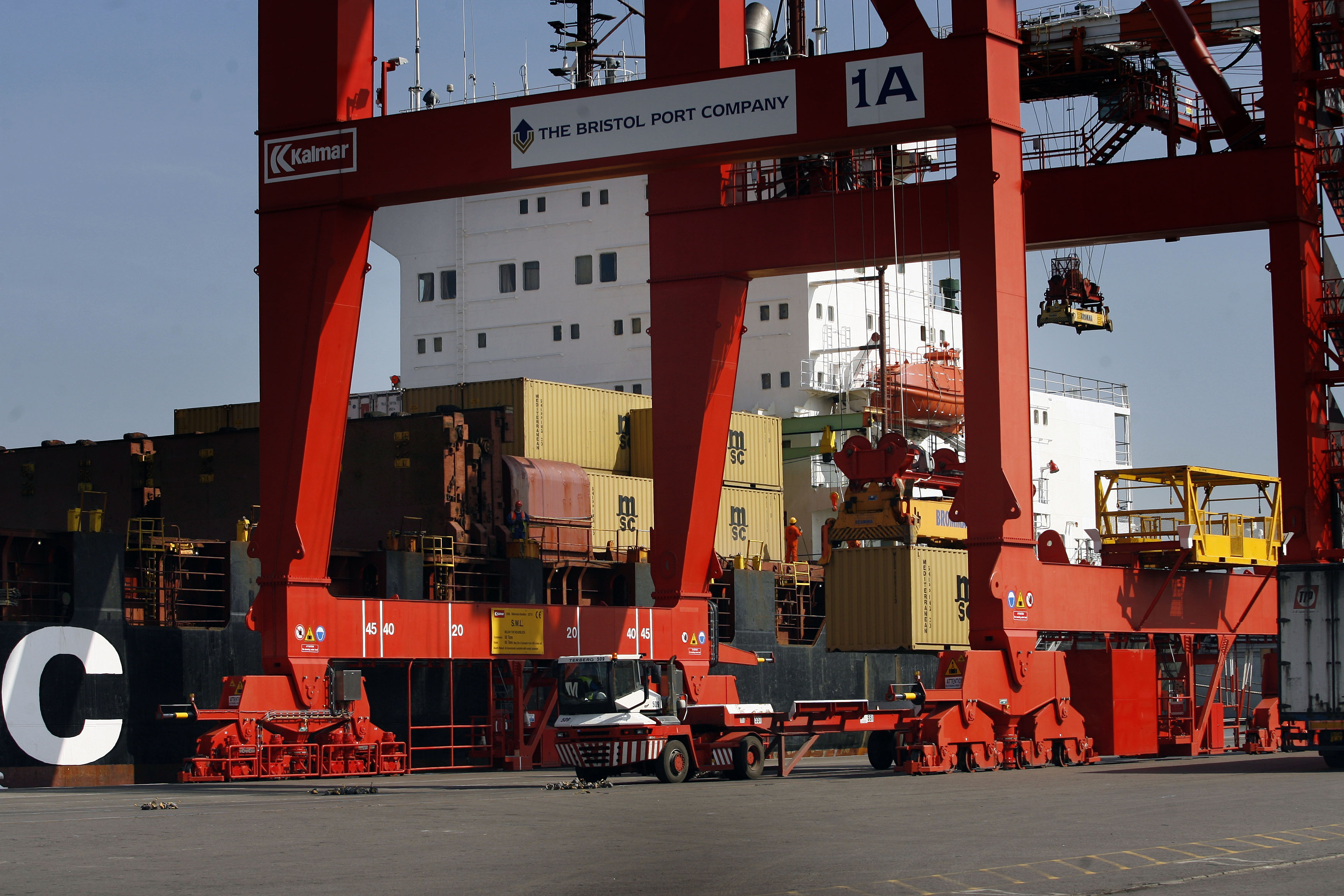
The Avonmouth Docks are part of the Port of Bristol, in England. They are situated on the northern side of the mouth of the River Avon, opposite the Royal Portbury Dock on the southern side, where the river joins the Severn estuary, within Avonmouth. Accessible via a long and wide lock, today the docks are one of the UK's major ports for chilled foods, especially fruit and vegetables. Land-side freight access and distribution is via either the M5 motorway or the Henbury Loop Line, whilst rail-passenger access is via Avonmouth railway station on the Severn Beach Line. Background Bristol Harbour had always been a major centre of trade within the wider UK economy, due to its strategic location to the west of the country, allowing access to both the Atlantic Ocean and the Mediterranean. Coastal trade was also important, with the area called "Welsh Back" concentrating on trows with cargoes from the Slate industry in Wales, stone, timber and coal. However, by the 18th century the ... [...More Info...] [...Related Items...] OR: [Wikipedia] [Google] [Baidu] |
River Avon (Bristol)
The River Avon is a river in the south west of England. To distinguish it from a number of other River Avon (other), rivers of the same name, it is often called the Bristol Avon. The name 'Avon' is a cognate of the Welsh language, Welsh word , meaning 'river'. The Avon source (river), rises just north of the village of Acton Turville in South Gloucestershire, before flowing through Wiltshire. In its lower reaches from Bath, Somerset, Bath to the Severn Estuary at Avonmouth near Bristol, the river is navigable and known as the Avon Navigation. The Avon is the Longest rivers of the United Kingdom, 19th longest river in the United Kingdom, at , although there are just as the crow flies between the source and its mouth in the Severn Estuary. The Drainage basin, catchment area is . Etymology The name "Avon" is a cognate of the Welsh language, Welsh word ''afon'' "river", both being derived from the Common Brittonic , "river". "River Avon (other), River A ... [...More Info...] [...Related Items...] OR: [Wikipedia] [Google] [Baidu] |
Shirehampton
Shirehampton is a district of Bristol in England, near Avonmouth, at the northwestern edge of the city. It originated as a separate village, retains a High Street with a parish church and shops, and is still thought of as a village by many of its 6,867 inhabitants. Although on the far northwest corner, and largely separated from the rest of Bristol by a broad swathe of parkland extending from the Blaise Castle estate, with the River Avon forming a barrier for access to Somerset, the community is still a convenient location from which to reach all parts of the city. Travel is also easy from Shirehampton into Gloucestershire, South Wales and Somerset since it lies within reach of the main motorways in the area, including the M5, the M4 Second Severn Crossing, and the M49, and it is served by the A4 Portway and by Shirehampton railway station, which allow access to near the city centre. It is informally known to local people as "Shire". Situation Shirehampton looks across the ... [...More Info...] [...Related Items...] OR: [Wikipedia] [Google] [Baidu] |
Nisbets
Nisbets is a British multi-channel retailer of catering equipment and supplies. It develops, retails and distributes commercial kitchen equipment, catering supplies and other hospitality products to hotels, restaurants, bars, cafes, schools and colleges. Nisbets is Europe's largest supplier of catering equipment. It retails both own-brand goods, under labels such as Mitre Linen and Home Chef, and products from popular third-party brands. It retails products online, by mail-order and through a network of physical retail outlets. Headquartered in Avonmouth, Bristol, Nisbets employs more than 2,000 people worldwide, and has offices in UK, Ireland, Belgium, Holland, Germany, France, Spain, Portugal and Australia. It exports to more than 100 countries, and was awarded The Queen's Award for Enterprise for International Trade in 2017. History 1983-2000: Founding of Nisbets Nisbets was founded by Andrew Nisbet in 1983. It started out selling knives, catering clothing and ... [...More Info...] [...Related Items...] OR: [Wikipedia] [Google] [Baidu] |
Bristol
Bristol () is a city, ceremonial county and unitary authority in England. Situated on the River Avon, it is bordered by the ceremonial counties of Gloucestershire to the north and Somerset to the south. Bristol is the most populous city in South West England. The wider Bristol Built-up Area is the eleventh most populous urban area in the United Kingdom. Iron Age hillforts and Roman villas were built near the confluence of the rivers Frome and Avon. Around the beginning of the 11th century, the settlement was known as (Old English: 'the place at the bridge'). Bristol received a royal charter in 1155 and was historically divided between Gloucestershire and Somerset until 1373 when it became a county corporate. From the 13th to the 18th century, Bristol was among the top three English cities, after London, in tax receipts. A major port, Bristol was a starting place for early voyages of exploration to the New World. On a ship out of Bristol in 1497, John Cabot, a Venetia ... [...More Info...] [...Related Items...] OR: [Wikipedia] [Google] [Baidu] |
Portway, Bristol
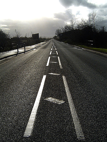
The Portway is a major road in the City of Bristol. It is part of the A4 and connects Bristol City Centre to the Avonmouth Docks and the M5 motorway via the Avon Gorge. The road was constructed following World War I in order to provide improved access to the ports at Avonmouth Docks, which had replaced Bristol Harbour as the major local centre for commercial shipping. Upon opening on 2 July 1926, it was the single most expensive road project in Britain, costing £800,000 (now about £ million). The construction posed a number of significant engineering challenges, including long and deep rock cuttings, a viaduct over the River Trym, and retaining walls against the gorge adjacent to the River Avon. Falling rocks have since been a problem along the Portway, particularly at the southern end close to the Clifton Suspension Bridge, with concrete canopies constructed to prevent loose rock and assist with remedial work. The Portway remains an important route to and from Bristol, and ... [...More Info...] [...Related Items...] OR: [Wikipedia] [Google] [Baidu] |
Avonmouth Bridge
The Avonmouth Bridge is a road bridge that carries the M5 motorway over the River Avon into Somerset near Bristol, England. The main span is long, and the bridge is long, with an air draught above mean high water level of . It also has a separate footpath and cycleway which connects the B4054 near Avonmouth station with the Royal Portbury Dock and the village of Pill. Construction The bridge was built with three lanes each way, with full hard shoulders. In 1995–2000, it was widened to four lanes each way, with the result that the hard shoulders are no longer of full width. The bridge was built to allow tall ships underneath. This gave the bridge steep gradients that cause heavy vehicles to slow down, resulting in congestion during rush hour and the summer tourist season: traffic can back up both on the bridge and on the approaches. The construction contract was let to Fairfield-Mabey and commenced in 1969; Fairfield-Mabey placed a sub-contract with Tarmac Civil Eng ... [...More Info...] [...Related Items...] OR: [Wikipedia] [Google] [Baidu] |
M5 Motorway
The M5 is a motorway in England linking the Midlands with the South West England, South West. It runs from junction 8 of the M6 motorway, M6 at West Bromwich near Birmingham to Exeter in Devon. Heading south-west, the M5 runs east of West Bromwich and west of Birmingham through Sandwell Valley. It continues past Bromsgrove (and from Birmingham and Bromsgrove is part of the Birmingham Motorway Box), Droitwich Spa, Worcester, England, Worcester, Tewkesbury, Cheltenham, Gloucester, Bristol, Clevedon, Weston-super-Mare, Bridgwater, Taunton, terminating at junction 31 for Exeter. Congestion on the section south of the M4 motorway, M4 is common during the summer holidays, on Friday afternoons and bank holidays. Route The M5 quite closely follows the route of the A38 road. The two deviate slightly around Bristol and the area south of Bristol from junctions 16 to the Sedgemoor services north of junction 22. The A38 goes straight through the centre of Bristol and passes by Bristol Airp ... [...More Info...] [...Related Items...] OR: [Wikipedia] [Google] [Baidu] |
A4 Road (England)
The A4 is a major road in England from Central London to Avonmouth via Heathrow Airport, Reading, Bath and Bristol. It is historically known as the Bath Road with newer sections including the Great West Road and Portway. The road was once the main route from London to Bath, Bristol and the west of England and formed, after the A40, the second main western artery from London. Although most traffic is carried by the M4 motorway today, the A4 still acts as the main route from Bristol to London for non-motorway traffic. History Turnpikes The A4 has gone through many transformations through the ages from pre-Roman routes, Roman roads (such as the one passing Silbury Hill), and basic wagon tracks. During the Middle Ages, most byways and tracks served to connect villages with their nearest market town. A survey of Savernake Forest near Hungerford in 1228 mentions "The King's Street" running between the town and Marlborough. This street corresponded roughly with the route of ... [...More Info...] [...Related Items...] OR: [Wikipedia] [Google] [Baidu] |
A403 Road
The A403 is a main road linking Bristol with the Severn Estuary. It runs from junction 1 of the M48 at Aust to the docks at Avonmouth. After the Severn Bridge was opened in 1966, the A403 was constructed in 1969 and 1970 to provide a direct route between the M4 motorway and Avonmouth. It is an important route for the local industries, allowing easy access between Wales and this part of England. It was financed by Gloucestershire County Council with a £387,000 grant from the Ministry of Transport and was initially known as the Avonmouth Aust Coast Road. Route The road is running through South Gloucestershire and the City of Bristol. Between the M4 at Aust and Pilning it replaced the B4055 on a realigned route. Between Pilning and Chittening Chittening is an industrial estate in Avonmouth, Bristol, England, bypassed by the A403 road, near the River Severn. It lies within the city boundary of Bristol, in Avonmouth ward, but used to be beyond it, in historic Gloucestershire, ... [...More Info...] [...Related Items...] OR: [Wikipedia] [Google] [Baidu] |
M49 Motorway
The M49 motorway is just long and forms a link between the M5 motorway west of Bristol at junction 18A and the M4 motorway at junction 22 before the Second Severn Crossing (now officially renamed the Prince of Wales Bridge). It was constructed at the same time as the bridge in 1996. It is unique in that it is only accessible from other motorways. Route The M49 begins at junction 18A of the M5 and then heads roughly north and northwest before it reaches its terminal junction with the M4 at junction 22, just before the Second Severn Crossing at Pilning Interchange. It cuts journey times for traffic to and from Avonmouth docks, Central and southern Bristol and South West England. Compared to driving via the M4/M5 interchange, using the M49 cuts the distance travelled by 6.2 miles. Having a two-way grade separated roundabout junction with the M4, it also fulfils the additional role of providing a bypass for the busy stretch of the M5 between the Avonmouth Bridge and the M4 in cas ... [...More Info...] [...Related Items...] OR: [Wikipedia] [Google] [Baidu] |
Royal Portbury Dock
The Royal Portbury Dock is part of the Port of Bristol, in England. It is situated near the village of Portbury on the southern side of the mouth of the River Avon, Bristol, Avon, where the river joins the Severn estuary — the Avonmouth Docks are on the opposite side of the Avon, within Avonmouth. The deepwater dock was constructed between 1972 and 1977, and is now a major port for the import of motor vehicles into the United Kingdom, UK. The M5 motorway runs nearby, and the huge car storage compounds around the dock are visible from the Avonmouth Bridge. A waste industrial area west of the port is being developed as the Portbury Ashlands Nature Reserve. The Royal Portbury Dock has the largest entrance lock into any UK port, accommodating vessels up to beam, length and draft. Operator The dock is now operated by The Bristol Port Company, which also operates Avonmouth Docks, and has done since 1991 when it purchased a 150-year lease from Bristol City Council. Between ... [...More Info...] [...Related Items...] OR: [Wikipedia] [Google] [Baidu] |


.jpg)


