|
Amsterdam-Oost
Amsterdam-Oost () is a borough of Amsterdam, Netherlands, established in May 2010 after a merger of the former boroughs of Zeeburg and Oost-Watergraafsmeer. In 2013, the borough had almost 123,000 inhabitants. History Amsterdam-Oost is the borough of Amsterdam on the eastern side of the Singelgracht canal. The borough is bordered by the Amstel river in the west, the ''Weespertrekvaart'' canal in the south, and the IJ lake in the east and north. The eastern city expansion beyond the 17th-century Amsterdam canal belt began in the last quarter of the 19th century with the development of the Oosterparkbuurt and Dapperbuurt. These neighborhoods, including the Weesperzijde area along the Amstel river, are called ''Oud-Oost'' ('Old East'). In the early 20th century, additional urban expansions were planned in eastern direction. Between 1920 and 1940, the Indische Buurt and Transvaalbuurt neighborhoods were constructed, partly on the territory of the former municipality of Nieuwe ... [...More Info...] [...Related Items...] OR: [Wikipedia] [Google] [Baidu] |
Oostpoort (Amsterdam)
Oostpoort (; en, East Gate) is a neighborhood in the borough Amsterdam-Oost in Amsterdam, Netherlands. The neighborhood is situated at between the Linnaeusstraat, the Ringvaart, the Amsterdam–Arnhem railway, and the Amsterdam–Zutphen railway.De Staat van Oostpoort 2013 Amsterdam-Oost
Amsterdam-Oost () is a borough of Amsterdam, Netherlands, established in May 2010 after a merger of the former boroughs of Zeeburg and Oost-Watergraafsmeer. In 2013, the borough had almost 123,000 inhabitants.
History
Amsterdam-Oost is the bor ... . Retrieved on 30 June 2014.
Initially, the area was named ''Polderweggebied'' after the Po ...
[...More Info...] [...Related Items...] OR: [Wikipedia] [Google] [Baidu] |
IJburg
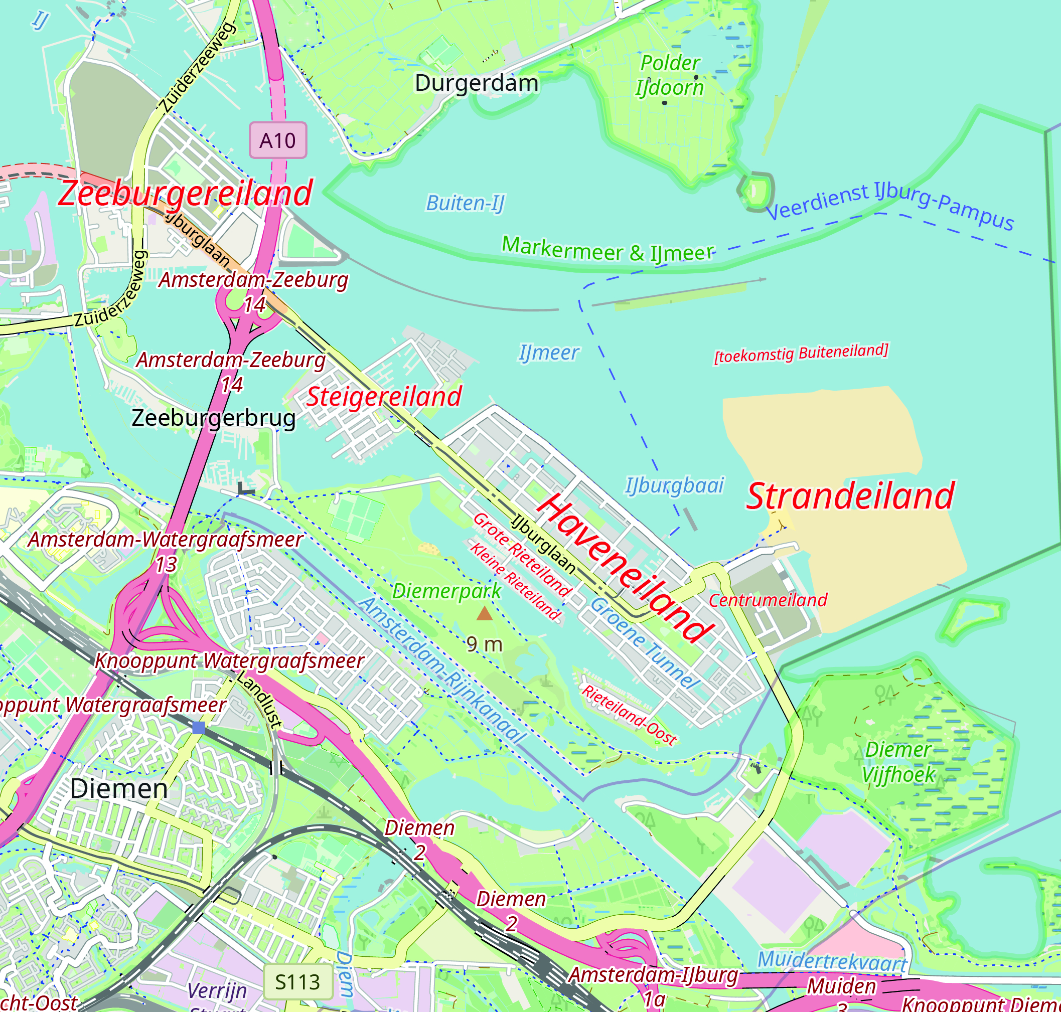
IJburg () is a residential neighbourhood under construction in Amsterdam, Netherlands. It is situated in the IJmeer and is being built on artificial islands which have been raised from the lake. The Haveneiland, Rieteilanden, Steigereiland and Centrumeiland are already inhabited as of 2004. It is part of the municipality Amsterdam-Oost and also contains the Diemerpark, one of the city's largest parks. History Planning (1965–1997) In 1965, the architects Jo van den Broek and Jacob B. Bakema designed the Pampus Plan for a town in the IJmeer intended to house 350,000 residents, most of whom were to come from crowded Amsterdam. But national plans changed and people were instead encouraged to move from the city to the expanding towns in the neighbouring areas like Purmerend, Hoorn and the new city of Almere. The Bijlmermeer neighbourhood was also constructed south of the city and Diemen was expanded. Policy changes in the 1980s resulted in the development of construction nearer ... [...More Info...] [...Related Items...] OR: [Wikipedia] [Google] [Baidu] |
Amsterdam
Amsterdam ( , , , lit. ''The Dam on the River Amstel'') is the Capital of the Netherlands, capital and Municipalities of the Netherlands, most populous city of the Netherlands, with The Hague being the seat of government. It has a population of 907,976 within the city proper, 1,558,755 in the City Region of Amsterdam, urban area and 2,480,394 in the Amsterdam metropolitan area, metropolitan area. Located in the Provinces of the Netherlands, Dutch province of North Holland, Amsterdam is colloquially referred to as the "Venice of the North", for its large number of canals, now designated a World Heritage Site, UNESCO World Heritage Site. Amsterdam was founded at the mouth of the Amstel River that was dammed to control flooding; the city's name derives from the Amstel dam. Originally a small fishing village in the late 12th century, Amsterdam became a major world port during the Dutch Golden Age of the 17th century, when the Netherlands was an economic powerhouse. Amsterdam is th ... [...More Info...] [...Related Items...] OR: [Wikipedia] [Google] [Baidu] |
Indische Buurt
(; "Indies Neighborhood") is a neighborhood in the borough of Oost, the eastern part of the city of Amsterdam, Netherlands. The name of the neighborhood dates from the early 20th century, and is derived from the fact that the neighborhood's streets are named after islands and other geographical concepts in the former Dutch colony of the Dutch East Indies or now known as Indonesia. The first street was named in 1902. In 2003, the neighborhood had around 23,000 inhabitants. The neighborhood is bounded on the west by the railroad Amsterdam - Hilversum (with the Muiderpoort Station), on the east side by Flevopark, on the north side by Zeeburgerdijk and on the south side by the Ringvaart Watergraafsmeer. Indische Buurt is the oldest part of the former Zeeburg district and is very ethnically diverse. A high percentage of the population is of immigrant origin (for Zeeburg this is already high at 55%, but higher in the Indische Buurt) and there are an estimated 100 languages spoken. Hi ... [...More Info...] [...Related Items...] OR: [Wikipedia] [Google] [Baidu] |
Oud-Oost
Oud-Oost is an officially designated area of the borough of Amsterdam-Oost (Amsterdam East) in Amsterdam, Netherlands. It consists of the areas closer to the city center, traditionally known as Amsterdam East, before the borough was expanded. It is made up of the smaller neighborhoods: *Dapperbuurt * Oosterparkbuurt *Oostpoort Oostpoort (; en, East Gate) is a neighborhood in the borough Amsterdam-Oost in Amsterdam, Netherlands. The neighborhood is situated at between the Linnaeusstraat, the Ringvaart, the Amsterdam–Arnhem railway, and the Amsterdam–Zutphen railwa ... * Transvaalbuurt * Weesperzijde References Neighbourhoods of Amsterdam Amsterdam-Oost {{NorthHolland-geo-stub ... [...More Info...] [...Related Items...] OR: [Wikipedia] [Google] [Baidu] |
Oostelijk Havengebied
The Eastern Docklands ( nl, Oostelijk Havengebied) is a neighborhood of Amsterdam, Netherlands, located between the IJ and the Nieuwe Vaart in the borough of Amsterdam-Oost. The harbor area was constructed in the late nineteenth century to allow for increasing trade with the Dutch East Indies; a new location was necessitated by the construction of the Amsterdam Centraal railway station, which replaced the old quays. East of the new station was a marshy area called ''De Rietlanden'', with the ''Zeeburgerdijk'' (then called ''Sint Antoniesdijk''), running via the ''Zeeburch'', a fort, to the Zuiderzee. The neighborhood consists of the districts: KNSM Island, Java-eiland, Oostelijke Handelskade, Cruquiuseiland, Borneo-eiland and Sporenburg. The area, about 2/3 water and 1/3 land, consists of an extension of the Oostelijke Handelskade, east of the center of town, and four artificial "islands" (peninsulas), all of which were former industrial and harbor locations of the port of Ams ... [...More Info...] [...Related Items...] OR: [Wikipedia] [Google] [Baidu] |
Trams In Amsterdam
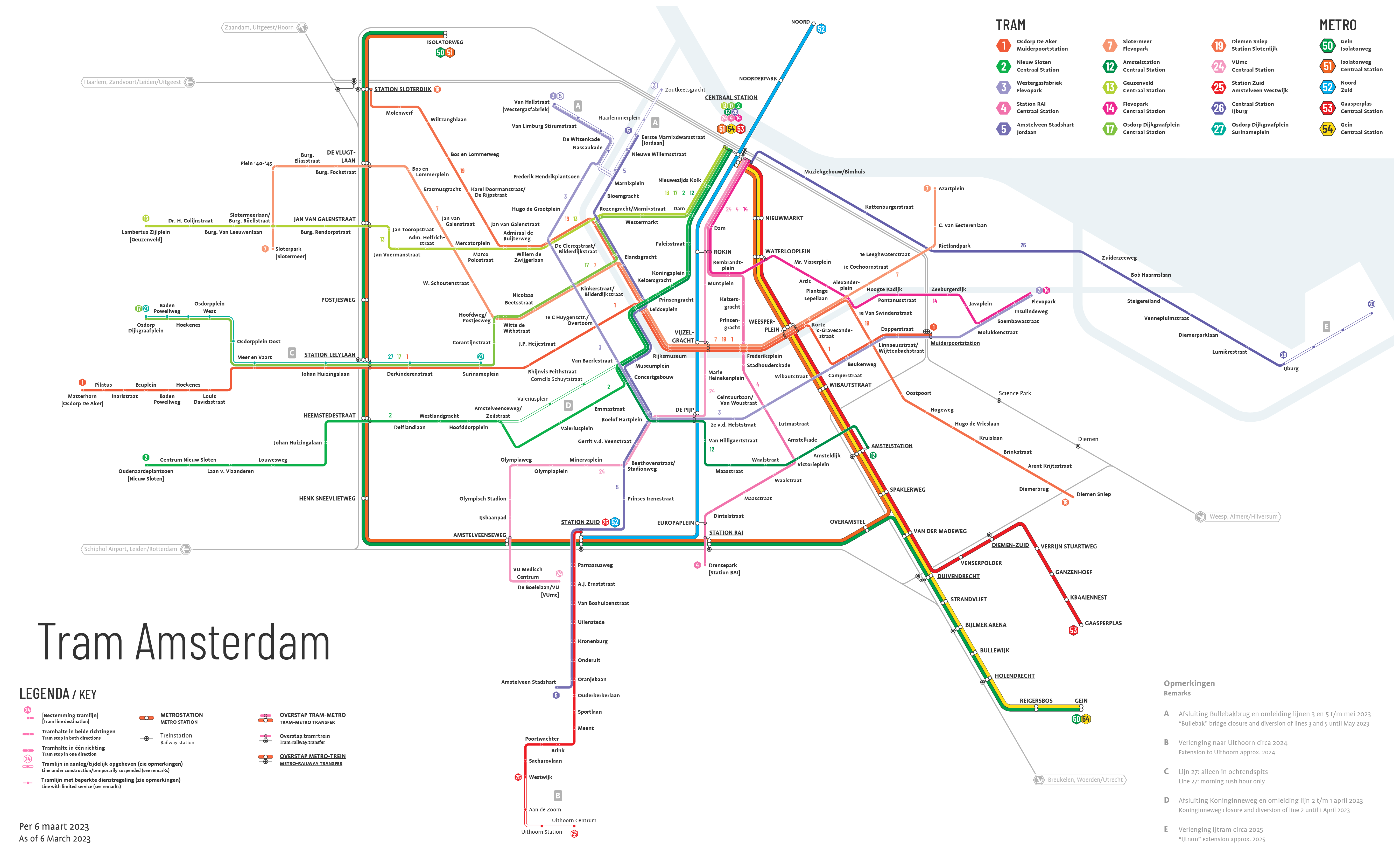
The Amsterdam Tram ( nl, Amsterdamse tram �ɑmstəɹˈdɑmsə tɾɛm is a tram network in Amsterdam, Netherlands. It dates back to 1875 and since 1943 has been operated by municipal public transport operator Gemeentelijk Vervoerbedrijf (GVB), which also runs the Amsterdam Metro and the city bus and ferry services. Amsterdam has the largest tram network in the Netherlands and one of the largest in Europe. Network overview The 15 tram lines within Amsterdam's tram network serve all boroughs in Amsterdam except for Amsterdam-Noord on the north side of the IJ. Tram lines 5 and 25 extend south of the borough of Amsterdam-Zuid to serve the municipality of Amstelveen, and tram line 19 extends east of the borough of Amsterdam-Oost to serve the municipality of Diemen. , the fleet consists of 227 trams, of which 155 are Combinos (types 13G and 14G) from Siemens and 72 are Urbos 100 trams from Construcciones y Auxiliar de Ferrocarriles (type 15G). The first 15G trams ran on line 25. Trams ... [...More Info...] [...Related Items...] OR: [Wikipedia] [Google] [Baidu] |
Amsterdam Amstel Railway Station
Amsterdam Amstel (; abbreviation: Asa) is a railway station in Amsterdam, Netherlands. The station opened in 1939. It is located to the southeast of Amsterdam Centraal in the borough of Amsterdam-Oost, near the Amstel river. Amsterdam Amstel is used daily by 50,000 train and metro passengers. Rail services at the station are provided by NS, the principal railway operator in the Netherlands. Metro, tram and city bus services are provided by municipal operator GVB. Regional buses are operated by Connexxion. Amstel station is situated in the Omval business district which includes the Rembrandt Tower, the tallest skyscraper in the city, and the ''Leeuwenburg'' campus of the Hogeschool van Amsterdam. History The station was built under the direction of architects H.G.J. Schelling of NS, the principal railway operator in the Netherlands, and John Leupen of the City of Amsterdam. The railway station was opened on 15 October 1939, by Queen Wilhelmina of the Netherlands. It is p ... [...More Info...] [...Related Items...] OR: [Wikipedia] [Google] [Baidu] |
Watergraafsmeer
The Watergraafsmeer is a polder in the Netherlands. It was reclaimed in 1629. In the 17th and 18th centuries, there were many buitenplaatsen in the Watergraafsmeer, though nowadays only one, Frankendael, remains. Since 1921, the Watergraafsmeer is part of the city of Amsterdam and its rural character has all but disappeared. It is located in the borough of Amsterdam-Oost. The most important streets in the Watergraafsmeer are the Middenweg and the Kruislaan. Famous persons * Johan Cruyff, football player * Max Euwe, Dutch chess player, Dutch chess champion, world chess champion (1935-37), international chess arbiter * Nola Hatterman, actress and painter * Samuel Jessurun de Mesquita, a graphic artist * Gerard Reve Gerard Kornelis van het Reve (14 December 1923 – 8 April 2006) was a Dutch writer. He started writing as Simon Gerard van het Reve and adopted the shorter Gerard Reve in 1973. Together with Willem Frederik Hermans and Harry Mulisch, he i ..., Dutch writer ... [...More Info...] [...Related Items...] OR: [Wikipedia] [Google] [Baidu] |
Zeeburg
Zeeburg () is a former borough of Amsterdam. It had 52,701 residents (January 2009) and an area of 19.31 km². The construction of new islands to the east called IJburg made it the most rapidly growing borough of Amsterdam. On 1 May 2010 Zeeburg merged with the borough of Amsterdam-Oost. History The borough, which was created in 1990, got its name from the Zeeburgerdijk (Zeeburg dike) and the Zeeburgereiland (Zeeburg island) which lie in the centre of the borough. The Zeeburgerdijk is named after the fort ‘Seeburg’ which in the 17th century was part of the dike that protected land from the Zuiderzee. This dike connected Amsterdam and Muiden and was the only land route to Naarden before the Watergraafsmeer was drained. From the end of the 19th century, with the construction of the Oostelijk Havengebied (Eastern Harbour) and the residential Indische Buurt, the area has slowly become part of the city. For the 1928 Summer Olympics, its shooting range was used for the shooting ... [...More Info...] [...Related Items...] OR: [Wikipedia] [Google] [Baidu] |
Boroughs Of Amsterdam
The boroughs of Amsterdam ( nl, stadsdelen; literally "''city parts''") are the eight principal subdivisions of the municipality of Amsterdam, Netherlands. Each borough is governed by a directly elected district committee (''bestuurscommissie''). The first Amsterdam boroughs were created in 1981, with other boroughs created in later years. The last area to be granted the status of borough was Amsterdam-Centrum (2002). The existing system of eight boroughs, covering all parts of Amsterdam, is the result of a major borough reform in 2010. The current boroughs have populations of around 80,000 to 150,000, which is equivalent to an average-sized municipality in the Netherlands. Borough government Until 2014, the Amsterdam boroughs had the status of submunicipalities (''deelgemeenten''), a form of government which existed only in Amsterdam and Rotterdam. The borough of Westpoort, however, was governed by the central municipal authorities and therefore not a submunicipality. The submu ... [...More Info...] [...Related Items...] OR: [Wikipedia] [Google] [Baidu] |
Dapperbuurt
Dapperbuurt is a neighborhood of Amsterdam, Netherlands ) , anthem = ( en, "William of Nassau") , image_map = , map_caption = , subdivision_type = Sovereign state , subdivision_name = Kingdom of the Netherlands , established_title = Before independence , established_date = Spanish Netherl .... Neighbourhoods of Amsterdam Amsterdam-Oost {{NorthHolland-geo-stub ... [...More Info...] [...Related Items...] OR: [Wikipedia] [Google] [Baidu] |

.jpg)


