|
Bytantay
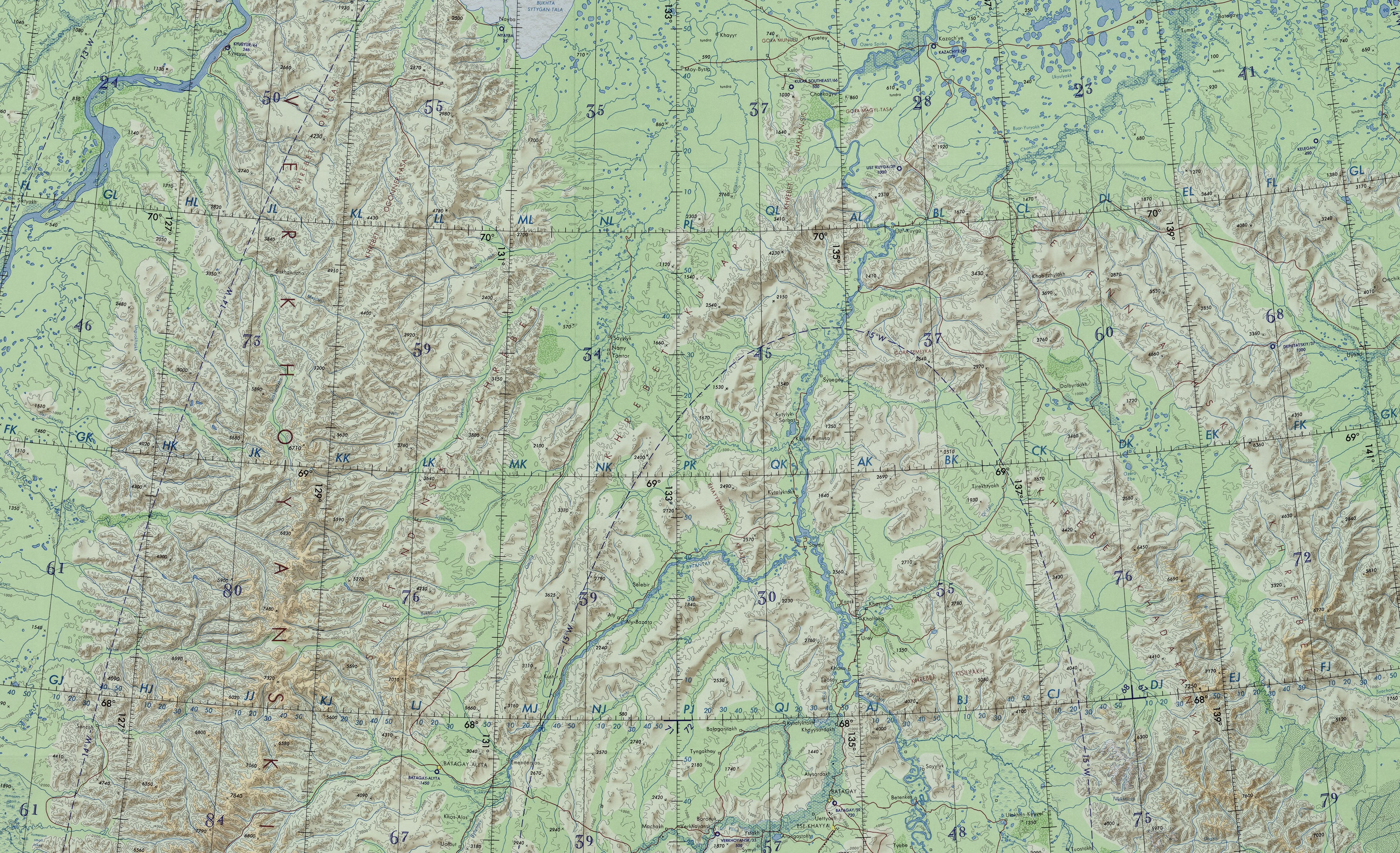
The Bytantay (russian: Бытантай; sah, Бытантай) is a river in the Republic of Sakha Republic, Sakha in Russia. It is a left hand tributary of the Yana (river), Yana, and is long, with a drainage basin of . Course The river begins in the eastern flank of the Verkhoyansk Range at an elevation of . It heads roughly northeast with the Kular Range to the northwest and then joins river Yana from the left from its mouth. There are more than two thousand lakes in the basin of the Bytantay. — ''статья из Большой советской энциклопедии''. Great Soviet Encyclopedia The main tributaries of the Bytantay are Billah and Tenki on the right; and Khobol, Achchygy-Sakkyryr, Ulakhan-Sakkyryr and Kulgaga-Suoh on the left. The Ulakhan-Sakkyryr joins the Bytantay a short distance to the east of Batag ... [...More Info...] [...Related Items...] OR: [Wikipedia] [Google] [Baidu] |
Batagay-Alyta
Batagay-Alyta (russian: Батагай-Алыта; sah, Баатаҕай Алыыта, ''Baatağay Alııta'', ), also known as Sakkyryr (russian: Саккырыр; sah, Саккырыыр, ''Saqqırıır'', ) is a rural locality (a '' selo'') and the administrative center of Eveno-Bytantaysky National District in the Sakha Republic, Russia. Its population as of the 2010 Census was 1,832. Geography Batagay-Alyta is located on the eastern flank of the Verkhoyansk Range, and southeast of the southern end of the Sietinden Range and southwest of the Kular Range. The town lies about to the north of the capital Yakutsk and a few kilometers from the left bank of the Ulakhan-Sakkyryr River, a tributary of the Bytantay. History It was founded in 1936 as the administrative center for the then newly created Sakkyryrsky District. It lost this function with the dissolution of the district in 1963, but regained it with the creation of Eveno-Bytantaysky District in 1989. Demographics P ... [...More Info...] [...Related Items...] OR: [Wikipedia] [Google] [Baidu] |
Kular Range
The Kular Range (russian: хребет Кулар, ''Khrebet Kular''; sah, Кулар сис, Kular Sis) is a range of mountains in far North-eastern Russia. Administratively the range is part of the Eveno-Bytantaysky National District of the Sakha Republic, Russian Federation.Kular (mountains) / ; in 35 vols. / Ch. ed. Yu. S. Osipov. 2004—2017. This range is one of the places in Yakutia where are found. [...More Info...] [...Related Items...] OR: [Wikipedia] [Google] [Baidu] |
Verkhoyansk Range
The Verkhoyansk Range (russian: Верхоянский хребет, ''Verkhojanskiy Khrebet''; sah, Үөһээ Дьааҥы сис хайата, ''Üöhee Chaangy sis khaĭata'') is a mountain range in the Sakha Republic, Russia near the settlement of Verkhoyansk, well-known for its frigid climate. It is part of the East Siberian Mountains. The range lies just west of the boundary of the Eurasian and the North American tectonic plates. The mountains were formed by folding, and represent an anticline. The Verkhoyansk Range was covered by glaciers during the Last Glacial Period and the mountains in the northern section, such as the Orulgan Range, display a typical Alpine relief. There are coal, silver, lead, tin and zinc deposits in the mountains. Geography Rising from the shores of the Buor-Khaya Gulf in the north, it runs southwards spanning roughly 1000 km (600 mi.) across Yakutia, east of the Central Yakutian Lowland, and west of the Chersky Range, reaching the ... [...More Info...] [...Related Items...] OR: [Wikipedia] [Google] [Baidu] |
Yana (river)
The Yana ( rus, Я́на, p=ˈjanə; sah, Дьааҥы, ''Caañı'') is a river in Sakha in Russia, located between the Lena to the west and the Indigirka to the east. Course It is long, and its drainage basin covers . Including its longest source river, the Sartang, it is long. Its annual discharge totals approximately . Most of this discharge occurs in May and June as the ice on the river breaks up. The Yana freezes up on the surface in October and stays under the ice until late May or early June. In the Verkhoyansk area, it stays frozen to the bottom for 70 to 110 days, and partly frozen for 220 days of the year. The river begins at the confluence of the rivers Sartang and Dulgalakh in the Yana-Oymyakon Highlands. It flows north across the vast Yana-Indigirka Lowland, part of the greater East Siberian Lowland, shared with the Indigirka to the east. As the river flows into the Yana Bay of the Laptev Sea, it forms a huge river delta covering . [...More Info...] [...Related Items...] OR: [Wikipedia] [Google] [Baidu] |

