|
Bylong Valley Way
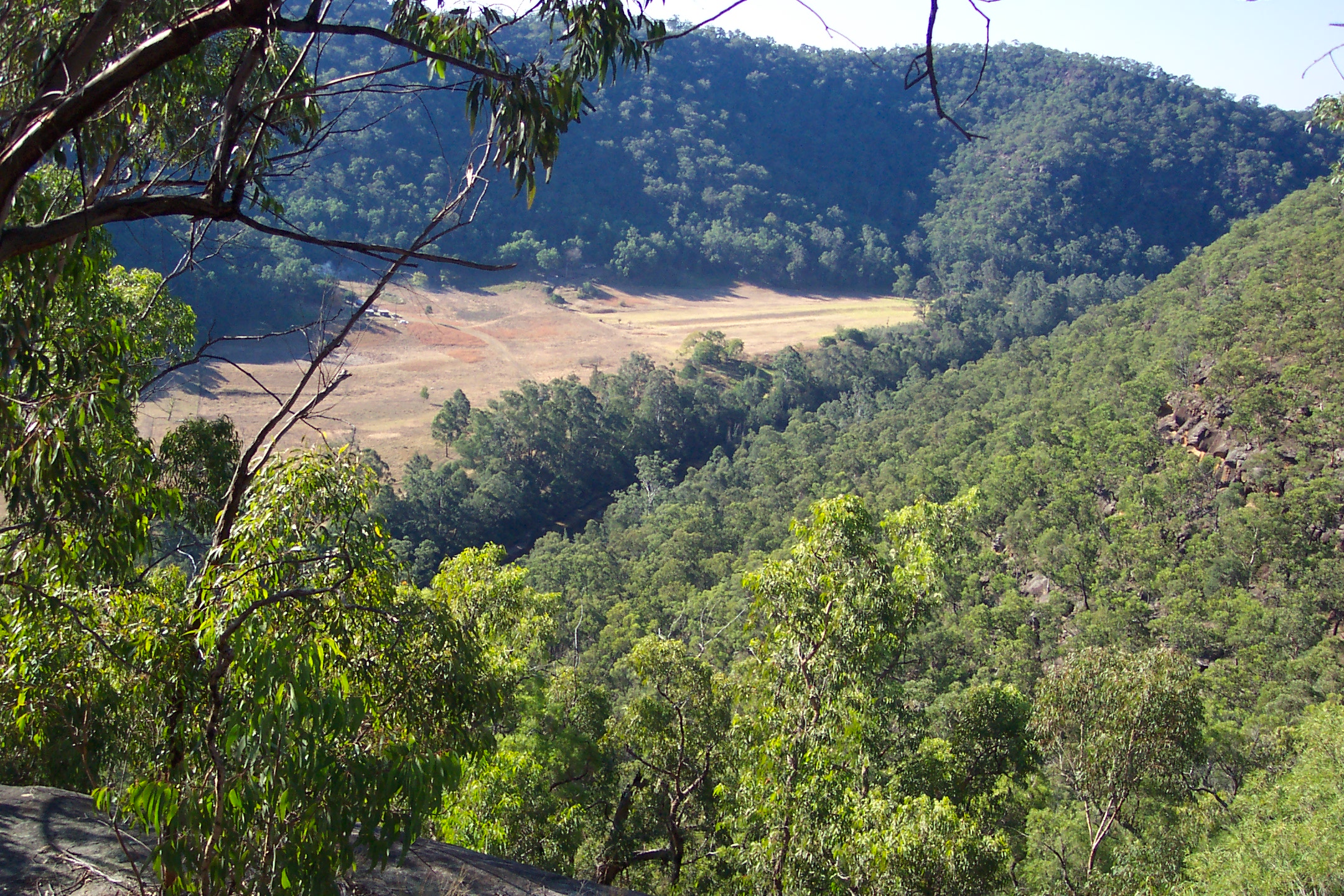
Bylong Valley Way is a New South Wales country road linking the Golden Highway near Sandy Hollow to the Castlereagh Highway near Ilford. It is named after the Bylong Valley, through which the road passes. Route In conjunction with the Bathurst-Ilford Road to Bathurst, this quiet, scenic route provides a leisurely alternative to going through Sydney to travel between the Hunter Region and Central Tablelands. History The passing of the ''Main Roads Act of 1924'' through the Parliament of New South Wales provided for the declaration of Main Roads, roads partially funded by the State government through the Main Roads Board (later the Department of Main Roads, and eventually Transport for NSW). Main Road No. 208 was declared from Sandy Hollow to Bylong (and continuing west via Wollar to Mudgee, and east via Wybong to the intersection with Great Northern Highway, today New England Highway, at Muswellbrook), and Main Road No. 215 was declared from Bylong via Rylstone to Ilford, on t ... [...More Info...] [...Related Items...] OR: [Wikipedia] [Google] [Baidu] |
Golden Highway
Golden Highway is a highway, located in the Hunter Region, Hunter and Orana (New South Wales), Orana regions of New South Wales, Australia. It runs eastwards from Dubbo towards Newcastle, New South Wales, Newcastle on the coast, allowing road transport to avoid travelling over the Blue Mountains (Australia), Blue Mountains to Sydney, and is designated route B84. Route From west to east, Golden Highway runs through Dunedoo where it is concurrency (road), concurrent with Castlereagh Highway for approximately then through Merriwa, New South Wales, Merriwa, Sandy Hollow, New South Wales, Sandy Hollow, Denman, New South Wales, Denman, Jerrys Plains, New South Wales, Jerrys Plains and Mount Thorley, joining New England Highway at Belford, New South Wales, Belford, south of Singleton, New South Wales, Singleton. Bylong Valley Way turns off Golden Highway east of Sandy Hollow. Golden Highway and Putty Road are concurrent for around , east of the Mount Thorley industrial estate nea ... [...More Info...] [...Related Items...] OR: [Wikipedia] [Google] [Baidu] |
Australian Dollar
The Australian dollar (sign: $; code: AUD) is the currency of Australia, including its external territories: Christmas Island, Cocos (Keeling) Islands, and Norfolk Island. It is officially used as currency by three independent Pacific Island states: Kiribati, Nauru, and Tuvalu. It is legal tender in Australia.''Reserve Bank Act 1959'', s.36(1) an ''Currency Act 1965'', s.16 Within Australia, it is almost always abbreviated with the ($), with A$ or AU$ sometimes used to distinguish it from other |
June 2007 Hunter Region And Central Coast Storms
The 2007 New South Wales storms started on 8 June 2007 following the development of an intense east coast low pressure system during the previous night. Over the next 36 hours these areas were battered by the system's strong winds and torrential rain, which caused extensive flooding, damage, loss of life and the grounding of a long bulk carrier. Impact The New South Wales Premier, Morris Iemma, declared a natural disaster for the affected areas. More than 105,000 homes had been left without power. Rainfall had exceeded in the Hunter region and in parts of the Central Coast and Sydney. Nearly 6,000 State Emergency Service volunteers, including crews from across New South Wales, Australian Capital Territory, Queensland and Victoria worked in the area, having responded to over 10,000 calls for assistance. The floods have claimed the lives of eight people. The strongest observed wind gusts were at Norah Head and at Newcastle. Aftermath A family of four and a nephew were kill ... [...More Info...] [...Related Items...] OR: [Wikipedia] [Google] [Baidu] |
Baerami, New South Wales
Baerami is a locality in the Muswellbrook Shire in the Upper Hunter region of New South Wales, Australia. The Bylong Valley Way crosses the Baerami Creek via Kirks Bridge at Baerami. Downstream of the bridge, the creek meets its confluence with the Goulburn River. The name of Baerami is associated with a deposit of oil shale, which was reputedly the largest in New South Wales and around twice the size of that at Glen Davis. However, the site where mining occurred on lies Baerami Creek, approximately 25 km south of the road junction near the crossing of Baerami Creek at Baerami, in the adjacent locality of Baerami Creek. The Sandy Hollow-Gulgong goods railway line passes through the locality. Points of interest include Baerami Community HallJames Estate Dingo Gully, and the olBaerami Catholic Church See also * Bylong * Sandy Hollow * Baerami Creek * Denman Denman may refer to: __NOTOC__ Places * Denman Glacier, near Antarctica * Denman Shire, New South Wales, Australia ** ... [...More Info...] [...Related Items...] OR: [Wikipedia] [Google] [Baidu] |
Mudgee
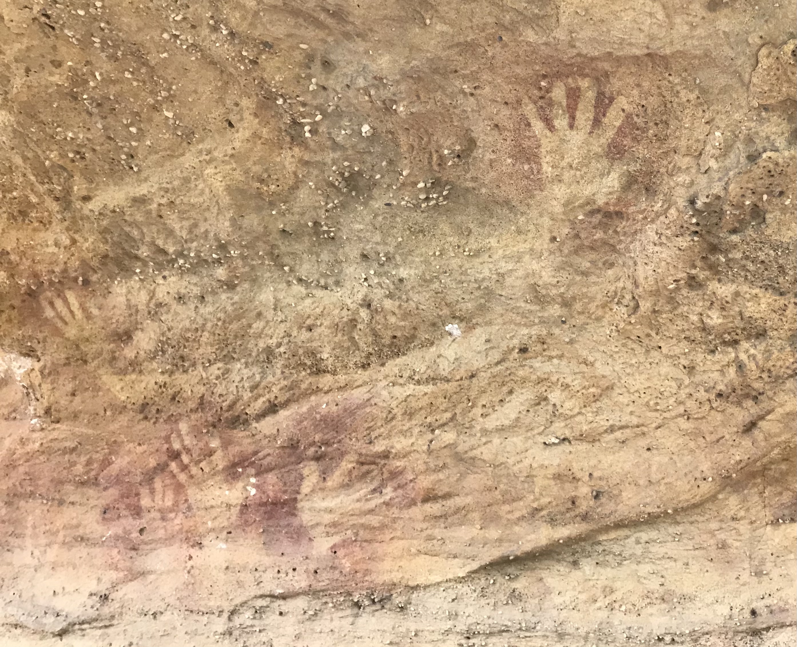
Mudgee is a town in the Central West (New South Wales), Central West of New South Wales, Australia. It is in the broad fertile Cudgegong River valley north-west of Sydney and is the largest town in the Mid-Western Regional Council Local government in Australia, local government area as well as being the council seat. As at June 2021 its population was 12,563. Estimated resident population, 30 June 2018. The district lies across the edge of the Interim Biogeographic Regionalisation for Australia, geological structure known as the Sydney Basin. History Wiradjuri people The Mudgee and Dabee clans of the Wiradjuri people lived at and around the site of what is now the town of Mudgee on the Cudgegong River. Some cultural and tool-making sites of these Aboriginal people remain, including the Hands on the Rocks, The Drip and Babyfoot Cave sites. Significance of local names Many place-names in the region are derived from the original Wiradjuri language, including Mudgee itself, ... [...More Info...] [...Related Items...] OR: [Wikipedia] [Google] [Baidu] |
Muswellbrook, New South Wales
Muswellbrook ( ) is a town in the Upper Hunter Region of New South Wales, Australia, about north of Sydney and north-west of Newcastle. Geologically, Muswellbrook is situated in the northern parts of the Sydney basin, bordering the New England region. The area is predominantly known for coal mining and horse breeding, but has also developed a reputation for gourmet food and wine production. As at June 2018 Muswellbrook has a population of 12,364. Estimated resident population, 30 June 2018. Located to the south of the Muswellbrook township are two coal fuelled power stations, Liddell and Bayswater. They were commissioned in 1973 and mid 1980s respectively and employ approximately 500 people from the area. History Before European settlement of the region the Wonnarua and Gamilaroi peoples occupied the land. The first European to explore the area was Chief Constable John Howe in 1819, with the first white settlement occurring in the 1820s. The township of Muswellbrook was gaze ... [...More Info...] [...Related Items...] OR: [Wikipedia] [Google] [Baidu] |
Canberra
Canberra ( ) is the capital city of Australia. Founded following the federation of the colonies of Australia as the seat of government for the new nation, it is Australia's largest inland city and the eighth-largest city overall. The city is located at the northern end of the Australian Capital Territory at the northern tip of the Australian Alps, the country's highest mountain range. As of June 2021, Canberra's estimated population was 453,558. The area chosen for the capital had been inhabited by Indigenous Australians for up to 21,000 years, with the principal group being the Ngunnawal people. European settlement commenced in the first half of the 19th century, as evidenced by surviving landmarks such as St John's Anglican Church and Blundells Cottage. On 1 January 1901, federation of the colonies of Australia was achieved. Following a long dispute over whether Sydney or Melbourne should be the national capital, a compromise was reached: the new capital would be buil ... [...More Info...] [...Related Items...] OR: [Wikipedia] [Google] [Baidu] |
Tablelands Way
Tablelands or tableland may refer to: Places Antarctica * Chaplains Tableland Australia New South Wales * Central Tablelands * Northern Tablelands * Southern Tablelands Northern Territory * Barkly Tableland * Tablelands Highway * Tablelands, Northern Territory Queensland * Atherton Tableland * Blackdown Tableland National Park * Electoral district of Tablelands * Tablelands Advertiser * Tablelands Folk Festival * Tablelands, Queensland (Gladstone Region) * Tablelands, Queensland (South Burnett Region) * Tablelands railway line * Tablelands Region, local government area * Windsor Tablelands Western Australia * Hampton Tableland * Shire of Tableland Canada * The Tablelands in Gros Morne National Park, Canada Tunisia * Jugurtha Tableland USA * Southwestern Tablelands See also * Plateaus * Table (landform) A table or tableland is a butte, flank of a mountain, or mountain, that has a flat top. This kind of landform has numerous names, including: * Butte * Mesa * * ... [...More Info...] [...Related Items...] OR: [Wikipedia] [Google] [Baidu] |
Chamber Of Commerce
A chamber of commerce, or board of trade, is a form of business network. For example, a local organization of businesses whose goal is to further the interests of businesses. Business owners in towns and cities form these local societies to advocate on behalf of the business community. Local businesses are members, and they elect a board of directors or executive council to set policy for the chamber. The board or council then hires a President, CEO, or Executive Director, plus staffing appropriate to size, to run the organization. A chamber of commerce may be a voluntary or a mandatory association of business firms belonging to different trades and industries. They serve as spokespeople and representatives of a business community. They differ from country to country. History The first chamber of commerce was founded in 1599 in Marseille, France, as the "Chambre de Commerce". Another official chamber of commerce followed 65 years later, probably in Bruges, then part of the S ... [...More Info...] [...Related Items...] OR: [Wikipedia] [Google] [Baidu] |
Goulburn River National Park
The Goulburn River National Park is a national park located in New South Wales, Australia, northwest of Sydney and it is south-west of Merriwa. The Goulburn River National Park is located in the Hunter Valley region and covers approximately of the Goulburn River. It is near the towns of Sandy Hollow, Denman, Merriwa, and Mudgee. The park with its beautiful surroundings, forest and river offers many opportunities for recreation, such as fishing, hiking, kayaking, swimming and camping. Animals The park is a sanctuary for kangaroos, wombats, emus, goannas, platypus, and a wide variety of birds. It lies within the Mudgee-Wollar Important Bird Area, so identified by BirdLife International because of its importance for the endangered regent honeyeater. Aboriginal heritage The park contains some 300 or more aboriginal site (mostly along the river). The Wiradjuri, Gamileroi and Wonnarua Clans peoples have traditionally lived in this area since ancient times. See also * Protecte ... [...More Info...] [...Related Items...] OR: [Wikipedia] [Google] [Baidu] |
Wollemi National Park
The Wollemi National Park () is a protected national park and wilderness area that is located in the northern Blue Mountains and Lower Hunter regions of New South Wales, in eastern Australia. The park, the second largest national park in New South Wales, contains the Wollemi Wildernessthe largest such wilderness area in Australiaand is situated approximately northwest of Sydney. The Wollemi National Park is one of the eight protected areas that, in 2000, was inscribed to form part of the UNESCO World Heritagelisted Greater Blue Mountains Area. The Wollemi National Park is the most northwesterly of the eight protected areas within the World Heritage Site. The national park forms part of the Great Dividing Range. The only known living wild specimens of the Wollemi Pine (''Wollemia nobilis'') were discovered in 1994. Special efforts were made to protect the trees when the 2019-20 Australian bushfires burned through the park. The national park is bounded to the north by the Go ... [...More Info...] [...Related Items...] OR: [Wikipedia] [Google] [Baidu] |

.jpg)


