|
Bylong Valley
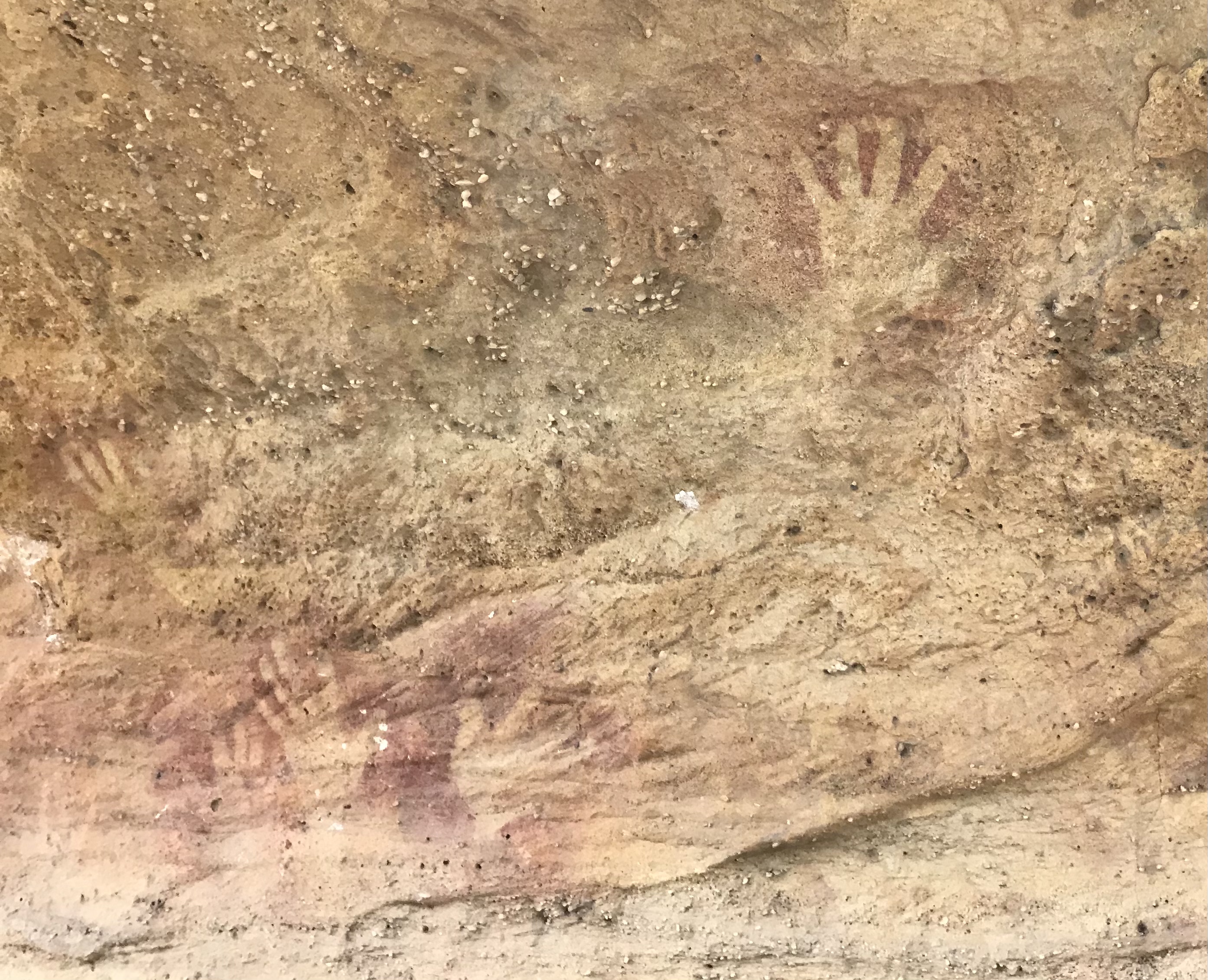
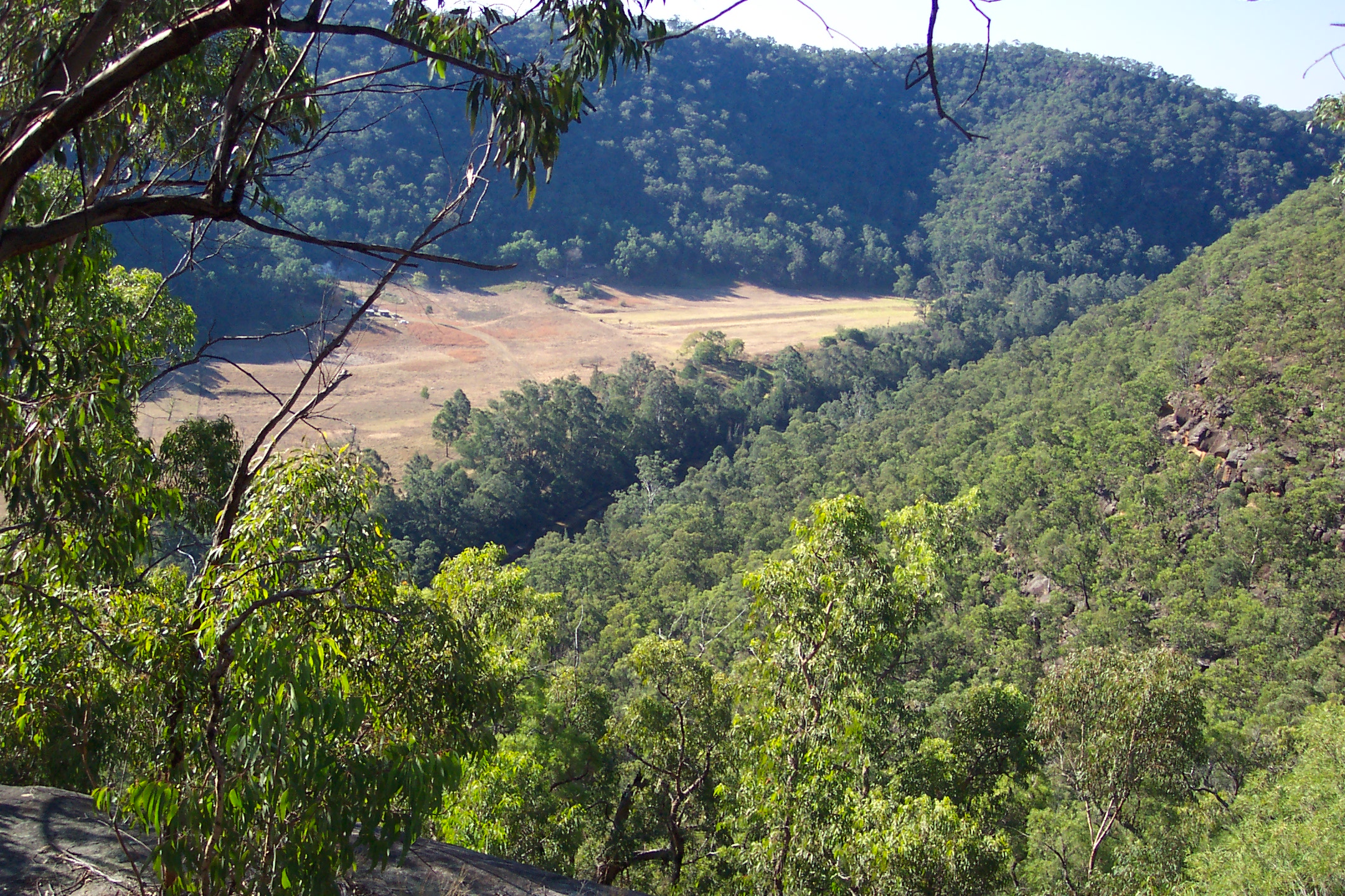
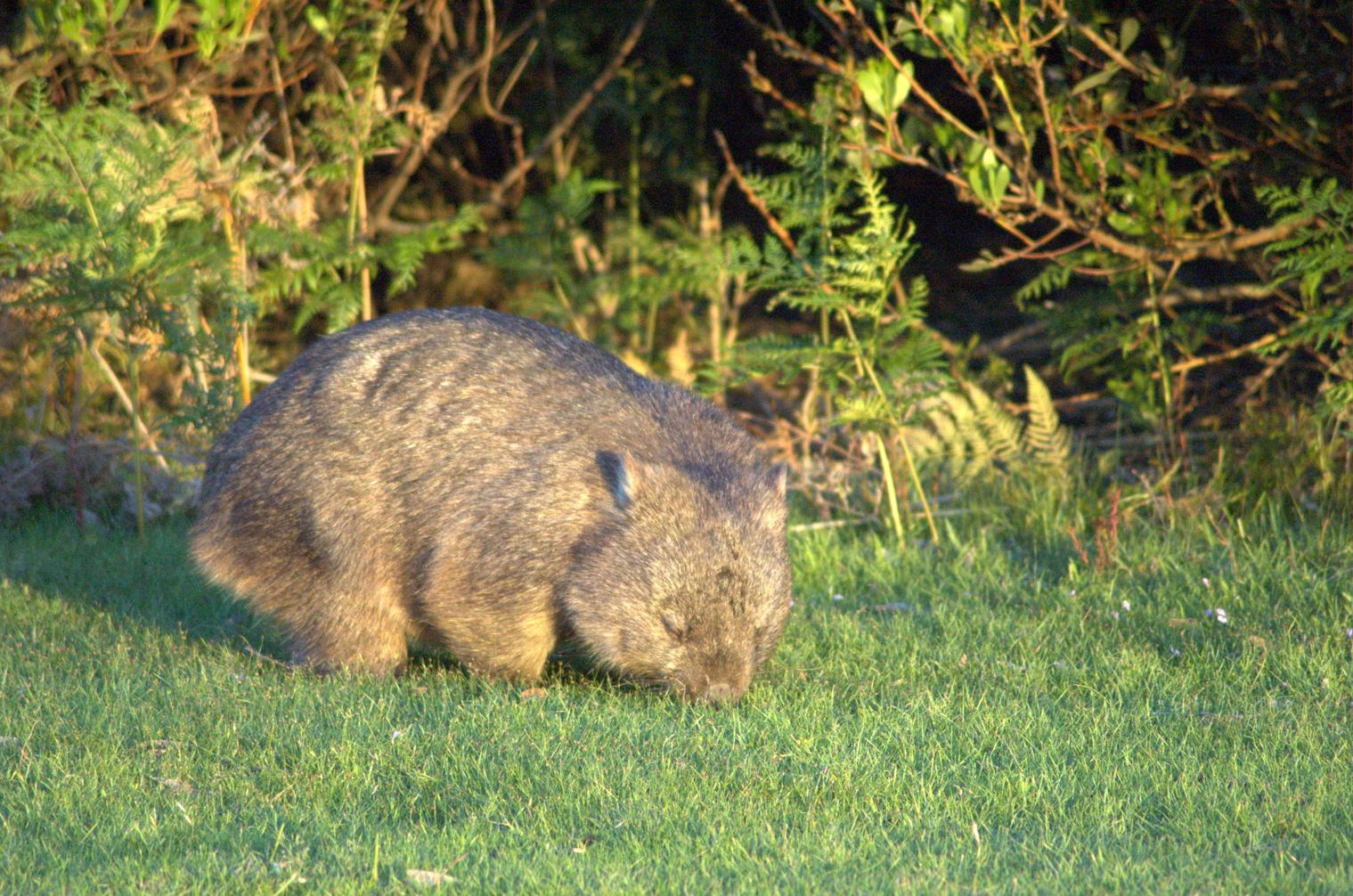
The Bylong Valley is a winding but relatively flat valley that crosses the Great Dividing Range between the Goulburn River National Park and Wollemi National Park, west of the upper Hunter Region in New South Wales, Australia. The picturesque countryside was the site of Aboriginal and early European settlements. Traveling in this scenic valley reveals its cultural heritage as well as sightings of wombats, wallabies and kangaroos.! The valley is split by a short ridge roughly one third of the way from its western end. The headwaters start in the Great Dividing Range to the north-west on Nullo Mountain. The Bylong Valley carries the Sandy Hollow-Gulgong cross-country railway line, which passes under Cox's Gap with a tunnel, and the Bylong Valley Way, which climbs over the ridge through the gap. The path across this ridge is steep and winding. The boundary between Muswellbrook Shire Council and the Mid-Western Regional Council area is on the crest of Cox's Gap. See also * List ... [...More Info...] [...Related Items...] OR: [Wikipedia] [Google] [Baidu] |
Great Dividing Range
The Great Dividing Range, also known as the East Australian Cordillera or the Eastern Highlands, is a cordillera system in eastern Australia consisting of an expansive collection of mountain ranges, plateaus and rolling hills, that runs roughly parallel to the east coast of Australia and forms the fifth-longest land-based mountain chain in the world, and the longest entirely within a single country. It is mainland Australia's most substantial topographic feature and serves as the definitive watershed for the river systems in eastern Australia, hence the name. The Great Dividing Range stretches more than from Dauan Island in the Torres Strait off the northern tip of Cape York Peninsula, running the entire length of the eastern coastline through Queensland and New South Wales, then turning west across Victoria before finally fading into the Wimmera plains as rolling hills west of the Grampians region. The width of the Range varies from about to over .Shaw, John H., ''Col ... [...More Info...] [...Related Items...] OR: [Wikipedia] [Google] [Baidu] |
Goulburn River National Park
The Goulburn River National Park is a national park located in New South Wales, Australia, northwest of Sydney and it is south-west of Merriwa. The Goulburn River National Park is located in the Hunter Valley region and covers approximately of the Goulburn River. It is near the towns of Sandy Hollow, Denman, Merriwa, and Mudgee. The park with its beautiful surroundings, forest and river offers many opportunities for recreation, such as fishing, hiking, kayaking, swimming and camping. Animals The park is a sanctuary for kangaroos, wombats, emus, goannas, platypus, and a wide variety of birds. It lies within the Mudgee-Wollar Important Bird Area, so identified by BirdLife International because of its importance for the endangered regent honeyeater. Aboriginal heritage The park contains some 300 or more aboriginal site (mostly along the river). The Wiradjuri, Gamileroi and Wonnarua Clans peoples have traditionally lived in this area since ancient times. See also * Protecte ... [...More Info...] [...Related Items...] OR: [Wikipedia] [Google] [Baidu] |
Wollemi National Park
The Wollemi National Park () is a protected national park and wilderness area that is located in the northern Blue Mountains and Lower Hunter regions of New South Wales, in eastern Australia. The park, the second largest national park in New South Wales, contains the Wollemi Wildernessthe largest such wilderness area in Australiaand is situated approximately northwest of Sydney. The Wollemi National Park is one of the eight protected areas that, in 2000, was inscribed to form part of the UNESCO World Heritagelisted Greater Blue Mountains Area. The Wollemi National Park is the most northwesterly of the eight protected areas within the World Heritage Site. The national park forms part of the Great Dividing Range. The only known living wild specimens of the Wollemi Pine (''Wollemia nobilis'') were discovered in 1994. Special efforts were made to protect the trees when the 2019-20 Australian bushfires burned through the park. The national park is bounded to the north by the Go ... [...More Info...] [...Related Items...] OR: [Wikipedia] [Google] [Baidu] |
Hunter Region
The Hunter Region, also commonly known as the Hunter Valley, is a region of New South Wales, Australia, extending from approximately to north of Sydney. It contains the Hunter River and its tributaries with highland areas to the north and south. Situated at the northern end of the Sydney Basin bioregion, the Hunter Valley is one of the largest river valleys on the NSW coast, and is most commonly known for its wineries and coal industry. Most of the population of the Hunter Region lives within of the coast, with 55% of the entire population living in the cities of Newcastle and Lake Macquarie. There are numerous other towns and villages scattered across the region in the eleven local government areas (LGAs) that make up the region. At the the combined population of the region was 682,465, and is expected to reach over 1,000,000 people by 2031. Under Australia's wine appellation system, the Hunter Valley wine zone Australian Geographical Indication (GI) covers the entire cat ... [...More Info...] [...Related Items...] OR: [Wikipedia] [Google] [Baidu] |
New South Wales
) , nickname = , image_map = New South Wales in Australia.svg , map_caption = Location of New South Wales in AustraliaCoordinates: , subdivision_type = Country , subdivision_name = Australia , established_title = Before federation , established_date = Colony of New South Wales , established_title2 = Establishment , established_date2 = 26 January 1788 , established_title3 = Responsible government , established_date3 = 6 June 1856 , established_title4 = Federation , established_date4 = 1 January 1901 , named_for = Wales , demonym = , capital = Sydney , largest_city = capital , coordinates = , admin_center = 128 local government areas , admin_center_type = Administration , leader_title1 = Monarch , leader_name1 = Charles III , leader_title2 = Governor , leader_name2 = Margaret Beazley , leader_title3 = Premier , leader_name3 = Dominic Perrottet (Liberal) , national_representation = Parliament of Australia , national_representation_type1 = Senat ... [...More Info...] [...Related Items...] OR: [Wikipedia] [Google] [Baidu] |
Australia
Australia, officially the Commonwealth of Australia, is a Sovereign state, sovereign country comprising the mainland of the Australia (continent), Australian continent, the island of Tasmania, and numerous List of islands of Australia, smaller islands. With an area of , Australia is the largest country by area in Oceania and the world's List of countries and dependencies by area, sixth-largest country. Australia is the oldest, flattest, and driest inhabited continent, with the least fertile soils. It is a Megadiverse countries, megadiverse country, and its size gives it a wide variety of landscapes and climates, with Deserts of Australia, deserts in the centre, tropical Forests of Australia, rainforests in the north-east, and List of mountains in Australia, mountain ranges in the south-east. The ancestors of Aboriginal Australians began arriving from south east Asia approximately Early human migrations#Nearby Oceania, 65,000 years ago, during the Last Glacial Period, last i ... [...More Info...] [...Related Items...] OR: [Wikipedia] [Google] [Baidu] |
Aboriginal Australians
Aboriginal Australians are the various Indigenous peoples of the Australian mainland and many of its islands, such as Tasmania, Fraser Island, Hinchinbrook Island, the Tiwi Islands, and Groote Eylandt, but excluding the Torres Strait Islands. The term Indigenous Australians refers to Aboriginal Australians and Torres Strait Islanders collectively. It is generally used when both groups are included in the topic being addressed. Torres Strait Islanders are ethnically and culturally distinct, despite extensive cultural exchange with some of the Aboriginal groups. The Torres Strait Islands are mostly part of Queensland but have a separate governmental status. Aboriginal Australians comprise many distinct peoples who have developed across Australia for over 50,000 years. These peoples have a broadly shared, though complex, genetic history, but only in the last 200 years have they been defined and started to self-identify as a single group. Australian Aboriginal identity has cha ... [...More Info...] [...Related Items...] OR: [Wikipedia] [Google] [Baidu] |
Wombat
Wombats are short-legged, muscular quadrupedal marsupials that are native to Australia. They are about in length with small, stubby tails and weigh between . All three of the extant species are members of the family Vombatidae. They are adaptable and habitat tolerant, and are found in forested, mountainous, and heathland areas of southern and eastern Australia, including Tasmania, as well as an isolated patch of about in Epping Forest National Park in central Queensland. Etymology The name "wombat" comes from the now-nearly extinct Dharug language spoken by the aboriginal Dharug people, who originally inhabited the Sydney area. It was first recorded in January 1798, when John Price and James Wilson, a white man who had adopted aboriginal ways, visited the area of what is now Bargo, New South Wales. Price wrote: "We saw several sorts of dung of different animals, one of which Wilson called a "Whom-batt", which is an animal about 20 inches high, with short legs and a thick bod ... [...More Info...] [...Related Items...] OR: [Wikipedia] [Google] [Baidu] |
Wallaby
A wallaby () is a small or middle-sized Macropodidae, macropod native to Australia and New Guinea, with introduced populations in New Zealand, Hawaii, the United Kingdom and other countries. They belong to the same Taxonomy (biology), taxonomic family as kangaroos and sometimes the same genus, but kangaroos are specifically categorised into the four largest species of the family. The term "wallaby" is an informal designation generally used for any macropod that is smaller than a kangaroo or a wallaroo that has not been designated otherwise. There are nine species (eight extant and one Extinction, extinct) of the brush wallaby (genus ''Notamacropus''). Their head and body length is and the tail is long. The 19 known species of Rock-wallaby, rock-wallabies (genus ''Petrogale'') live among rocks, usually near water; two species in this genus are endangered. The two living species of hare-wallabies (genus ''Lagorchestes''; two other species in this genus are extinct) are sma ... [...More Info...] [...Related Items...] OR: [Wikipedia] [Google] [Baidu] |
Bylong Valley Way
Bylong Valley Way is a New South Wales country road linking the Golden Highway near Sandy Hollow to the Castlereagh Highway near Ilford. It is named after the Bylong Valley, through which the road passes. Route In conjunction with the Bathurst-Ilford Road to Bathurst, this quiet, scenic route provides a leisurely alternative to going through Sydney to travel between the Hunter Region and Central Tablelands. History The passing of the ''Main Roads Act of 1924'' through the Parliament of New South Wales provided for the declaration of Main Roads, roads partially funded by the State government through the Main Roads Board (later the Department of Main Roads, and eventually Transport for NSW). Main Road No. 208 was declared from Sandy Hollow to Bylong (and continuing west via Wollar to Mudgee, and east via Wybong to the intersection with Great Northern Highway, today New England Highway, at Muswellbrook), and Main Road No. 215 was declared from Bylong via Rylstone to Ilford, on t ... [...More Info...] [...Related Items...] OR: [Wikipedia] [Google] [Baidu] |


